Beaches with Green Waters on Crete Island

Find a beach with Green waters near you

Discover a unique palette of natural beauty on the island of Crete, where more than 24 green water beaches are waiting to captivate your senses. Listed on our website, these beaches are celebrated for their tranquil emerald waters, a result of unique geological formations and abundant underwater vegetation.

Creating a serene and rejuvenating ambience, these lush, green aquatic expanses are a sight to behold. Whether you’re a nature enthusiast, a photographer, or a traveller seeking off-the-beaten-path experiences, Crete’s green water beaches offer an enchanting divergence from the usual blue and azure waters.

Explore our curated selection of these verdant seaside paradises, and let the harmonious blend of green hues, golden sands, and Cretan sun immerse you in an extraordinary coastal retreat.

  • Red beach
  • Sand
  • Normal
  • Blue, Green

The Kokkini Ammos, or Red Beach, can be found 68km southwest of Heraklion and a short 800m from the popular resort of Matala. You can reach this hidden gem by following a clearly marked trail from Matala, which takes you over Kastri hill. While the trail includes some initial rock climbing and a steep descent at the end, it’s quite feasible. After a 15-25 minute walk from Matala, passing through a shepherd’s gate along the way, the breathtaking Red Beach comes into view. It’s an ideal spot for enjoying panoramic views and beautiful sunsets. Alternatively, you can also reach the beach by boat from Matala Harbour for a small fee of around 5 euros.

The beach is most noted for its red sand, a result of the area’s unique geology, which forms a stunning contrast against the bright blue-green sea. However, it’s important to note that it’s not shielded from the typical western winds in the region. The beach has minimal facilities, with a simple stone-wall coffee shop that opens occasionally offering food and drinks, and some umbrellas. It’s recommended to bring your own mats and umbrellas as the only natural shade is provided by a few tamarisk trees near the canteen.

In the 1960s and 70s, Red Beach was a popular spot among hippies, and its legacy continues with enthusiasts still visiting the beach regularly. Especially the northern part of the beach has gained a reputation as a nudist-friendly area and has gained international recognition for this. The beach and its surrounding area are protected by the Natura 2000 program due to its ecological importance.

The northern end of the beach features a long rocky limestone formation, similar to the limestone found in Matala. These rocks are decorated with carvings of Minoan and Egyptian sea figures, created by Gerard, a Belgian fan of Matala. These carvings have become a key part of the beach’s appeal. Between Matala and the Red Beach, there’s a large rock known as Theosini that offers stunning views of Messara Bay. This rock has been eroded by the sea, creating a marine cave known as Kouroupi, which can only be accessed by boat. The cave is a haven for endangered Mediterranean seals and various species of wild pigeons.

  • Stavros beach
  • Sand
  • Shallow
  • Blue, Green

Stavros beach is situated 17km northeast of Chania on the farthest point of Cape Akrotiri, is known for its distinct, camel-shaped mountain, Vardies. This towering landmark gained recognition in the film “Zorba the Greek” as the backdrop for Anthony Quinn’s iconic Sirtaki Dance in 1964. Once a quaint fishing hamlet, Stavros has since transformed into a bustling tourist hub, complete with numerous hotels and top-tier tourist facilities. The area’s popularity is further boosted by its two stunning beaches.

The primary beach lies to the village’s east, nestled at the base of the Vardies mountain and adjacent to the scenic harbour. It forms a protected, semi-circular lagoon with pristine white sands and shallow, turquoise waters. The contrast between the rugged mountain and the tranquil beach provides a unique and enchanting swimming experience. As anticipated, the beach is well-equipped with all the necessary amenities.

200 meters northwest of the main beach, you’ll find Stavros’ secondary beach, a mix of sandy stretches and rocky areas. It’s less developed and cleaner than its counterpart, but its exposure to the elements can lead to wavy seas. The peninsula separating the two beaches holds historical significance, housing remnants of an ancient quarry that provided limestone for Chania’s Venetian-era Walls (13th- 17th century).

Beyond beaches, Stavros offers an array of other services including accommodation, eateries, mini markets, shops, cafes, and regular bus connections to Chania city.

  • Matala beach
  • Fine Pebbles, Sand
  • Deep
  • Blue, Green

The beach of Matala is situated 68km southwest of Heraklion, where the Messara plain and Asteroussia Mountains intersect. It is one of the most frequented tourist spots in Crete and the most well-known beach in the southern region of the Heraklion prefecture. Matala is notable for its rock-carved caves and its association with the hippie culture of the 1970s. It lies in close proximity to Phaestus, the second largest palace of the Minoan civilization, having once served as its port. During the era of the Romans, Matala transformed into a port for Gortyn.

Nestled at the end of a small valley, Matala overlooks an enclosed bay with a picturesque view of the Paximadia islands. The beach spans 300m and features beautiful sandy shores, fine gravel, and crystal-clear deep waters. However, parts of the seabed, particularly the central area, are quite rocky and waves are common due to frequent westerly winds. A large cave can be found on the northern part of the beach, from which some thrill-seekers dive.

Matala beach is well-equipped with amenities such as umbrellas, restrooms, showers, lifeguards, first aid facilities, beach volleyball courts, snack bars, water sports, excursion boats, and a camping site. The surrounding area of Matala offers a range of accommodation, dining, and entertainment options. The beach is largely shaded by tamarisk trees, providing a respite from the sun. Come evening, the beach bars are brimming with people, both locals and tourists. The internationally acclaimed Matala Festival draws large crowds every June.

  • Bali beaches
  • Sand
  • Shallow
  • Green

The coastal resort of Bali is situated in a vast bay, 30km east of Rethymno and 43km west of Heraklion. The National Road that connects Heraklion and Rethymno passes alongside the village, making Bali easily reachable from all parts of the island. It’s a perfect spot for family getaways and romantic vacations. Bali boasts four beaches nestled in sandy coves with appealing greenish waters. The beaches, shielded by the bay facing west, are typically tranquil and suitable for children, with good organization. The coolness of the water is attributed to the numerous springs around that channel fresh water into the sea from the Psiloritis Range.

Livadi Beach

As you enter the village, the first beach you encounter is Livadi, the longest in the area. It’s located in an open bay, which is more exposed to winds than the other three. Despite being well-organized and frequently bustling, it’s less picturesque than the others. Its name, Livadi (meaning meadows), is due to the nearby valley. At the eastern end of Livadi, you’ll find two separate smaller beaches, Kouskouras.

Varkotopos Beach

Moving ahead, at the village center, you’ll find the secluded bay of Varkotopos featuring a beautiful beach with sand and gravel, which is well-organized and popular. It’s perfect for young children due to the shallow waters and proximity to all necessary amenities.

Limani (Harbor) Beach

Further north, you’ll come across the scenic port of Bali, adjacent to a clean beach. Known as Limani in Greek, it’s well-organized and surrounded by numerous restaurants and shops.

Karavostasis Beach

Karavostasis, the last beach you’ll encounter, is the most beautiful in the area. It’s smaller than the other bays, which often makes it appear crowded. Although it’s well-organized, it’s less so than the others.

  • Vai beach
  • Fine Pebbles, Sand
  • Shallow
  • Blue, Green

Vai beach is located 94km east of Agios Nikolaos and 24km east of Sitia. It is the most famous beach in east Crete, as its main feature is the large palm grove with the Cretan Date Palm (Phoenix theophrasti). Its name derives from the word vai, meaning palm in Greek. The palm grove is the largest in Europe with approximately 5000 trees, while there are smaller colonies in other parts of Crete and in Southwest Turkey. According to the legend, the trees have grown from discarded date stones thrown into the sea by Saracen pirates. However, the palm grove is more than 2000 years old and the pirates are more recent. Thus this hypothesis has changed and the Saracens have been replaced with Phoenicians, that governed the Mediterranean Sea 20 centuries ago.

The heavenly palm grove is planted in a wide valley watered by the local river for centuries. An exotic sandy beach with whitish sand is formed near the shore, backed by the Edenic palm forest, reminding of African and Caribbean seascapes. The entire region is owned by the powerful Toplou Monastery, which is the largest landowner in eastern Crete. The 15th-century monastery is built like a fortress and hosts a great collection of Byzantine icons.

Vai was totally unknown until the early 1970s, when a popular commercial for the Bounty chocolate with coconut was filmed here, using the magical background of palm trees. In the advert, coconuts were falling from trees, however, Vai palms produce dates. Consequently, coconuts had to be falsely hung to create the right impression. The ad made this unknown earthly paradise renowned throughout the world. Thus, hundreds of hippies started to stay here on their holidays. In the 1980s, when hippies faded out, Vai was invaded by backpackers and rapidly degenerated into a rubbish-strewn campground. The palm grove was consequently fenced off and proclaimed a conservation area, being open to the public only during daylight.

The beach has whitish sand and flat turquoise waters. In a few places, there are slippery smooth rocks, while on the opposite there are small islets that beautify the landscape. The beach is slightly organized (whatever the protection scheme allows) with umbrellas, showers, water sports and a canteen. The closest rooms to let are located outside the protected area (15′-25 ‘walk). If you want to stay isolated, there is a lovely sandy beach 5 minutes north of Vai, while another option is the idyllic Psili Ammos beach in the south.

If you come by car then you should leave it in the parking area. There are also buses running from Sitia and all travel agencies in Crete organize daily tours. The only drawback of Vai is that from the first moment you think that someone wants to dip into your pocket. Indeed, prices for parking, umbrellas and the canteen are too high. However, Vai is one of the most special beaches in Crete that surely deserve a visit.

  • Vathy beach
  • Rocks in places, Sand
  • Normal
  • Blue, Green

Vathi, a breathtaking beach, lies 79km and 17km southwest of Heraklion and the Sivas village respectively. It’s located near Crete’s southernmost point, Cape Lithino, and well away from bustling cities, making it a perfect spot for those longing for ultimate serenity. The beach is nestled at the mouth of a petite gorge and enclosed by extensive cliffs. Its circular cove shields it from the open sea, rendering Vathi a natural sanctuary, with legends claiming it served as a pirate anchorage. The beach, well-protected, typically boasts calm waters, despite surrounding beaches often witnessing waves. Only southwest winds trigger storms in this region.

The gorge walls in the area are adorned with fascinating natural cavities, resulting from wind and salt erosion of the white limestone. The vicinity hosts a few makeshift huts, old campervans, and basic homes constructed by locals, primarily from the Gergeri village. These locals’ ancestors would bring their flocks to this warm location in the winter, and their descendants now enjoy their summers here.

The beach is predominantly sandy with sporadic stones. The shallow waters are bordered by numerous tamarisk trees providing shade. Nudity is prohibited here, respecting the area’s religious heritage (linked to the Odigitria Monastery).

To reach Vathi by car, drive along the paved road from Sivas village towards the Odigitria Monastery. From the monastery, take the first dirt track on your right, heading west towards Kefali Peak and up the untamed Cape Lithino. Continue for about 15km on the rough gravel road, following the signs to Vathi. Alternatively, if you’re without a car or prefer not to drive, consider hopping on an excursion boat to Vathi from Matala, Kokkinos Pirgos, or Agia Galini.

  • Agia Pelagia beach
  • Sand
  • Normal
  • Blue, Green

Situated 21km west of Heraklion, on the southern side of the compact Cape Souda, you’ll find Agia Pelagia beach, also known as Santa Pelagia. This beach is nestled amidst several picturesque coves with stunning beaches. Originally, Agia Pelagia was a quaint settlement utilized by Achlada villagers for agricultural purposes, but it has since evolved into a bustling tourist destination replete with hotels, restaurants, cafes, bars, and more. Routine bus services to Heraklion ensure its accessibility.

The primary beach of Agia Pelagia is a slender, sandy stretch with greenish water. The Turks dubbed it Tsanak Limani, meaning ‘plate harbor’ due to its circular shape. The bay forms a natural, tranquil harbor, and the beach provides an array of amenities such as watersports, diving, food, and accommodation. However, in some areas, the beach is narrow with sunbeds occupying most of the space.

The beach is well-shielded from northern winds by the Cape of Souda, where ruins of the ancient port town Apollonia can be found. A luxury hotel now stands on Souda, but the ruins are accessible for tourists. A small shrine stands near the hotel, marking where the icon of Santa Pelagia was discovered centuries ago. Not far from the beach is the former Agia Pelagia monastery, renowned throughout the island during the Venetian era. Worshippers would flock to the beach during the monastery’s feast, seeking healing in the sand.

A short walk past the shrine on Cape of Souda will lead you to Fylakes, considered the most beautiful beach of Agia Pelagia. Fylakes consists of two small coves with fine sand and greenish water, concealed by Cape Souda’s towering rocks. Accessing Fylakes requires navigating the rocky coast and wading through chest-high water, so secure your belongings accordingly.

To the east of Agia Pelagia, beneath Hotel Diana, is the lesser-known pebbled beach, Vlyhada. This small, man-made beach is exposed to the winds and can only be reached by swimming from Agia Pelagia, as the hotel does not permit land access.

Agia Pelagia served as a crucial port during the Venetian period, providing aid to the besieged Cretans during the Candia siege. The Turks later constructed a fort here, though no remnants remain today. The port was also where the legendary ship of Arkadi docked during the Cretan Revolution to provide ammunition to the rebels.

  • Souda beach
  • Fine Pebbles, Rocks in places
  • Normal
  • Blue, Green

Souda is nestled 41km to the southwest of Rethymno city, and a mere 3km east from the bustling resort of Plakias. Don’t mistake it for Souda Bay, the natural harbour of Chania city. It is, in fact, the final beach along the Plakias seafront, known as Yialia, commencing at Shinaria many kilometers away. Situated at the mouth of a verdant valley, Souda is crisscrossed by the Finikas river, which flows all year round. Cretan palm trees of Theophrastus, native to the area, flourish along the river and numerous other locations, establishing Souda as a significant refuge for the species.

In the midst of this stunning landscape, a sandy beach stretches out, adored by all who visit. However, this affection can quickly turn to annoyance when the northern winds whip up the sand, blasting unsuspecting swimmers. The landscape today bears no resemblance to the secluded paradise of the 90s, where a narrow dirt path led to a rocky shoreline and a sparsely populated nudist beach. While nudists still frequent the area, they no longer enjoy the same level of comfort. The beach is now more accessible with paved roads, organized facilities, umbrellas, and showers. There are several taverns and accommodations nearby. The rocky beach edges offer ideal conditions for fishing and snorkeling. A few benches can be found above the eastern rocks on the main road, offering panoramic views of the South Cretan Sea.

  • Loutro
  • Fine Pebbles, Pebbles
  • Deep
  • Deep blue, Green

Located roughly 71 km south of Chania city on Crete Island, Loutro is a quaint seaside village at the edge of Cape Mouri. This charming village is steeped in history, once being the site of the ancient city of Phoenix and the port of ancient Anopolis. It later served as a winter port for Chora Sfakion, its naturally formed harbour providing safe anchorage for ships even amidst harsh weather conditions.

Loutro makes for an excellent base for exploring the neighbouring beaches, accessible by taxi boat, canoe, or on foot. A small ferry can whisk you away to the stunning Glyka Nera beach to the village’s east. Alternatively, you can opt for a canoe ride or a hike along the E4 trail to the secluded pebbly beaches of Timios Stavros and Pervolaki, with your journey continuing to Glyka Nera. If you prefer to stay within Loutro, the village’s own beach and the extended Keramos beach to the east offer a serene retreat, especially during strong southern winds. These well-maintained pebbly beaches boast calm, crystal-clear waters in shades of deep blue and green. Nearby beaches of Likos, Finikas, and Marmara are also within easy reach by boat or on foot.

Loutro is a haven for those seeking a unique experience away from the bustle of mass tourism. This picturesque fishing village in southwest Crete is devoid of large hotels and swimming pools, crowded streets, restaurants, and beaches, and even cars! The only means of access is by boat or a 1.5-2 hour trek from Chora Sfakion. Daily ferry services operate to and from Chora Sfakion, Sougia, Gavdos island, Paleochora, and Agia Roumeli.

Things to do in Loutro

While in Loutro, you can revel in nature’s beauty by exploring the scenic mountain landscape, valleys, and gorges. Start with a visit to the Koules fort situated above Loutro, then head to the small port of Finikas. The village brims with historic sites, including the Old School, which served as the Chancellor of Sfakia’s seat in 1821, and the ancient Church of Panagia nestled next to it. Marvel at the tall Cretan date palm trees and the ruins of the Castella fort, part of the ancient town Phoenix, and the temple of Apollo just south of the village.

For the more adventurous, a climb to the idyllic village and plateau of Anopolis awaits. This entails a two-hour ascent on a 2000-year-old mule track, culminating in a selection of inviting taverns at the top. You can also explore the Aradena gorge or snorkel in the local waters, home to frequent sea turtle visitors.

Loutro, which translates to “bath” in Greek, was named after the baths discovered in the area, their waters once directed towards nearby Anopolis.

  • Sarandaris coves
  • Fine Pebbles, Rocks in places, Sand
  • Normal
  • Blue, Green

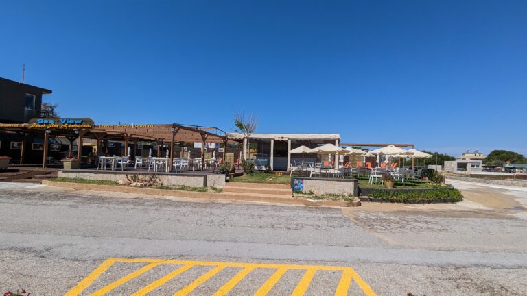
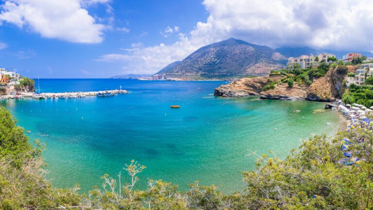
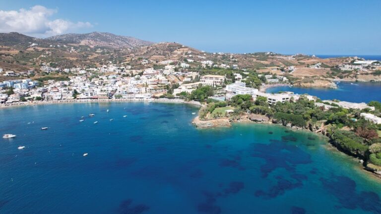
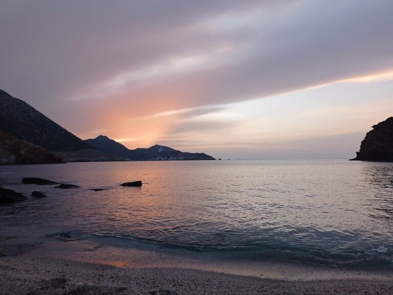
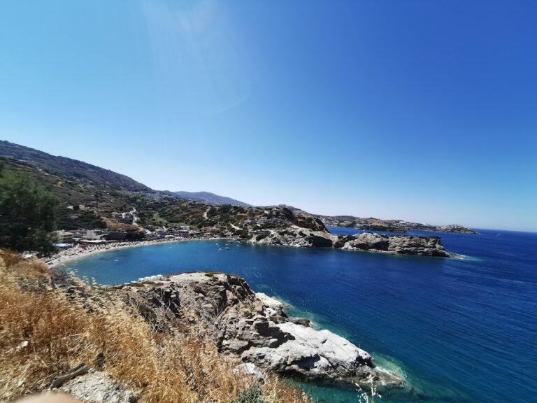
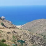
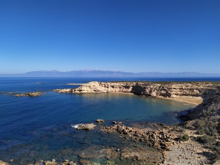
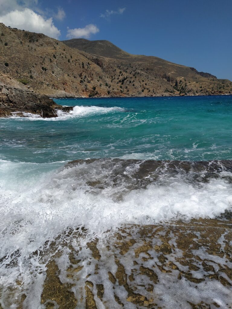
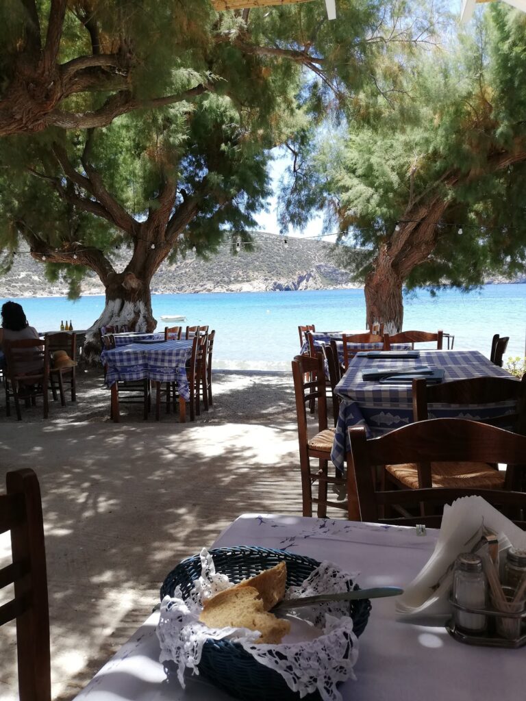
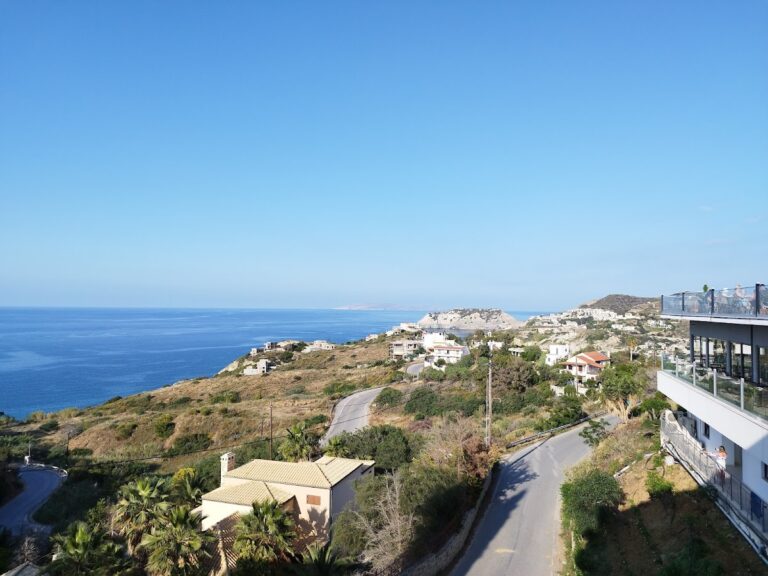
The tranquil beaches of Hersonissos Coves, also known as Limanakia, are located 27km east of Heraklion, extending from Cape Sarandaris to Hersonissos harbour. The beaches are protected from the strong northwest winds by Cape Sarandaris (Sarantari), providing calm waters for visitors. These coves are easily reachable and are situated near the vibrant town of Hersonissos with plenty of bars and cafes.

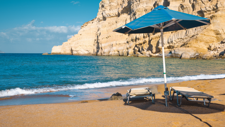
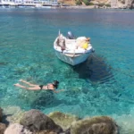
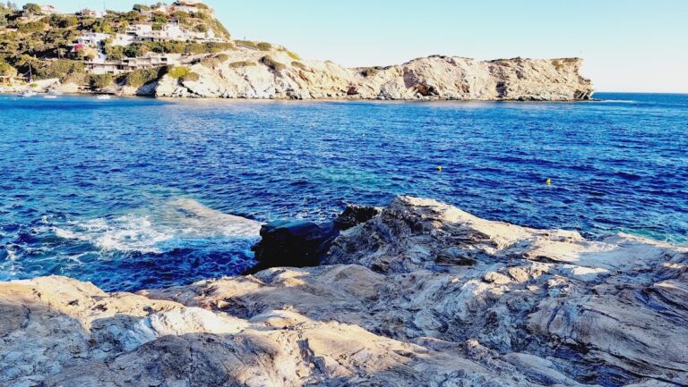
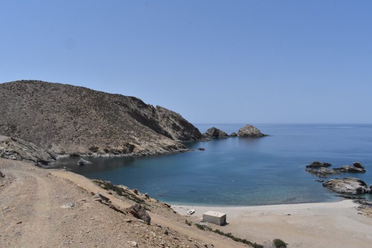
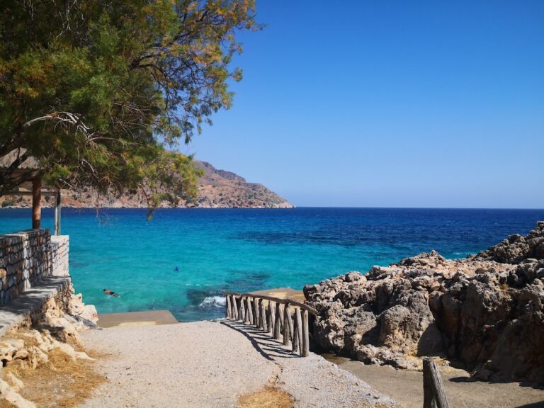
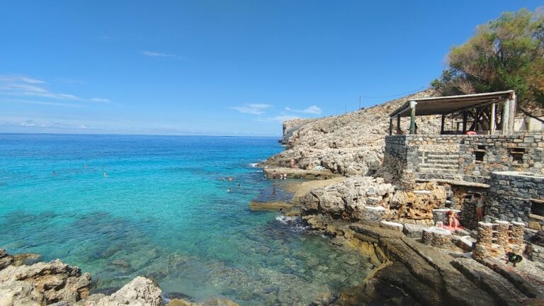
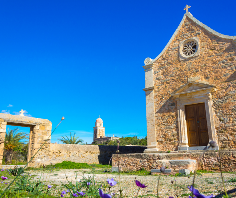
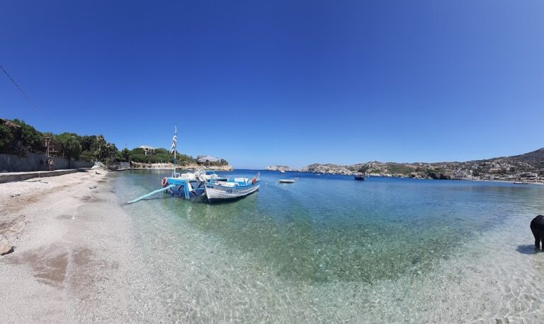
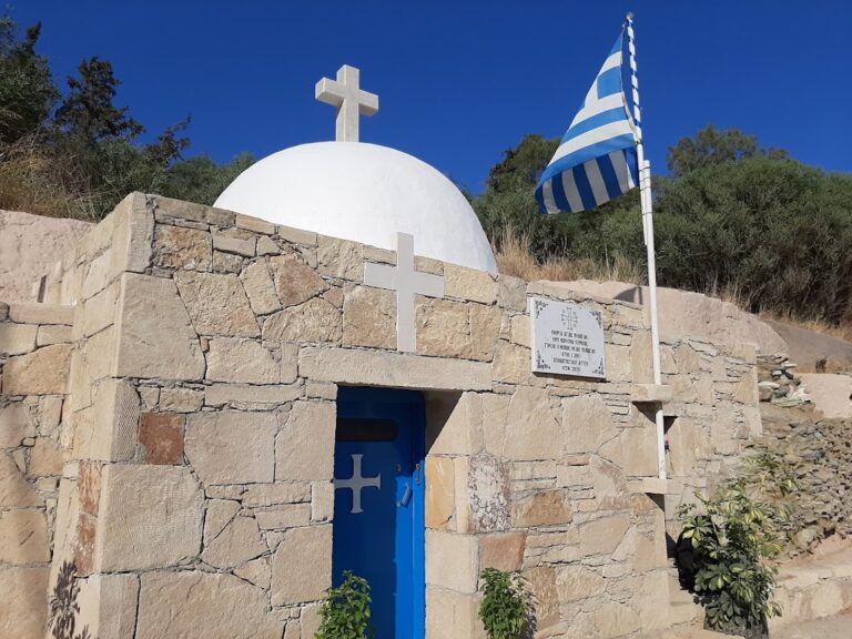
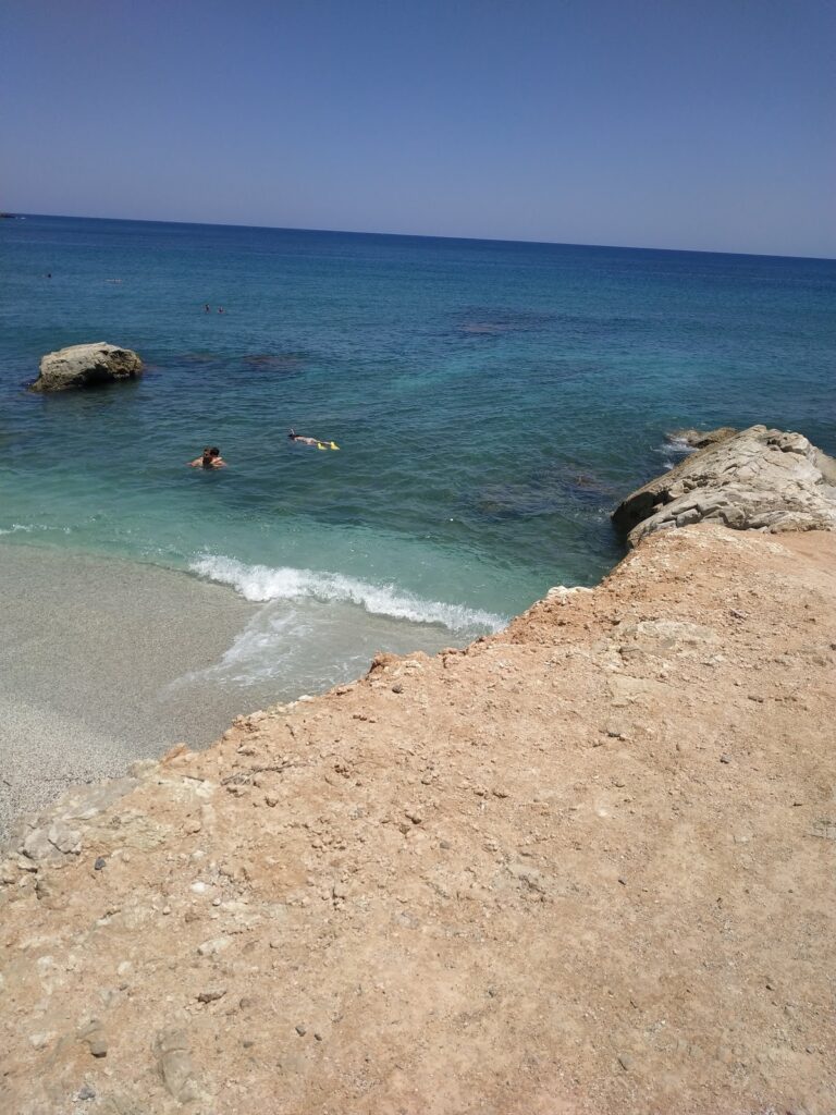
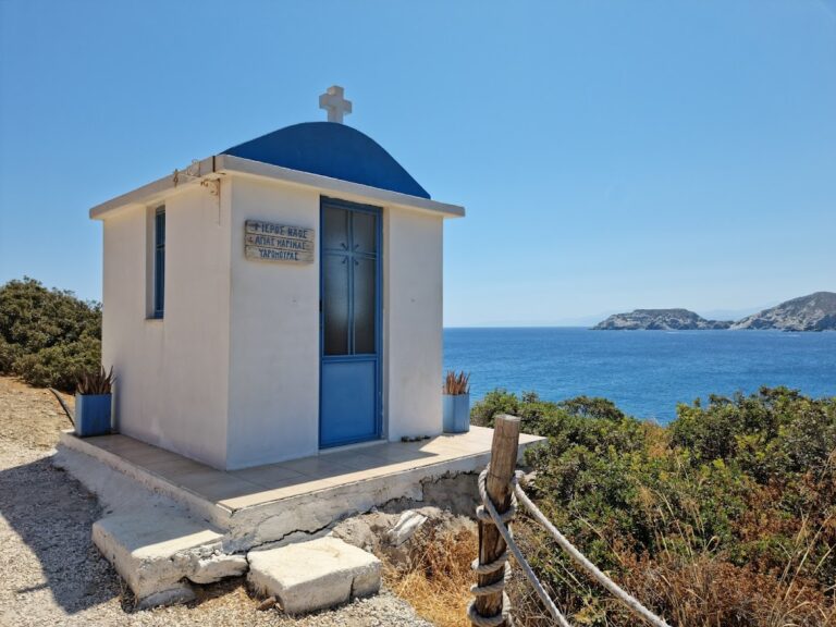
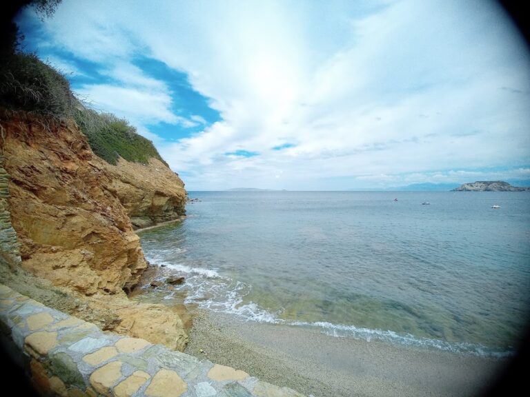
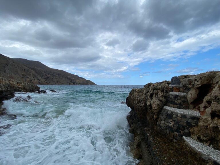
The western edge of the coves features a concrete dock ideal for diving, nestled on the rocky western side of Cape Sarandaris (Sarantari) near the quaint St. George Sarandaris chapel. A staircase leads to a sunbathing spot with hotel umbrellas and a rocky seabed perfect for swimming and snorkeling.

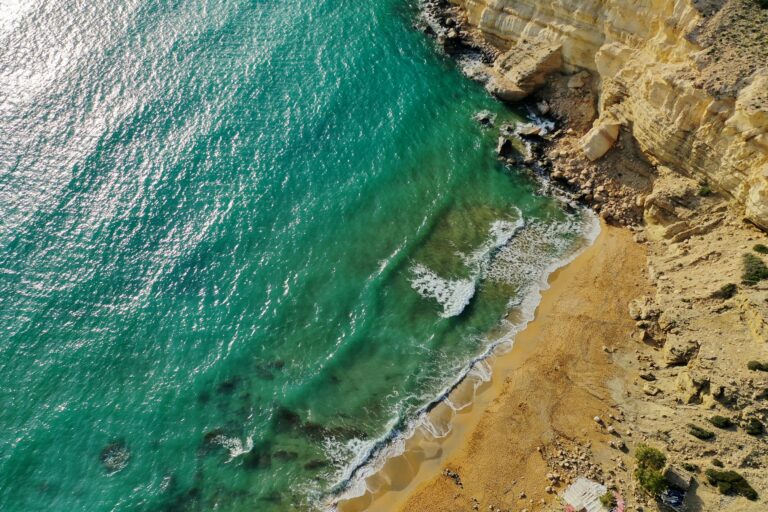
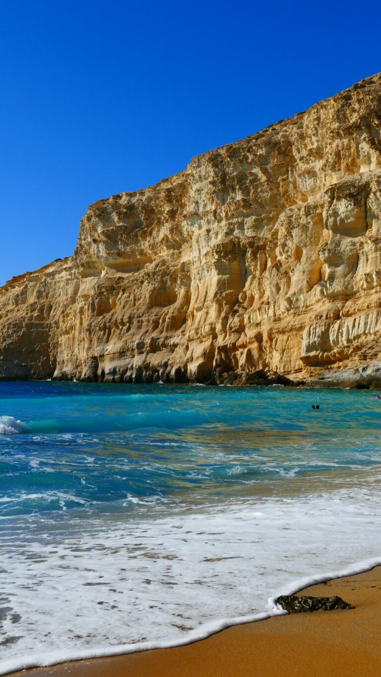
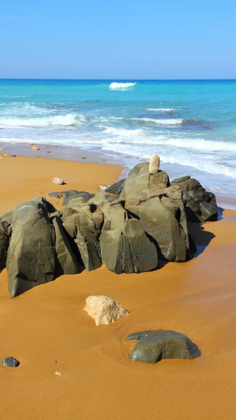
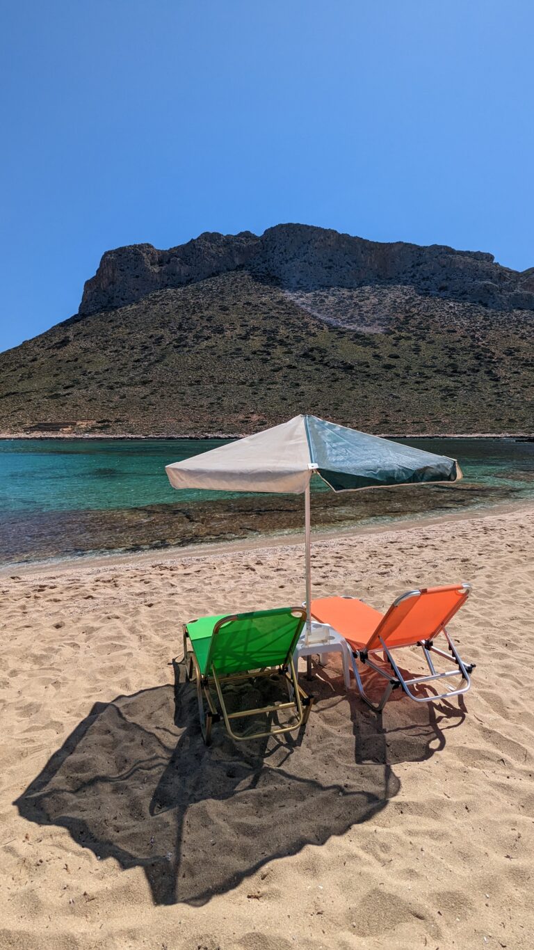
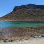
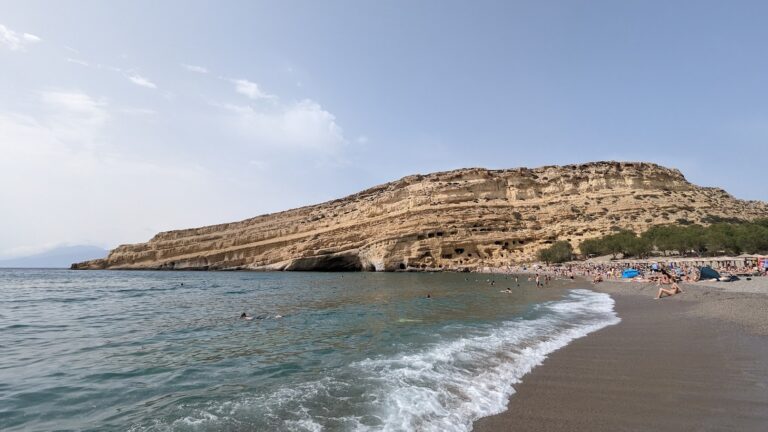
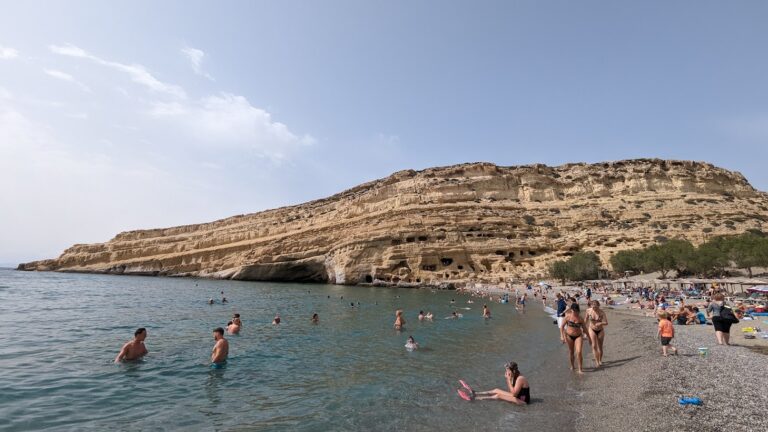
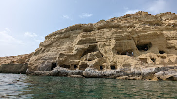
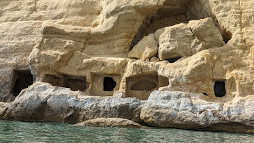
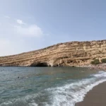
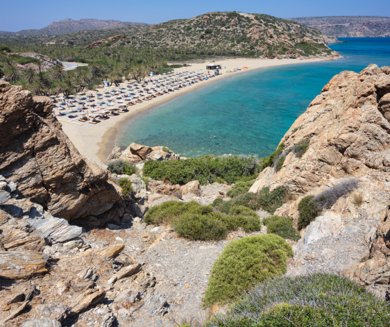
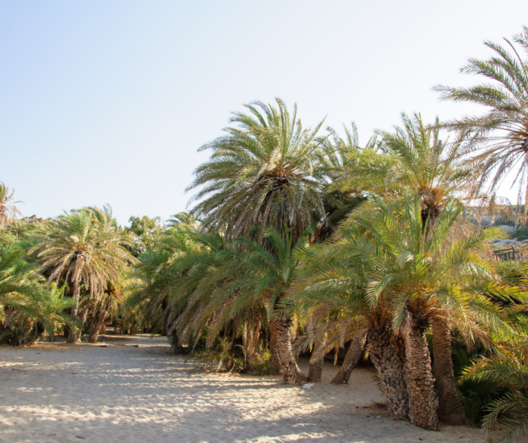
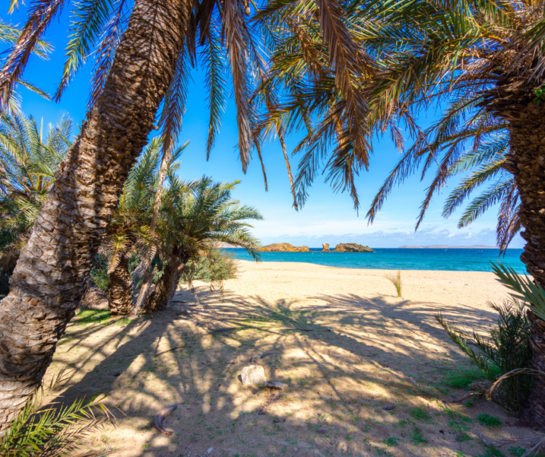
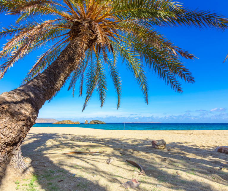
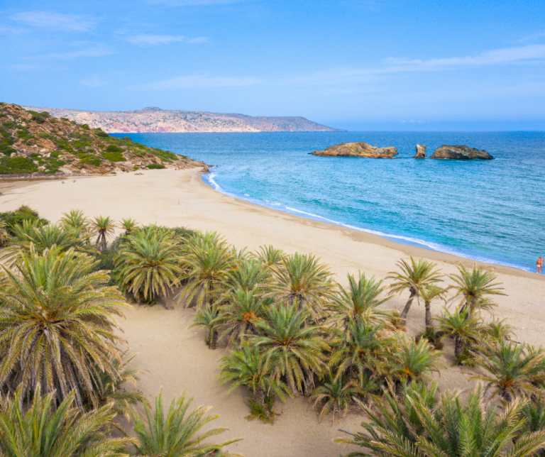
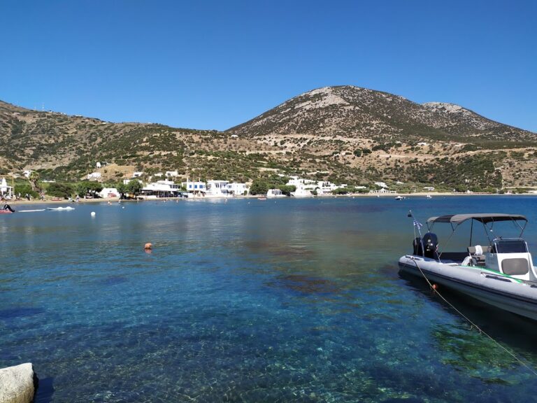
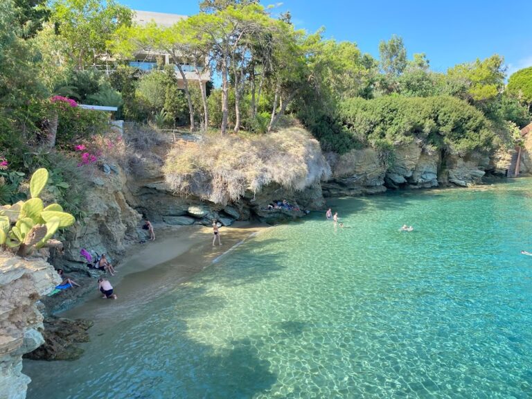
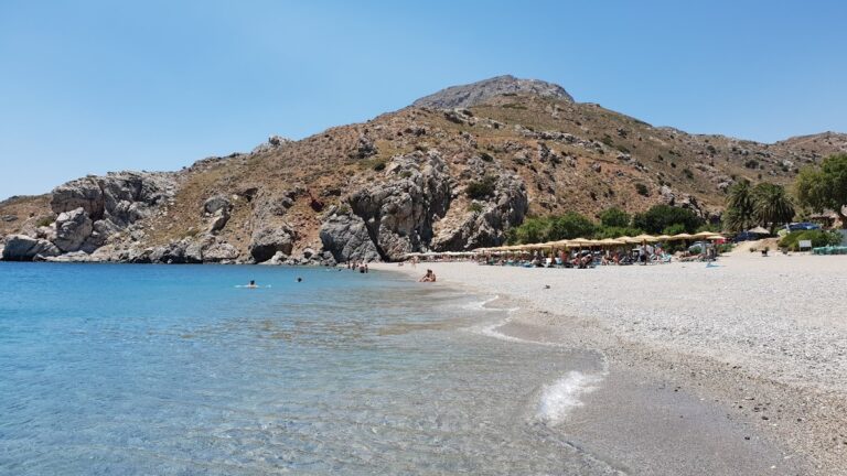
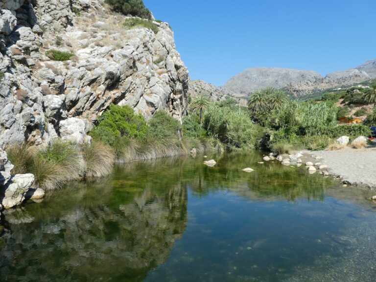
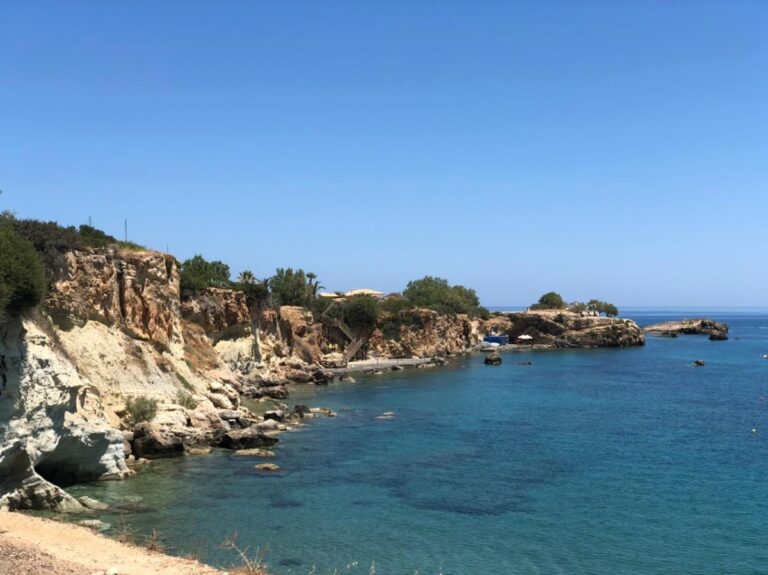
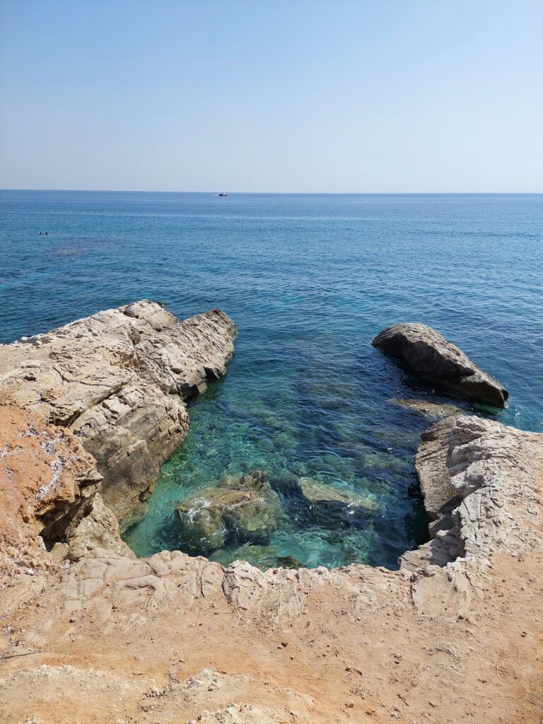
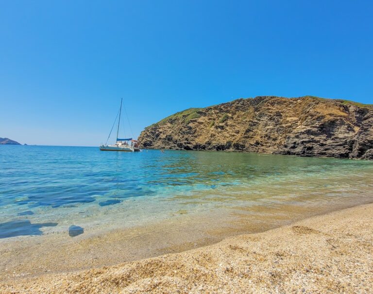
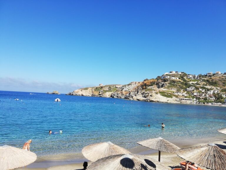
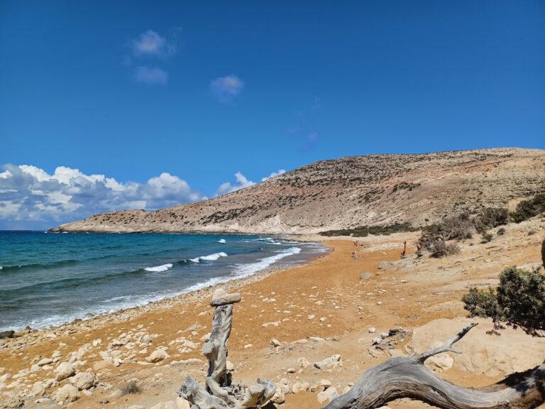
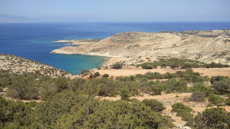
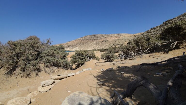
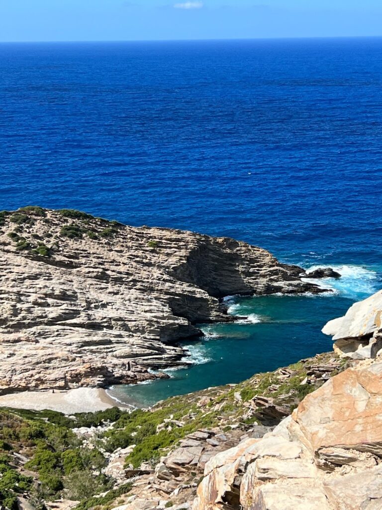
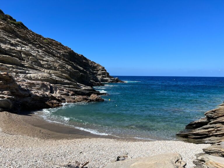
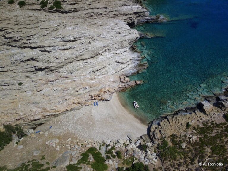
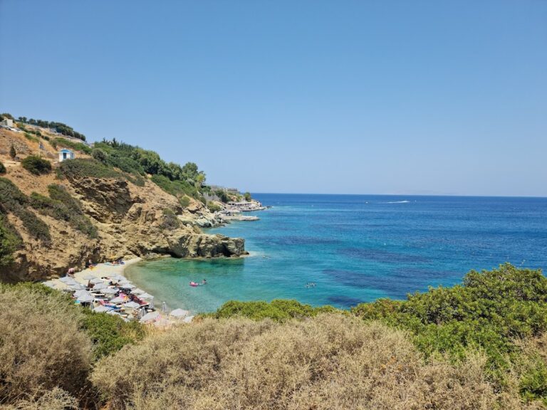
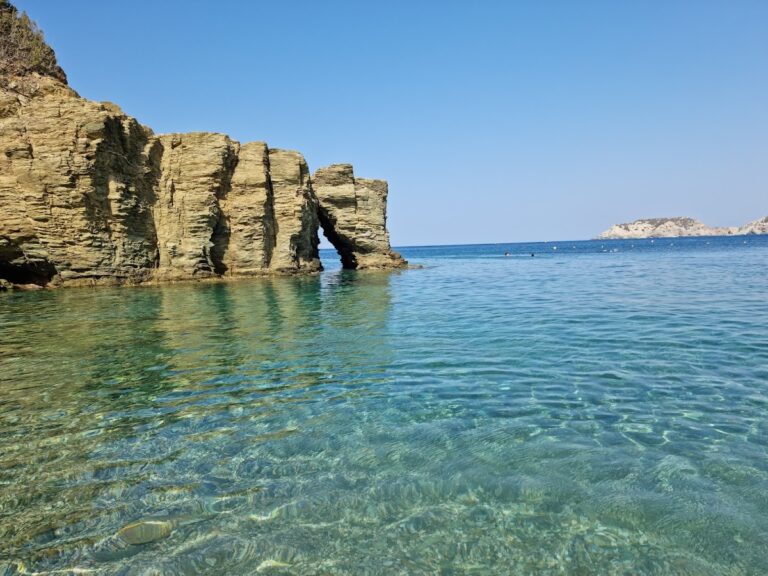
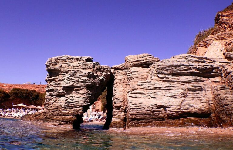
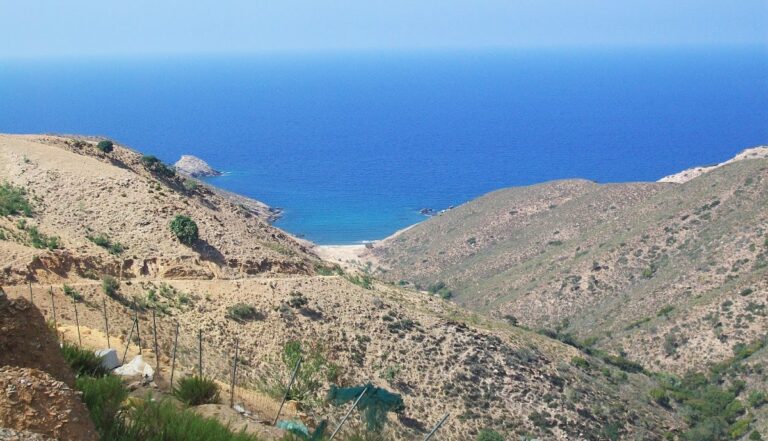
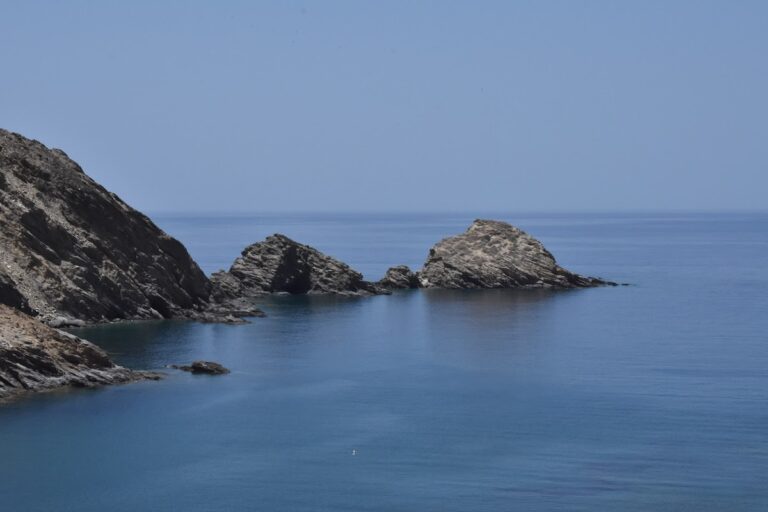
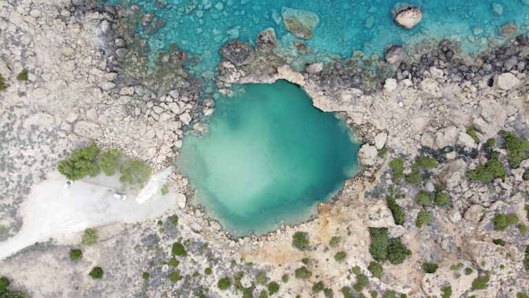
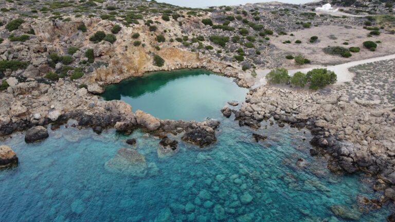
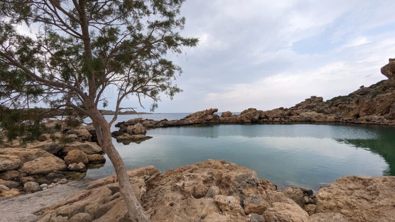
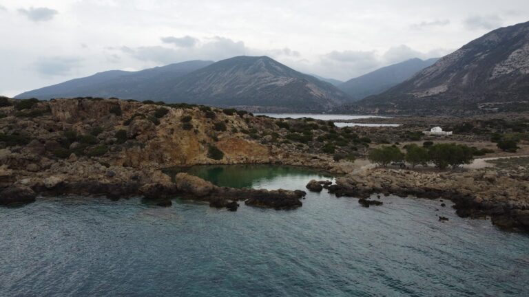
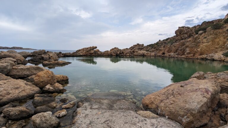
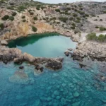
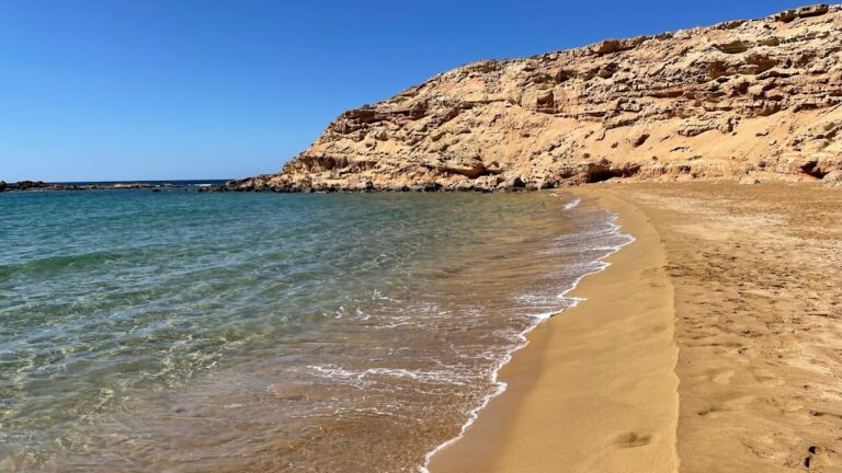
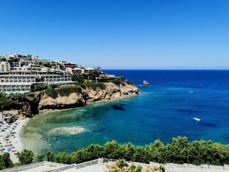
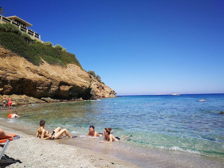
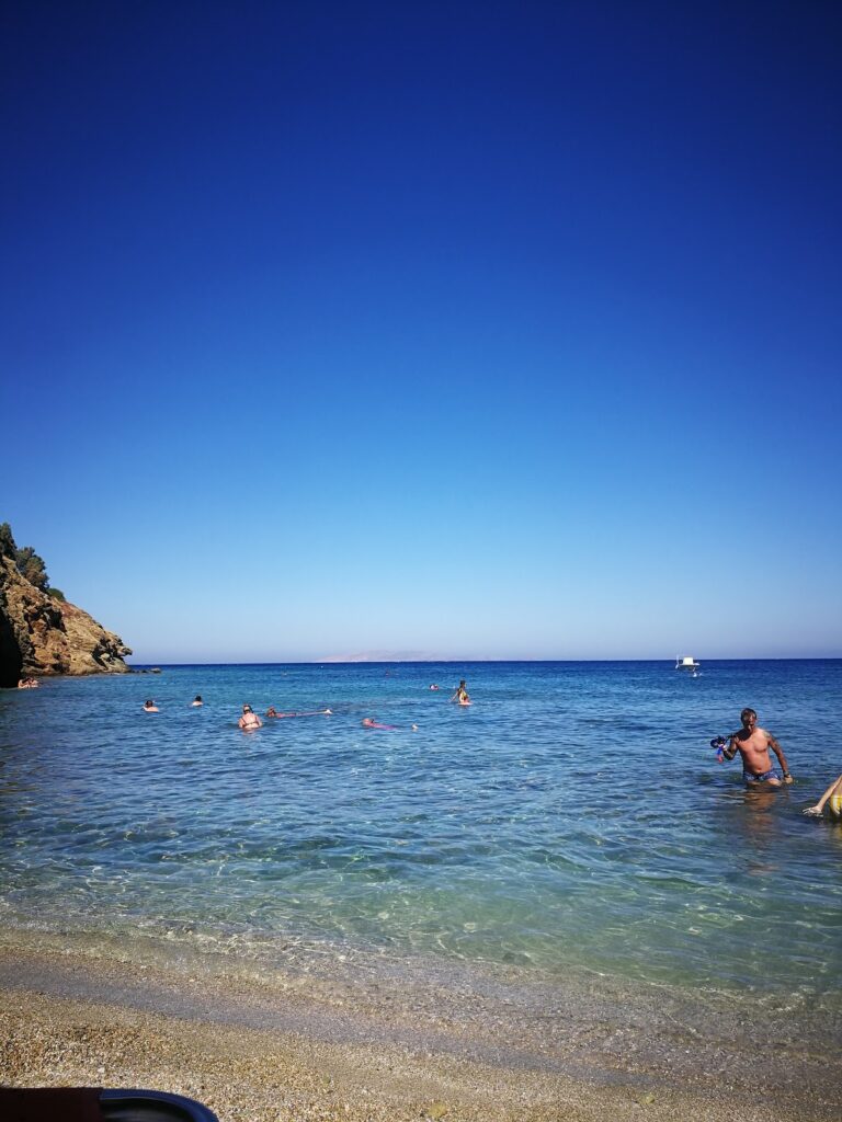
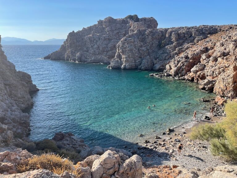
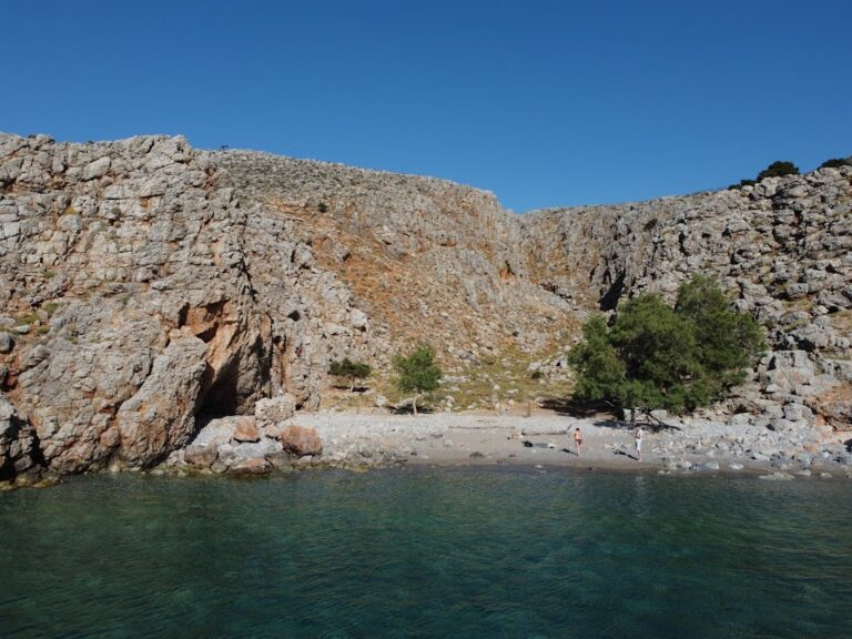
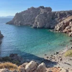
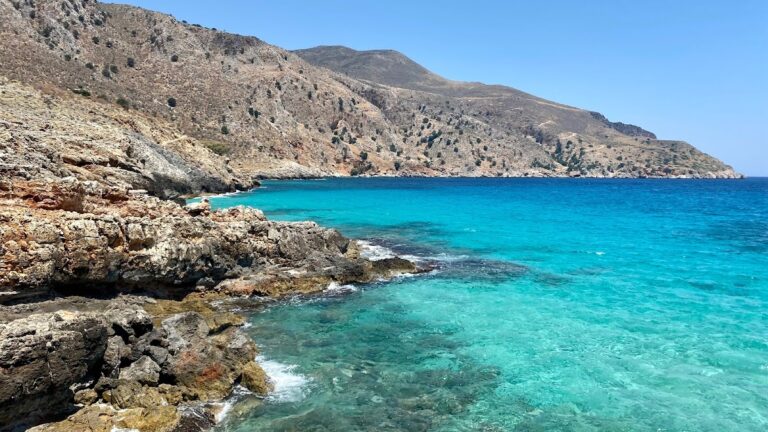
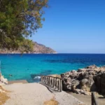
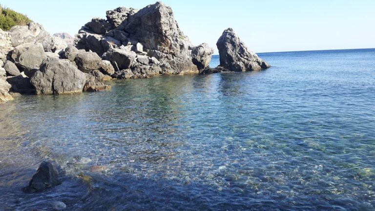
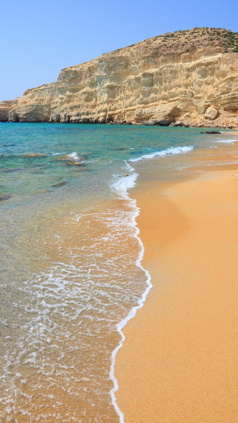
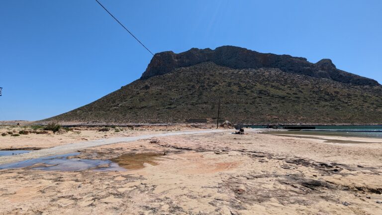
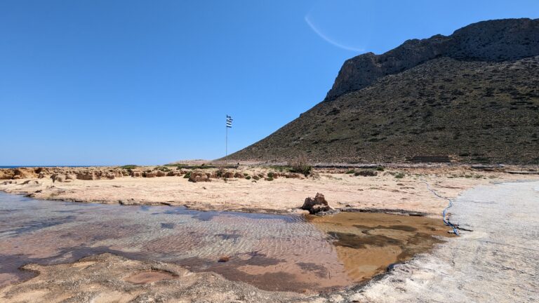
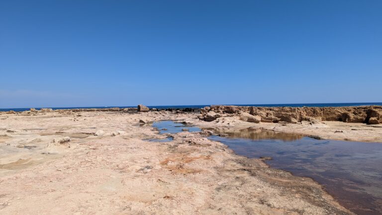
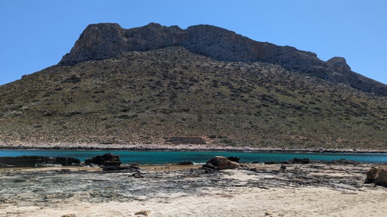
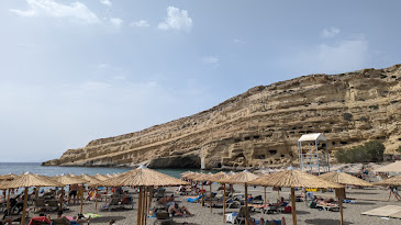
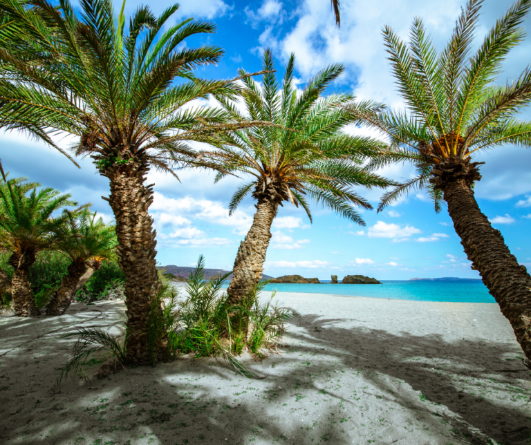
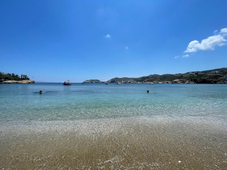
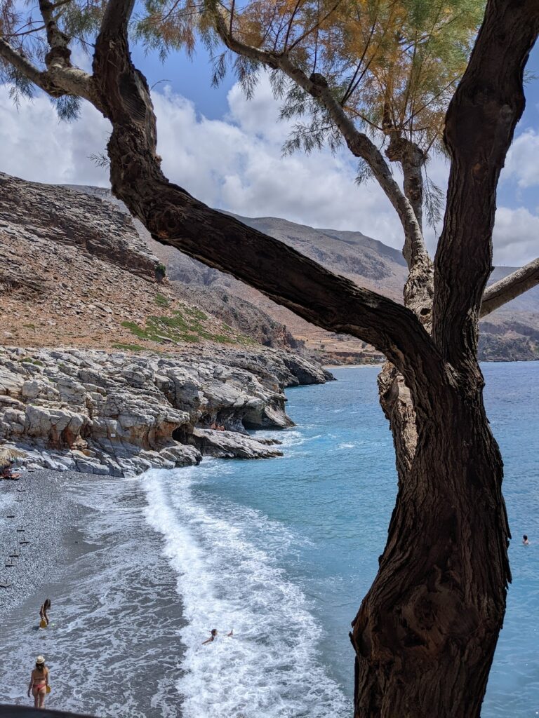
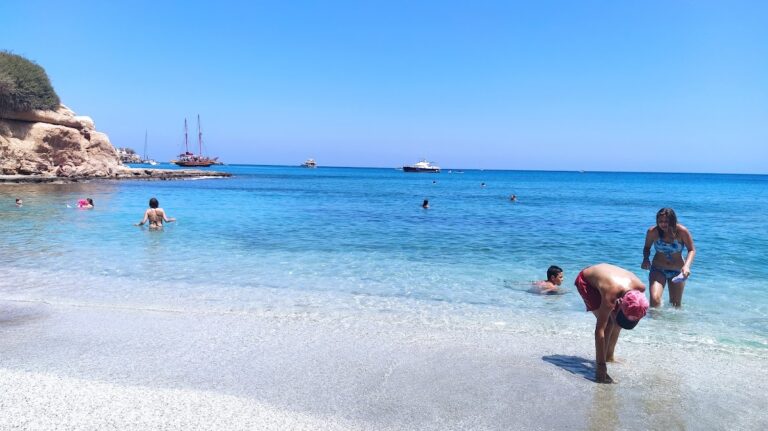
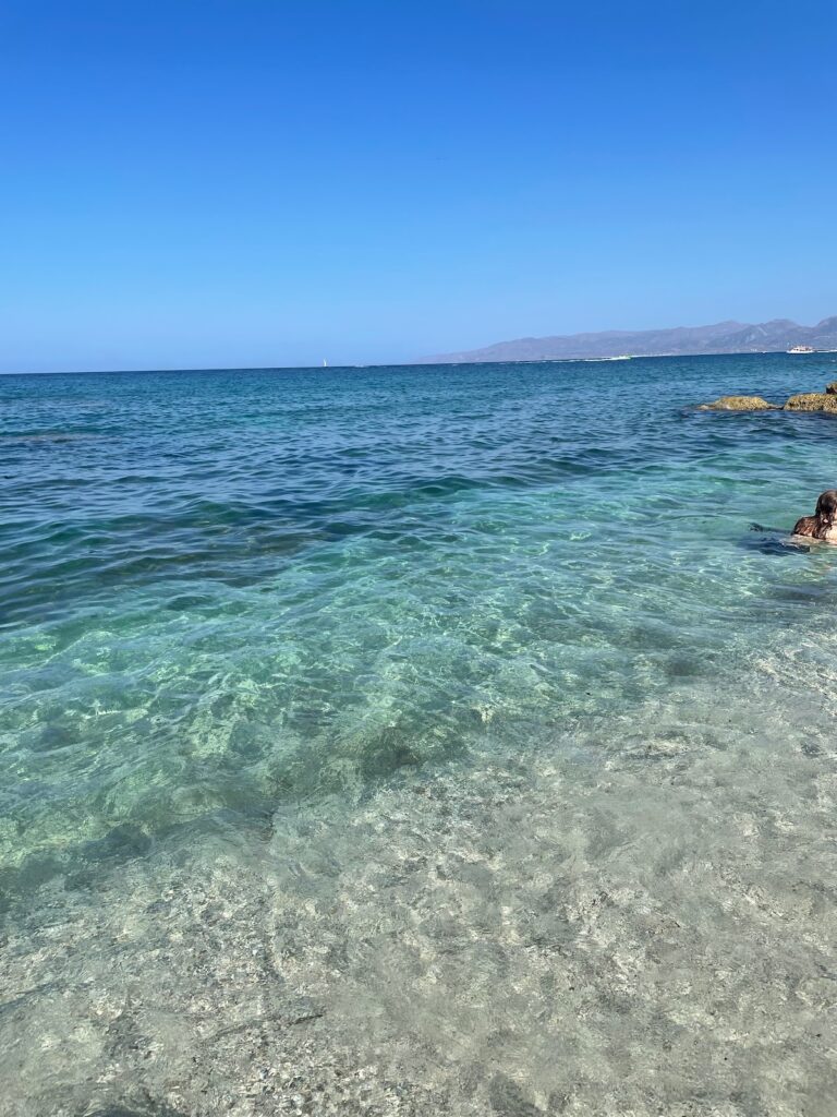
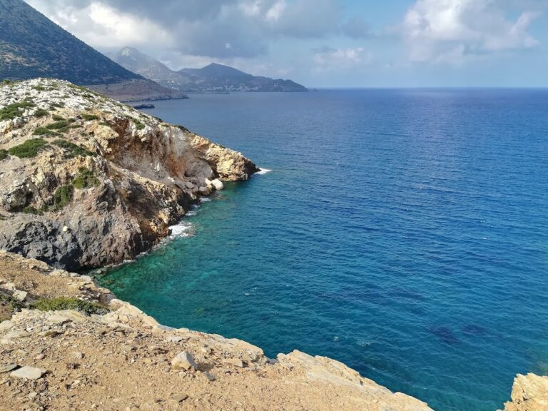
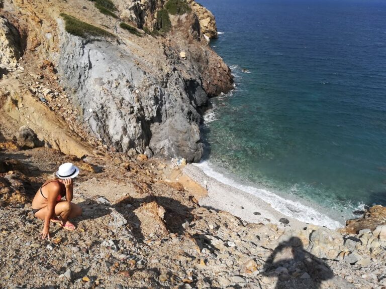
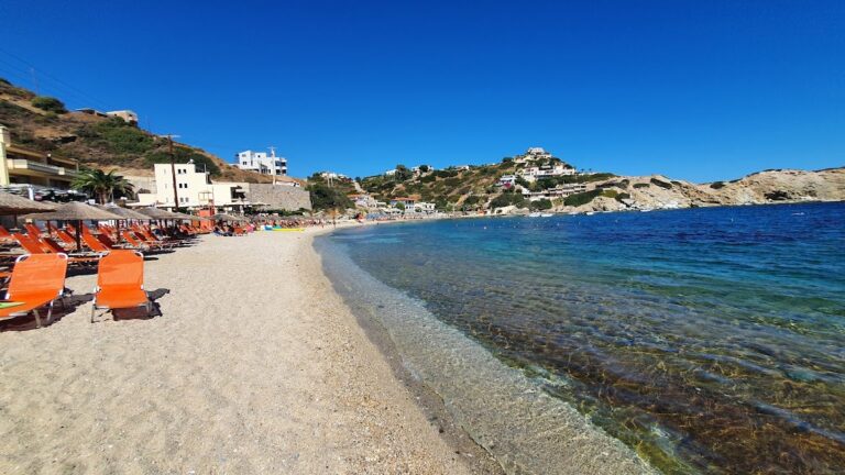
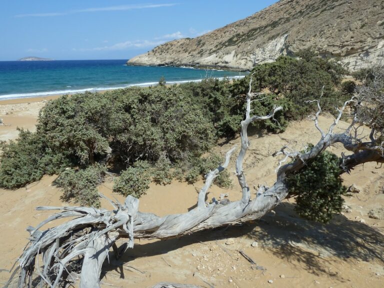
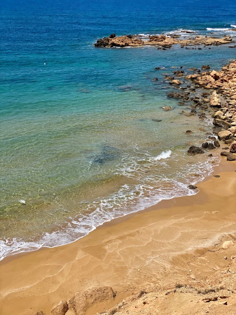
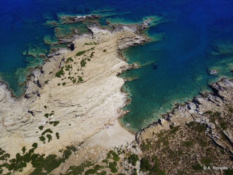
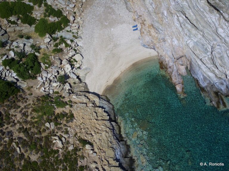
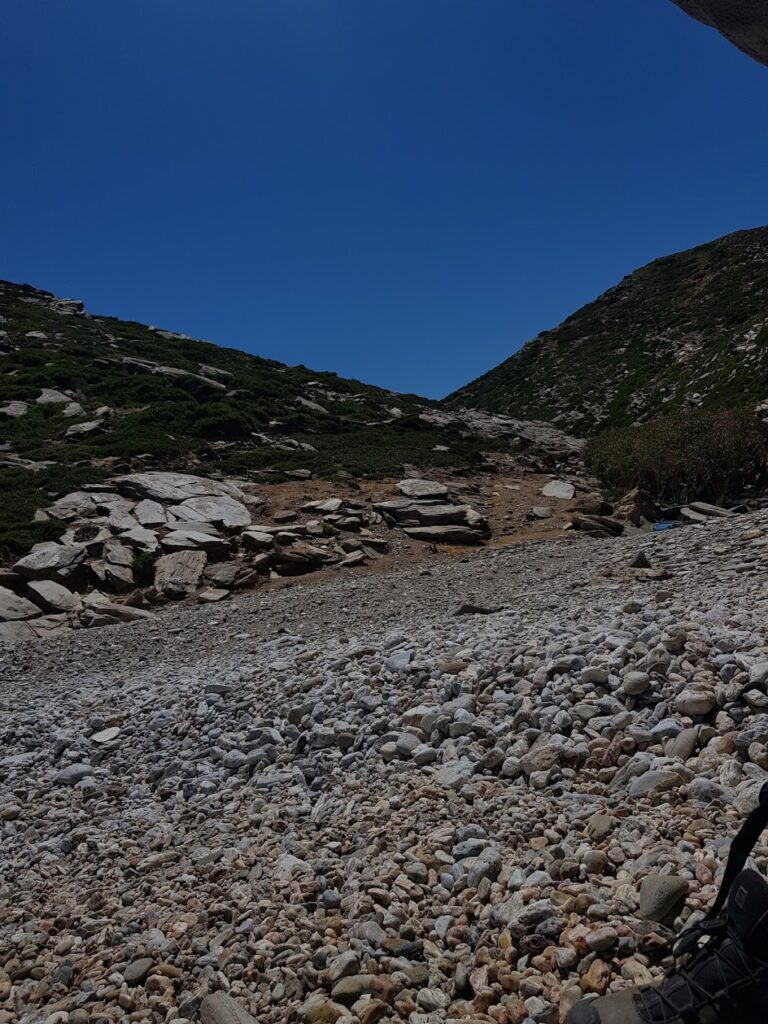
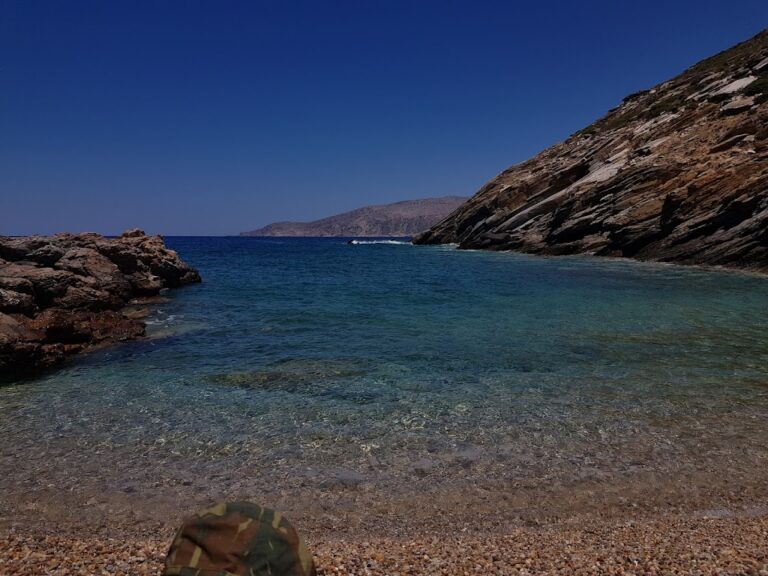
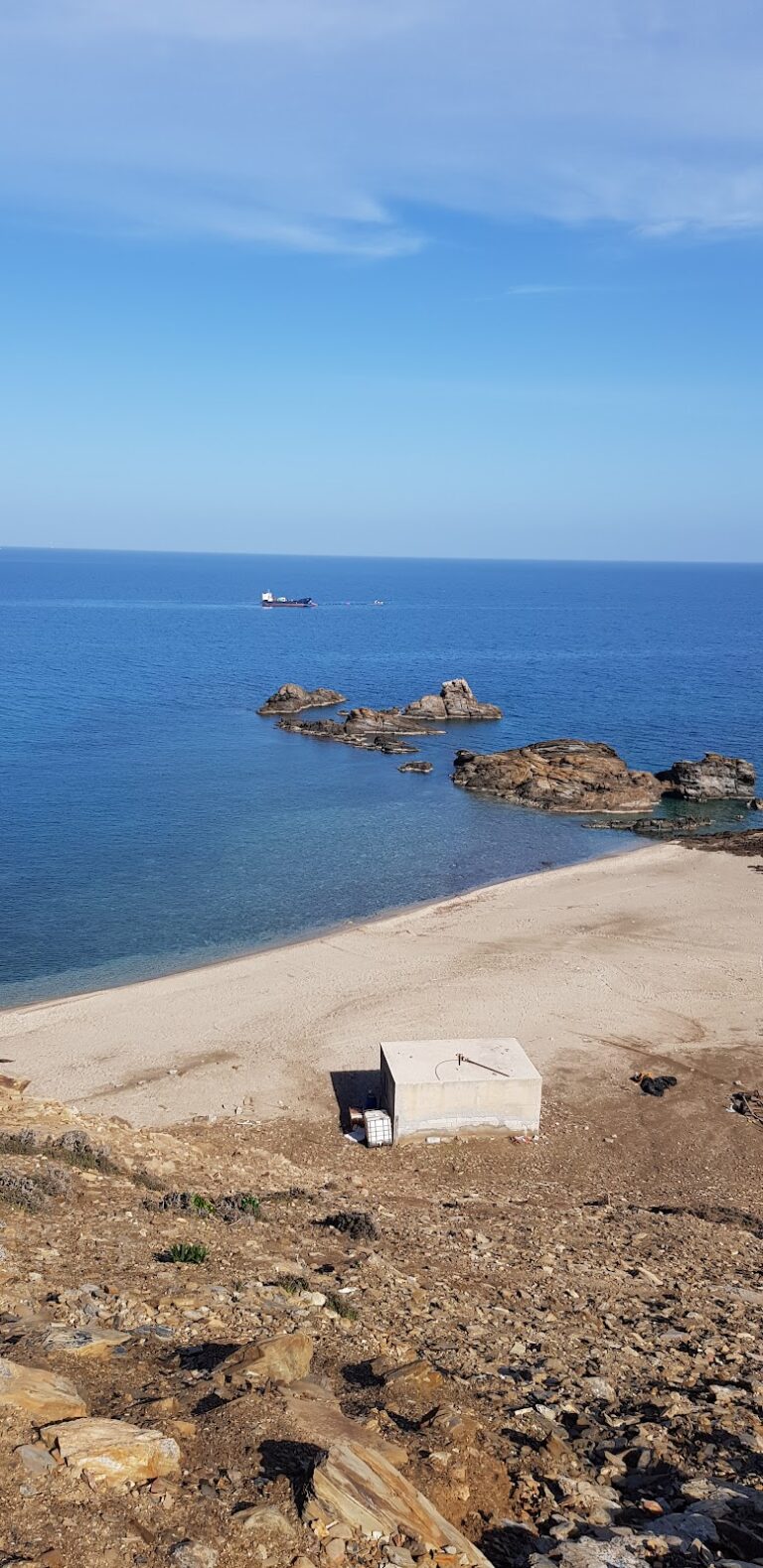
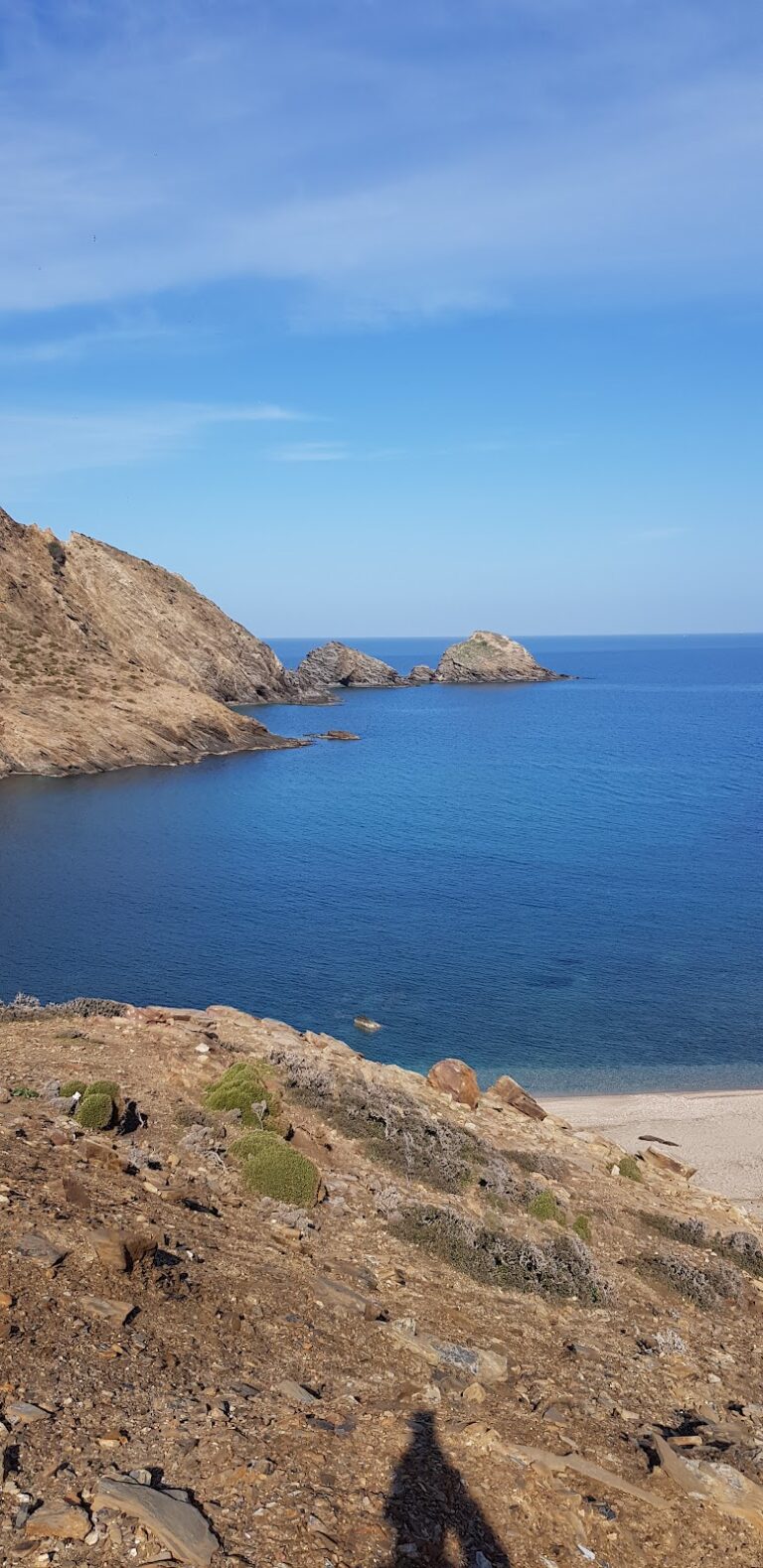
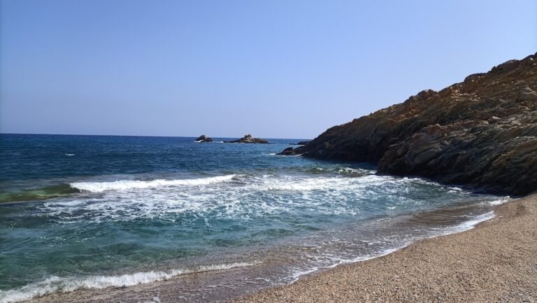
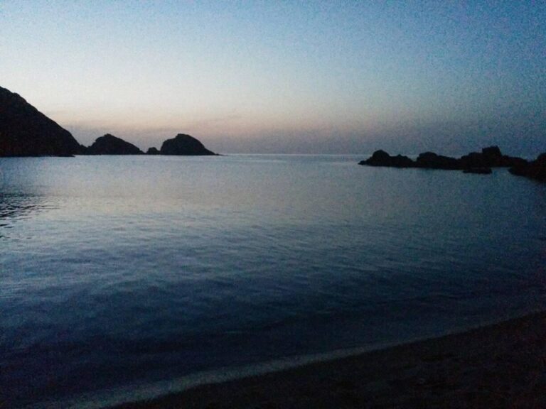
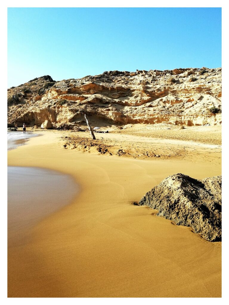
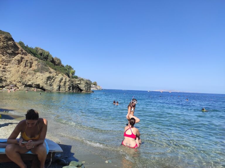
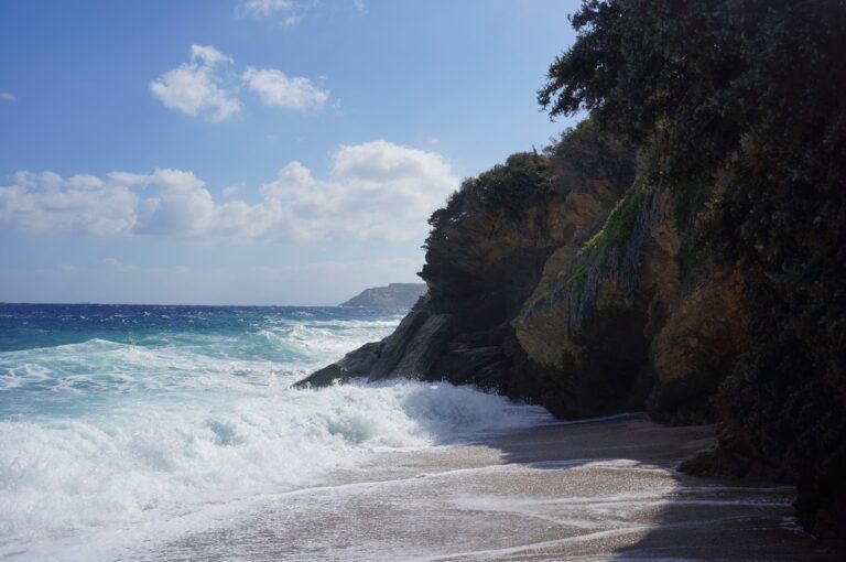
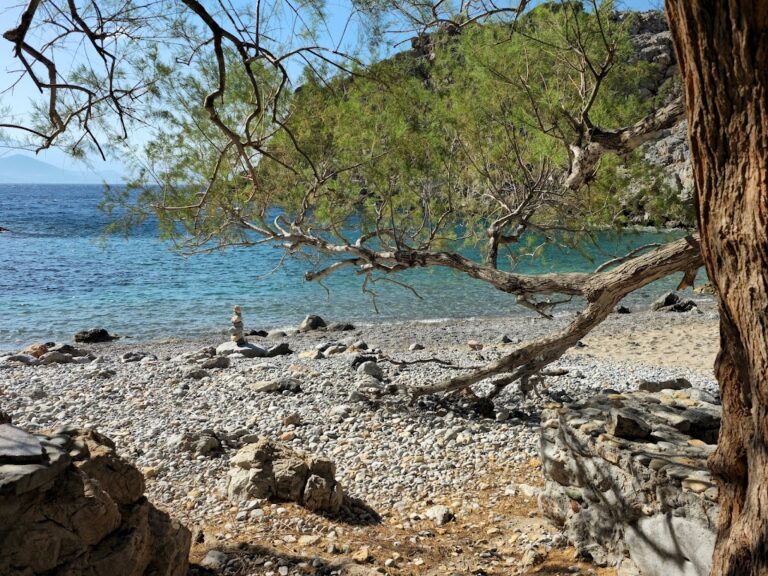
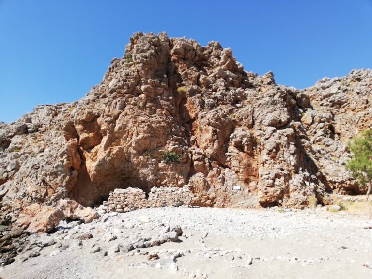
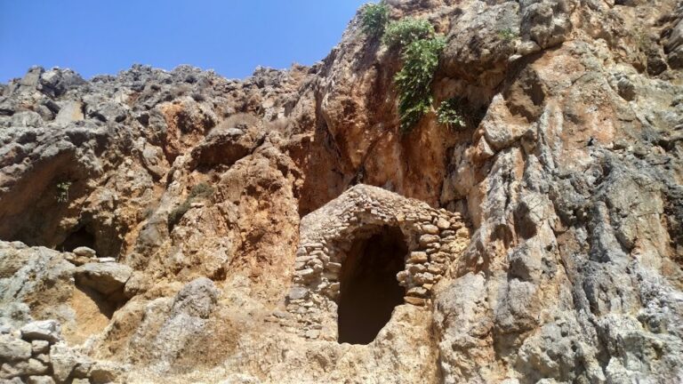
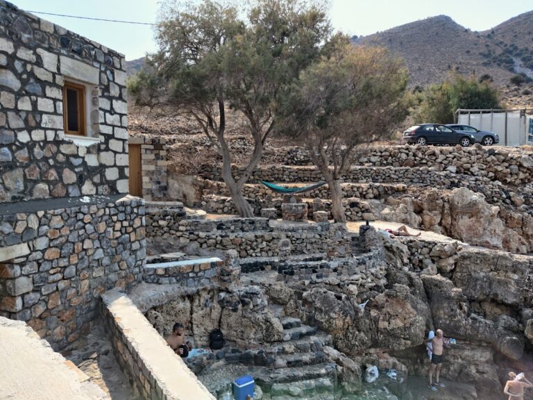
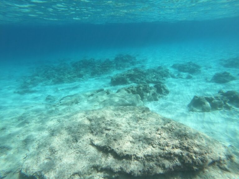
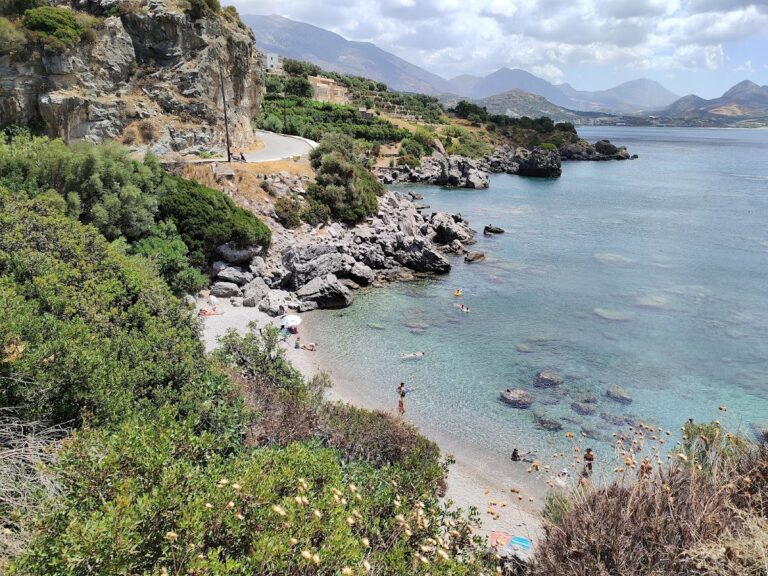
Further down, at Cape Sarandaris’s base, you’ll discover the breathtaking Sarantari Cape beach, arguably the most picturesque and sheltered beach in Hersonissos. Its sandy beaches, shallow crystal-clear waters, and an intriguing sea cave make it a tranquil alternative to other beaches, despite the challenging descent through steep limestone cliffs.

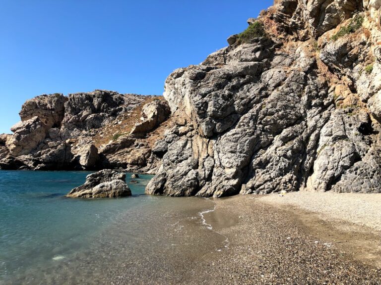
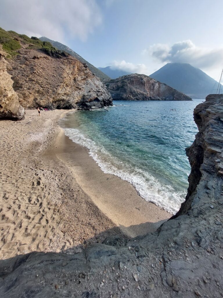
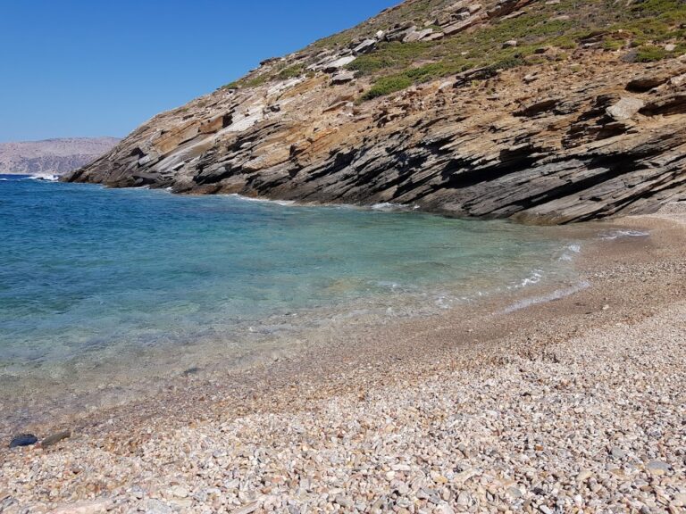
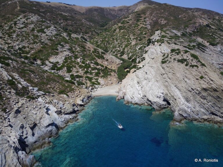
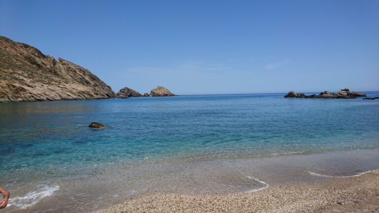
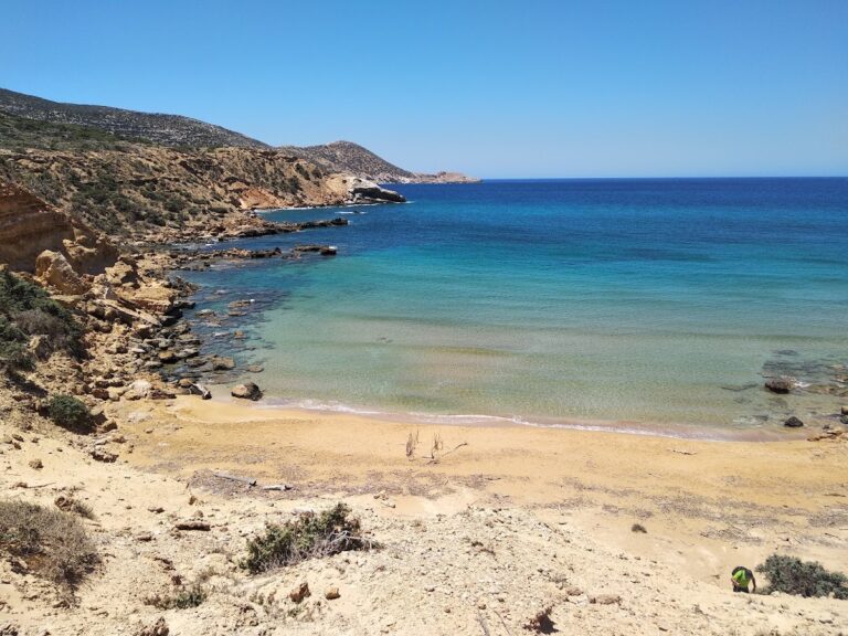
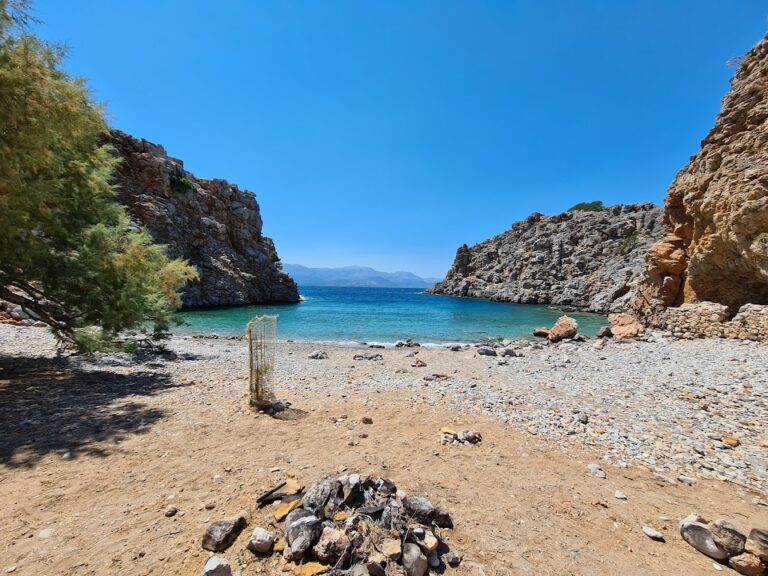
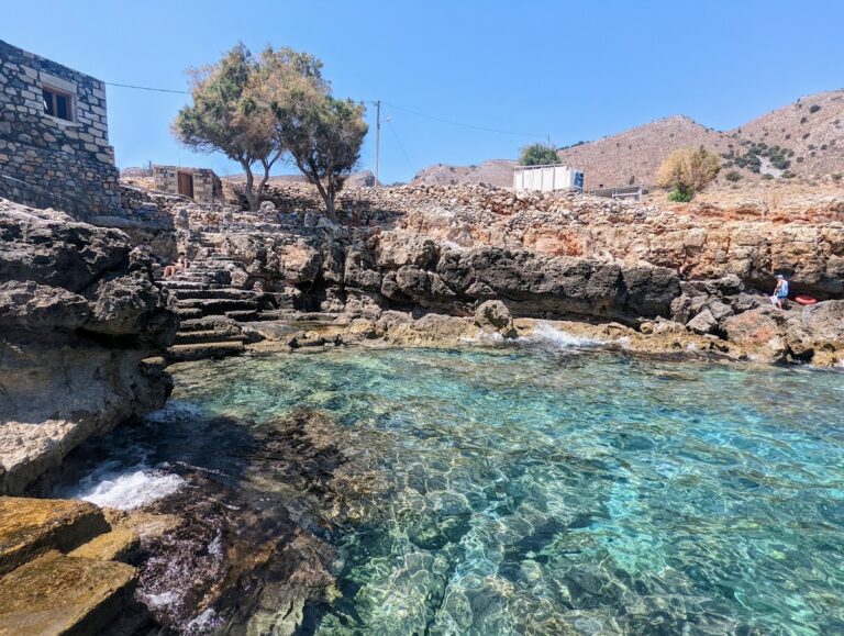
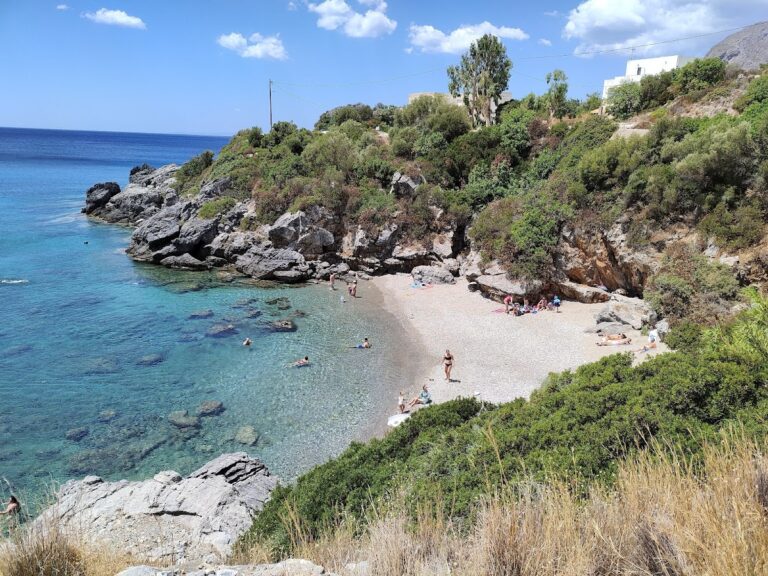
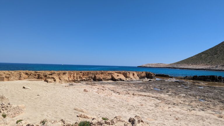
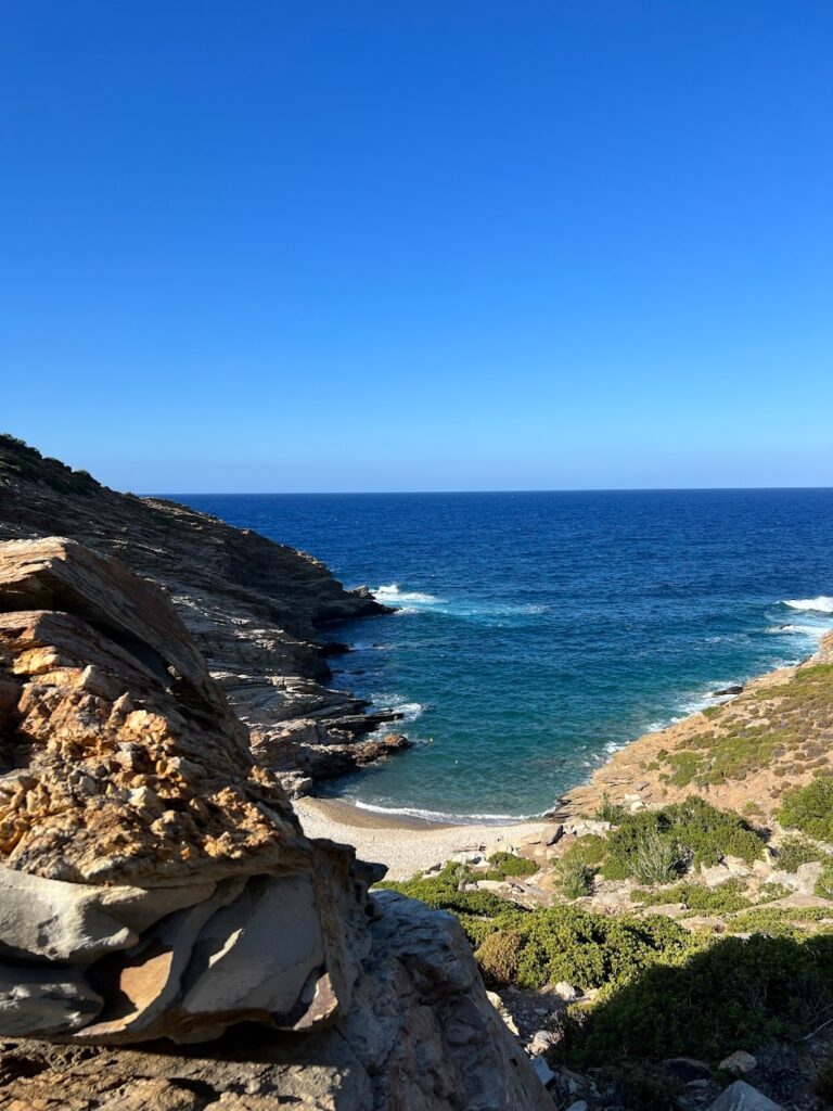
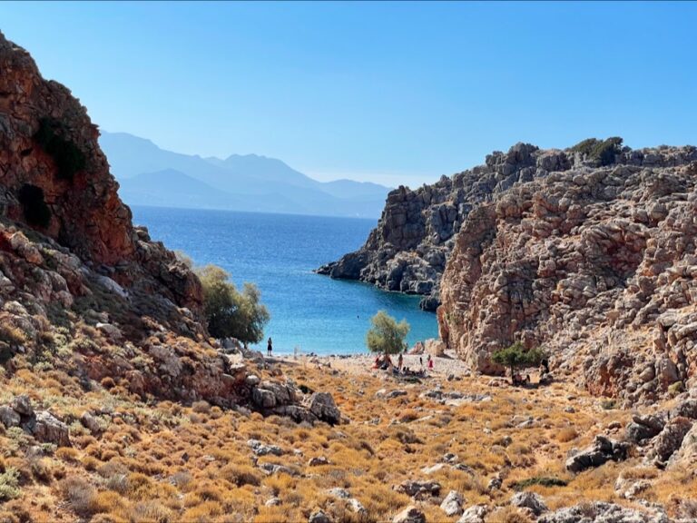
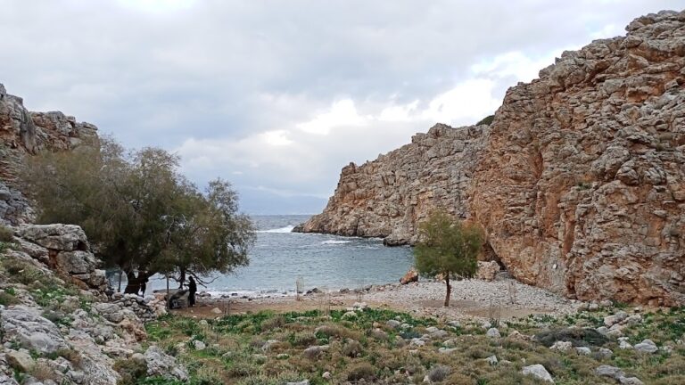
Contrary to popular belief, Hersonissos also has a stony naturist beach located next to Sarandaris Cape, hidden discreetly by tall cliffs. This sandy, rocky cove provides a peaceful spot for swimming and solitude.

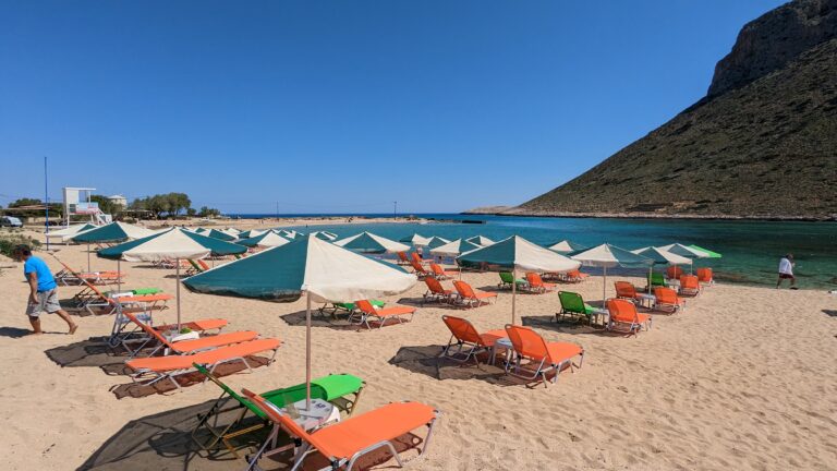
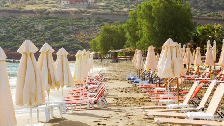
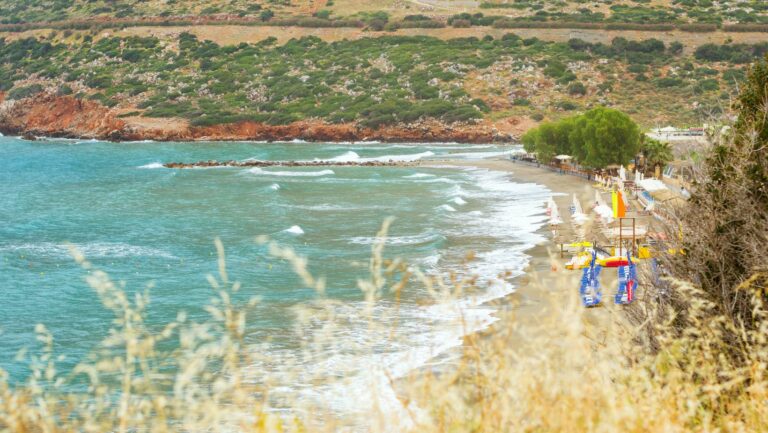
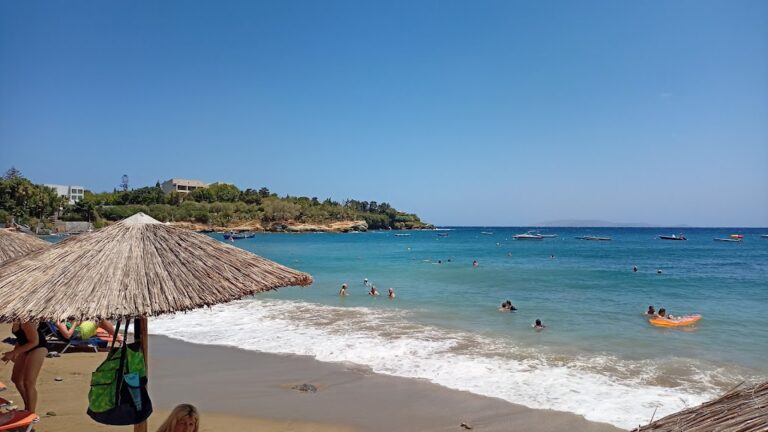
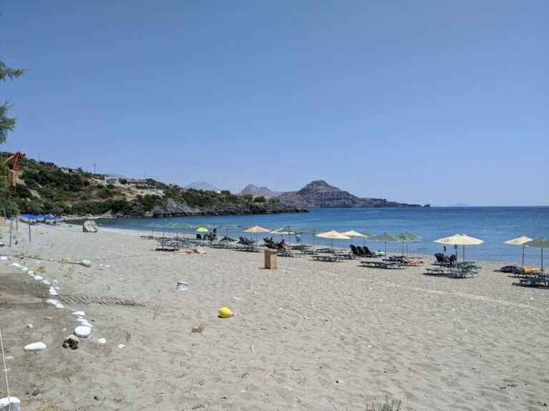
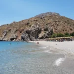
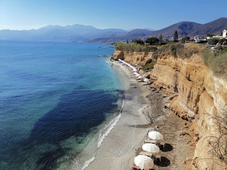
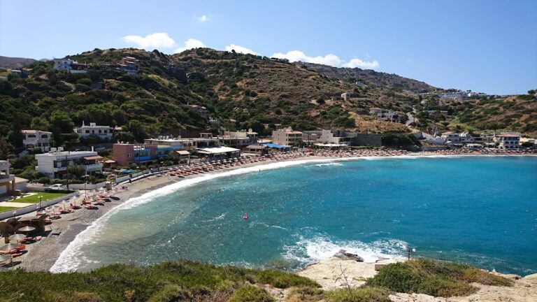
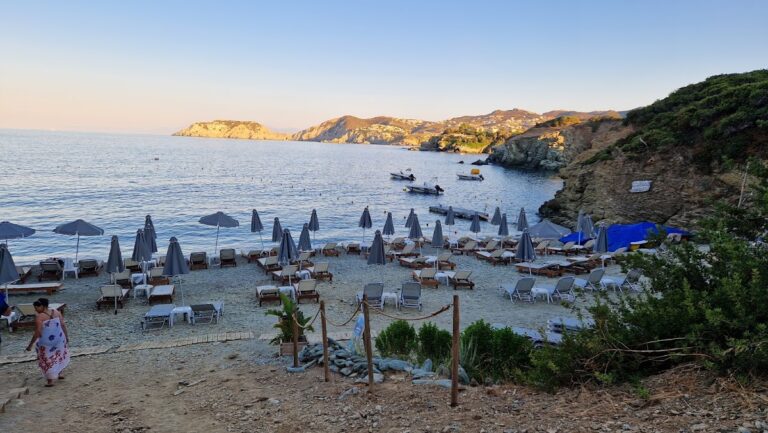
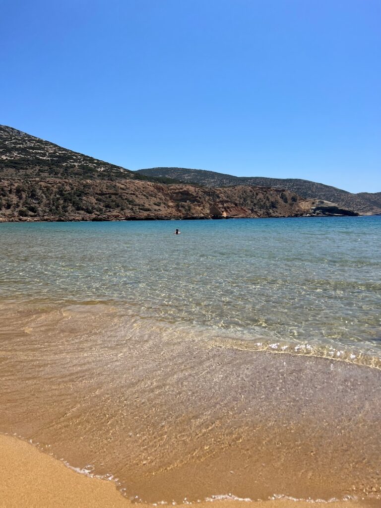
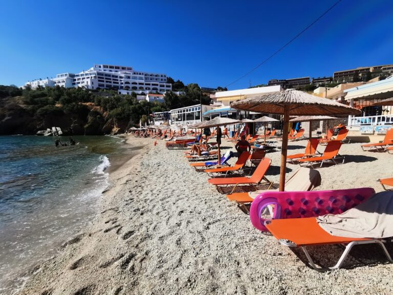
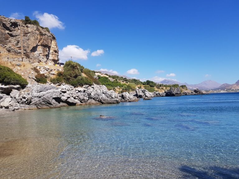
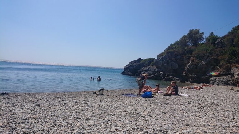
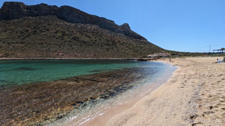
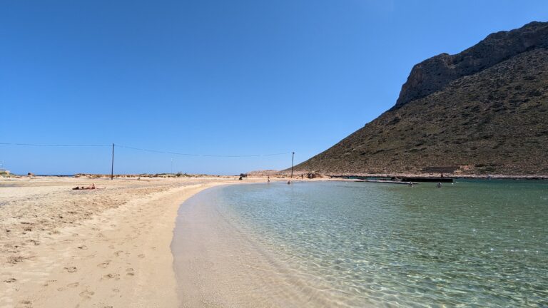
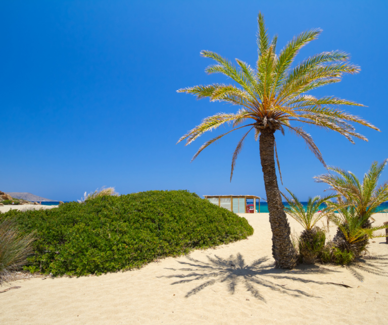
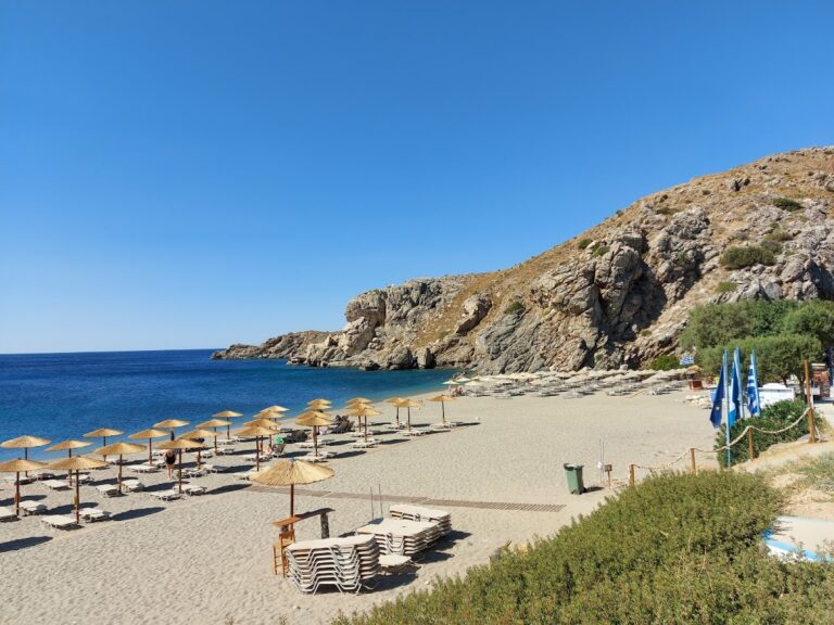
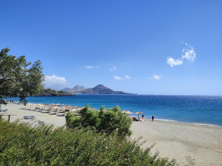
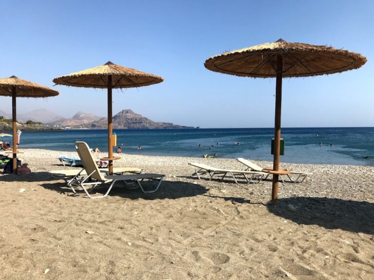
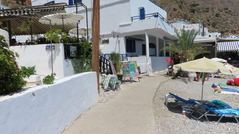
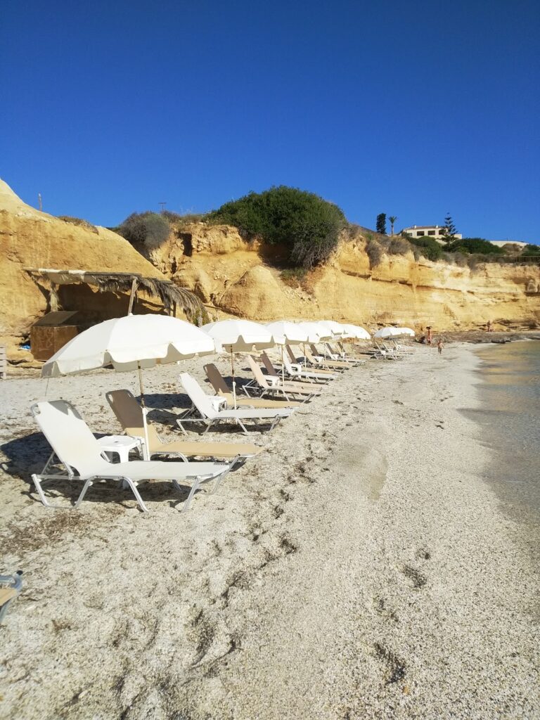
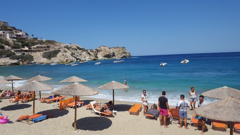
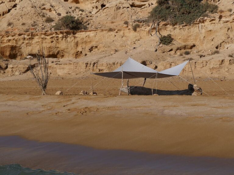
The well-known Sarandari beach comes next, popular among children due to its shallow waters and soft sands. The beach offers umbrellas, sunbeds, and a small canteen for convenience.

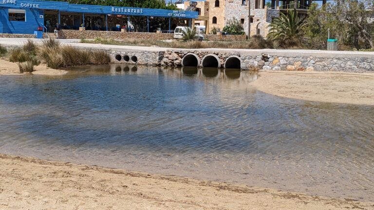
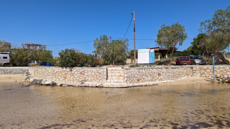
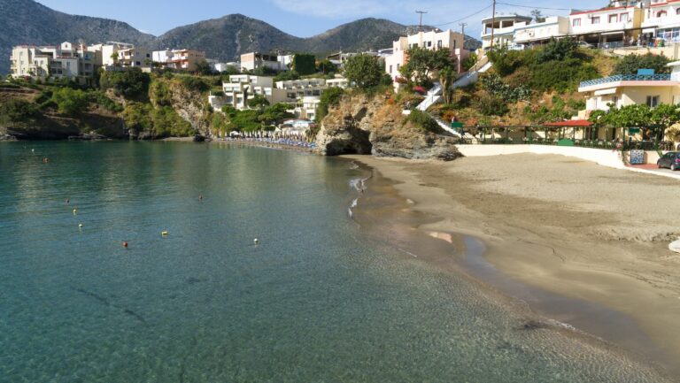
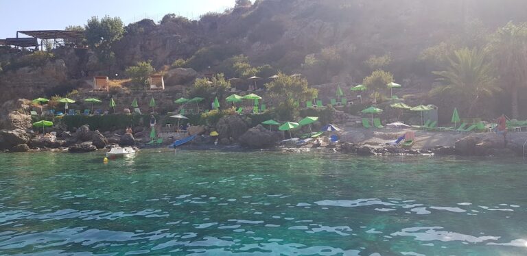
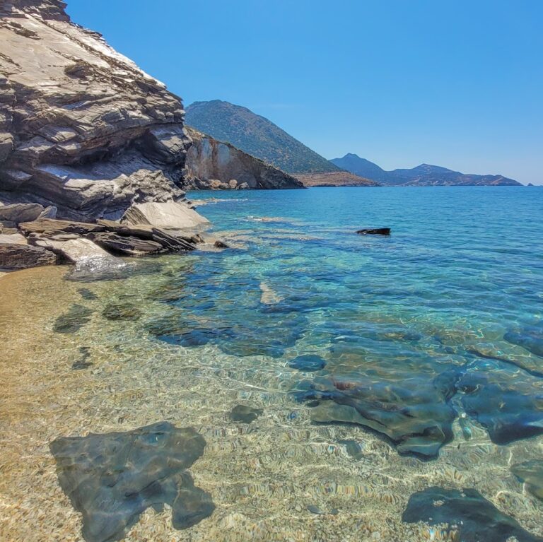
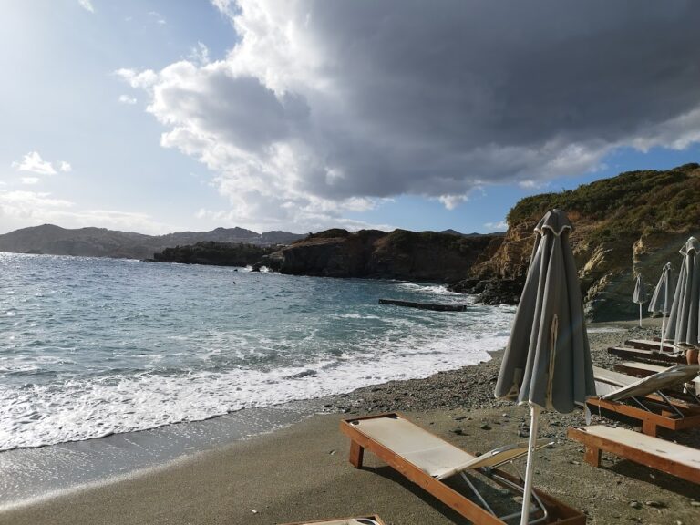
Next to Sarandari is Giofyri beach, situated under the main road and supported by a massive concrete wall. With its unique white coarse sand, deeper waters, and rocky seabed, it’s a popular choice among visitors, complete with umbrella and sunbed facilities.

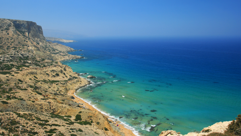
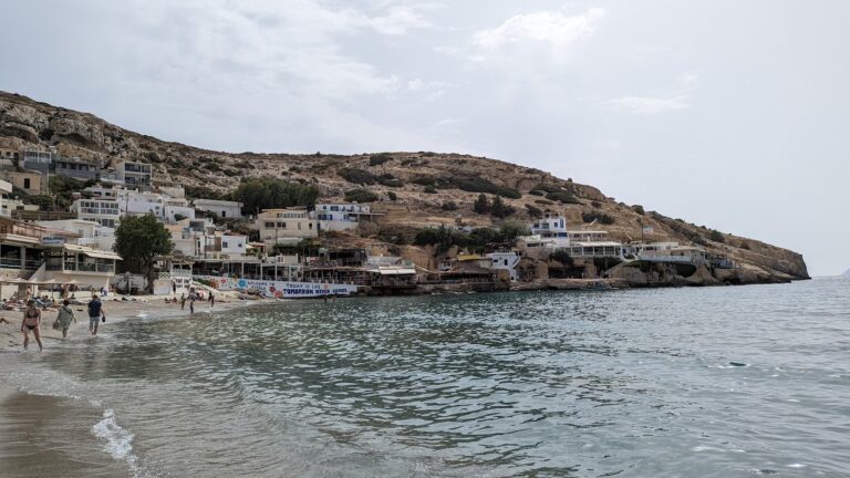
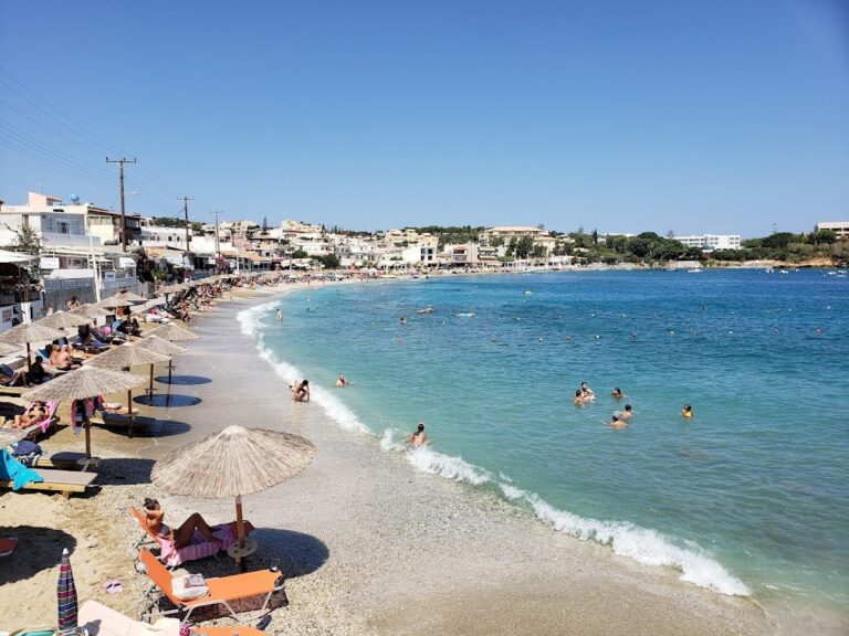
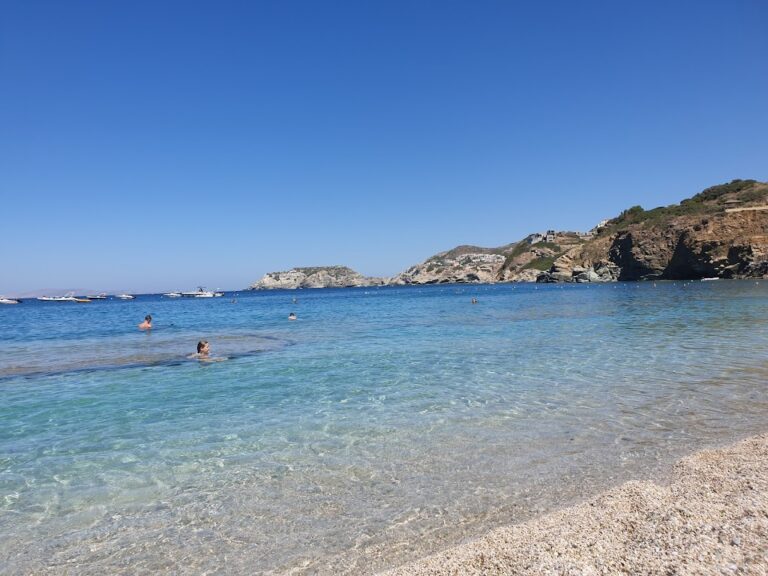
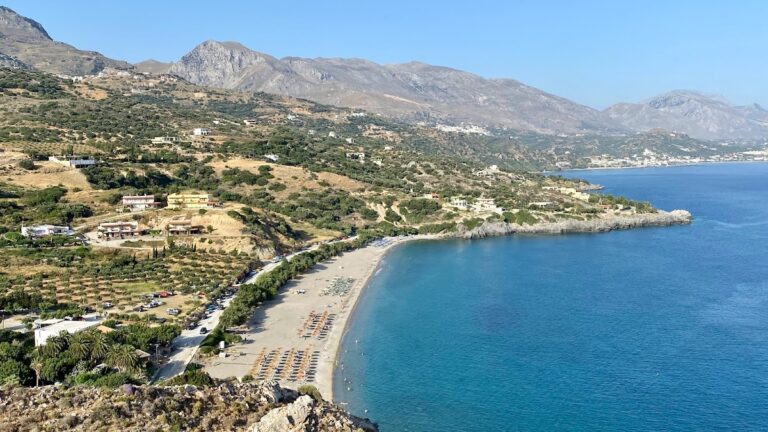
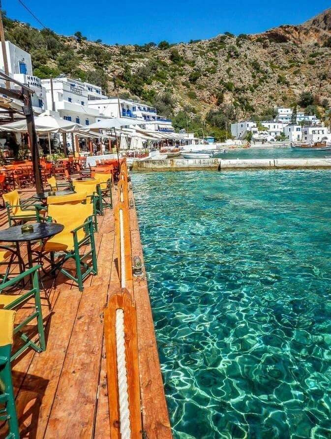
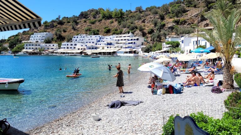
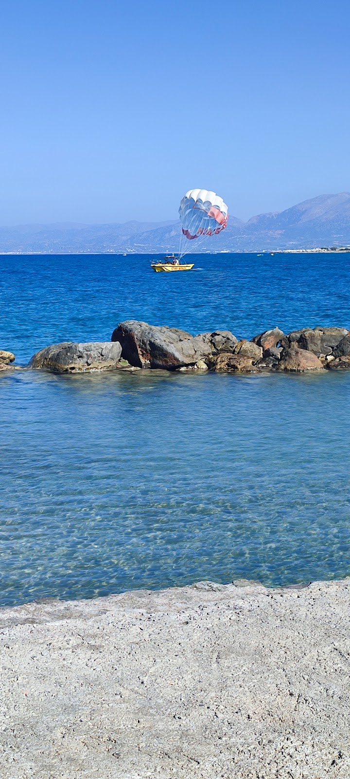
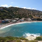
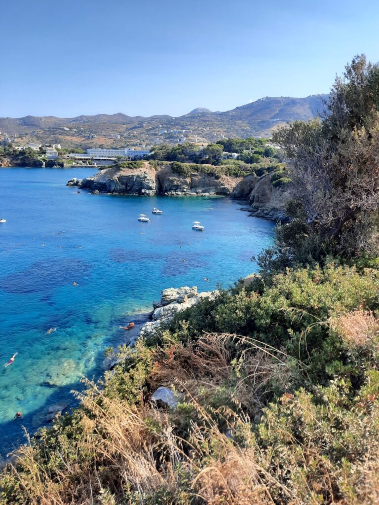
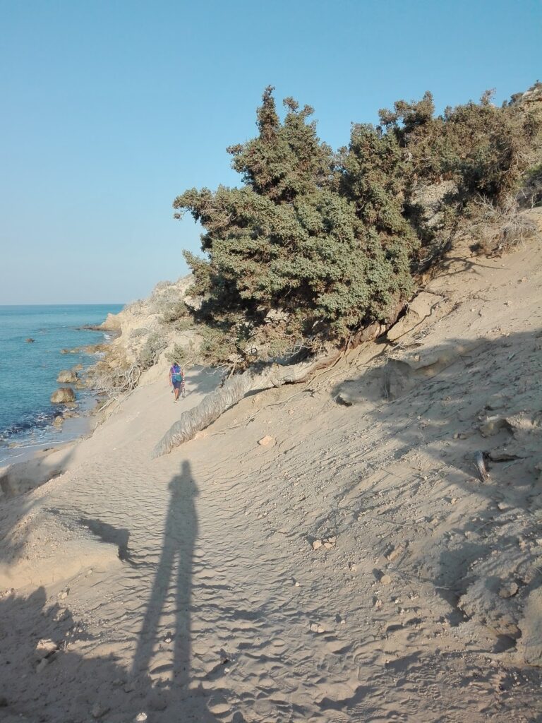
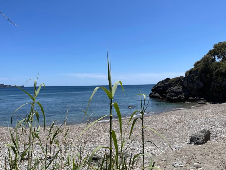
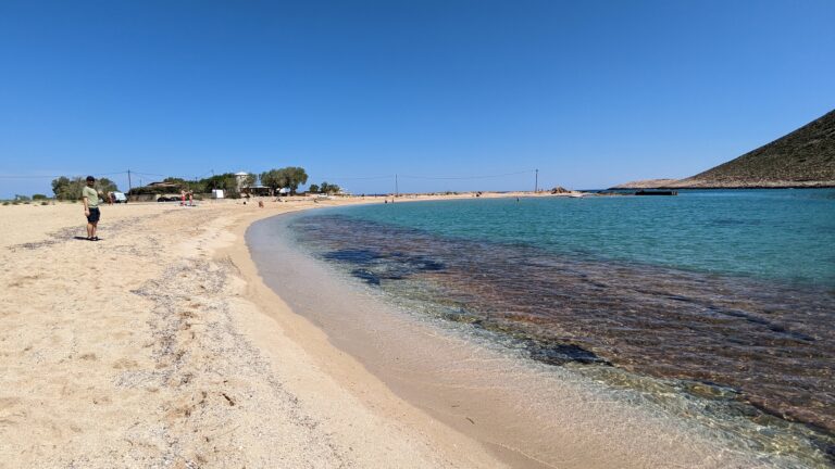
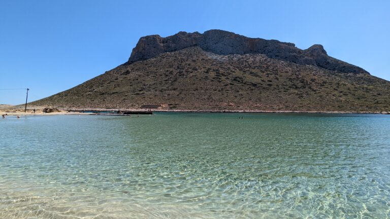
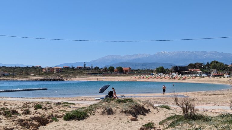
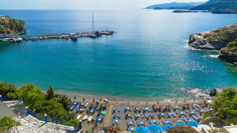
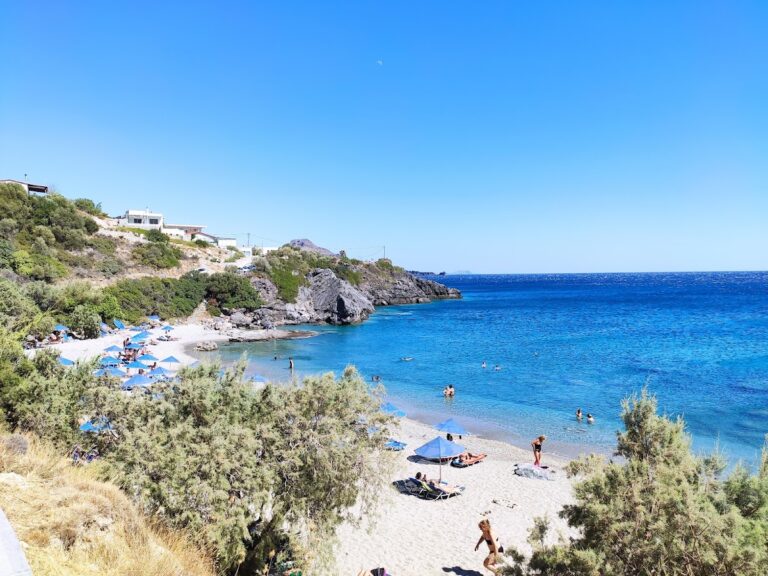
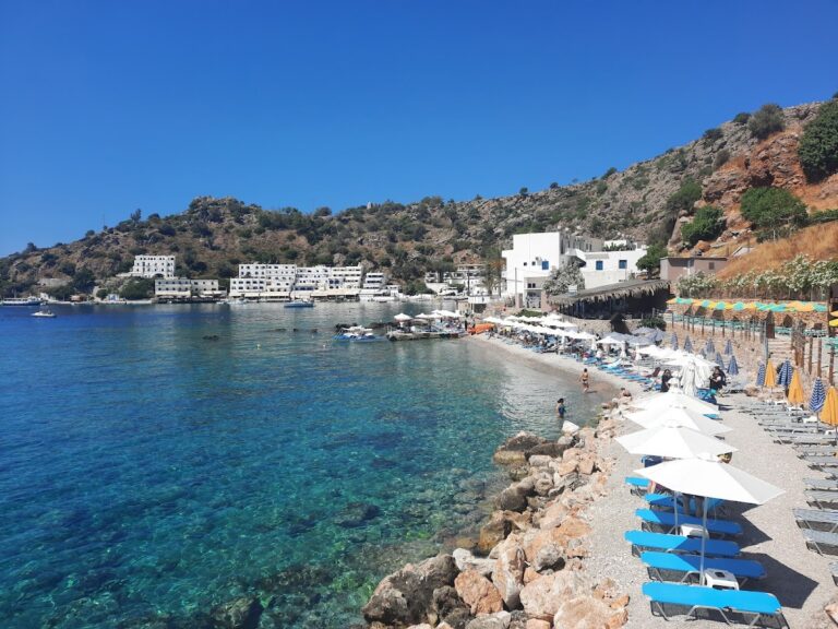
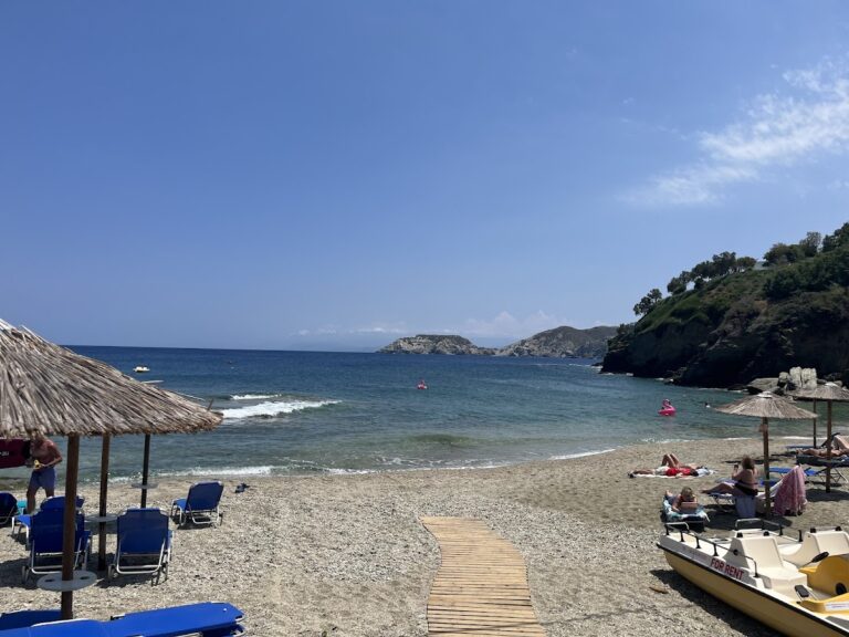
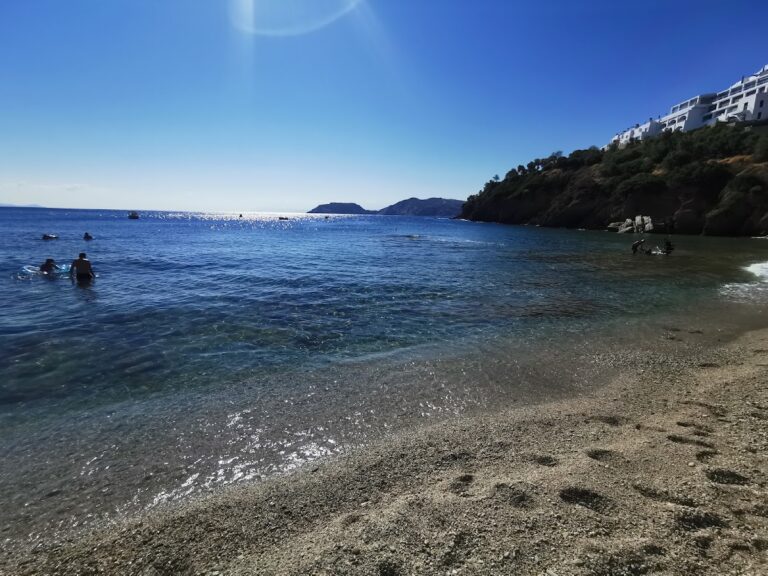
Heading east from Giofyri along the coastal road, a series of small, slim beaches framed by white rocks awaits, their light-blue waters offering a truly mesmerizing sight. This captivating landscape stretches until you reach the large beach in front of the Creta Maris hotel, which extends up to Hersonissos port. This beach is well-equipped with sunbeds, umbrellas, water sports facilities, and a beach volleyball court, becoming busier and more exposed to winds nearer the harbor.

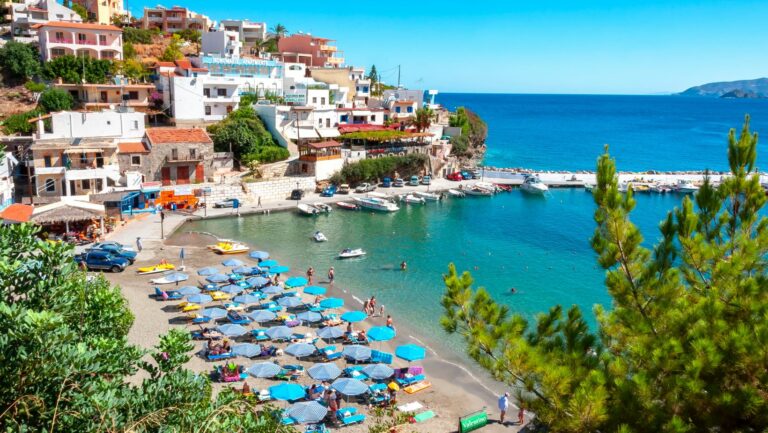
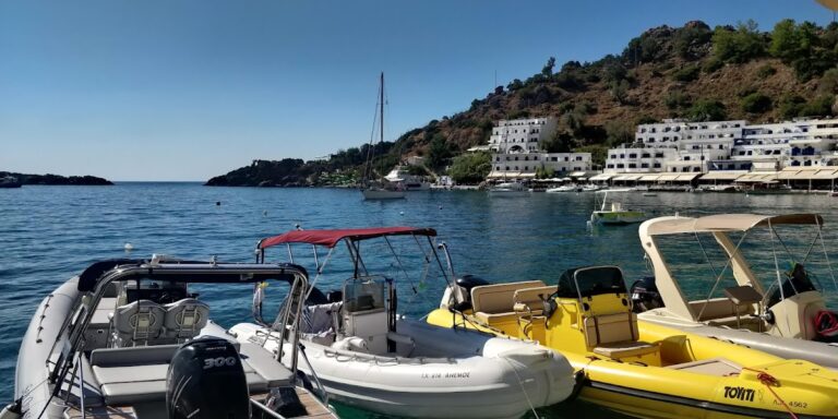
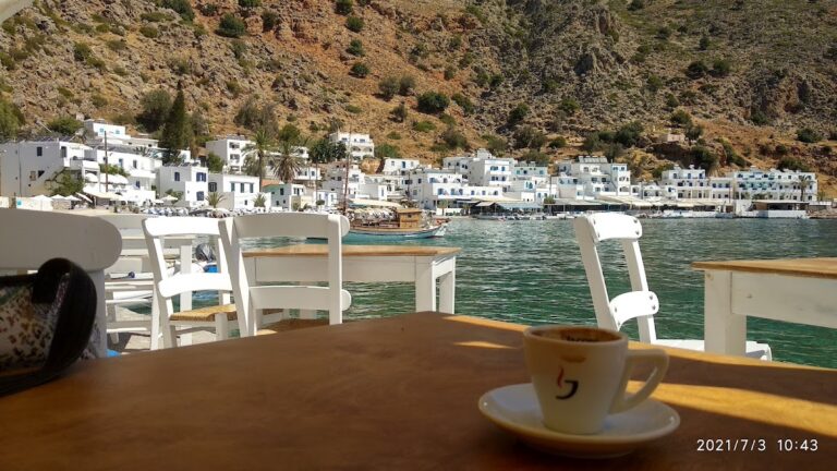
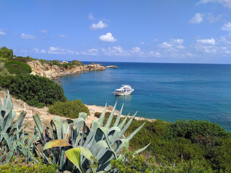
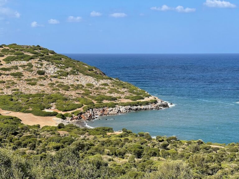
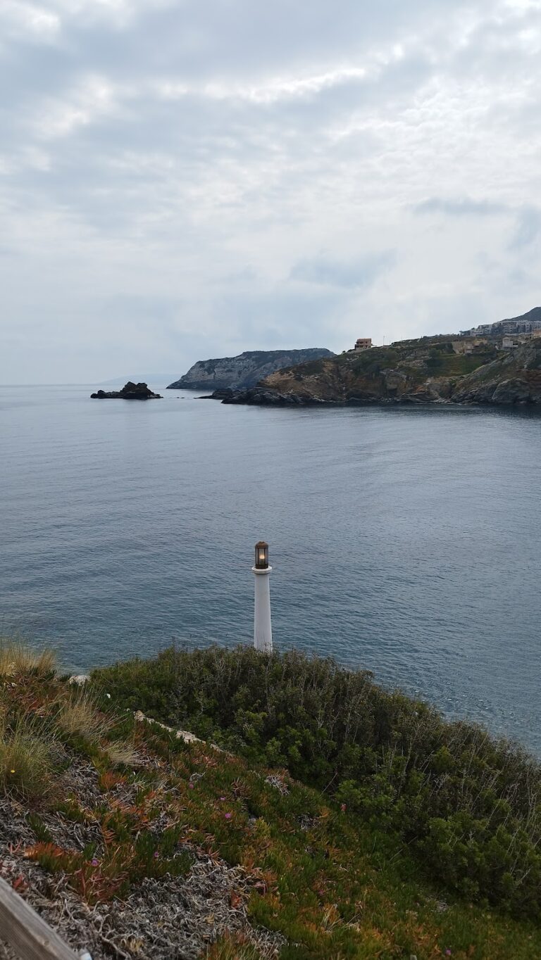
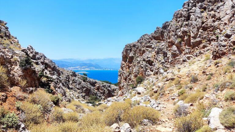
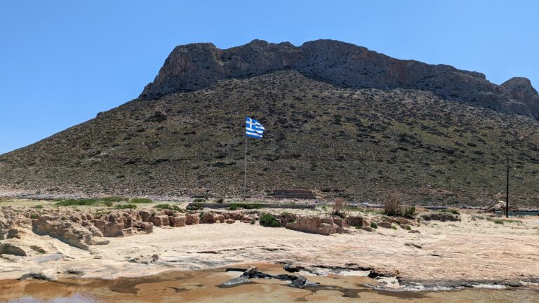
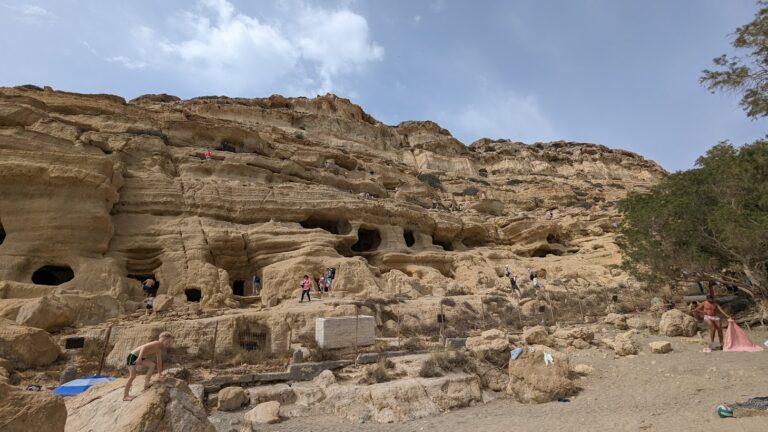
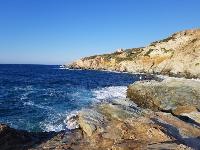
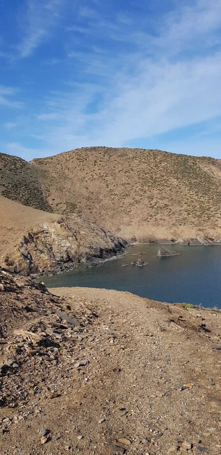
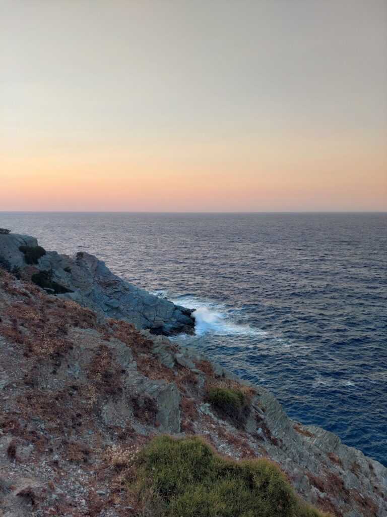
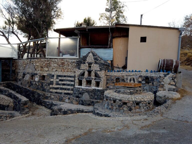
Regardless of whether you decide to swim, a casual walk from the port to Cape Sarandaris offers stunning views of Hersonissos Bay and St. George’s chapel in Sarandaris. At Hersonissos port, consider visiting the lighthouse and the Agia Paraskevi church, partially built into the rock. On Kastri Hill, the remnants of the early Christian Hersonissos basilica and its preserved mosaics are a must-see.

  • Glaros beaches
  • Pebbles, Sand
  • Normal
  • Green

Charakas is a region situated approximately 36km to the east of Rethymno and 44km to the west of Heraklion, near Bali. Just half a kilometer east of the Panagia Charakiani Church, a small peninsula forms where the petite beaches of Glaros and Katevati can be found. The major highway that links Heraklion and Rethymno is conveniently close by.

Katevati Beach

Located on the western edge of this peninsula is the small but charming Katevati beach, known for its large pebbles. It boasts spectacular views of the rugged Talean Mountains to the south. Its rocky underbelly makes it an ideal spot for fishing and snorkeling. However, it is unregulated, so visitors are advised to come equipped with necessities such as an umbrella, food, and water. Furthermore, it is shielded from the prevalent northern winds due to its eastern positioning. To the north of the beach, on a hill, there are ruins from an ancient settlement.

Glaros Beach

A short distance to the north of the first beach, accessible via a trail starting north of the highway, are the three beautiful beaches of Glaros (also referred to as Glaria or Peristeri) which face west. The beach gets its name from the small, greenish islet of Glaros that’s separated from the shore by a very narrow canal (less than 2m in width). While the shore is sandy, the seabed is rocky, making it an ideal spot for solitude seekers and snorkeling enthusiasts. The northernmost beach, which can be reached by crossing a hill with a Minoan settlement, is considered the most beautiful.

Charakiani Beach

Situated below the Panagia Charakiani Church is a beach with large, round pebbles that attract snorkelers and spearfishermen. This beach can be easily accessed by following a trail that starts from the church. It is easily identifiable by a small islet located directly opposite the beach.

  • Ligaria beach
  • Rocks in places, Sand
  • Normal
  • Green

The Ligaria beach, nestled 21km northwest of Heraklion and just 1km east of Agia Pelagia, is shielded by the Bay of Ligaria from the common northwest winds of the region. Not far from here is the Panagia church, a relic from its days as the Panagia Ligariani monastery. The area is named after this monastery, which in turn, derives its name from the abundant osier plant, also known as ‘ligaria’ in Greek, famous for its pliable stems and lovely flowers.

The beach is an enchanting spot with its rough sand and serene, turquoise water. The presence of small boats adds to the charm of the scene. While the eastern part is more exposed to waves and tends to gather more debris, the western side boasts cleaner water and a flat sea. Smooth rocks are found close to the shore except for the western part of Ligaria which has small sandy areas. The beach is well-equipped with facilities like umbrellas, sunbeds, water sports, a diving school, beach bars, restaurants, and accommodations. However, parking can be a challenge, especially on weekends due to the influx of locals.

A trail leading northeast from the west end of the beach takes you to the top of the cape safeguarding Ligaria. Adjacent to this cape lies a secluded little beach named Parasfougario. It has sand and pebbles but is exposed to the wind. A stone pathway starting from a cliffside house leads to this beach, but it is off-limits as it falls under private property.

  • Potamos beach - Chania
  • Sand
  • Shallow
  • Blue, Green

Potamos beach, along with its neighbouring Pirgos beach, is situated on the northwest shore of Gavdos island, 7km northwest from the Karave port. The beach’s striking features include its lengthy stretch of reddish sand, shallow waters, impressive clay geological formations, and steep cliffs, all of which emerge from a small canyon. The beach earns its name, Potamos, from the Greek word for river.

This beach, enveloped in pines and junipers, is a popular spot for hiking enthusiasts. Visiting the river area offers a unique opportunity to examine the surrounding rock formations or indulge in a clay spa treatment.

The Lighthouse – Ambelos – Potamos Trail
The principal way to access Potamos beach is by a 1.5-2 hour hike from Ambelos. Before reaching Ambelos, it’s worth visiting the Gavdos lighthouse, situated at an altitude of 368m. The lighthouse, which now functions as a small museum and coffee shop, was constructed in 1880 and could be seen from 40 miles away (ranking it the 2nd longest distance globally). However, it was bombed in May 1942 and later reconstructed. A little further along, you’ll encounter the chapels and deserted houses of Ambelos, where the crumbling stone cottages evoke memories of Gavdos’ bygone era.

The path to Potamos from Ambelos traverses a dense pine forest and provides views of the Gavdopoula islet. The hike is fairly easy, making it suitable for beginner hikers. Alternatively, a dirt road leading to a spot about 500m east of the beach is available for those who prefer not to walk. Midway, you’ll come across the derelict settlement of Neveli.

Bo Cove
As you make your way down to Potamos, you’ll notice Bo’s rocky shore to your left. Bo is a tiny cove facing north with a rocky seabed. The locals claim its peculiar name originates from the sound “bo bo” made by the waves crashing against the rocks.

  • Bogazi beach at Sises
  • Pebbles
  • Normal
  • Green

Bogazi beach is nestled in a secluded area on the periphery of the Sisses community in the district of Mylopotamos, located in the Talea Range and east of the German outpost at Pyrgos peak. Its remote location makes it only accessible by boat, as the nearby dirt roads are extremely challenging to navigate. Hence, it remains largely undiscovered. A year-round flowing stream lined with plane trees concludes its course at Bogazi. The beach, facing east and flanked by stunning rock formations to the north, is one of the rare wave-free beaches on the northern coastline of Rethymnon.

  • Parasfougario beach
  • Rocks in places, Sand
  • Normal
  • Green

Parasfougario Beach, situated in the Achlada district of Malevizi province, is approximately 22 km northwest of Heraklion on the island of Crete. Positioned on a steep incline between the well-known beaches of Lygaria and Agia Pelagia, the only access to it is by a 20-25 minute swim from either of these beaches.

A set of stairs from a nearby house lead directly down to this petite beach. Its backdrop of a slope blanketed in crithmum adds to its charm. The ocean floor features pebbles and coarse sand, and a small cave to the east further enhances the picturesque setting.

Unlike its neighbouring beaches, Parasfougario is exposed to the northern winds. As a result, it is advisable to avoid it during windy periods, as it tends to accumulate a significant amount of rubbish during these times.

  • Korakia beach
  • Pebbles
  • Normal
  • Green

The secluded bay of Korakia is located 48km east of Rethymno and 39km west of Heraklion, near the village Sisses and close to Fodele beach. There are three adjacent beaches, which are mainly sandy with large pebbles in places, open to northwest winds. The beaches are secluded and almost unknown to everybody. Korakia is totally unorganized, thus you should have anything you need with you. However, the seawater has been significantly degraded, due to the north winds that carry rubbish and because of the nearby landfill of Heraklion city.

The area is a candidate for the construction of the new Power Station of Crete, but this has raised many arguments against this by ecologists. In order to access Korakia from Fodele, you should take the highway to Rethymno and turn right 1km after Fodele, on a very bad dirt track that leads to the beach after 1.5km.

  • Voulolimni beach
  • Rocks in places
  • Normal
  • Green

Situated 70km southeast of Chania and just 500m northwest of the Chrysoskalitissa Monastery, you’ll find Voulolimni – a unique ‘sunken lake’. This is not your typical beach, but rather a natural rocky ‘pool’ that has become a hidden gem for the locals of the Chrysoskalitissa village.

Voulolimni is nestled within a small crater, encircled by rocks, creating a beautiful sea lake. This quaint salt lake is shielded from the strong local winds thanks to its geological formation, with only a small opening connecting it to the open sea. As such, it doubles as a natural harbor for small boats.

Its waters remain calm, boasting an enchanting greenish hue that many swimmers find irresistible. While there are no facilities directly adjacent to the lake, you can find accommodation options and taverns in the nearby Chrysoskalitissa village. This makes Voulolimni a perfect spot for those seeking tranquillity amidst Crete’s natural beauty.

  • Pirgos beach
  • Sand
  • Shallow
  • Blue, Green

The Tower, or Pirgos, is positioned along the northwestern shoreline of Gavdos, a mere 6km northwest from the Karave port. Two neighboring beaches of emerald sand split by a smattering of rocks are the highlights of Pirgos bay. These secluded and unspoiled spots are often chosen by outdoor campers, given their significant distance from any tourist facilities. The beach is shielded by towering cliffs and lacks any natural tree shade.

The only routes to Pirgos are by foot or boat. A trek from the village of Ambelos will last approximately 2-2.5 hours, while the descent to the beach via the steep path from the bay’s northern tip requires careful attention. One guarantee is the lasting impression left by your first encounter with Pirgos’ sparkling sea and untamed surroundings. Don’t forget to pack essentials like water and food for your visit.

  • Psaromoura beach
  • Pebbles
  • Deep
  • Blue, Green

Psaromoura, situated 22km northwest of Heraklion and only 500m north of Agia Pelagia, faces east and is protected from the prevalent northwest winds. There are no immediate accommodations or dining options on the beach, but various facilities can be found within a short walking distance. The beach is pebbled and tends to be frequented more by locals than tourists. The northern end of the beach features a large, folded rock formation common to the Talea Range area, which shields the beach from the waves.

In the past, Psaromoura was one of the most beautiful unorganized beaches in Crete. Today, it has been transformed into a well-organized beach equipped with umbrellas, sun loungers, and a beach canteen serving refreshments and cocktails. Environmental groups in Crete have repeatedly requested the removal of the umbrellas to restore the beach to its original state.

To reach Psaromoura, one must drive to Agia Pelagia. After passing the Hotel Capsis Out of the Blue, continue westwards for an additional 100 meters before turning right onto a small road. A few steps ahead, you’ll find a closed gate and a sign indicating “To the Beach”. After parking your car, head west past the gate and you’ll soon arrive at Psaromoura. Alternatively, heading east from the gate will lead you to an elevated view of Kladissos Beach, accessible via the hotel.

The name Psaromoura derives from the Greek words psari, meaning fish, and mouri, meaning cape. Thus, it is located on a cape populated with fish.

  • Mononaftis beach
  • Fine Pebbles, Rocks in places
  • Normal
  • Deep blue, Green

Mononaftis is a stunning pebble-strewn beach situated 24km northwest of Heraklion and just 1km north of Agia Pelagia on the island of Crete. Its name, meaning “One sailor”, originates from a local tale about a shipwreck where only one sailor survived. Interestingly, the term Mononaftis also refers to the large boulder floating about 50m off the shore.

The beach is nestled in the northern region of the Agia Pelagia peninsula and is shielded from the prevalent north winds due to its eastward facing position. This makes it, along with the nearby beaches, a popular choice among locals.

Mononaftis beach has a mixture of coarse sand and pebbles and the sea displays a unique greenish hue. It’s well-equipped with amenities such as umbrellas, sunbeds, and water sports facilities. Additionally, a variety of cafes, restaurants, and accommodation options can be found in close proximity. The seabed is rocky, making it a perfect spot for fishing and scuba diving.

Reaching Mononaftis from Heraklion involves driving on the National Road towards Chania, bypassing the first sign to Agia Pelagia. Take a right at the second exit to Agia Pelagia/Achlada and continue northwards towards the sea. After driving for 2-3 km, you’ll notice a petrol station on your left. Take a left before the station and keep driving until you arrive at the Mononaftis settlement. However, be aware that finding parking can be a challenge during the peak season.

  • Agriomandra beach
  • Fine Pebbles, Pebbles
  • Deep
  • Deep blue, Green

Agriomandra, a hidden gem of a beach, can be found 24km east of Agios Nikolaos, or alternatively, 3km west of Kavousi village and Tholos beach. This beach, hidden at the exit of the Agriomandra gorge, is only accessible by foot through the canyon. To reach the entrance to the gorge, follow a dirt road that cuts through the verdant meadows west of Kavoussi, known as Lakos Ambelion. A short, manageable trail from this point will bring you to the beach, about a 10-minute walk. Along the way, you’ll notice several petite caves nestled into the rocks, one of which is a stone-built church from the Byzantine era, dedicated to St. John the Theologian. As you continue on, you’ll come upon the stunning pebbly beach with its transparent green waters, tucked away between the protective arms of the gorge cliffs.

The seclusion of the beach, primarily due to its challenging access, makes it the perfect spot for privacy, nudism, and snorkelling. Tamarisk trees provide ample shade and the beach itself was first used as a port by the Venetians, with remnants of their buildings still visible today. In fact, until 1920, goods and animals were transported to Agios Nikolaos from this sheltered harbour due to the lack of roads. You’ll also notice the remains of a tax office and a well once used for water.

The name Agriomandra comes from the Greek words Agrios, meaning wild or savage, and mantra, meaning a pen for animals. The term mandra is often used in Crete to describe open spaces where animals were gathered for shipping. The beach’s alternate name, Agiomandra, is likely a nod to the church of St. John located in the gorge.

If you ever visit, consider a walk north along the steep shore to Tholos. After about 400m, you’ll come across the deserted Sykies beach, named for the fig trees that inhabit the area. Next, you’ll encounter the striking landscape of towering cliffs, reaching their peak height of 250m at the impressive Spathi cape, a locale known to the locals as the Sword of Homatas. Here, a rocky beach with crystal clear blue waters awaits, accessible only by boat. The cape is also accessible from Tholos, being in close proximity to both the Theriospilios Cave and the Chryssokamino ancient site.

  • Ombrosgialos bay
  • Rocks in places
  • Deep
  • Deep blue, Green

Ombros Gialos (or Omprosgialos) is located 26km east of Chania, on the east coast of Drapanokefala, near Kefalas and Paleloni villages. It is a rocky beach with blue deep water. There is a small harbour with a dock, from which swimmers usually dive in the crystal waters. Next to the harbour, there is only one tavern, very famous for its fish dishes. The coast is not well organized and is quite far from well-organized accommodation choices. The sea around Ombrosgialos is ideal for snorkelers and scuba divers.

Ombrosgialos can be accessed by car through the asphalt road that starts from Paleloni. Though, another way is to come here by private boat from any nearby port, such as Georgioupolis or Kalives.

  • Fotinari beach
  • Fine Pebbles, Pebbles, Rocks in places
  • Normal
  • Blue, Green

Situated 37km south of Rethymno, nestled between Plakias and Souda’s beach, Fotinari (also known as Foteinari) offers two serene beaches resting in a compact bay rich with vegetation. The rocky seabed provides a perfect spot for fishing and snorkelling activities.

These adjoining pebbly beaches lack organisation, however, you can easily find accommodation and dining options nearby. As you approach from Plakias, heading towards Souda beach, the first beach you’ll encounter is the Small Fotinari, also referred to as Fotinaraki, due to its smaller size compared to the following beach, the Big Fotinari.

Both beaches are conveniently located near the main road, which runs directly over them. Two brief stone paths cut through a pair of small woods, leading straight to the beach. Additionally, Big Fotinari offers shade beneath the towering rocks that surround it.

© All rights reserved. Crete Locals