Gorges to hike and walk near Zoúrva, in Chania region

List of Gorges near Zoúrva

  • 1.4 km
  • Sarakina Gorge, Meskla
  • 3 km
  • 1 h
  • Hiking

Situated close to the village of Meskla, 20 km away from Chania town and nestled at the foot of the White Mountains, you’ll find the impressive yet compact Sarakina Gorge (be careful not to mix it up with the other well-known Sarakina Gorge in East Crete, near Mythi in the Province of Ierapetra). The gorge takes its name from local lore that suggests Saracenes once used it as a hiding place. The gorge’s somewhat elusive location keeps it off the beaten track for many locals, maintaining its status as an untouched, natural spectacle.

Hidden within a deep ravine, Sarakina is bordered by towering cypress and plane trees. In an effort to make this natural gem more accessible, local authorities have developed walking trails throughout the gorge. Starting and ending in Meskla, next to the Church of the Panagia, where you find the parking space. The circular trail offers an hour’s worth of easy hiking. The journey commences with a ten-minute walk on a dirt road which then leads to a path alongside the river.

The trail is interspersed with wooden and stone staircases and metal walkways crossing the river. After the first segment, the landscape transforms drastically, transitioning from a gravel bed to solid limestone boulders. The resulting view is an awe-inspiring natural artwork as the rock appears split down the middle, carving out a breathtaking sculpture.

  • 1.9 km
  • Tromarissa Gorge in Zourva
  • 2 km
  • 6 h
  • Canyoneering equipment needed

The Tromarissa Gorge, named after local legends of fairies and goblins that frightened passersby, is situated close to the village of Zourva. The spring of Tromarissa, which translates to ‘scare’ in Greek, is where these tales are said to originate.

Beginning beneath the Agavani peak of the White Mountains, this technical canyon concludes near Zourva, with the Ambelitsiotis River (also known as Zourvanos) flowing alongside it. A hiking trail passes through the gorge, with additional trails stemming from the spring area towards the White Mountains and Pera Gourgouthes. The stream’s course features around 40+ medium-height rappels (waterfalls), the tallest of which is 17m. It takes a small group of canyoneers approximately six hours to traverse the gorge. The Chania Mountaineering Club (ΕΟΣ Chania) has secured the descents to Zourva with double bolts.

  • 4.1 km
  • Kydoni Gorge
  • 2 km
  • 1 h
  • Hiking

In the mountainous region of Kydonia near Chania, nestled at the base of the White Mountains, you’ll find the picturesque Kydoni gorge. Named after the area, not the Greek word for “quince” which is also kydoni, this gorge is one of the most verdant in Crete, boasting lush vegetation with trees towering over twenty meters high. The journey begins in the village of Karanou, starting at the site of an ancient fountain. A downhill path takes you through a breathtaking centuries-old olive grove, past the church of Saint Demetrius (Agios Dimitrios) with its remnants of old frescoes, and finally to the stream bed. The greenery is abundant throughout the gorge, with sunlight only filtering through in a few places, making it a perfect spot for a cool walk on a hot, sunny day.

The trail that traverses the gorge is one of the most well-marked in Crete, with signs posted every 500 meters indicating the distance. The entire route is 2 km long, ending where the Kydoni stream meets the Platanias river tributary, Mavropiliotis, in the Mavra Pila area. The name Mavra Pila translates to “dark muddy soil” in the Cretan dialect, a fitting description for the blackish soil that turns into black mud when wet.

The trail continues from the end of the Kydoni gorge into the Boriano gorge, which runs parallel to Kydoni and originates from the Boriana neighborhood in Karanou. The Kydoni stream is typically dry throughout the year, only filling with water during the heavy rains of winter. Along the route, there are 2-3 small waterfalls, with the tallest one crossed by a charming wooden bridge that leads to a rock shelter adorned with small stalactites. The descent through Kydoni takes about an hour of hiking. Towards the bottom of the gorge, you’ll find two old trails leading to the nearby settlement of Skordalou.

  • 4.9 km
  • Boriana Gorge
  • 2 km
  • 1 h
  • Hiking

The verdant Boriano canyon, more commonly referred to as Karanou Gorge, begins in the Boriana neighborhood of Karanou village and extends for 1800 meters until it merges with the Mavropiliotis River via an attractively laid out path. The trail features a dilapidated watermill, caves, and the entrances to the old iron ore quarries (locally referred to as the Averof quarries), along with a charcoal furnace and tunnels. The gorge runs parallel to the Kydoni Gorge, and it’s common for hikers to explore both gorges simultaneously.

  • 5.1 km
  • Therisso Gorge
  • 6 km
  • 2 h
  • Hiking

Positioned near the city of Chania, the Therisso Gorge (also known as Eleftherios Venizelos) is an awe-inspiring sight. This six-kilometre-long canyon is adorned with impressive vertical cliffs and lush greenery, rivalling any other gorge in the Chania region. Accessible by car, it’s worth combining a trip to the gorge with a visit to the historic village of Therisso, nestled at the foot of the White Mountains, just 15 kilometres from Chania. This village, steeped in history, offers an unforgettable experience to any visitor.

With a population of just over 100, the valiant village of Therisso has held a significant role in Crete’s modern history, mainly due to the resilience of its inhabitants against Turkish invasions. In 1866, the village was burnt by Mustapha Pasha Naili, forcing many, including the mother of future Greek Prime Minister, Eleftherios Venizelos, to relocate to Kythera and the Peloponnese. Therisso gained further historical prominence in 1905 when Eleftherios Venizelos and his allies initiated a revolution against the autocratic rule of Prince George, imposed by the Great Powers, charting a course for Crete’s union with Greece. Notably, the heroic Halides brothers, key figures in the 1821 revolution, also hailed from Therisso.

  • 9.3 km
  • Cyclamen Gorge
  • 5 km
  • 2 h
  • Hiking

The Cyclamen Gorge, also known as Agios Georgios Gorge or Gorge Vandes, is nestled on the northern slopes of the White Mountains. Its starting point is the Aletrouvari settlement, situated at an altitude of 300m, and it extends east of Agios Georgios village, ultimately ending at the village of Vandes, which is at an elevation of 50m. The stream that runs through this gorge gathers water from the Drakona area, resulting in the formation of quaint, small ponds at certain spots.

However, this route is not recommended for novice hikers as it requires approximately 2 hours to traverse from Aletrouvari or about 1 hour from Agios Georgios. As visitors journey through this route, they will encounter a diverse landscape that changes along the river, all under the cool shade of towering plane trees and cypresses.

  • 9.5 km
  • Samaria Gorge
  • 18 km
  • 6 h
  • E4 trail

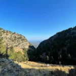
The gorge of Samaria is the most famous trekking gorge in Europe and a part of the European E4 hiking trail. Thousands of tourists flock here daily in the summer season to walk from the top to the bottom. For many visitors, it is the sole purpose of their visit to Crete. The length of the gorge reaches 14.5km and takes almost 5-7 hours to hike from Xyloskalo at Omalos plateau to Agia Roumeli beach, depending on the trekking pace.

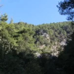
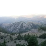
The gorge is located in the south of Chania Prefecture in the larger uninhabited area of Europe, where no roads even exist. It was created by the river flowing between the main massif of the White Mountains (Lefka Ori) and the range of Volakias. There are many smaller gorges vertical to Samaria Gorge, some of which have never been crossed by humans and require canyoning equipment. One of these, Perdika, has the highest waterfall in Crete (220m).

Samaria gorge hike

While the gorge is officially 15km long, this distance actually refers to the hiking distance between the settlement of Omalos on the northern side of the plateau Omalos and the village of Agia Roumeli. In fact, the gorge is 13 km long, starting at an altitude of 1,250m at the northern entrance, and ending at the shores of the South Cretan Sea in Agia Roumeli. The walk through Samaria Natural Park is 13 km long, i.e. from the ticket kiosk at Xyloskalo to the kiosk at Agia Roumeli old village, but you have to walk 1.5 more kilometres to reach the beach of Agia Roumeli, making the hike totally 14.5km.

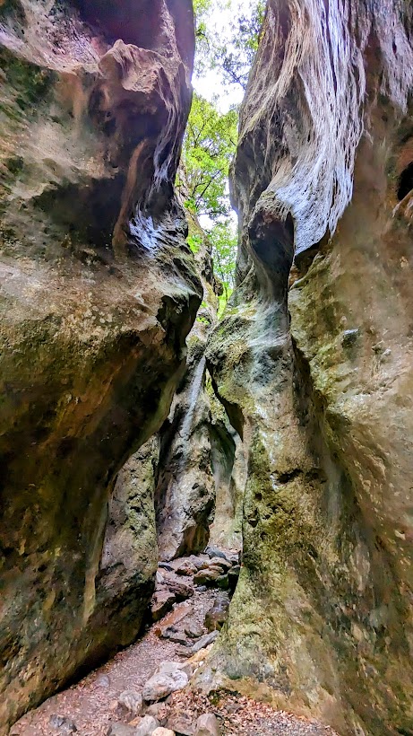
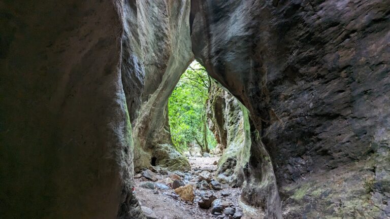
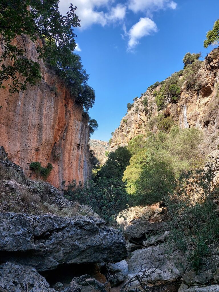
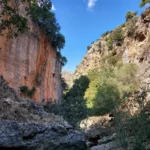
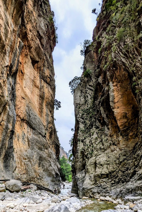
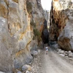
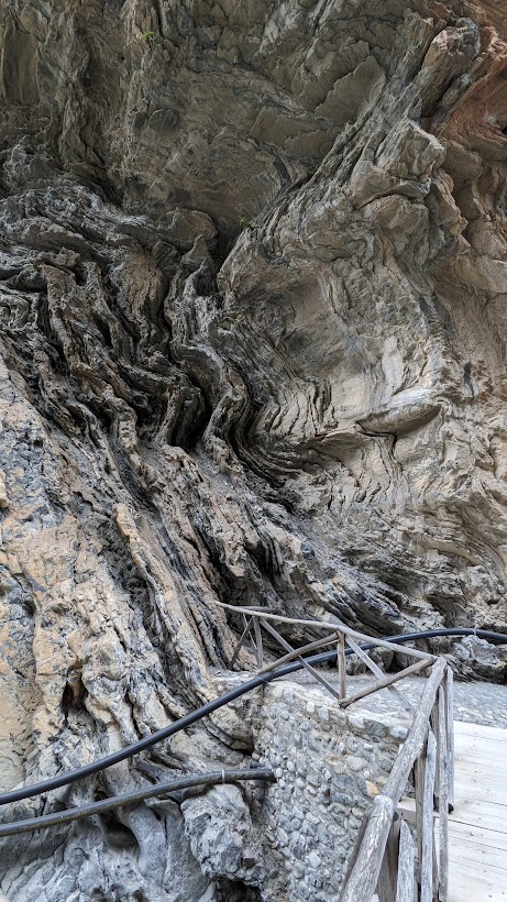
The most famous part of the gorge is the stretch known as the Iron Gates (Sideroportes), where the sides of the gorge close into a width of only four meters and soar up to a height of 500 m. The gorge became a national park in 1962, particularly as a refuge for the rare Cretan ibex, which is today restricted to the Lefka Ori National Park, the island Thodorou and several more islets. There are several endemic species of fauna and flora in the gorge and surrounding area.

The desert village of Samaria lies just inside the gorge. It was finally abandoned by the last remaining inhabitants in 1962 to make way for the park. The village and the gorge are believed to take their names from the village’s old church of Mary of Egypt (Osia Maria).

A “must” for visitors to Crete is to complete the walk down the gorge from the Omalos plateau to Agia Roumeli on the South Cretan Sea. From there most visitors get the ferry to the port of Chora Sfakion and catch a coach back to Chania. The walk takes 4-7 hours and can be strenuous, especially at the peak of summer.

When to visit the gorge of Samaria?

The problem with the gorge of Samaria is crowds. It has become one of the most popular attractions in Crete and there are up to 3000 visitors a day on very busy days. If you have the bad luck to pick one of those days, the atmosphere will be really spoilt. Starting at dawn (before the tourist coaches arrive) will give you a bit of a head start. It is possible to find good and cheap accommodation in Omalos or get the first bus from Chania. You can also start walking after 12:00, there won’t be many people and you will have shade at all times, but you will most probably need to spend the night in Agia Roumeli because the last ferry will have left. However, we encourage you to do that, since staying in Agia Roumeli is quite cheap and the beach is majestic. The first tourist buses arrive at around 7:30 am and from then on it is an uninterrupted stream of buses until about 11:00 am.

As far as the times of the year are concerned, the best time is spring: the weather is still cool and the vegetation is at its best. The worst time is in the middle of the summer during a heat wave. Please give it a miss and come again at a better time.

Samaria gorge tour

All local tour operators in Crete provide organized tours to the gorge. These include bus transportation from your hotel to the entrance (near Omalos village), and the bus will be waiting for you to disembark the ferry in Chora Sfakion to take you back. If you are on your own, you can make a one-day round trip from Chania, Sougia or Paleochora. Note that the morning buses from Sougia and Paleochora do not operate on Sunday, but still make sure that you know the timetables. The ferries leave Agia Roumeli to Chora Sfakion (eastbound) and to Sougia/Paleochora (westbound) in the afternoon.

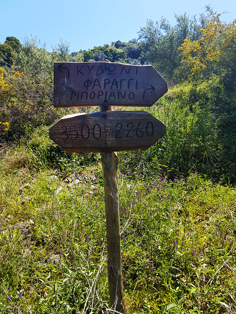
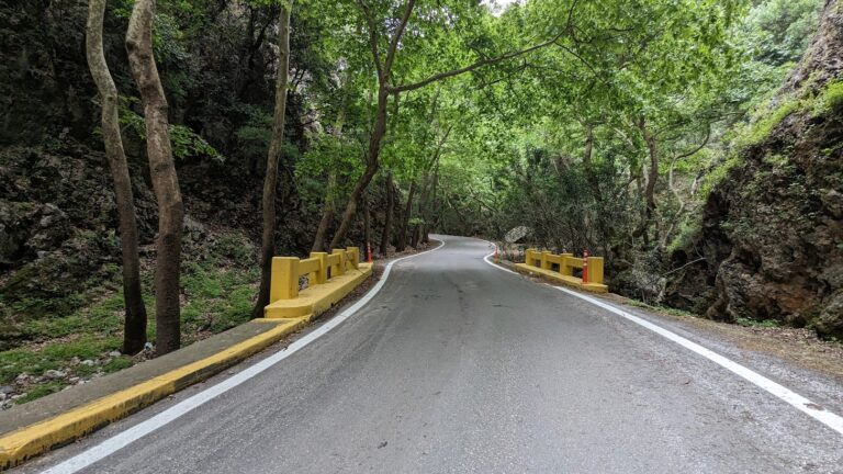
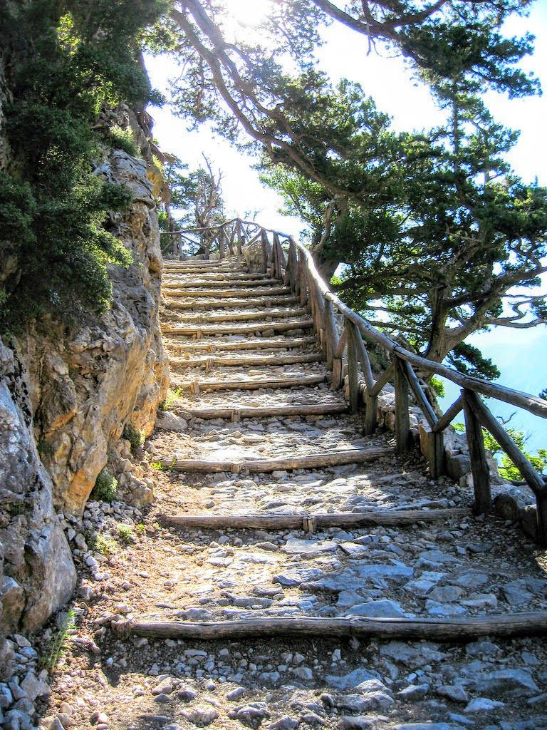
The trail from Xyloskalo

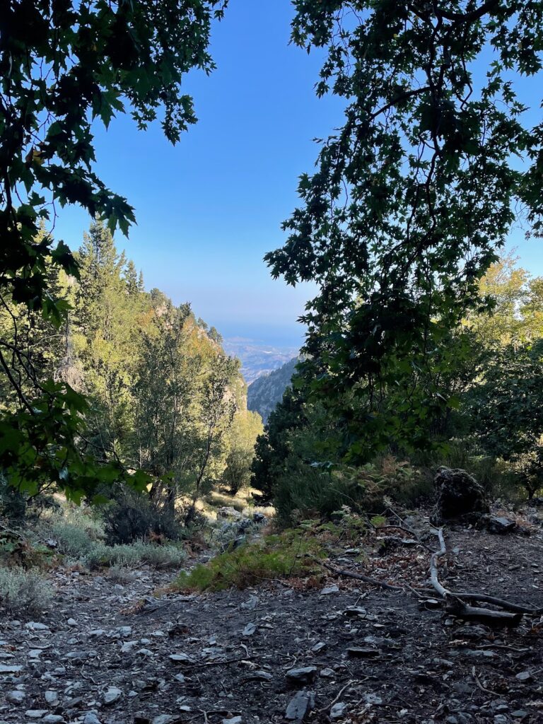
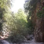
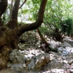
Descent in the canyon starts from the position of Xyloskalo at Omalos Plateau, at an altitude of 1200m, where you have to pay a small entrance fee for the protection of the reserve. The trail is wooded with cypress and pine trees, wide and very well discernible, while at the beginning descends abruptly. We meet drinking water and toilets very often. In about three hours we reach the old village of Samaria, at an altitude of about 300 meters, after crossing by the church of Saint George.

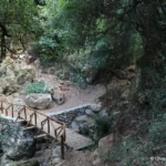
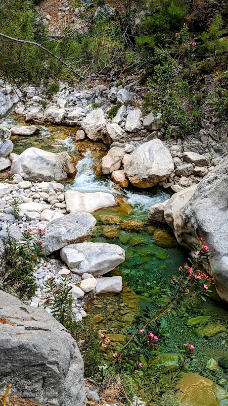
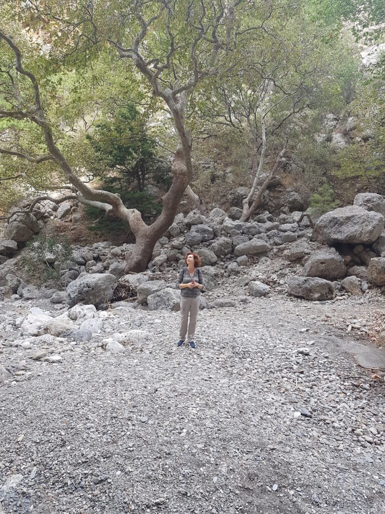
In Samaria there are old houses, trees offering shade, water springs and if you are lucky you will meet the endangered Cretan wild goat. From here onwards the landscape changes, becomes drier and the slope gets smooth. One hour later we walk along the riverbed for some time. There are several small wooden bridges in several places, above the river.

After one more hour, we meet the imposing Sideroportes (Iron Gates) which is a very narrow passage between two tall vertical 500m high cliffs. We soon reach the old village of Agia Roumeli which was abandoned in the mid-1900s due to a devastating flood and was moved to the seaside settlement of Agia Roumeli, about 30 minutes away.

  • 9.5 km
  • Askidia Gorge
  • 2.5 km
  • 2 h
  • Hiking

The Prasses or Askidia canyon is nestled within the forested area of the White Mountains. The exit of this canyon is situated close to the Askidia village (at an elevation of 480m), which is a section of the Prasses village, hence the dual names. To find the beginning of the canyon, you need to drive on the road from Chania to Sougia, then take a turn at Petras Seli intersection that leads to Omalos Plateau. After approximately 1.5km past the turnoff to Omalos, you will come across a dirt road and footpath that lead to the Platanos area. This region is captivating with its ferns, plane trees, and water springs. It is also the starting point of the lush Prasses canyon, a journey that takes roughly 2 hours.

The gorge boasts striking vertical walls and is surrounded by a thick pine forest (the northernmost in the Chania prefecture). This, combined with the river bed’s deciduous trees (such as maples and sycamores), creates a stunning landscape, particularly in the fall. The canyon is perfect for leisurely hikes along its riverbed, taking photos, and bird watching. Additionally, there are 2-3 small caves along the walls. Upon exiting the gorge, you will encounter the tiny hamlet of Askidia, concealed within a thick chestnut forest. If you don’t have a car, an additional half-hour walk will take you to the picturesque Prasses village.

  • 12.2 km
  • Fygou Gorge
  • 3 km
  • 1 h
  • Hiking

Fygou Gorge, a small yet stunning sub-gorge of the renowned Agia Irini Gorge, is situated near Sougia. This narrow canyon played a significant role in history, serving as an escape route for local rebels to the Sfakia mountains during various revolutions, hence its name ‘Fygou’, meaning escape.

In present times, many trekkers embarking on the Agia Irini Gorge trail, the second most popular gorge in Crete after Samaria, choose to commence their journey from Fygou Gorge. After approximately an hour of walking, they meet the Agia Irini Gorge.

A beautiful path winds through Fygou, weaving between a picturesque cypress and pine grove. An abandoned settlement and a Forest Service outpost can be found at the location known as Polla Spitakia. Near the point where Fygou Gorge meets the Agia Irini Gorge, the historic Hirotrypa cave is located. This site marks a tragic event from 1822 when two local hermits were murdered by the Ottomans.

  • 12.9 km
  • Agia Irini Gorge - Chania
  • 7.5 km
  • 3 h
  • E4 trail

Situated on the western flank of the White Mountains in the Selino province, the Agia Irini gorge owes its name to the nearby village of Agia Irini (Saint Irene), a mere 46 km from Chania.

The trail of Agia Irini Gorge commences just below the Agia Irini village and concludes at the Oasis Taverna. The track, which descends approximately 500 meters, extends for 7.5 km and requires nearly three hours to navigate. It is a well-preserved and predominantly shaded path, embellished with pine trees, plane trees, and oleander bushes.

The journey from the exit of the gorge to the village of Sougia covers about 5 km along a lightly used road with scarce shade. On sweltering days, arranging transportation to Sougia is recommended. The gorge, which is open all year round, is graced with a small river, but certain sections may become inaccessible or dangerous after heavy rain. From April to October, during the tourist season, a nominal fee is collected at the entrance (or exit for those hiking uphill) of the gorge. This fee aids in maintaining the path, collecting trash, and general upkeep to ensure a pleasant experience for all visitors.

The gorge forms part of the European footpath E4. Its southern entrance is positioned 5 kilometers north of Sougia. It is included in the NATURA 2000 protected areas and has been declared a wildlife reserve by the Ministry of Agriculture. The gorge is home to the endangered Cretan ibex, agrimi, and boasts a variety of microenvironments and habitats for an array of wildlife species. The diverse flora, including trees (cypress, pine, maple, plane, oak, holm oak), shrubs, brushwoods, and fine herbs such as dittany, is of significant importance.

The gorge holds immense significance, not only for its rich biodiversity and aesthetic appeal but also for its historical and cultural significance. At the “Polla Spitakia” area within the gorge, rebels found refuge from the Ottomans. This is where the “Fygou” path begins, which served as an escape route from the gorge to the Omalos plateau. The area houses the Byzantine Church of Christ (1358 AD) and the dilapidated church of Saint George (1460 AD). The gorge, second in popularity to Samaria in the Chania prefecture, remains open for a longer duration.

  • 13.7 km
  • Diktamos Gorge
  • 7.5 km
  • 3 h
  • Hiking

The Diktamos Canyon, nestled within the White Mountains, commences 21km to the east of Chania, near the Katochori village at an elevation of 300m. It concludes 8km further east, at the Faragi village, situated at a height of 40m and in close proximity to the Stylos village in the Apokoronas province. Consequently, it is also referred to as the Katechori Gorge or Stylos Gorge. The canyon’s stream serves as the primary tributary of the Kiliaris River, gathering water from the northern slopes of the Mavri peak and discharging it onto the Kalives beach.

Navigating through the canyon can be challenging, with certain areas requiring extra caution and approximately 3 hours to traverse. The canyon is a stunning, verdant landscape filled with towering trees and steep inclines, home to dittany or diktamos, a herb endemic to Crete. In Stylos, you have the opportunity to explore the ancient church of Apostle John (Agios Ioannis Theologos), refresh yourself at the local springs, and replenish your energy at the village’s taverns.

  • 14.9 km
  • Tripiti Gorge - Chania
  • 9 km
  • 9 h
  • Hiking

Tripiti, the second largest gorge in proximity to Samaria gorge after Klados gorge, can be reached from Omalos plateau via the Gigilos peak trail that intersects Linosseli spring. However, caution is advised due to a precarious pathway where massive landslides could occur, potentially trapping you. It is strongly recommended to be accompanied by an experienced hiker for safety.

As one of Crete’s longest gorges, Tripiti necessitates a two-day journey since no roads lead directly to its entrance. The adventure begins on the first day from Plateau Omalos (elevation 1200 meters), climbing towards the formidable Gigilos peak (2080m). The path crosses the Linoseli spring (1,400m), then ascends to a mountain ridge at 1700m where the Koustogerako trail intersects with the Gigilos trail. From this ridge, the descent to Tripiti gorge’s riverbed commences, which can be reached from Omalos in about three hours. Overnight options include staying on the ridge or continuing slightly further to the dilapidated Tzatzimos sheepfold.

The following day, continue down the trail until it intersects with the river bed at an elevation of 700m. From there, follow the bed to reach the South Cretan Sea at Tripiti beach. The journey from Gigilos to the beach is approximately six hours. The gorge is a spectacle with towering, often cavernous walls (Tripiti’s name derives from the Greek word for caves, “tripes”). It’s not uncommon for hikers to encounter the endangered Cretan ibex amidst the lush flora and pine trees.

Close to Tripiti beach, located at Cape Tripiti, you’ll find a water cistern, a quaint goat pen, and the picturesque chapel of Saint Nicholas. The Tripiti peninsula was once home to the ancient town Pikilasos, a port for the influential town Elyros. If no boat is available for pick-up, a 3-4 hour walk along the E4 trail to the west will take you to the coastal village of Sougia. This trail also passes by the ruins of the Turkish tower of Voukelasi and the chapel of Profitis Ilias (Prophet Elijah). On the feast day of Prophet Elijah (19-20 July), many people from Sougia visit the chapel either by boat or on foot.

For the initial part of the gorge, the riverbed has steep descents requiring canyoneering equipment. Therefore, canyoners can bypass the side trail and traverse the gorge using technical gear in the bed.

© All rights reserved. Crete Locals