Gorges to hike and walk near Roústika, in Rethymno region

List of Gorges near Roústika

  • 2.2 km
  • Moundros Gorge (Kollita)
  • 2 h
  • E4 trail

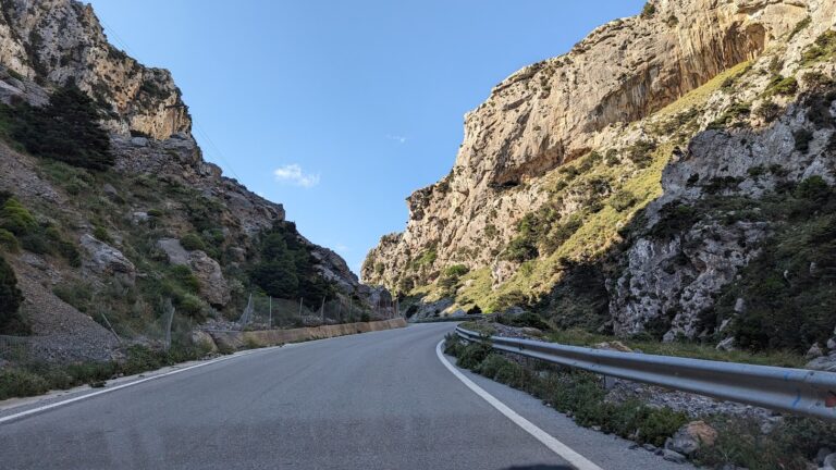
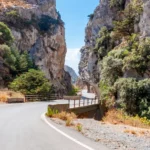
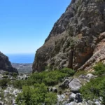
The Twin Ravines, or Kollita Gorges, are situated near the scenic village of Argyroupolis, approximately 22km southwest of the city of Rethymnon. The name derives from two adjacent canyons that conclude near the village of Kato Poros. The eastern canyon, Moundros Gorge, is bordered by the Vigla peak (567m) to the east and Nissiani hill to the west, which houses the deserted Nissi settlement. West of Moundros gorge lies the Vilandredo gorge, named after the village at its entrance and more commonly referred to as Kollita Gorge.

These gorges are perfect for casual hikers due to their ease and stunning beauty. They are particularly suitable for groups of friends who can park in Kato Poros or Argyroupoli, explore the Moundriano canyon, and return via the second Kollita Gorge.

Suggested Two Gorges Route
Starting from the verdant Argiroupoli, built on the ancient city of Lappa, we journey east to the village of Moundros, known for its springs and fountains. The village is home to many beautiful Venetian structures (old courts, prisons, and noble houses) and the churches of Saint Constantine, Saints Anargyri (11th century), and Saint Nicholas are well worth a visit. Don’t forget to wander the narrow streets of Moundros. Close to Moundros, the deserted Nissi settlement, famous for its stunning stone structures, can be found.

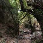
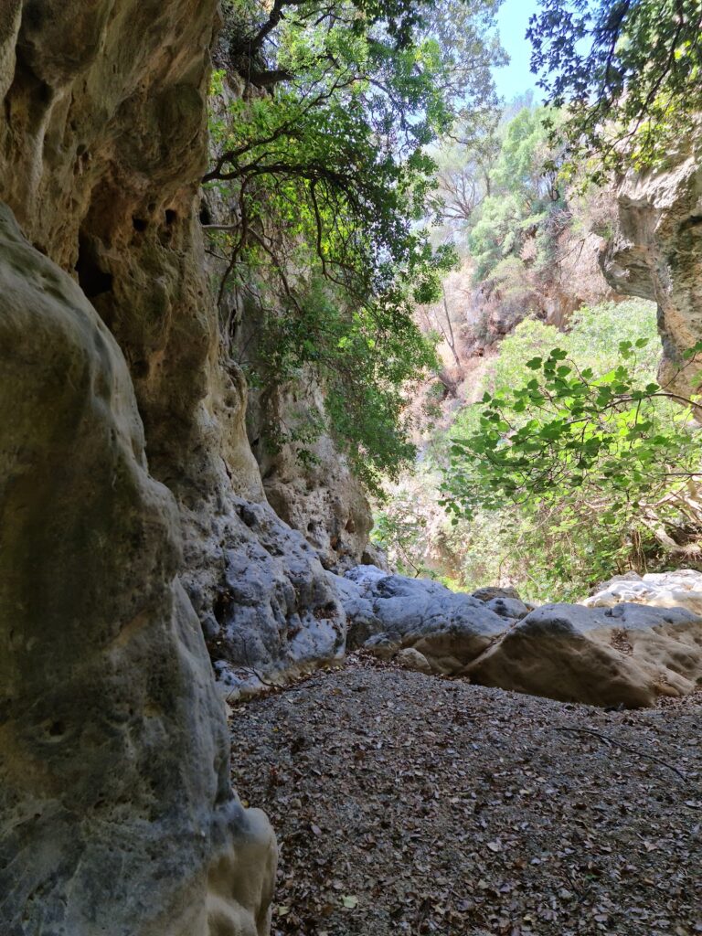
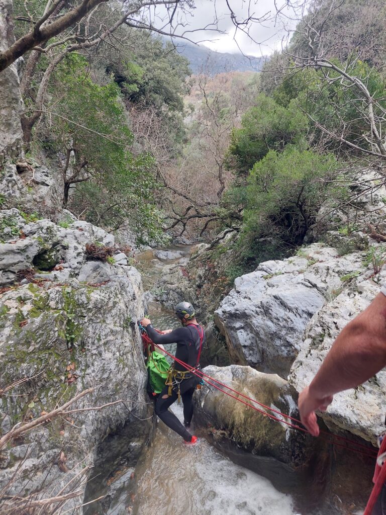
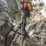
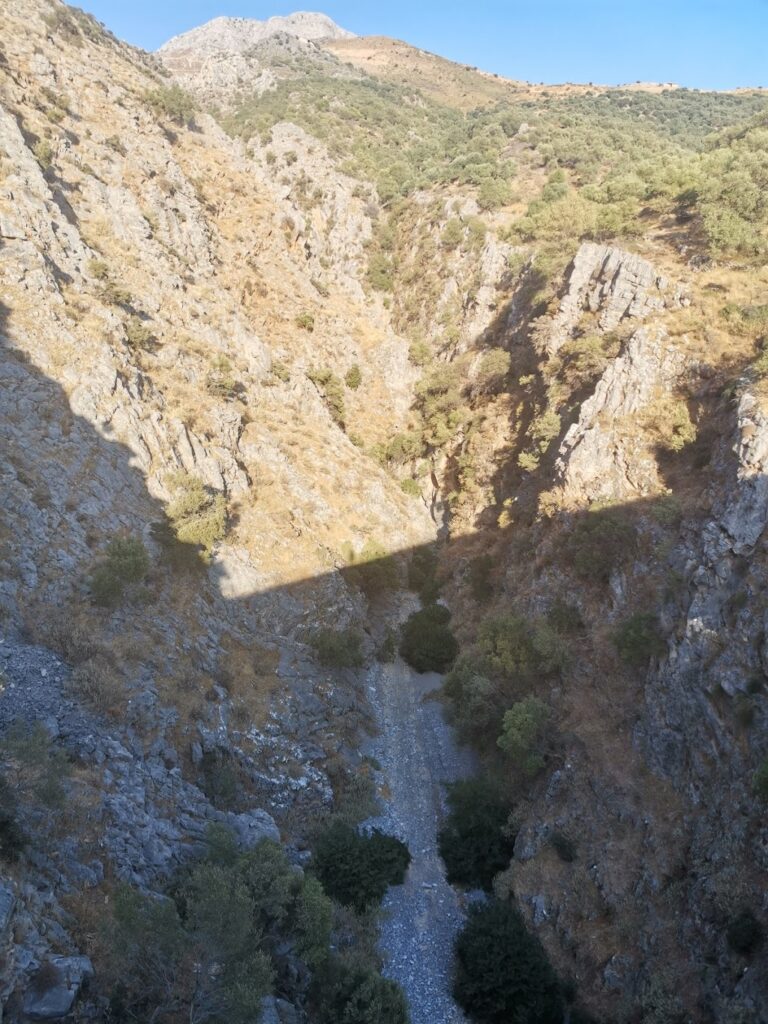
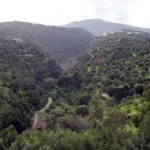
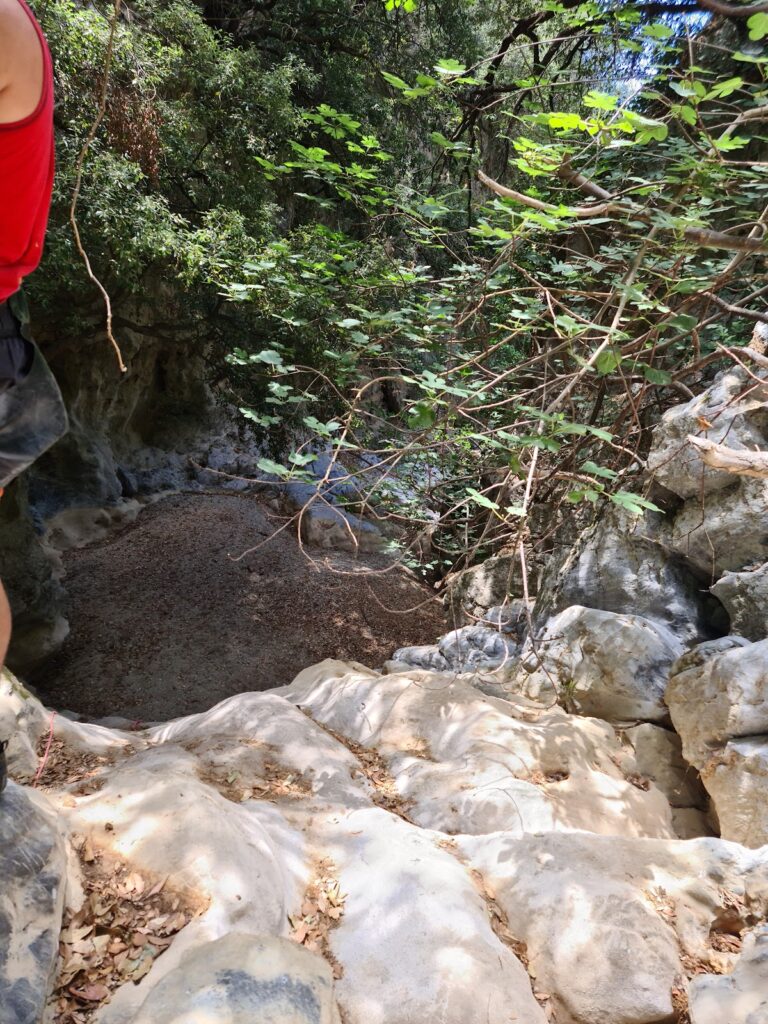
From the village, the entrance to the verdant Moundros gorge is accessible, leading to the village of Velonado. A well-defined path descends to the riverbed, which is usually filled with water. The canyon is filled with towering plane trees and several fresh water ponds. After roughly 1.5 hours of walking, we reach the southern entrance of Moundriano Gorge, near Velonado.

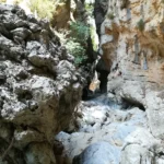
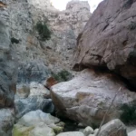
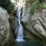
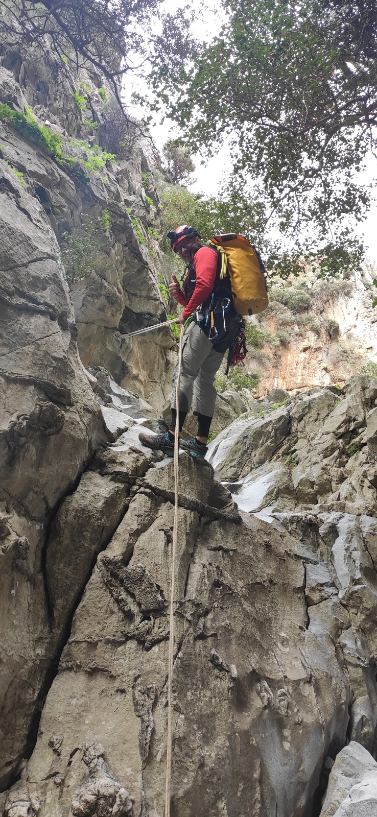
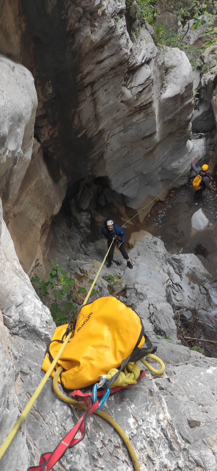
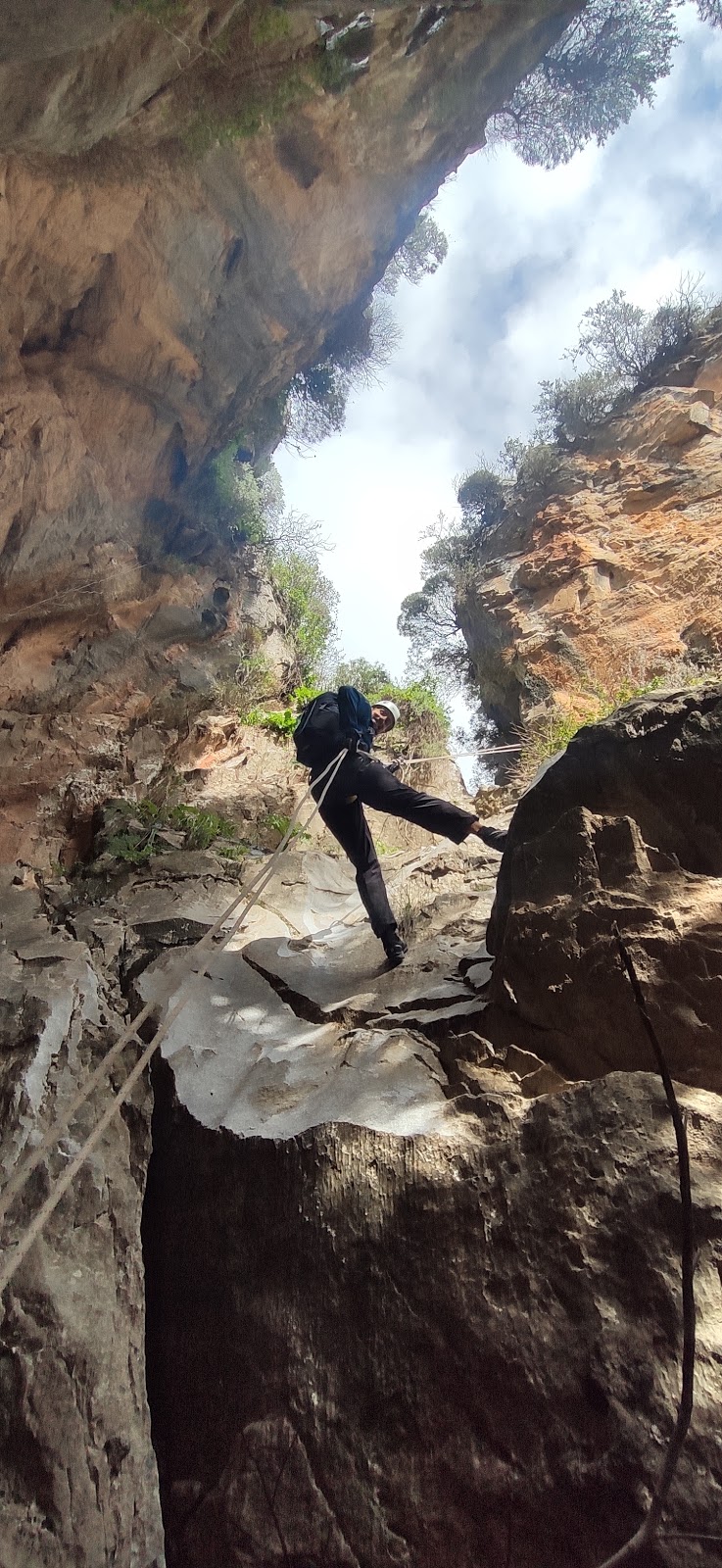
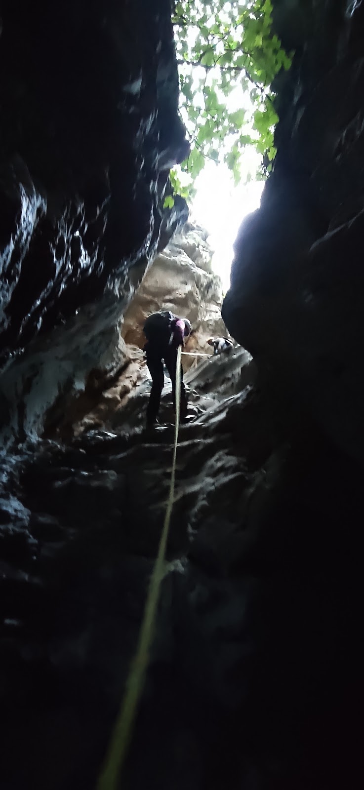
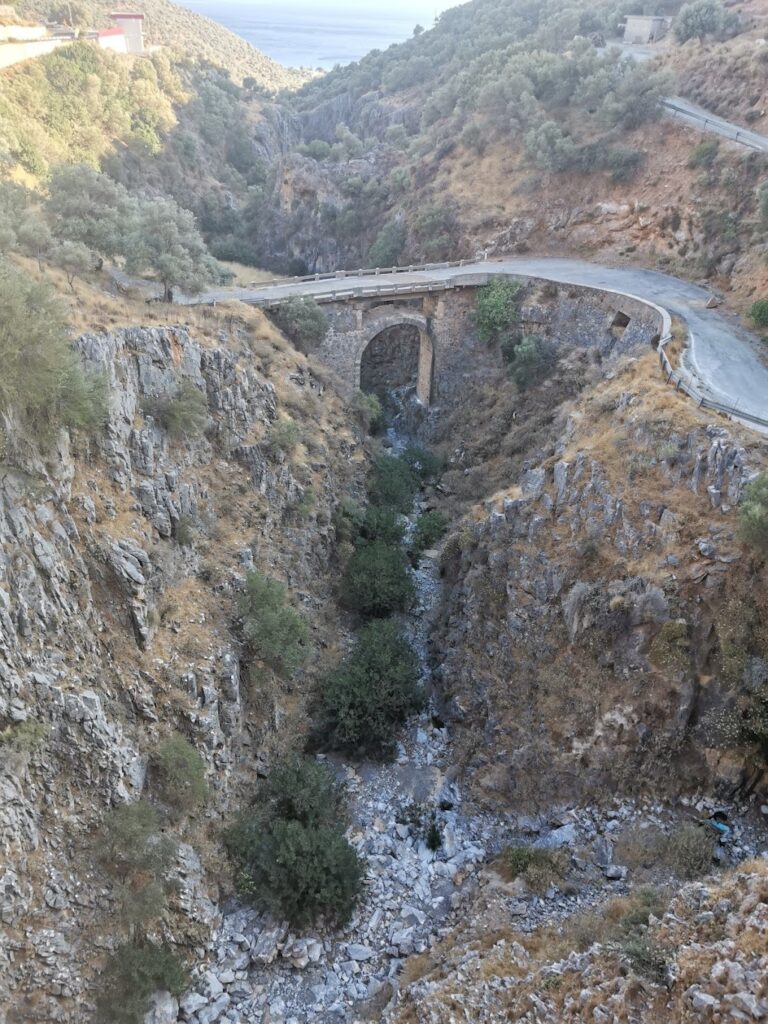
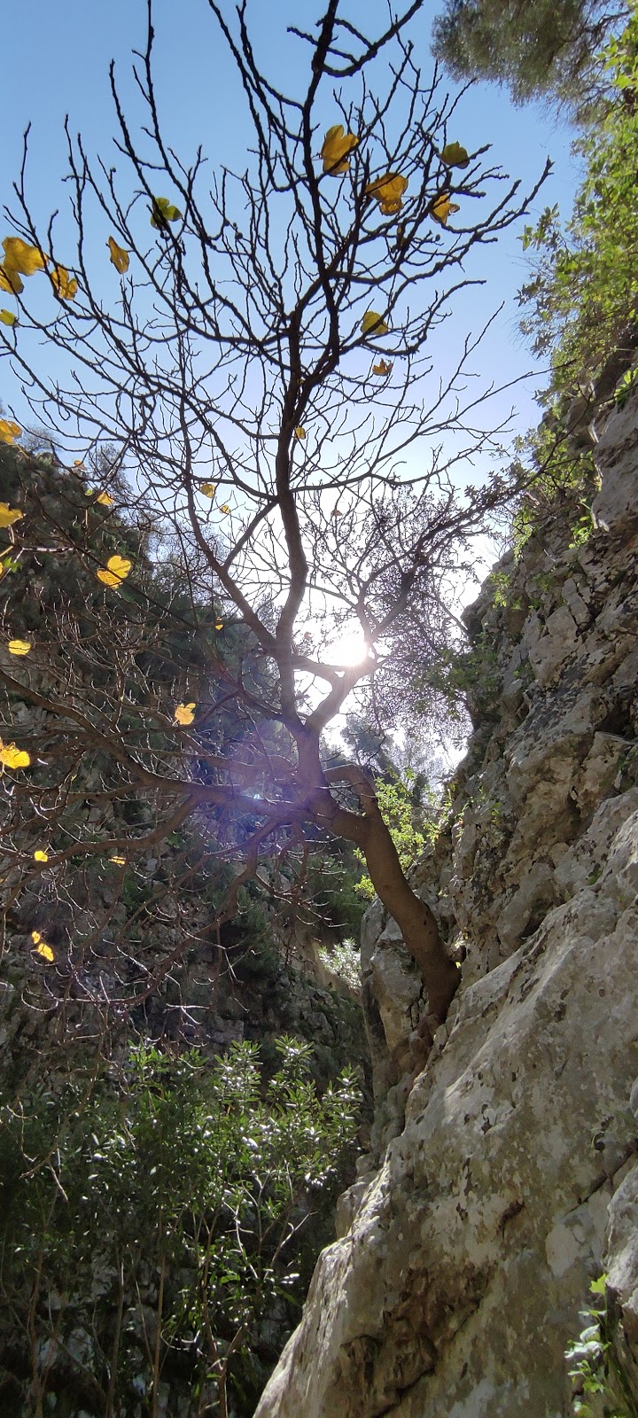
Upon exiting the canyon, we follow the asphalt road west to the entrance of the second canyon, Kollita Gorge, near Vilandredo. This canyon, more magnificent than Moundriano, is lush with plane trees, and the path follows the riverbed. The most beautiful section of the canyon is where the high walls nearly touch, forming a narrow passage. Fig and holly trees can be seen on the gorge’s slopes, hanging overhead. After approximately four hours, we exit the canyon, which once provided water for the Roman baths of Lappa, now Argyroupolis.

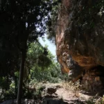
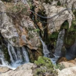
Following the ancient stone path through laurels, myrtles, and hollies, we reach Kato Poros and the area of Pente Parthenes (Five Virgins). Here, one can find the spring beneath the perennial plane tree of Pente Parthenes, the chapel of the Five Virgins, and the Hellenistic and Roman tombs of Lappa. From here, the trail broadens and leads us back to the lush green Argiroupoli. In Argiroupoli, the Venetian buildings, churches, and picturesque alleys are worth a visit. A popular attraction is the springs of Argyroupolis, with the most notable spring located in the cavernous chapel of Agia Dynami. The area is lush with several small waterfalls and numerous restaurants.

  • 3.1 km
  • Kollita Gorges (Vilandredo)
  • 4 km
  • 2.5 h
  • E4 trail

The Twin Ravines, or Kollita Gorges, can be found near the charming village of Argyroupolis, approximately 22km southwest of the city of Rethymnon. The name refers to the two parallel canyons that conclude near the village of Kato Poros. The easternmost canyon, Moundros Gorge, is bordered by the Vigla peak (567m) to the east and the Nissiani hill to the west, where you can find the abandoned settlement of Nissi. Adjacent to Moundros Gorge to the west, is the Vilandredo Gorge, named after the village at its entrance and often referred to as Kollita Gorge.

The gorges offer an ideal hiking experience for novices due to their ease and stunning surroundings. It’s a perfect outing for groups of friends – park your car in Kato Poros or Argyroupolis, explore the Moundriano canyon, and return via the second Kollita Gorge for a round trip.

A suggested itinerary for the two gorges starts in the verdant Argiroupoli, built on the site of the ancient city of Lappa. From there, head east to the village of Moundros, known for its springs, fountains, and beautiful Venetian architecture. Don’t miss a stroll through the narrow streets of Moundros and a visit to the churches of Saint Constantine, Saints Anargyri (11th century), and Saint Nicholas. Near Moundros, you’ll find the deserted settlement of Nissi, notable for its impressive stone structures.

From the village, make your way to the northern entrance of the lush Moundros Gorge, which leads to the village of Velonado. A well-marked path descends to the riverbed, which is typically full of water. The canyon boasts towering plane trees and several freshwater ponds. After about a 1.5-hour walk, you’ll reach the southern entrance of Moundriano Gorge near Velonado.

Exiting the canyon, head west on the asphalt road to the entrance of the second canyon, Kollita Gorge, near Vilandredo. This canyon is even more impressive than Moundriano, filled with plane trees and a path that runs along the riverbed. The most breathtaking part of the canyon is where its towering walls nearly touch, creating a very narrow passage. Along the slopes of the gorge, you’ll spot numerous fig and holly trees. After a total of four hours, you’ll exit the canyon, which once supplied water to the Roman baths of Lappa, now Argyroupolis.

Following the old stone path amidst laurels, myrtles, and hollies, you’ll reach Kato Poros and the area of Pente Parthenes (Five Virgins). Here, you’ll find a spring under the perennial plane tree of Pente Parthenes, the chapel of the Five Virgins, and the Hellenistic and Roman tombs of Lappa. From here, the trail broadens and leads back to the lush green Argiroupoli. In Argiroupoli, be sure to visit the Venetian buildings, churches, and picturesque alleyways. The springs of Argyroupolis are a popular attraction, particularly the spring in the cavernous chapel of Agia Dynami. The area is lush with several small waterfalls and numerous restaurants.

  • 6.6 km
  • Petres Gorge
  • 1.5 km
  • 1 h
  • Hiking

Situated 13km west of Rethymno, Petres Gorge opens up at the Petres beach. It houses the longest river in Rethymnon province, which is replenished by multiple tributaries that gather the waters of Kollita Gorges from the west to Mount Vrysinas in the east, spanning almost half of Rethymnon Prefecture. The river flows throughout the year and forms a significant wetland of Crete, particularly near its mouth at Episkopi.

The gorge narrows down to a small section about 1km long, beginning near the village of Karoti. Despite its short length, it is definitely worth exploring. It is easily accessible and perfect for swimming in the ponds that form along its course. However, fences are installed to confine goats, so carrying a cutter might be useful in case the fences are locked. Certain areas with large rocks may require a bit of climbing and extra caution.

  • 7.6 km
  • Kotsyfos Gorge
  • 2 km
  • 2 h
  • Hiking

The gorge of Kotsifos starts at Kannevos village and ends at Plakias. The starting point is very narrow with a width of about 10m, which gradually increases and reaches 600m. The total length is 1800m, and the almost vertical sides that reach a height of 600m. Inside the gorge, there is a small temple built inside a rocky cavity dedicated to Saint Nicholas.

Hiking in the upper part of the gorge (Kanevos – Bridge of Sellia).
Starting from the village Kanevos you can start hiking on the riverbed and reach the bridge that connects villages Selia and Myrthios (after about one hour of course). Along the way, there are large boulders that block the passage, but with a little attention, you can overcome them. At one point the side-gorge of Boutsinas meets Kotsyfos with an impressive waterfall of 20 meters. In summer the riverbed is dry.

Course in the upper part of the gorge (Bridge of Sellia – Plakias)
At the location of the bridge that heads to Selia, the canyon gradually turns into a wide valley. You can continue our course at the bottom of the gorge, along the riverbed. After meeting a modern temple, after 3-4 minutes you meet a dirt road that heads backwards (opposite the flow of the river). If you follow this road in a few minutes you will meet the springs of Kotsifos where a pond is formed (surrounding villages get water from here). From here onwards, the river has a water flow throughout the year emptying on the beach of Plakias.

  • 8.6 km
  • Kakoperatos Gorge at Agios Vasilios
  • 0.9 km
  • 3 h
  • Canyoneering equipment needed

Kakoperatos Canyon, situated near the village of Agios Vasilios in the province of the same name, is a tributary of the Megalos River (Kourtaliotis). Its name, which translates to “bad passage” in Greek, indicates the necessity of technical equipment for human access. This stunningly scenic and rugged canyon is perfect for canyoning. It is endowed with water for most of the year and features 7-8 remarkable waterfalls. These create deep ponds filled with clear turquoise waters, making them ideal for jumping.

It’s likely that no other canyon in Crete boasts such vibrant turquoise waters. The canyon’s exit is located adjacent to the last residences of Agios Vasilios, with its stream flowing through the village courtyards!

  • 9.5 km
  • Rodakino Gorge
  • 3.2 km
  • 6 h

The canyon, located to the north of Rodakino village, requires canyoning equipment for access. It begins to the south of Kryoneritis Mount’s peak and extends for 5km before merging with the SykiaSykia canyon, just prior to the Rodakino bridge. The stretch before the Sikia junction features 16 rappels, and there are an additional 4 rappels in the Sikia gorge leading up to the bridge.

Most of the year, the canyon is dry, and in many spots, it narrows to just 1.5m. Typically, canyoners enter the gorge midway, not at the beginning. To find the entrance, one must drive on a dirt road that starts in Rodakino and ends at a sheepfold roughly 2.5km to the northeast. From there, a small stream is descended until the canyon’s riverbed is reached. This part of the canyon has a maximum rappel of 15m and takes around four hours to traverse.

  • 10.4 km
  • Gallos Gorge
  • 5.5 km
  • 3 h
  • Hiking

The stunning Galliano canyon begins to the southeast of Gallos and concludes at the Rethymnon town, channeling water from the Armeni region to the Koumbes beach. It stretches over a distance of 5.5km, with the journey taking you through a lush ravine. Regrettably, there are multiple spots where shepherds have put up wires to confine their herds, making the trek along the stream challenging.

Close to the entrance, you’ll encounter the ancient Saounatsides watermill, which was operational until the 20th century. You can also see remnants of an old chapel nearby. A few meters south of the mill, another path leads to the cave-like temple of Saint Anthony.

  • 10.5 km
  • Sykia Gorge at Rodakino

The stunning Sykia gorge, which is actually the easternmost gorge in the province of Sfakia, is located north of Rodakino village. It’s a technical canyon, meaning that traversing it requires specialized equipment due to its over 10 steep descents or waterfalls, which are safeguarded by the speleological groups of Crete. The tallest rappel stands at around 12 meters high.

The Sykia stream combines with the untamed canyons of Rodakino (also known as Maglinara) and the longest gorge in the area, Karavos. The stream then flows under both the new and old bridges of Rodakino, finally reaching the picturesque Korakas beach. Canyon explorers typically leave the gorge just after the old bridge, while those up for a full-length trek will encounter another rappel. The narrowest part of Sykia, after it merges with the Rodakino Gorge, is truly breathtaking.

Speleological clubs have named the gorge Sykia, meaning sycamore-fig tree, due to the abundance of fig trees found along the route. However, its official name is Xepitira. Except for times following heavy rainfall, the gorge is typically dry.

  • 12.6 km
  • Skaloti Gorge
  • 2 km
  • 1.5 h
  • Hiking

The Skaloti Gorge, nestled within the extensive area of Fragokastelo, is one of many parallel canyons in the region. This compact canyon spans a distance of 2km, beginning from the picturesque Manikas plateau and concluding at the coastal village of Skaloti. The journey, which takes approximately 2.5 hours, involves hiking along an ancient path paved with stones and surrounded by steep inclines. Initially, the canyon is wide and open, but it gradually narrows and the walls become vertical. Vegetation in the area is primarily composed of bushes and undergrowth. The Perama stream traverses the gorge, finally emptying onto the shores of Lakki beach.

  • 13.0 km
  • Kourtaliotis Gorge at Preveli
  • 7 km
  • 4 h
  • Hiking

Situated 22km south of Rethymno, Kourtaliotis Gorge, with its stunning 3km length, stands as one of Rethymno’s most breathtaking natural wonders. The gorge originates from the village of Koxare, weaving its way between the towering Kouroupa and Koules mountains of the Xiro Oros range. The dramatic cliffs of the gorge, reaching heights of up to 600 meters, house numerous caves and openings, offering a home to a variety of unique fauna.

This majestic landscape is adorned by the Kourtaliotis River, which continues its course until it merges with the Frati Gorge and ultimately leads to Lake Preveli, taking on the name Megalos River in its final stages.

The beauty of this gorge can be experienced by following a paved road that cuts through the canyon. Steps from the Koxare-Asomatos street will guide you to the gorge’s base, where you’ll find the chapel of the local Saint Nicholas Kourtaliotis. One of the standout attractions here are the springs of Kourtaliotis, nestled near the chapel. Further exploration reveals Kourtaliotis’ stunning waterfall, accessible by swimming from a lower river level, leading to a darker, narrower part of the gorge.

A trek along the river takes you to the Megalos River bridge and onwards to Preveli’s palm beach. Kourtaliotiko gorge is a treasure trove of aesthetics, biodiversity, and ecological significance. Beyond its dense Cretan Date Palm trees, the second-largest palm forest on Crete, the gorge’s slopes are home to lush vegetation. The river’s estuary features sand dunes and formations of protected marine plants like Posidonia. It also provides a habitat for local species like the tortoise and freshwater snake.

  • 13.2 km
  • Myli Gorge
  • 2.5 km
  • 2.5 h
  • Hiking

Located near the town of Rethymno, Mili Gorge is an enchanting green oasis. It’s essentially a ravine that houses a vast array of plants and trees, forming a genuine botanical garden. The gorge gathers water from the northern slopes of Mount Vrysinas, beginning north of the Chromonastiri village and south of the Xero Chorio settlement. In recent times, it has become a popular spot for hikers who enjoy the pleasant trail that spans the entire valley.

Within the heart of the canyon lies the abandoned village of Mili, named after the water mills that were once situated in the gorge. The village is split into two areas, Ano Mili (Upper mills) and Kato Mili (Lower mills). The majority of villagers were millers, with nearly all the cereals from the region and surrounding villages being milled at Mili.

Nowadays, only one renovated watermill remains in good condition for visitors to understand its operation. Besides the numerous mills, the area is home to gardens filled with fruit trees and vegetables. Water continuously flows from the springs scattered throughout the canyon, with the largest springs being Saint Anthony and Five Virgins. The water along its course forms small waterfalls and lakes, perfect for a refreshing dip under the shade of towering plane trees.

The village of Mili was deserted in 1972 due to fear of landslides, with some mills being renovated into residences and a cafe-restaurant for guests. The villagers moved and built the village Nei Mili (new mills) high above the gorge on the west. The gorge also boasts a significant number of striking churches, including the cavernous church of Saint Anthony (Agios Antonios) and the cavernous church of Saint John (Agios Ioannis), as well as the cemetery church of the Holy Five Virgins (Pente Parthenes).

Further along Kato Mili, you’ll encounter the cavernous chapels of Saint Paraskevi (Agia Paraskevi) and Saint Nicholas (Agios Nikolaos).

  • 14.6 km
  • Kaminolakkos Gorge

In northern Rethymnon, beneath the village of Myrthios (not to be confused with the Myrthios near Plakias), a petite ravine teeming with plane trees gives way to a wild and untamed gorge at Kaminolakos. The gorge is typically dry, only filling with water after significant rainfall. It is accessible only with canyoneering gear. This gorge remained unexplored until March 22, 2013, when Christopher Cheiladakis, Argyro Koghylaki, and Rudolf Riegler ventured into it for the first time, installing safety rings in the process.

The initial stretch of the gorge is particularly wild, leading to a series of small rappels before reaching the final waterfall, a towering 55 meters high. This waterfall is nestled under an umbrella of large trees, hidden away in a shadowy enclave. The gorge culminates at the renowned stone bridge of Simas, which is situated on the road to Amari. This bridge, the highest in Crete, is considered an architectural marvel of its time.

  • 14.8 km
  • Kallikratis Gorge
  • 6.5 km
  • 3 h
  • E4 trail

The Kallikratis Canyon, a relatively small gorge located in the southeast of Lefka Ori (White Mountains) in the Sfakia province, forms part of the E4 European walking route. It serves as a passageway connecting the mountain pasture lands with the lowland villages of the Frangokastelo plain. A hike through this gorge offers a delightful walk and stunning views of the South Cretan Sea. The entrance to the canyon is situated at the Kallikratis plateau, accessible via a paved road from Askyfou, Asi Gonia, or Frangokastelo.

Kallikratis is home to the charming Panagia church, and from here, you can begin your descent through the gorge, which concludes in the village of Patsianos. From Kallikratis village, follow the asphalt road leading to Patsianos that runs parallel to the gorge bed. At certain points, you will need to follow the riverbed, which gradually deepens, with the road rising high above you. After about half an hour, the road will have risen considerably to the left, and the stream will be fairly deep. The trail has been slightly modified in some places due to debris from road construction.

© All rights reserved. Crete Locals