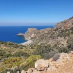
Traveling along the western coast of Crete towards Elafonissi beach, you’ll encounter the picturesque village of Kambos, nestled within the Kissamos province. A brief detour off the main road to the west will bring you to the verdant Kambos canyon, the most westerly gorge on the island, which is fed by the small Koutroulis massif.
A scenic hiking trail winds its way through the canyon, beneath the shade of towering plane trees and alongside a river that flows year-round. The journey is punctuated by striking rock formations and culminates at a natural spring. From there, the path reconnects with the road descending from the village, leading to the subterranean churches of Agia Ekaterini and Agia Marina.
Continuing your trek along the riverbed can occasionally prove challenging due to thick vegetation and water, but the journey is worth it. From Agia Kyriaki, the path follows the riverbed to the secluded yet stunning Platanakia beach, where plane trees stretch their branches out to the sea.
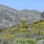
The Sirikari gorge, situated 55km west of Chania and 17km south of Kissamos, is nestled in a verdant area filled with canyons and streams. The paved road leading to Sirikari weaves through lush vegetation, offering a glimpse of the area’s beauty from the get-go. The gorge splits into two parallel paths here – Tsichliano to the west and Kioliano or Sirikariano to the east, both culminating at the Polirinia settlement, the site of the ancient town of Polirinia. The town’s ancient walls, still in a decent state of preservation, stand tall in its citadel, atop a hill with a panoramic view of the Kissamos bay.
Close to Sirikari, an enchanting forest unfolds, home to towering chestnut trees, quaint waterfalls, and babbling brooks. Although it isn’t the only chestnut forest in the Chania prefecture, with several others dotting the slopes of the White Mountains, its beauty and vastness set it apart.
Adjacent to Sirikari, in Sineniana, stand two well-preserved old watermills. A visit to the Church of the Assumption is also recommended, particularly on August 15th, when a traditional feast is held. The church, nestled in the chestnut grove, is surrounded by other trees like holm oaks, cypresses, and plane trees. A little further along, you can explore an abandoned village set amidst a stunning oak wood. Additionally, the Sirikari village houses the 15th-century Byzantine church of the Holy Apostles (Agii Apostoli), which is definitely worth a visit.
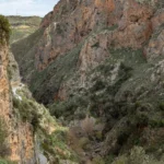
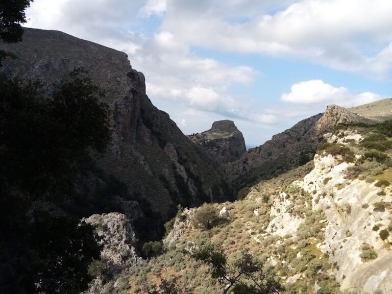
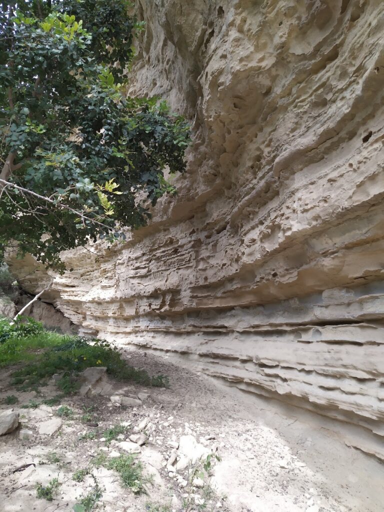
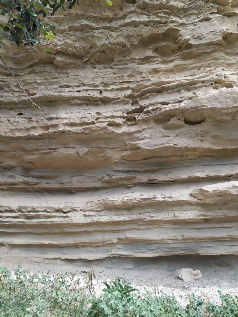
The gorge of Topolia (Topoliano) is located in west Crete and it runs along the road leading to Elafonissi via Elos. The canyon actually starts near the village Strovles at an altitude of 450m, and exits near the village Topolia, at an altitude of 150m. However, the narrowest and most impressive hiking part of the gorge is located between Katsomatados and Topolia, where the side rocks are very high and steep. The canyon is crossed by the River Tyflos, which originates from Mount Dikeos. At the beginning of the narrow part, it is worth visiting the Cave of Agia Sofia, located just above the main road.
The canyon and the wider area host rare and endemic plants of Crete, while the Cave of St. Sophia houses a species of cave spider that lives only there (Pholcus creticus). According to local traditions, Topolia Gorge hosted fairies and the Minoan goddess Vritomartis. Here, the legendary Talos used to stop and enjoy the divine music of the fairies. When Talos arrived at the place, rested inside a big cave, drank water and fell asleep. Then, the fairies and elves of the river arrived, singing and dancing.
The Maganistra Gorge, which originates near the peak of Limni and close to Agios Dimitrios in Varsamakia, winds its way through the abandoned village of Pateriana before concluding its 3 km journey in Lousakies. The gorge is flanked by the towering peaks of Kouvara and Profitis Ilias. The water flow in the gorge lasts until early summer and it offers a moderately challenging trek. The gorge’s river merges with various smaller streams before eventually ending in the town of Kissamos.
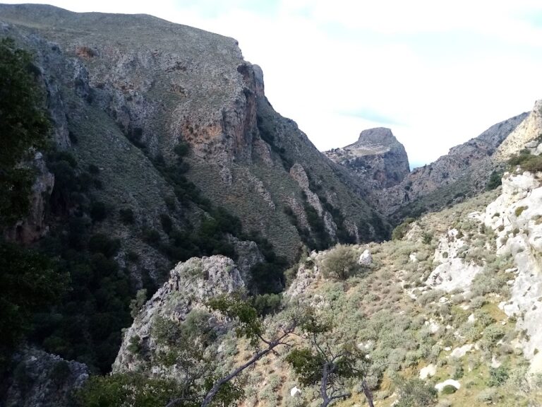
In the overlooked area of Selino, South Chania, you’ll discover the hidden gem that is the Pelekaniotis River. This river, boasting the highest water flow in Selino, holds such significance that it inspired the name of the Paleochora municipality – Pelekanos. It remains a steady water source throughout the year, culminating in a verdant green valley at the Macherota location. The towering cliffs of the canyon serve as a habitat for numerous birds of prey, providing company for hikers along their journey.
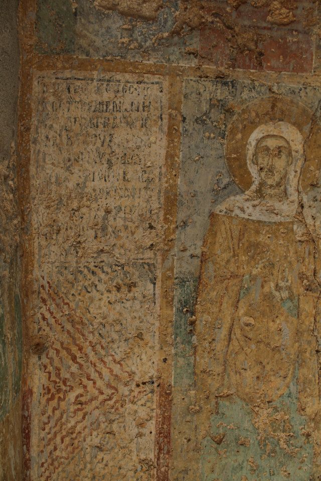
The gorge’s exit can be located by following a dirt road that begins at Grameno beach near Paleochora and traces the river’s west bank. Regrettably, this path crosses a small area littered with rubbish and debris. However, beyond this, the scenery transforms into a lush Cretan landscape. Two kilometres in, the Agios Mamas chapel, adorned with well-preserved frescoes, can be found on the western shore. Despite its significance, the existence of Saint Mammes (Agios Mamas) remains largely unknown, even to locals. Across from Agios Mamas, the old whitewashed chapel of Saint George stands, though it lacks frescoes.
A kilometre further, the dirt road ends at a tank filled with drinkable water. From this point, the gorge can be explored on foot, particularly during summer when the water levels are lower. Adventurous hikers might prefer to visit the Pelekanos Gorge in winter, to witness a 25m high waterfall cascading into the river.
Approximately halfway through the gorge, some of Crete’s most impressive plane trees can be found, with some over 1000 years old and featuring remarkable trunk formations. Much of the canyon is narrow, with sunlight rarely reaching the riverbed. This natural masterpiece is adorned with vertical walls dotted with numerous holm oak trees.
The Gorge Chalase, also known as Porofarago, begins close to the Sassalos village and concludes just before reaching the Makronas village, after a four-hour journey through lush vegetation. The gorge is fed by two primary streams that converge south of Sassalos; the Mylonofarago ravine that originates from the Mylones village, and the Kalogirou stream.
Navigating through the gorge can be quite challenging due to a significant landslide (referred to as ‘chalase’ in the Cretan dialect) at a certain point, and the absence of a well-defined path. Near Malathyros, approximately halfway through the route, the trail transitions into a dirt road that follows the riverbed all the way to Makronas. Just before reaching Makronas, we come across a historical site where, on August 28, 1944, German forces executed 62 civilian men from Malathyros as retribution for the activities of local guerrilla groups. The German atrocities committed during this time have yet to be brought to justice.
The Kandanos Gorge is a site of remarkable natural beauty and historical significance, currently threatened by the operations of a large quarry. This gorge was the battlefield for the first armed conflict between locals and governmental forces during World War II. On May 24, 1941, Kandanos residents took up arms against German forces advancing towards their town, a day after the Battle of Floria, where all but one German soldier were killed. In retaliation, the Germans decimated Kandanos and its neighboring villages, executing numerous civilians. To this day, justice for the German war crimes committed in Kandanos and Floria, along with other martyred Cretan villages, remains elusive.
In addition to its historical value, the gorge is teeming with cypress trees and lush vegetation. It’s also traversed by a beautiful stone road leading to Chania, built by locals in the late 1920s. This road stands as a fine example of preindustrial construction.
The upper portion of the Gorge is known as Spina Gorge, named after a nearby village. The lower section, which begins where the gorge intersects the stone road near the Church of Agios Irineos and ends at Anavos, is referred to as Kandanos Gorge. Despite the different names, they are part of the same ravine.


