Beaches with Normal Water Depth on Crete Island

Find a beach with Normal water depth near you

Crete’s coastline is a mosaic of around 180 “normal” water beaches, offering a balanced blend of depth and accessibility for all types of beachgoers, as listed on our website. These beaches provide an optimal depth for a wide variety of water activities, making them universally appealing.

Whether you’re a swimmer who enjoys an invigorating workout, a snorkeler exploring the vibrant underwater world, or simply someone who loves to float and bask in the sun, these beaches cater to all preferences. Their waters are deep enough for a full swim, yet shallow enough near the shore for safe and enjoyable wading.

Aside from their versatility, these beaches also offer diverse ecosystems that support a rich array of marine life. Visitors can expect to see a variety of fishes and other sea creatures, adding to the overall experience.

Moreover, the water at these beaches reflects the classic image of the Greek coastline, blending hues of azure, turquoise, and deep blue, providing a stunning backdrop for a day at the beach or memorable vacation photos.

Our comprehensive guide to Crete’s “normal” water beaches details each location’s unique features, ensuring every visitor finds their perfect spot on this beautiful island. Uncover the charm of Crete’s varied coastline and find your perfect beach experience among our extensive listings.

  • Katholiko Bay, Akrotiri
  • Rocks in places
  • Normal
  • Deep blue, Turquoise

Katholiko Bay, nestled in northwest Crete, is just a 30-minute drive from Chania. This captivating destination promises an adventurous hike that showcases numerous caves, a historic abandoned monastery, a stunning Avlaki gorge, and finally culminates at the picturesque Katholiko Bay. This beach once served as a port for the Katholiko Monastery, where monks used to dock and mend their boats. Its strategic location also made it a prime target for pirate invasions, leading to the monastery’s abandonment in the 16th century.

To embark on this adventure, start at the Gouverneto Monastery. A 30-minute trek will lead you to the deserted Katholiko Monastery. Venture below the bridge, traverse the Avlaki gorge, and in another 20 minutes, the mesmerizing beach awaits. While it’s a rocky haven devoid of sand, the crystalline waters more than compensate. With towering cliffs enclosing the beach, it’s an ideal spot for cliff-diving enthusiasts. Note that the area lacks shade, but there’s a quaint cave on the mountainside for some respite.

  • Paralia Schisma Elountas
  • Sand
  • Normal
  • Blue

Elounda’s Skisma Beach is a picturesque sandy enclave, perfect for families. Its cleanliness and organization make it especially welcoming.

Little ones delight in its flat sandy terrain and the playground, while older kids gravitate towards the available water sports. Occasional winds result in bigger waves, offering simple surfing opportunities.

With convenient facilities like restrooms and showers, coupled with an array of nearby taverns, it’s an ideal spot for families with children.

  • Kimzou Sea Lounge Beach
  • Fine Pebbles, White Sand
  • Normal
  • Blue, Deep blue

The charming Kimzu Sea Lounge isn’t just a fantastic bar, but also hosts an enchanting beach with shimmering white pebbles and sand, lapped by crystal-clear waters. The beach is located just 1 km away from Lake Voulismeni in Agios Nikolaos.

The beach offers full amenities, including an ample supply of sunbeds and umbrellas. Unique to this locale, visitors get to recline on lush, cool grass rather than hot sand, a delightful departure from typical beach experiences.

Despite its small size, the beach doesn’t usually feel crowded, offering ample space for all visitors. The water is shallow and inviting, making it particularly popular with families with young children. Strategically placed anti-wave blocks, about 120 meters off the coast, ensure the beach remains free of large waves, adding to its serene atmosphere.

Adjacent to the bar, a park provides additional recreation options, featuring a large children’s playground and a basketball court. It’s an idyllic spot for spending an entire day, from sipping on a rich Greek coffee in the morning, enjoying a delicious lunch and dinner, to toasting the day away with craft cocktails in the evening. The Kimzu Sea Lounge truly offers a comprehensive beach-bar experience.

  • Agii Pantes Beach
  • Sand
  • Normal
  • Blue, Turquoise

Agii Pantes island is home to a quaint sandy beach situated just across the port of Agios Nikolaos. The beach, as well as the whole island, is accessible only by boat or via kayak or SUP departing from Ammoudi beach. It stands adjacent to the little islet Mikronisi, both acting as natural barriers safeguarding Agios Nikolaos. Moreover, the island serves as a habitat for several hybrid species of the endangered Cretan ibex.

  • Triopetra beach
  • Fine Pebbles, Pebbles, Sand
  • Normal
  • Blue

Triopetra beach, nestled at the base of Mount Siderotas and 52km south of Rethymno, can be reached via paved roads leading from either Akoumia or Sachtouria. Part of the extensive Akoumiani Gialia beachfront, Triopetra got its name as a historical winter refuge for the inhabitants of Akoumia, who built small huts near their olive groves. Presently, most land and hotels in the area are owned by descendants of these Akoumia residents.

Triopetra boasts two distinct beaches, separated by a petite peninsula. The peninsula’s defining feature is the three spectacular rocks jutting out from the sea, giving Triopetra its name, which translates to “Three Rocks”.

The first beach, Small Triopetra or Koumado, resides in an enclosed bay lined with sand and rock to the south of the three rocks. Here, the Akoumianos river meanders into the sea, forming a natural boundary between Triopetra and the enchanting Agios Pavlos Sandhills at Cape Melissa. Small Triopetra hosts a handful of taverns and rooms, with umbrellas available for sun-seekers. Additionally, the southeast edge of the beach is home to a small harbour, known as Stomio or “mouth”, named after the river’s mouth meeting the sea. Just 1km northeast of the beach, the awe-inspiring chapel of Prophet Elias stands on a high hill, commanding an impressive view over Akoumiani Gialia.

  • Red beach
  • Sand
  • Normal
  • Blue, Green

The Kokkini Ammos, or Red Beach, can be found 68km southwest of Heraklion and a short 800m from the popular resort of Matala. You can reach this hidden gem by following a clearly marked trail from Matala, which takes you over Kastri hill. While the trail includes some initial rock climbing and a steep descent at the end, it’s quite feasible. After a 15-25 minute walk from Matala, passing through a shepherd’s gate along the way, the breathtaking Red Beach comes into view. It’s an ideal spot for enjoying panoramic views and beautiful sunsets. Alternatively, you can also reach the beach by boat from Matala Harbour for a small fee of around 5 euros.

The beach is most noted for its red sand, a result of the area’s unique geology, which forms a stunning contrast against the bright blue-green sea. However, it’s important to note that it’s not shielded from the typical western winds in the region. The beach has minimal facilities, with a simple stone-wall coffee shop that opens occasionally offering food and drinks, and some umbrellas. It’s recommended to bring your own mats and umbrellas as the only natural shade is provided by a few tamarisk trees near the canteen.

In the 1960s and 70s, Red Beach was a popular spot among hippies, and its legacy continues with enthusiasts still visiting the beach regularly. Especially the northern part of the beach has gained a reputation as a nudist-friendly area and has gained international recognition for this. The beach and its surrounding area are protected by the Natura 2000 program due to its ecological importance.

The northern end of the beach features a long rocky limestone formation, similar to the limestone found in Matala. These rocks are decorated with carvings of Minoan and Egyptian sea figures, created by Gerard, a Belgian fan of Matala. These carvings have become a key part of the beach’s appeal. Between Matala and the Red Beach, there’s a large rock known as Theosini that offers stunning views of Messara Bay. This rock has been eroded by the sea, creating a marine cave known as Kouroupi, which can only be accessed by boat. The cave is a haven for endangered Mediterranean seals and various species of wild pigeons.

  • Gramvousa Islet
  • Rocks in places, White Sand
  • Normal
  • Turquoise

The island of Imeri Gramvousa is located 20km northwest of Kissamos, opposite the imposing Cape of Gramvousa and 2 miles northwest of the famous lagoon of Balos.

Its historical significance is captured by the majestic Venetian fortress that remains standing 137m above the beach. This fortress is not just a relic of the past but also an icon of pirate legends, which suggests a buried treasure somewhere on the island. An old shipwreck, long deserted near the beach, has become an integral element of Gramvousa’s unique panorama.

Two sizable bays on the island’s southern flank cradle the iconic shipwreck between them. The western bay, situated below the castle, is a popular destination for hundreds of daily visitors who arrive via excursion boats from Kissamos, a journey that takes an hour. These boats make a stop at Gramvousa before heading onward to the stunning Balos Beach.

Visitors have the chance to explore the castle and shipwreck, as well as indulge in a refreshing swim in the crystal-clear waters of the western cove, adjacent to the Holy Apostles Church. The beach, known for its mesmerising turquoise hue, features a mix of white sand and occasional rocky spots. Tamarisk trees near the beach provide a natural shade, while the area’s seabed is a snorkeler’s delight. Excursion boats provide food and water from onboard bars. Due to the area’s protection under the Natura 2000 program, no additional facilities are available, and overnight stays are prohibited.

  • Preveli beach
  • Sand
  • Normal
  • Blue

Nestled approximately 35km to the south of Rethymno and 10km east of Plakias, you’ll find Preveli Beach, also known as Lake Preveli or Phoenix. This gem lies where the majestic Kourtaliotikos Gorge meets the flow of the Grand River (Megalos Potamos). Recognized as the most celebrated beach in southern Crete, it has been a summer haven for countless visitors and was a preferred spot for hippies in the ’60s and ’70s.

In this oasis, a lush colony of Theophrastus palm trees flourishes along the banks of the Grand River, evoking a tropical paradise. The river culminates in a 500m long lake before joining the sea, providing year-round water. You can saunter under the canopy of the palm and other trees, following the river as it ascends through the stunning canyon, and take refreshing dips in the cool pools within the gorge.

In 2010, a major fire devastated this tropical paradise, but remarkably, the palm grove has mostly rejuvenated. At the river’s exit, a beach of pebbles and sand stretches out, where the seawater remains refreshingly cool due to the river. A striking heart-shaped rock adds charm to the eastern section of the beach. Since the area is protected, the beach remains unspoiled, with no parasols.

Venturing to Preveli Beach:

Two main routes lead to Preveli, either from the west or east. One option is driving from Plakias towards the Preveli Monastery, and 1.5km beyond the Kato Monastery of Preveli, you’ll find a spacious car park. Here begins the path descending to the beach. This parking spot offers an extraordinary viewpoint from the towering cliffs to the west, perfect for capturing stunning photos. It’s a 15-20 minute walk to reach the beach, but be prepared for a strenuous climb back up.

An alternative route to avoid the steep ascent involves driving along the paved road to nearby Drimiskiano Amoudi and taking a brief 5-minute walk to Preveli. However, this route doesn’t offer an impressive cliff-top view. You can also opt for a boat ride to Preveli from Agia Galini and Plakias.

The beach owes its name to the nearby historic Preveli Monastery, a male-only monastery established in the 16th or 17th century, dedicated to St. John the Theologian. The old and new monasteries, known as Piso and Kato Monastery respectively, are situated in the vicinity. The former, now deserted, is located just south of the ancient Preveli stone bridge.

  • Falassarna beach
  • Rocks in places, White Sand
  • Normal
  • Turquoise

The stunning Falassarna beach is situated 59km to the west of Chania city and about 17km to the west of Kissamos, at the western end of the Gramvousa peninsula. The northern end of this beach features the remains of the ancient Greco-Roman city of Phalassarna. Widely acclaimed, Falassarna is home to some of the most celebrated beaches in Greece, having been awarded the best beach in Crete and recognized as one of the top 10 European beaches multiple times. The area spans a large expanse and is made up of five consecutive beaches, with the two central beaches being the most popular.

The whitish sand on Falassarna gives the water a tropical hue. Visitors may find themselves entranced by the beach and its turquoise waters, provided the west wind is not blowing (which is rare in west Crete). The main beach, Pachia Ammos, is a 1km long and 150m wide exotic beach. Despite being the most popular, due to its size, it never seems too crowded. There are a few snack bars, cafes, umbrellas, and services for water sports and beach volleyball courts.

To the north of the main beach is another 800m long beach that is divided into smaller beaches by a sand dune and some rocks. This beach is quieter than Pachia Ammos and offers no facilities. A small cove facing south near the archaeological site is also an option for those who prefer isolation, although it has a rocky seabed. A long sandy beach at Livadi, located to the south of Pachia Ammos, is great for snorkelling and is surrounded by a wetland area that attracts many birds during winter. South of this beach, near the small harbour of Limeniskos settlement, there is a small pebbly beach, which is ideal for those who prefer not to stay remote.

Falassarna is situated in a protected nature reserve, and the sunset considered the best in Crete, is a romantic sight to behold. However, one drawback is that the beach is typically wavy due to its westward orientation, although this is desirable for windsurfers. The area’s greenhouses are also rumoured to pollute the sea with fertilizers and waste, which is unfortunate if true. Visitors who lack transportation can take the bus from Chania or Kissamos.

  • Ligres beach
  • Fine Pebbles
  • Normal
  • Blue

Situated 51km to the south of Rethymno and 7km below the village of Kerames, Ligres is nestled at the base of the grand Siderotas mountain. It forms the northern segment of the Akoumiani Gialia beachfront, which runs from the cape of Mellissa to the south.

Ligres is an expansive beach graced with rough sand and a spectacular deep sea. Its somewhat challenging access has thankfully deterred the encroachment of tourism, preserving it as one of the most serene, secluded and pristine beaches on the island. Although the beach is not developed, there are a few taverns and rooms available on its western side accessible via a poorly maintained asphalt road. At the beach’s western tip, there is a stunning waterfall that boasts a year-round water supply, cascading right next to the sea.

Beyond the northern end of the beach, also known as Katsouni, lies a secluded beach favored primarily by nudists. Despite its seclusion, there are numerous spots along this vast, uninhabited beach where nude swimming is possible. It’s worth venturing along the beachfront to Triopetra, up to the Xiromilia area, to marvel at the astonishing rock formations. In the heart of Ligres, a remarkable reddish boulder stands out near the sea.

  • Agia Fotia beach
  • Fine Pebbles
  • Normal
  • Deep blue

The beach of Agia Fotia is situated 45km southeast of Agios Nikolaos and 12km east from Ierapetra. It’s a small bay nestling at the outlet of a stream flowing down from the Thripti mountain. The name of the settlement is derived from the local Church of Agia Fotini, also known as Agia Fotia. The stream is cloaked by enormous plane trees, while the bay is encircled by conglomerate cliffs, adding to the enchanting landscape.

This beach is well-known and a favourite among the inhabitants of the city of Ierapetra. Its shores are covered in coarse greyish sand, while the water is crystal clear and tranquil. The beach is well-equipped with amenities including beach bars, taverns, and hotels. There are tamarisk trees on the beach where one can find shade. Additionally, beach volleyball tournaments are hosted annually at the local court, a recent tradition that has added to its popularity.

  • Myrtos beach
  • Fine Pebbles, Sand
  • Normal
  • Blue

Myrtos, a quaint seaside village, lies 13km west of Ierapetra where the River Kryos meanders through the stunning Sarakina Gorge and into a valley abundant with greenhouses and citrus groves. Despite recent mild development, Myrtos has retained its traditional charm. Its appealing beaches, characterized by coarse grey sand that doesn’t stick to the skin, have amassed a global following. The village offers small hotels, bars, cafes, restaurants, supermarkets, a gas station, and a clinic, in addition to a nearby pharmacy and accessible bus route to Ierapetra.

The extensive beach, considered among the finest in southern Crete, is ideal for serene family vacations as it’s sheltered from strong winds. According to locals, Myrtos is where the wind never rages. The beach is well-equipped with lifeguards, umbrellas, showers, changing rooms, cafes, restaurants, water sports, and beach volleyball. As you head west, the beach widens and offers even more tranquility.

Take a leisurely stroll around Myrtos’ local harbor or wander through its traditional narrow streets filled with lush gardens and homes that echo Aegean landscapes. The surrounding nature and gorges are also worth exploring. Notably, you can visit two Minoan settlements, Fournou Korifi (near Nea Myrtos) and Pirgos (on the east shores of the River Kryos), which were uncovered during excavations. The Archaeological and Folk Art Museum of Myrtos, situated next to the old church of St. Anthony, is a point of interest. Lastly, a monument in the village commemorates the 18 victims who were executed by the Nazis in 1943 as retribution for the deaths of two Germans in the neighboring village of Symi.

  • Platanias beach
  • Sand
  • Normal
  • Blue

Platanias, a coastal hamlet situated 11km west of the city of Chania, has seen a significant surge in tourism in recent years, transforming it from a quaint village into a bustling suburb of Chania. Its close proximity to the city, coupled with its stunning beach and frequent bus services from Chania, have made it the most favoured beach near the city. The original village, nestled on a hillside, offers a breathtaking view of the sea and the islet of Thodorou.

The beach in Platanias is an attractive stretch of sandy shore dotted with hotels of varying class and standard tourist facilities. Beachgoers can avail of all the amenities typical of well-organized beaches, including beach bars, umbrellas, showers, snack bars, lifeguards, and water sports. On the eastern side of the local harbour, near Agia Marina, swimmers can enjoy several small, man-made coves. In the summer, the area’s nightclubs come alive, hosting thousands of both Greek and foreign party-goers who dance until daybreak.

  • Kaminaki beach
  • Pebbles
  • Normal
  • Blue

Kaminaki Beach, a secluded pebbly beach ideal for fishing, is situated 58km south of Heraklion, on the southeastern fringes of the Asterousia Mountains. The rugged mountains surrounding the beach create a quintessentially Cretan landscape, featuring hard-to-reach gorges, bare rocks, steep cliffs, and isolated beaches mostly reachable by boat. The beach lies at the end of the wild Perivoliano Gorge, also known as Gerontzou.

Access to Kaminaki Beach is primarily via sea, given the difficulty in descending the gorge and the beach’s distance from the nearest road. The closest harbour can be found 3km west in Treis Ekklisies. A smaller beach located 400m west in the Agio Pnevma area is not as aesthetically appealing as Kaminaki.

On the opposite side, a striking beach with turquoise waters and a unique Δ-shaped sea cave can be found 700m east of Kaminaki. The beach is nestled in the embrace of Alykevra Bay, at the Sfakidia location, and is well-shielded by Cape Alykapounda. Heading west beyond Alykapounda Cape, you’ll find Alykevra, where a small rocky bay houses a freshwater spring. This spring was historically used by local shepherds to quench their flocks’ thirst. The area of Alykevra features a single beach situated at the mouth of a narrow canyon at the Prikovlyhada location. Despite its small size (1.5m in width), the pebble beach of Prikovlyhada is exceptional, with the canyon walls providing sunshade and nearby caves adding to its charm.

  • Sissi beaches
  • Rocks in places, Sand
  • Normal
  • Blue

Sissi, also known as Sisi, is a tranquil traditional seaside village nestled 26km west of Agios Nikolaos and 41km east of Heraklion, not far from Malia. The village is renowned for its natural harbour, characterized by tranquil deep green waters, and its charming taverns nestled within narrow streets. The Sissi coastline is predominantly rocky, with only a few sandy stretches. The sea around here is typically choppy, making the only calm swimming spot the small beach within the harbor (Limani). This petite beach offers a few umbrellas and showers for visitors.

If you desire to explore other beaches, you can travel east to Harkoma bay, home to the well-kept Boufos beach. This sandy beach is exposed to the wind. Adjacent to it, you’ll find the smaller Avlaki beach, situated at the exit of a narrow bay.

Moving further east, you’ll find the sandy Kalimera beach, located in front of the Kalimera Kriti hotel. Managed by the hotel, the beach is well-organized and boasts of shallow waters, making it perfect for children. On the opposite side of the hotel is Spiliada, the last beach within the Sissi territory. Spiliada is a sandy beach shaded by numerous tamarisk trees, offering a more peaceful atmosphere compared to the other beaches.

  • Menies beach
  • Fine Pebbles, Pebbles, Rocks in places
  • Normal
  • Blue, Deep blue

Menies, also known as Diktynna, is situated 45 kilometers northwest of Chania, on the northeastern coast of the Rodopos Peninsula and at the mouth of the Foundas Gorge. This secluded beach is characterized by its pebbles and the deep, crystal blue of its waters. Protected from the prevalent winds in the region, Menies offers a haven of solitude, far from the hustle and bustle of city life. With no signs of modern civilization for miles, visitors are advised to come prepared with all necessities. The journey to Menies beach can be challenging, as it involves a 23-kilometer ride on a dirt track, beginning from the village of Rodopos. This road, though unpaved, leads to the beach but isn’t suitable for low-slung vehicles. An alternative route to Menies is via small boats that depart from Platanias harbor.

Menies sits on the historical site of ancient Diktynna, which was the primary temple of the goddess Vritomartis, the Cretan counterpart of Artemis. This sanctuary used to draw worshippers from all over the island, who would travel via a road that linked the sanctuary to the town of Polirinia. Some sections of this paved road are still intact across the Rodopos peninsula. Vritomartis was worshipped here during the Hellenistic and Roman periods. Today, a few remnants of the ancient Roman temple can still be seen, although no traces of the Hellenistic temple have been discovered.

Roughly one kilometer southwest of the beach, visitors can explore the ancient monastery of St. George, constructed in the 9th century. The monastery was later abandoned during the pirate invasions, but the 16th-century lookout tower used to spot incoming pirate ships can still be seen in the monastery’s courtyard.

Several small bays can be found between Menies and Afrata, formed at the mouths of small streams and accessible either on foot or by boat. The most picturesque of these is Xeronissia, situated beneath the Saint George monastery.

  • Zakros beach
  • Fine Pebbles
  • Normal
  • Blue

Kato Zakros, a quaint fishing village, is nestled 107km east of Agios Nikolaos and 40km east of Sitia. It serves as the scenic port of Ano Zakros village, which is located 7km to the west, amidst a fertile valley bordered by rugged mountains and lush olive groves. This remote corner of Crete provides the perfect escape for those seeking tranquillity and an escape from the bustling city life, making it a favourite among families.

The village, though small, offers all the fundamental amenities without the trappings of luxury. The villagers primarily focus on the production of world-class olive oil. Rich in archaeological sites, including the renowned Minoan palace of Zakros, the village retains its natural beauty with limited construction. However, you will find a few accommodations, taverns, mini markets, pharmacies, and petrol stations. Regular bus services from Sitia also connect the village. The warm and welcoming locals will make you feel right at home.

The serene beach fringing the village is nestled within a large protected bay. Comprising mainly pebbles and occasional rocks, the beach boasts tranquil waters, offering a peaceful retreat even during the busy month of August. The rocky seabed is a paradise for fishing enthusiasts.

When in Kato Zakros, the famous Gorge of Zakros, ominously known as Deads’ Gorge, is a must-visit. Named after the many Minoan graves discovered within its cavernous sides, the gorge offers an adventurous hike from Zakros village that takes around two hours. The Minoan palace of Zakros, the fourth largest after Knossos, Phaestus, and Malia, is a significant archaeological site located near the gorge’s exit. It houses numerous artistic masterpieces from 1900BC and is open to the public, with the most significant findings displayed at the Archaeological Museum of Heraklion.

An old dirt road leading to Zakros, offering breathtaking views of the Gorge’s steep cliffs, is worth exploring if you have a car. Upon reaching the village, take a leisurely stroll through its narrow streets and visit its churches. The springs of Zakros, forming a small oasis amidst the wild landscape of Eastern Crete, are also worth a visit.

If time permits, a boat trip (or rigorous hike) to the secluded Cave of Pelekita could be an exciting expedition. As one of Crete’s largest caves, it has traces of Neolithic habitation. A nearby quarry, presumably used by the Minoans for constructing the palace of Zakros, is also an interesting sight.

  • Golden Beach Belegrina
  • Sand, White Sand
  • Normal, Shallow
  • Blue, Turquoise

Crete is home to numerous stunning beaches, and the Golden Beach on Chrissi Island is considered one of the finest in all of Europe. However, a significant update has recently been implemented by the local government: they have suspended all boat access to the island.

Here’s what this implies:

  • Disembarking from all types of vessels is now prohibited, meaning no boats are allowed to dock at Chrissi Island.
  • While visitors are permitted to swim from their boat to the beach, they are prohibited from venturing into the island’s interior. This is an effort to protect the habitat of the island’s sea cedars.
  • Essentially, boats will drop you off 10-20 metres from the shore, from where you’ll need to swim to reach this paradisiacal beach.
  • The island no longer features sun umbrellas or other amenities.

These changes have been put into effect to preserve the land and marine environments of Chrissi Island.

Typically, throngs of visitors would arrive daily by boat from Ierapetra to enjoy the famous Belerinina or Golden Beach on Chrissi Island. The stunning tableau of vivid blue waters, white sands tinged pink from countless crushed shells, and junipers with expansive roots holding the sand in place is an irresistible allure for anyone.

  • Komos beach
  • Sand
  • Normal
  • Blue

Situated 66km southwest of Heraklion, Kommos (or Komos) lies a mere 2km north of Matala and in close proximity to Pitsidia village. It stands as the southernmost and remotest section of the extensive beachfront of Messara Bay. Once serving as the port of Phaestus, the remnants of the ancient port of Kommos can still be observed on the beach. It can be reached by driving towards Matala and following a sign to Kommos near Pitsidia.

The entire beachfront of Messara is exposed to the prevalent westerly winds. Visitors should exercise caution as the seabed can be rocky in certain areas. The beach also serves as a nesting ground for the protected loggerhead sea turtles (Caretta caretta) between the months of May and September.

Potamos or Potamoserma, the northern section of Kommos, is a popular spot among naturists, dating back to when hippies frequented the area. The location is dotted with sparse tamarisk trees and devoid of buildings due to its protected archaeological status, restricting construction. Next to the archaeological site in the south, there is a developed beach equipped with amenities such as umbrellas, sun beds, a toilet, showers, a canteen and a lifeguard. Surrounding sand dunes are home to white sand lilies that mark the end of summer. Nearby Kalamaki or Pitsidia and Matala offer options for accommodation and dining.

The sight of Paximadia islets during sunset is breathtaking. A large rock, known locally as Volakas, stands 300m out at sea, opposite the archaeological site. According to local lore, this rock is the tip of the boulder that the blinded Cyclops Polyphemus hurled at Odysseus’ ship to prevent his escape, following Odysseus and his crew’s escape from Polyphemus’ cave.

Kommos, the ancient port of Phaestus, was established around 200BC. However, it was subsequently destroyed by an earthquake and then rebuilt at the same location. The archaeological site of Komos, not open to the public, houses a Minoan harbour, public buildings, warehouses, oil presses, shipyards and a large courtyard. Archaeologists have uncovered a small temple, constructed on the ruins of an older one.

  • Vathy beach
  • Rocks in places, Sand
  • Normal
  • Blue, Green

Vathi, a breathtaking beach, lies 79km and 17km southwest of Heraklion and the Sivas village respectively. It’s located near Crete’s southernmost point, Cape Lithino, and well away from bustling cities, making it a perfect spot for those longing for ultimate serenity. The beach is nestled at the mouth of a petite gorge and enclosed by extensive cliffs. Its circular cove shields it from the open sea, rendering Vathi a natural sanctuary, with legends claiming it served as a pirate anchorage. The beach, well-protected, typically boasts calm waters, despite surrounding beaches often witnessing waves. Only southwest winds trigger storms in this region.

The gorge walls in the area are adorned with fascinating natural cavities, resulting from wind and salt erosion of the white limestone. The vicinity hosts a few makeshift huts, old campervans, and basic homes constructed by locals, primarily from the Gergeri village. These locals’ ancestors would bring their flocks to this warm location in the winter, and their descendants now enjoy their summers here.

The beach is predominantly sandy with sporadic stones. The shallow waters are bordered by numerous tamarisk trees providing shade. Nudity is prohibited here, respecting the area’s religious heritage (linked to the Odigitria Monastery).

To reach Vathi by car, drive along the paved road from Sivas village towards the Odigitria Monastery. From the monastery, take the first dirt track on your right, heading west towards Kefali Peak and up the untamed Cape Lithino. Continue for about 15km on the rough gravel road, following the signs to Vathi. Alternatively, if you’re without a car or prefer not to drive, consider hopping on an excursion boat to Vathi from Matala, Kokkinos Pirgos, or Agia Galini.

  • Agia Pelagia beach
  • Sand
  • Normal
  • Blue, Green

Situated 21km west of Heraklion, on the southern side of the compact Cape Souda, you’ll find Agia Pelagia beach, also known as Santa Pelagia. This beach is nestled amidst several picturesque coves with stunning beaches. Originally, Agia Pelagia was a quaint settlement utilized by Achlada villagers for agricultural purposes, but it has since evolved into a bustling tourist destination replete with hotels, restaurants, cafes, bars, and more. Routine bus services to Heraklion ensure its accessibility.

The primary beach of Agia Pelagia is a slender, sandy stretch with greenish water. The Turks dubbed it Tsanak Limani, meaning ‘plate harbor’ due to its circular shape. The bay forms a natural, tranquil harbor, and the beach provides an array of amenities such as watersports, diving, food, and accommodation. However, in some areas, the beach is narrow with sunbeds occupying most of the space.

The beach is well-shielded from northern winds by the Cape of Souda, where ruins of the ancient port town Apollonia can be found. A luxury hotel now stands on Souda, but the ruins are accessible for tourists. A small shrine stands near the hotel, marking where the icon of Santa Pelagia was discovered centuries ago. Not far from the beach is the former Agia Pelagia monastery, renowned throughout the island during the Venetian era. Worshippers would flock to the beach during the monastery’s feast, seeking healing in the sand.

A short walk past the shrine on Cape of Souda will lead you to Fylakes, considered the most beautiful beach of Agia Pelagia. Fylakes consists of two small coves with fine sand and greenish water, concealed by Cape Souda’s towering rocks. Accessing Fylakes requires navigating the rocky coast and wading through chest-high water, so secure your belongings accordingly.

To the east of Agia Pelagia, beneath Hotel Diana, is the lesser-known pebbled beach, Vlyhada. This small, man-made beach is exposed to the winds and can only be reached by swimming from Agia Pelagia, as the hotel does not permit land access.

Agia Pelagia served as a crucial port during the Venetian period, providing aid to the besieged Cretans during the Candia siege. The Turks later constructed a fort here, though no remnants remain today. The port was also where the legendary ship of Arkadi docked during the Cretan Revolution to provide ammunition to the rebels.

  • Skinaria beach
  • Fine Pebbles, Rocks in places
  • Normal
  • Turquoise

Located 33km south of Rethymno and 3km south of the village of Lefkogia on Crete Island, you’ll find the small, serene beach of Skinaria (or Shinaria). The beach is situated in the eastern part of the broader Plakias area. Skinaria boasts soft, grey-beige sand and fine pebbles, complemented by the crystal blue depths of the sea. The sea bed is primarily rocky, though the northern part of the beach features sandy terrain.

The area is teeming with life, both terrestrial and marine. Freshwater ponds dot the beach, fed by springs from the Kouroupa mountain. These ponds have fostered lush vegetation around them, giving the area a tropical landscape feel. The local inhabitants claim that the marine life is as vibrant as the terrestrial, and indeed, Skinaria’s seabed is one of the richest on the island. It is home to an abundance of marine creatures, including huge morays, blackfish, and octopuses. Furthermore, the water’s clarity is remarkable, often exceeding 40m horizontally, making it a popular spot for scuba diving centres in Crete.

The beach offers minimal organization, with a local tavern providing a few umbrellas and refreshments. On our last visit, umbrellas and sunbeds were complimentary with a refreshment purchase. Access to the beach is via a narrow, 2km road that begins in Lefkogia. Along the way, an awe-inspiring cylindrical cave can be spotted within a rock on your left.

  • Souda beach
  • Fine Pebbles, Rocks in places
  • Normal
  • Blue, Green

Souda is nestled 41km to the southwest of Rethymno city, and a mere 3km east from the bustling resort of Plakias. Don’t mistake it for Souda Bay, the natural harbour of Chania city. It is, in fact, the final beach along the Plakias seafront, known as Yialia, commencing at Shinaria many kilometers away. Situated at the mouth of a verdant valley, Souda is crisscrossed by the Finikas river, which flows all year round. Cretan palm trees of Theophrastus, native to the area, flourish along the river and numerous other locations, establishing Souda as a significant refuge for the species.

In the midst of this stunning landscape, a sandy beach stretches out, adored by all who visit. However, this affection can quickly turn to annoyance when the northern winds whip up the sand, blasting unsuspecting swimmers. The landscape today bears no resemblance to the secluded paradise of the 90s, where a narrow dirt path led to a rocky shoreline and a sparsely populated nudist beach. While nudists still frequent the area, they no longer enjoy the same level of comfort. The beach is now more accessible with paved roads, organized facilities, umbrellas, and showers. There are several taverns and accommodations nearby. The rocky beach edges offer ideal conditions for fishing and snorkeling. A few benches can be found above the eastern rocks on the main road, offering panoramic views of the South Cretan Sea.

  • Ammoudi beaches, Plakias
  • White Sand
  • Normal
  • Turquoise

Located 32km south of Rethymno and 4km east of Plakias, you’ll find the beach complex of Ammoudi. Access is available via a paved road from the village of Lefkogia. This road leads you directly to the first beach, Ammoudi, recognizable by its distinctive green slippery rock. The beach has a slight organization, with available amenities such as umbrellas, nearby taverns and rooms, and even a scuba diving centre. Its thick white sand, rocky seabed, and bright green waters make it ideal for diving and snorkelling. There’s also the option to find shade and camp under the many tamarisk trees located next to the beach.

Heading west from Ammoudi, a dirt road begins that will take you towards Damnoni, passing by towering cliffs and impressive rocks. Just 200m west of Ammoudi, along this dirt road, you’ll discover a parking plateau that offers an unrestricted view of Damnoni. Here, you’ll see an enchanting miniature sandy beach, featuring turquoise waters and a unique rock in the sea. Known as Klisidi, this beach is an attractive choice when not crowded, though this is rare during peak season.

Adjacent to Klisidi, you’ll encounter the stunning nudist beach of Small Ammoudi or Ammoudaki. This small beach is popular among nudists for its turquoise waters and exceptional white coarse sand. It also has a small canteen offering umbrellas and sunbeds. On the beach’s west side, you can swim in a marine cave, where the sunlight turns the water a vibrant blue. You can easily walk on the sandy seabed. There’s also an underwater hole connecting Ammoudaki with Klisidi, allowing you to travel between the two beaches with just a dive. If you wish to reach the Ammoudi beaches on foot, simply walk east of Damnoni until you reach Ammoudaki.

  • Sarandaris coves
  • Fine Pebbles, Rocks in places, Sand
  • Normal
  • Blue, Green

The tranquil beaches of Hersonissos Coves, also known as Limanakia, are located 27km east of Heraklion, extending from Cape Sarandaris to Hersonissos harbour. The beaches are protected from the strong northwest winds by Cape Sarandaris (Sarantari), providing calm waters for visitors. These coves are easily reachable and are situated near the vibrant town of Hersonissos with plenty of bars and cafes.

The western edge of the coves features a concrete dock ideal for diving, nestled on the rocky western side of Cape Sarandaris (Sarantari) near the quaint St. George Sarandaris chapel. A staircase leads to a sunbathing spot with hotel umbrellas and a rocky seabed perfect for swimming and snorkeling.

Further down, at Cape Sarandaris’s base, you’ll discover the breathtaking Sarantari Cape beach, arguably the most picturesque and sheltered beach in Hersonissos. Its sandy beaches, shallow crystal-clear waters, and an intriguing sea cave make it a tranquil alternative to other beaches, despite the challenging descent through steep limestone cliffs.

Contrary to popular belief, Hersonissos also has a stony naturist beach located next to Sarandaris Cape, hidden discreetly by tall cliffs. This sandy, rocky cove provides a peaceful spot for swimming and solitude.

The well-known Sarandari beach comes next, popular among children due to its shallow waters and soft sands. The beach offers umbrellas, sunbeds, and a small canteen for convenience.

Next to Sarandari is Giofyri beach, situated under the main road and supported by a massive concrete wall. With its unique white coarse sand, deeper waters, and rocky seabed, it’s a popular choice among visitors, complete with umbrella and sunbed facilities.

Heading east from Giofyri along the coastal road, a series of small, slim beaches framed by white rocks awaits, their light-blue waters offering a truly mesmerizing sight. This captivating landscape stretches until you reach the large beach in front of the Creta Maris hotel, which extends up to Hersonissos port. This beach is well-equipped with sunbeds, umbrellas, water sports facilities, and a beach volleyball court, becoming busier and more exposed to winds nearer the harbor.

Regardless of whether you decide to swim, a casual walk from the port to Cape Sarandaris offers stunning views of Hersonissos Bay and St. George’s chapel in Sarandaris. At Hersonissos port, consider visiting the lighthouse and the Agia Paraskevi church, partially built into the rock. On Kastri Hill, the remnants of the early Christian Hersonissos basilica and its preserved mosaics are a must-see.

  • Glaros beaches
  • Pebbles, Sand
  • Normal
  • Green

Charakas is a region situated approximately 36km to the east of Rethymno and 44km to the west of Heraklion, near Bali. Just half a kilometer east of the Panagia Charakiani Church, a small peninsula forms where the petite beaches of Glaros and Katevati can be found. The major highway that links Heraklion and Rethymno is conveniently close by.

Katevati Beach

Located on the western edge of this peninsula is the small but charming Katevati beach, known for its large pebbles. It boasts spectacular views of the rugged Talean Mountains to the south. Its rocky underbelly makes it an ideal spot for fishing and snorkeling. However, it is unregulated, so visitors are advised to come equipped with necessities such as an umbrella, food, and water. Furthermore, it is shielded from the prevalent northern winds due to its eastern positioning. To the north of the beach, on a hill, there are ruins from an ancient settlement.

Glaros Beach

A short distance to the north of the first beach, accessible via a trail starting north of the highway, are the three beautiful beaches of Glaros (also referred to as Glaria or Peristeri) which face west. The beach gets its name from the small, greenish islet of Glaros that’s separated from the shore by a very narrow canal (less than 2m in width). While the shore is sandy, the seabed is rocky, making it an ideal spot for solitude seekers and snorkeling enthusiasts. The northernmost beach, which can be reached by crossing a hill with a Minoan settlement, is considered the most beautiful.

Charakiani Beach

Situated below the Panagia Charakiani Church is a beach with large, round pebbles that attract snorkelers and spearfishermen. This beach can be easily accessed by following a trail that starts from the church. It is easily identifiable by a small islet located directly opposite the beach.

  • Martsalo beach
  • Pebbles
  • Normal
  • Deep blue

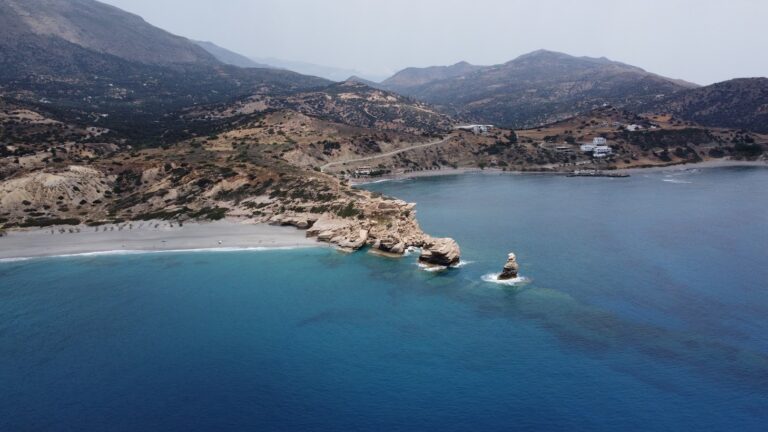
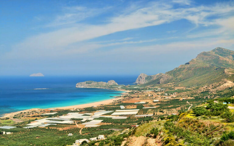
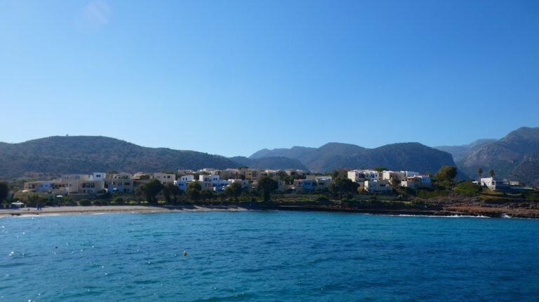
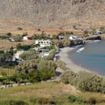
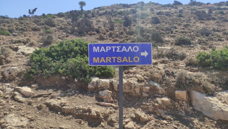
Martsalo, a secluded beach located in the western Asterousia Range, is just a few kilometres from Cape Lithino, the “horn” of Messara Plain, and 80km southwest of Heraklion. To reach this isolated spot, follow the dirt road from Odigitria Monastery to Lithino Cape, bearing right after the monastery. After travelling some distance, a sign indicating Martsalo will appear. Following this rough track will lead you to the entrance of Martsalo Gorge.

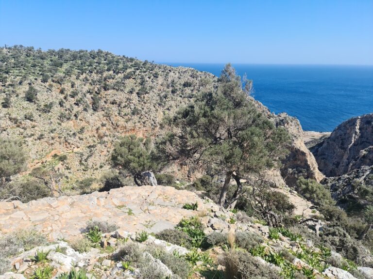
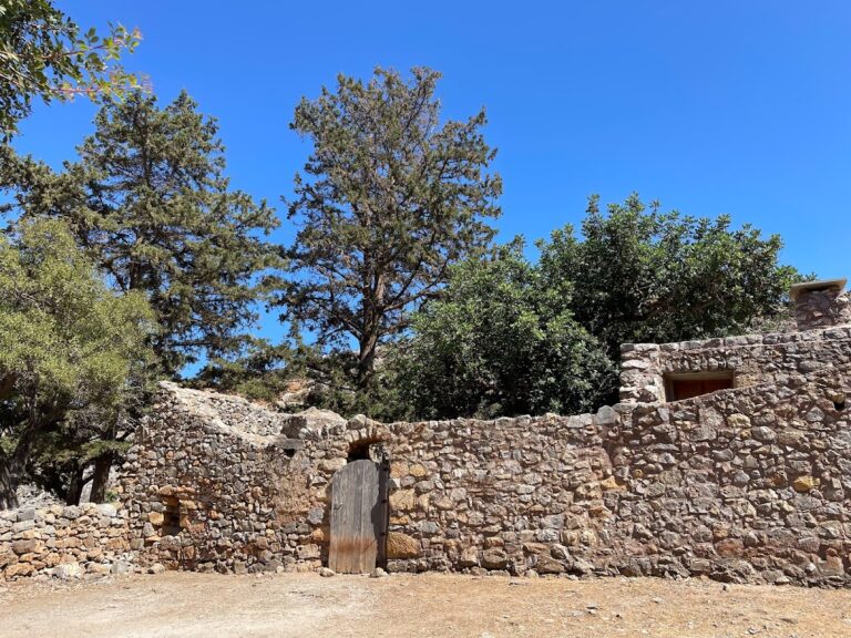
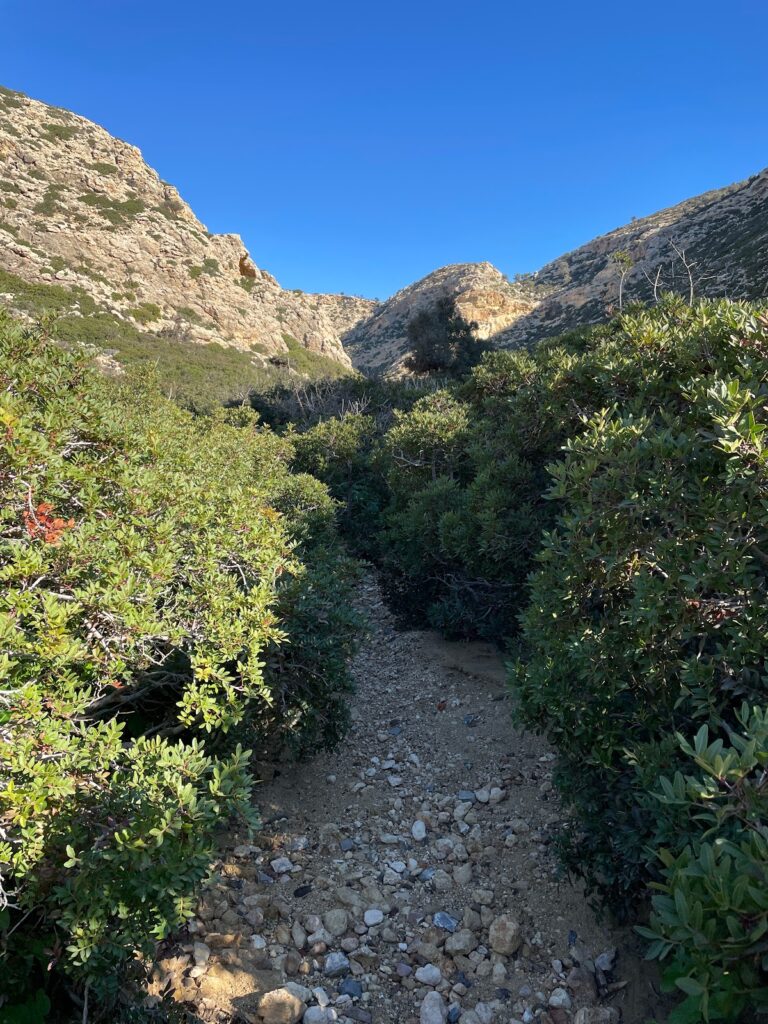
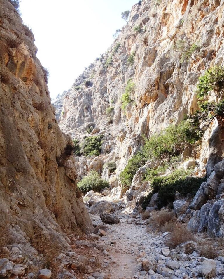
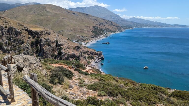
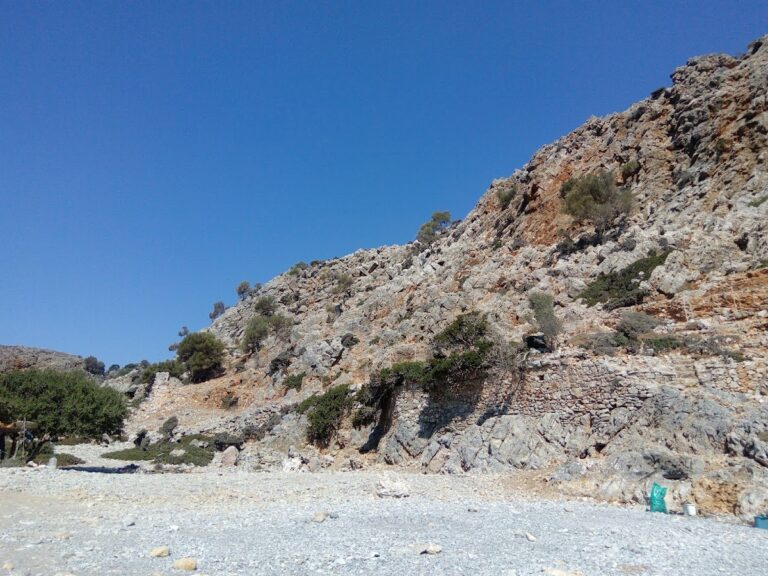
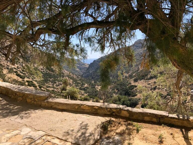
Parking your car at the gorge’s entrance, continue on foot for roughly 2km to the south. The hike through the gorge is not particularly challenging. The gorge, along with others in the area (like Agiofarago), has served as a hermitage for the Odigitria monastery, giving it significant religious importance. Remnants of the cells where monks once lived can still be observed in the gorge.

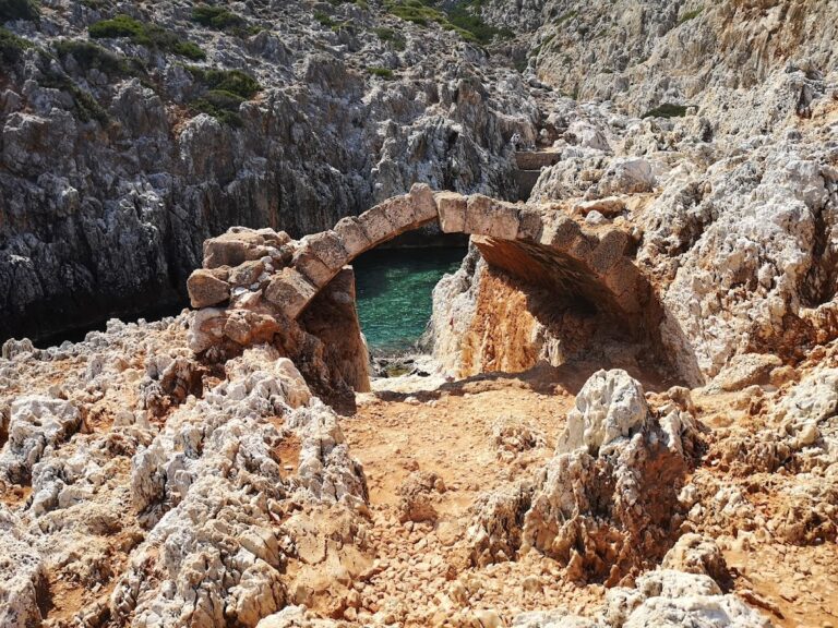
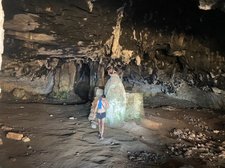
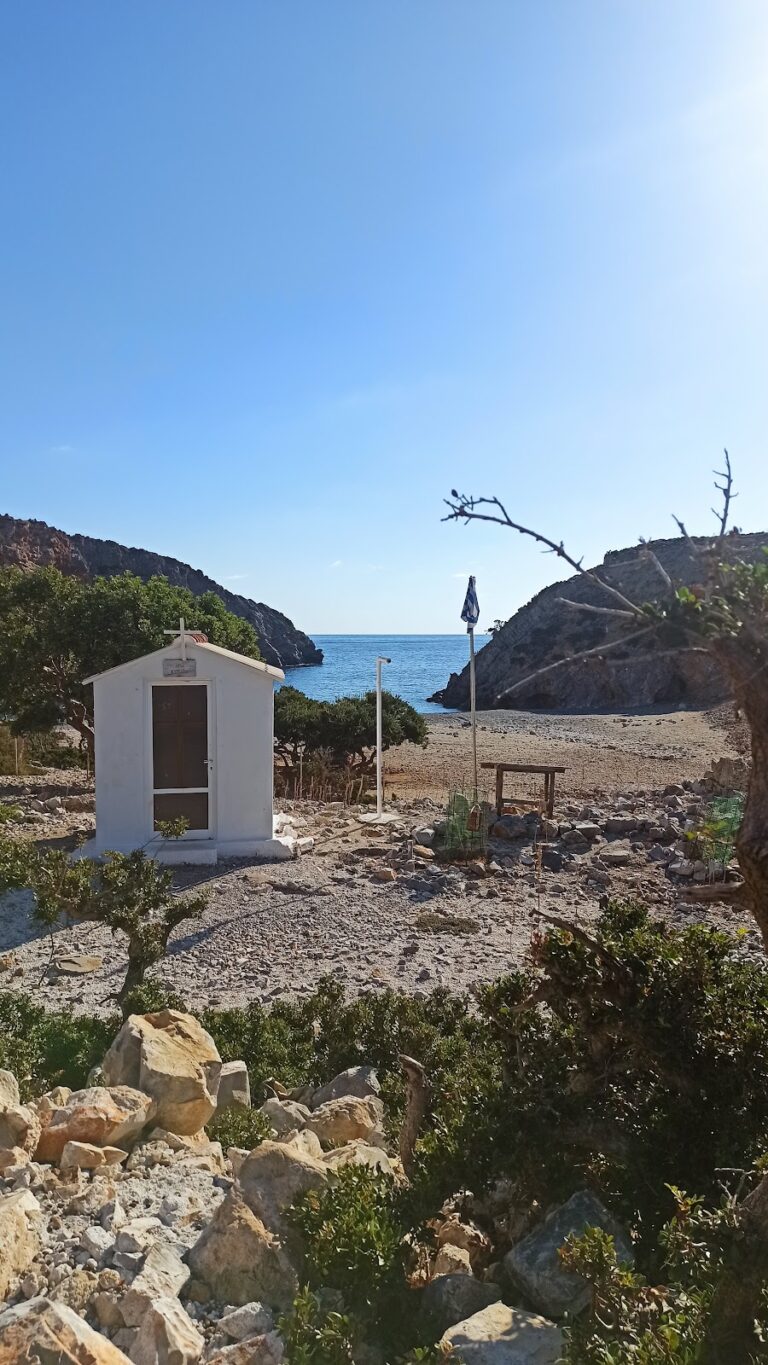
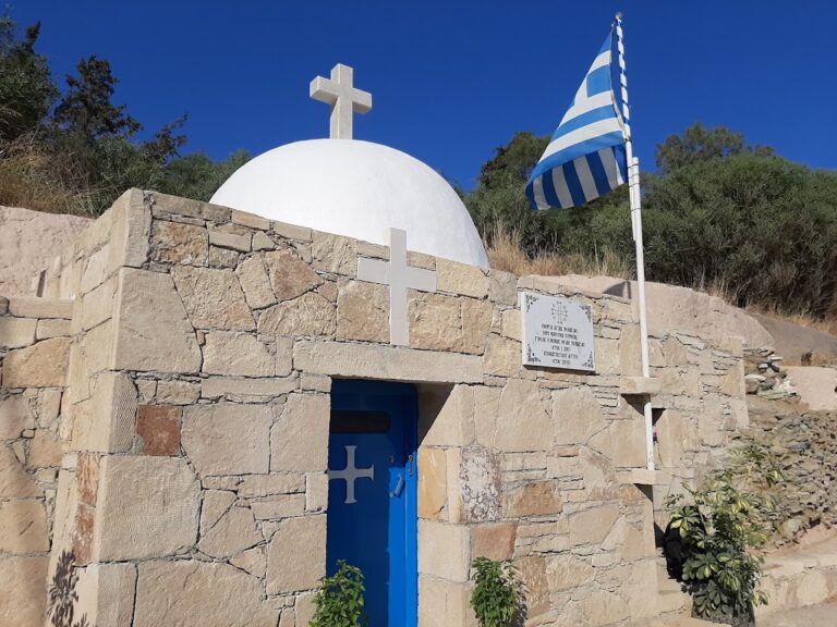
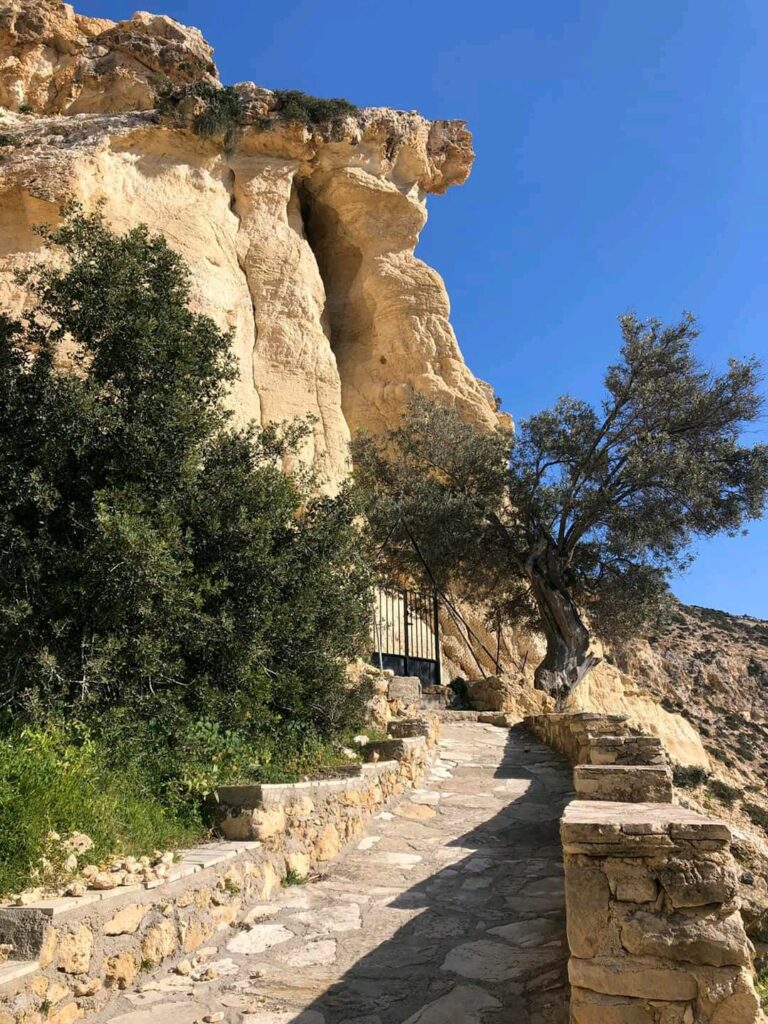
At the start of your journey, you’ll discover the beautiful church of Panagia Martsaliani, dedicated to the Annunciation. This church, constructed within a cave, served as a catacomb during the Christian persecutions. Centuries later, it was rediscovered by a shepherd. An icon of the Annunciation uncovered at that time is now preserved in the Odigitria Monastery. On August 15, when the Church celebrates, numerous visitors travel from the Mesara Plain to Martsalo.

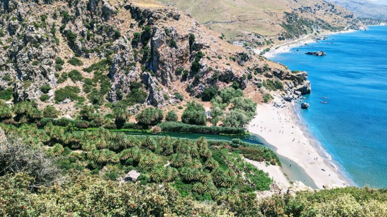
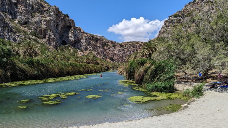
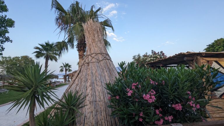
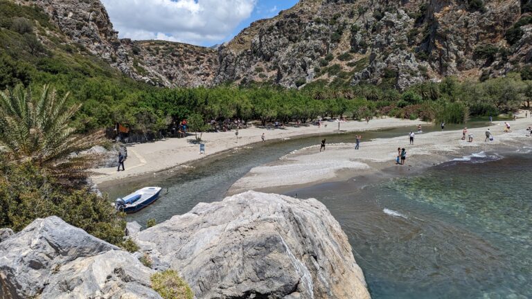
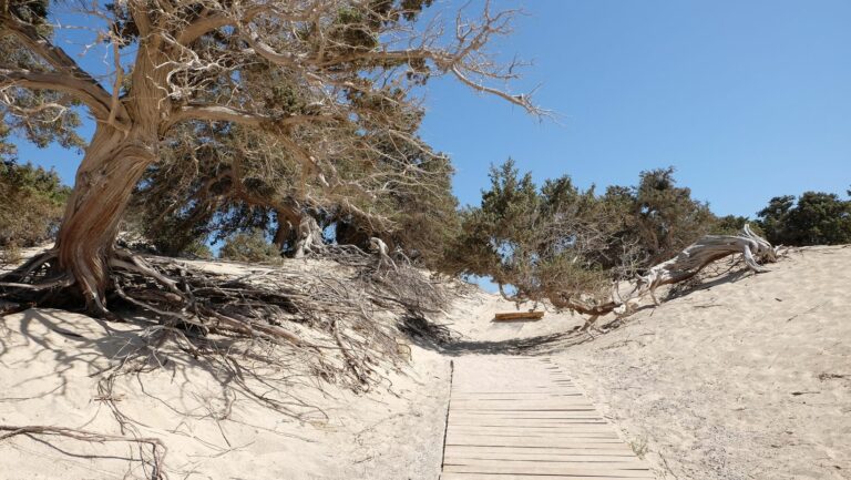
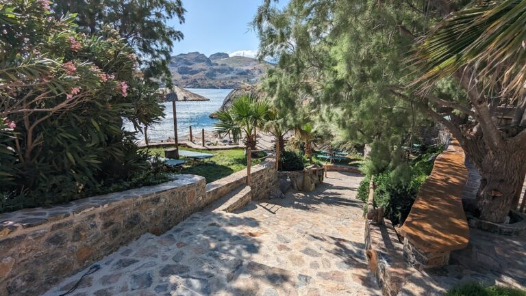
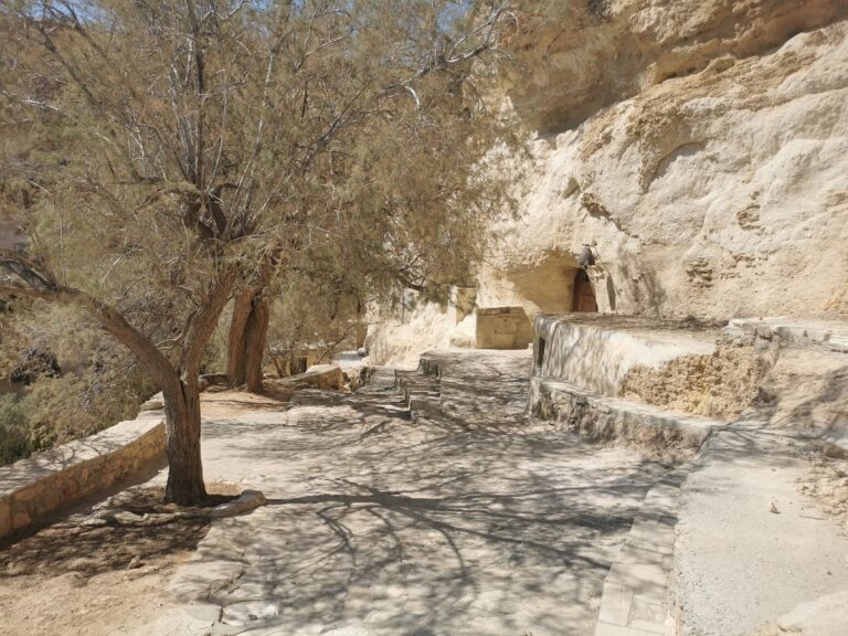
As you continue down the gorge, you’ll pass between the indigenous Phoenix Theophrasti palm trees. Martsalo is home to one of the largest colonies of this species in Crete, and the largest in the Heraklion prefecture. In the gorge’s center, a stone container collects water from a nearby spring, and around it, the hermits cultivate their necessities.

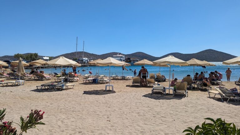
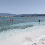
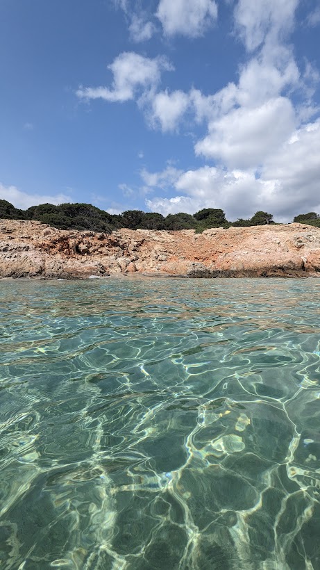
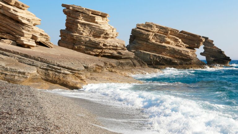
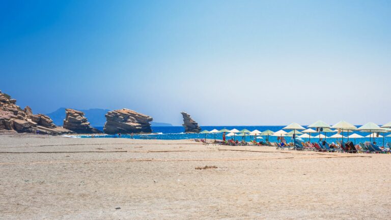
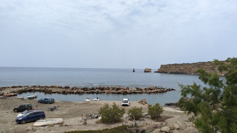
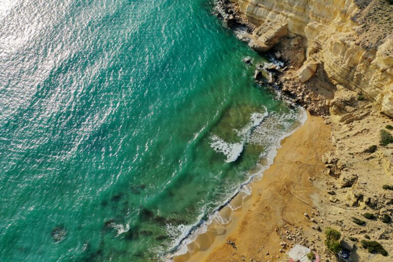
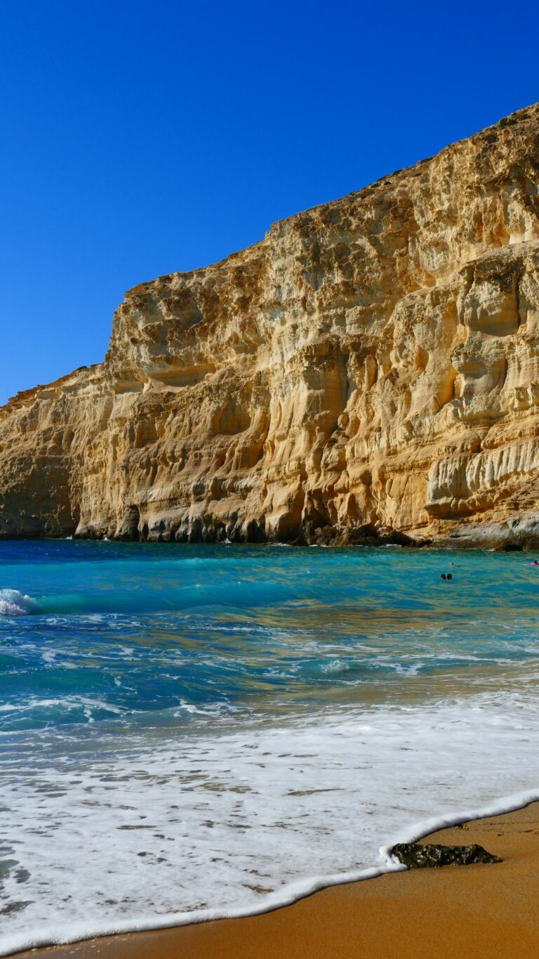
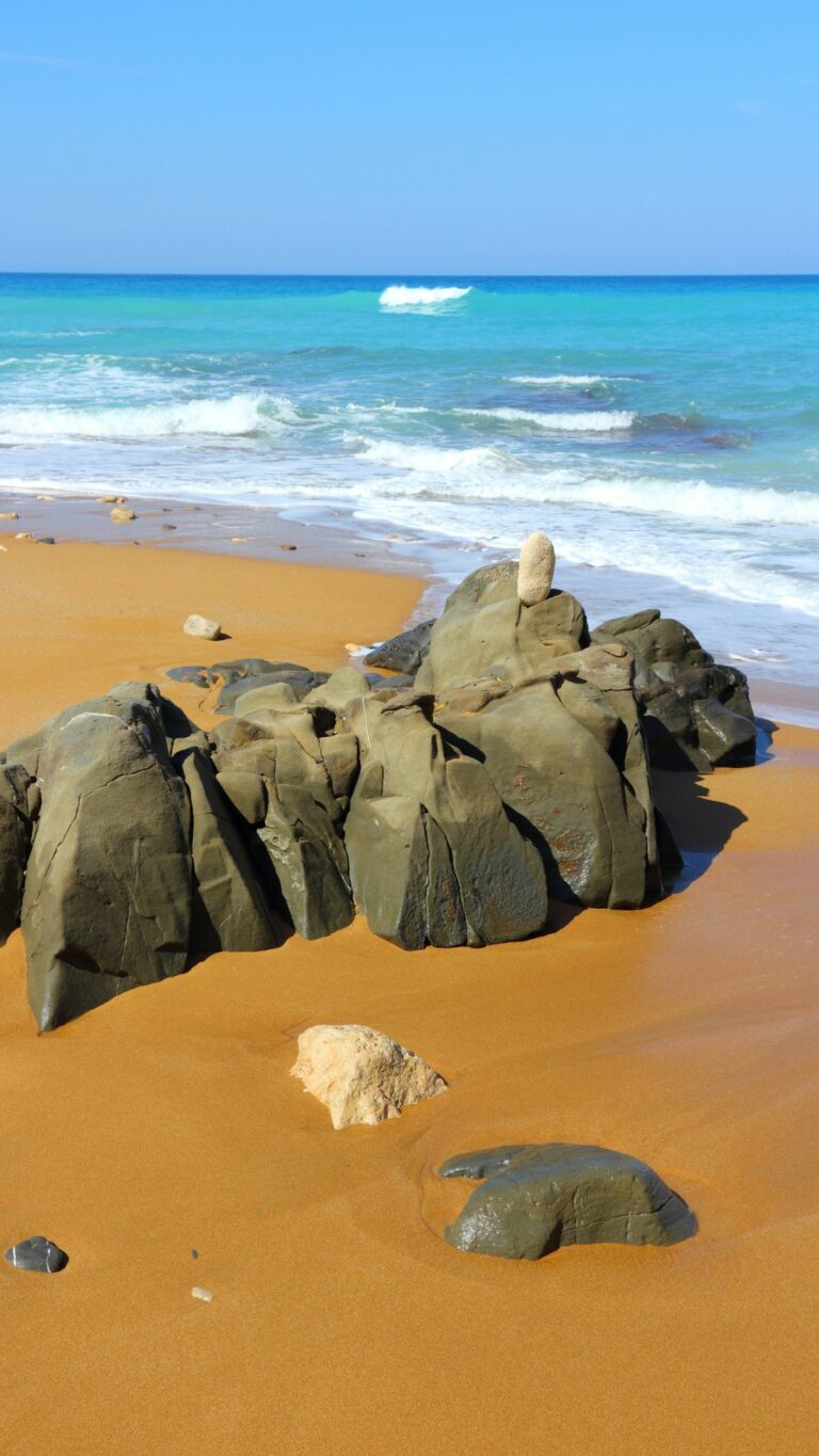
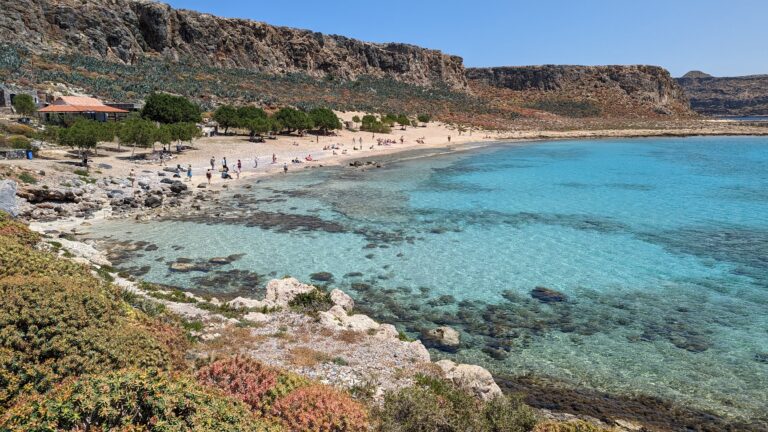
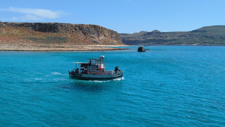
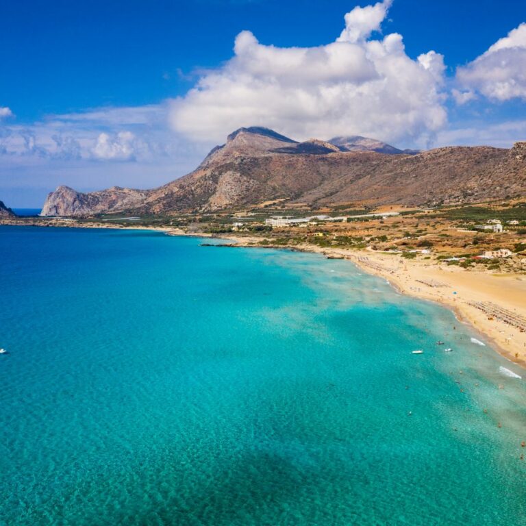
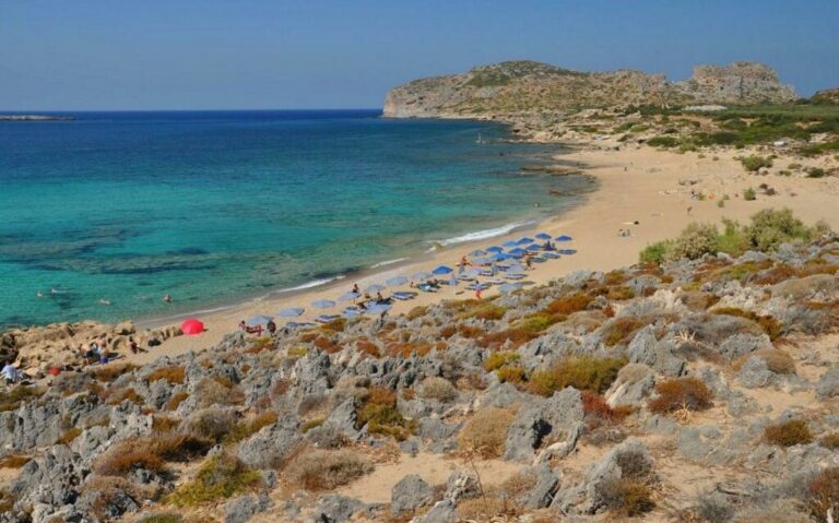
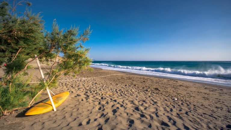
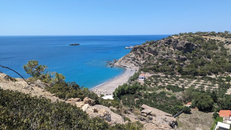
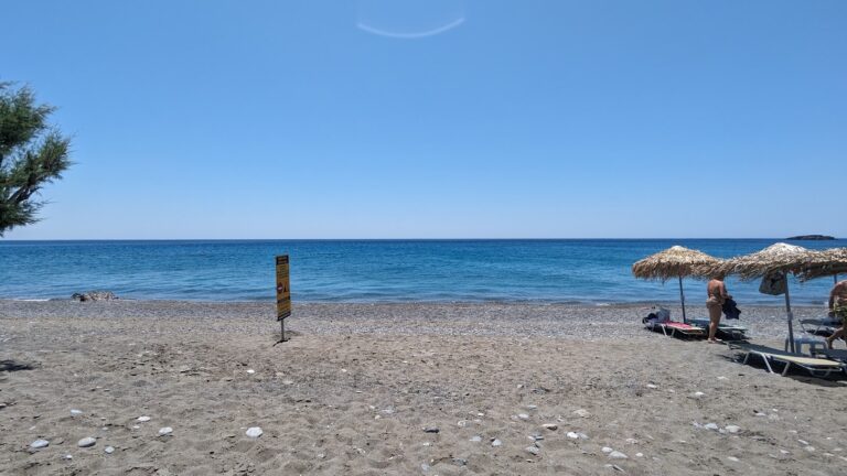
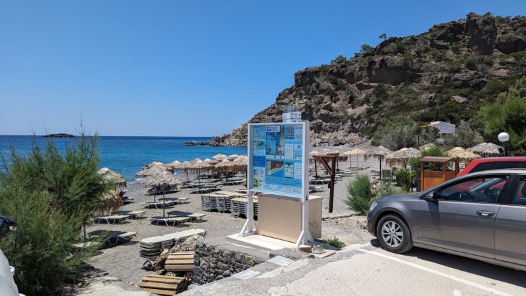
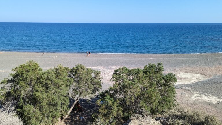
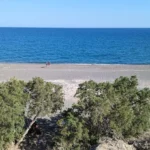
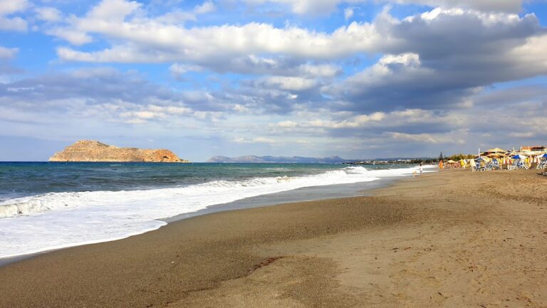
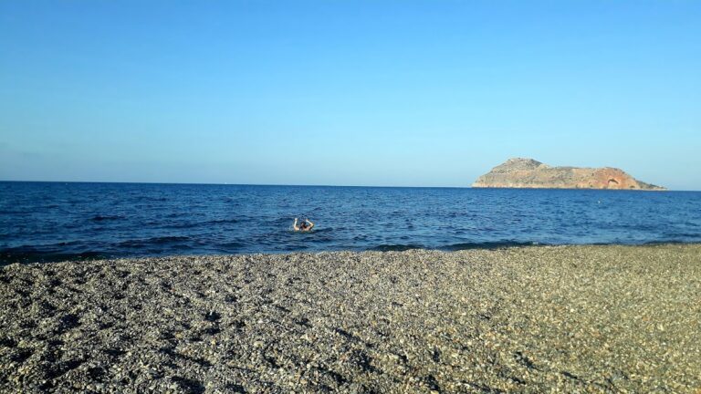
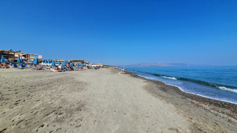
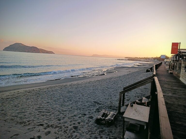
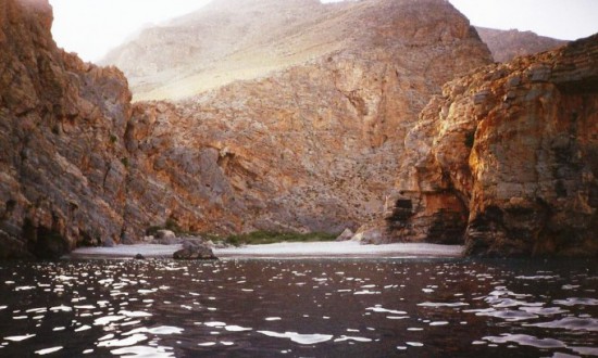
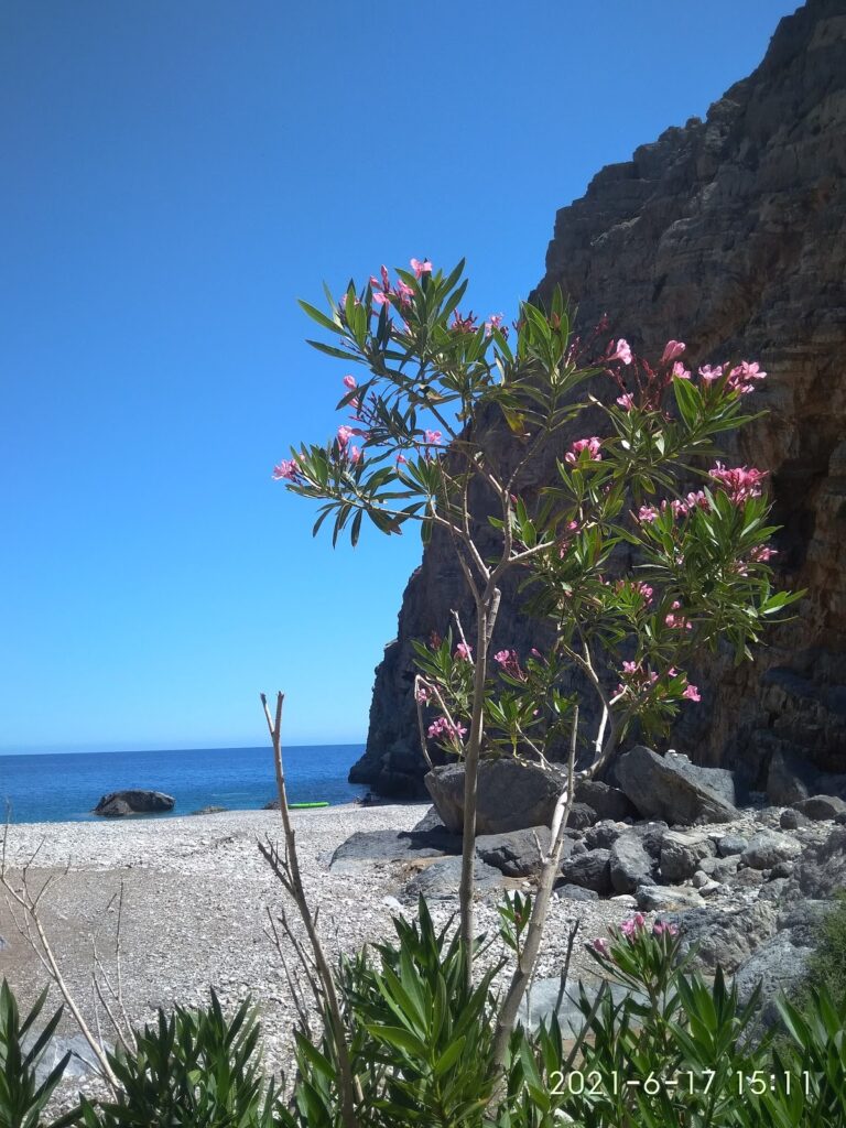
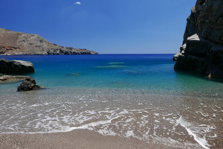
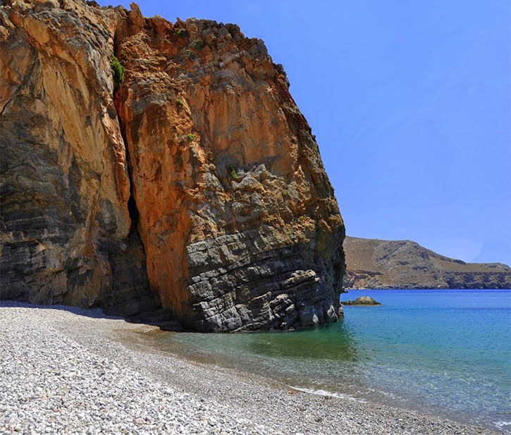
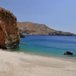
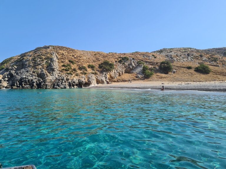
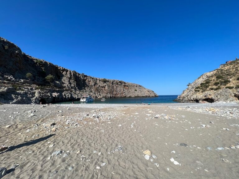
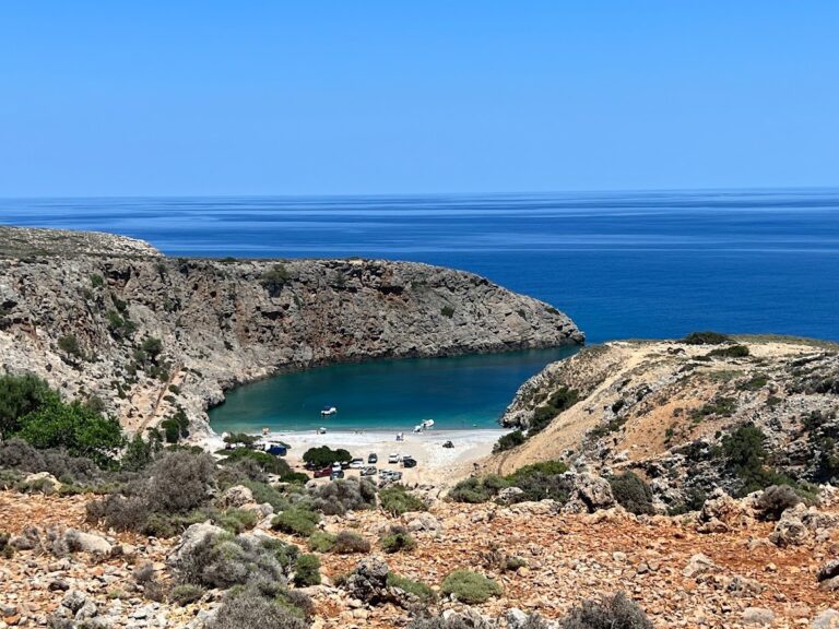
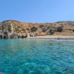
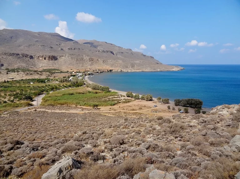
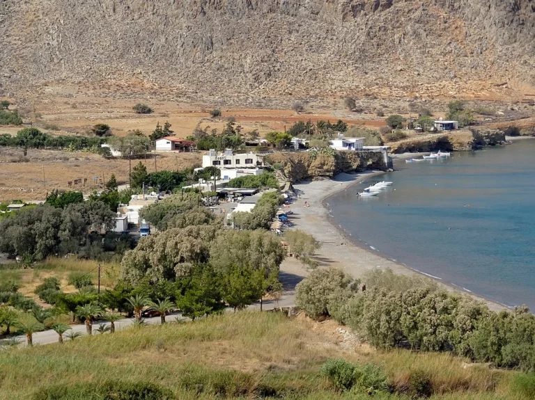
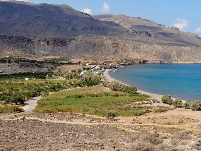
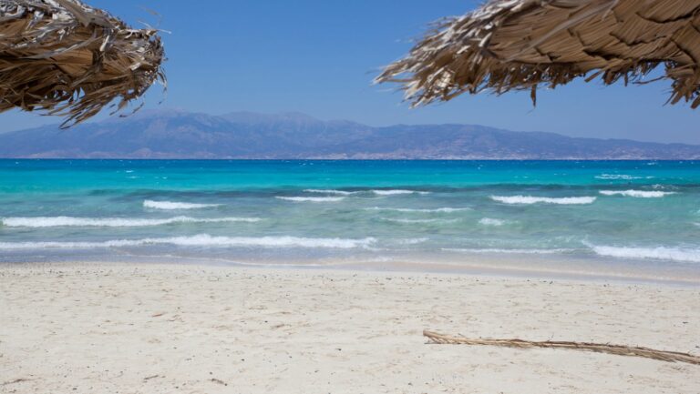
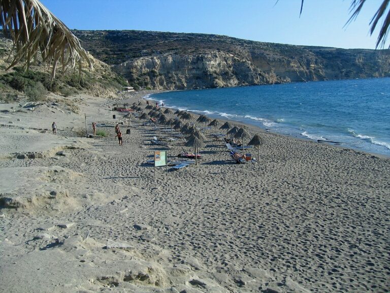
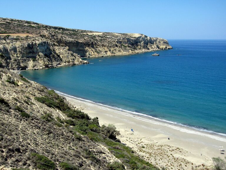
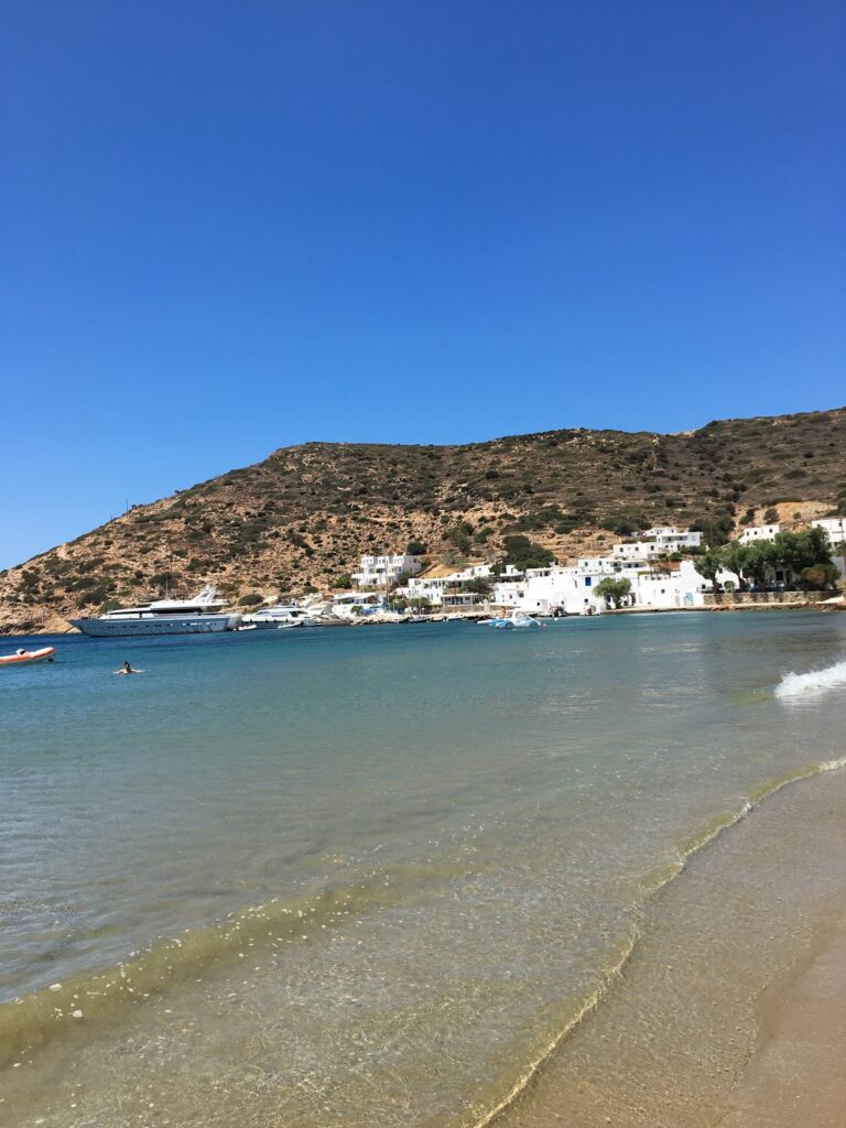
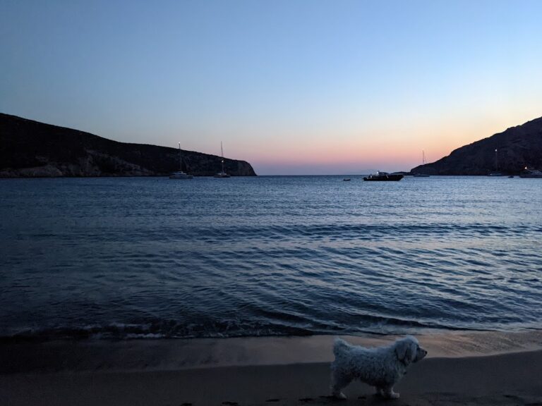
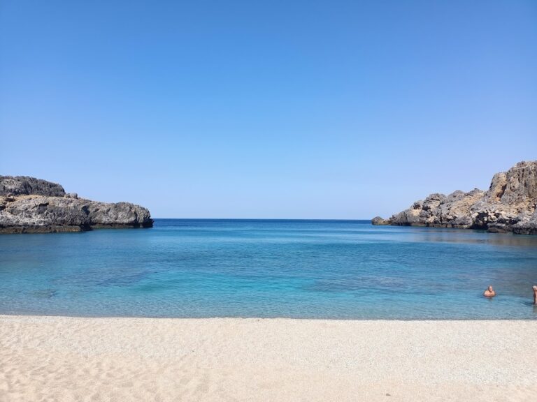
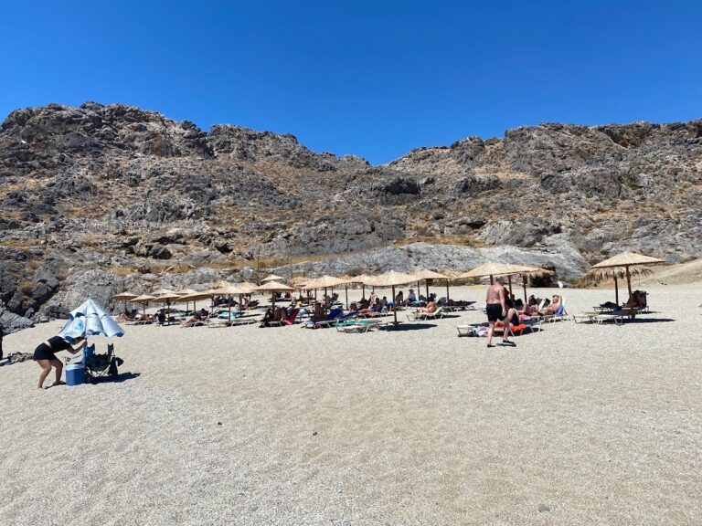
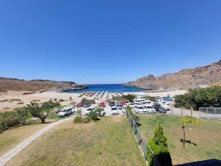
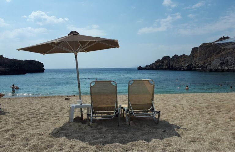
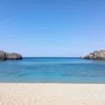
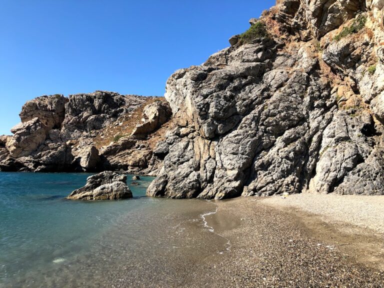
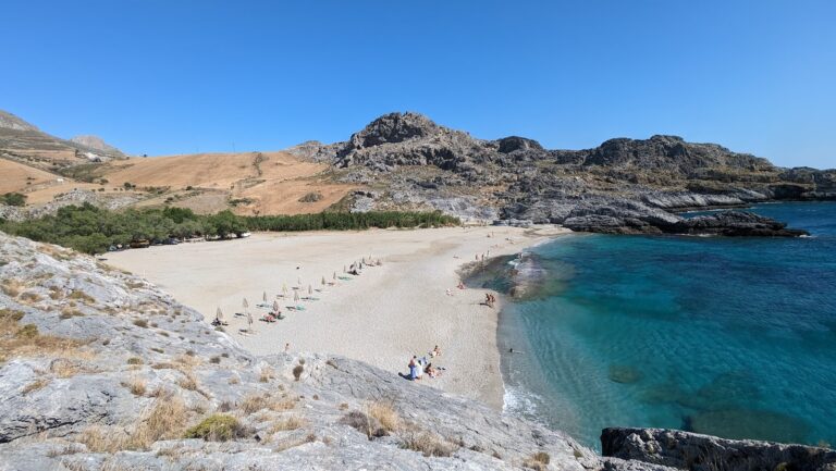
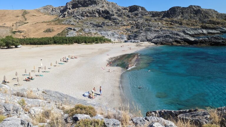
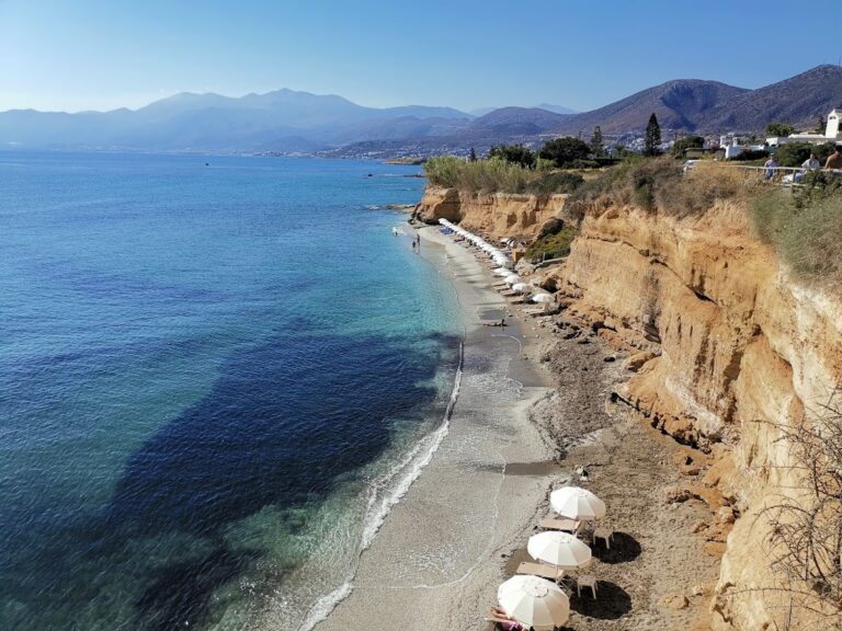
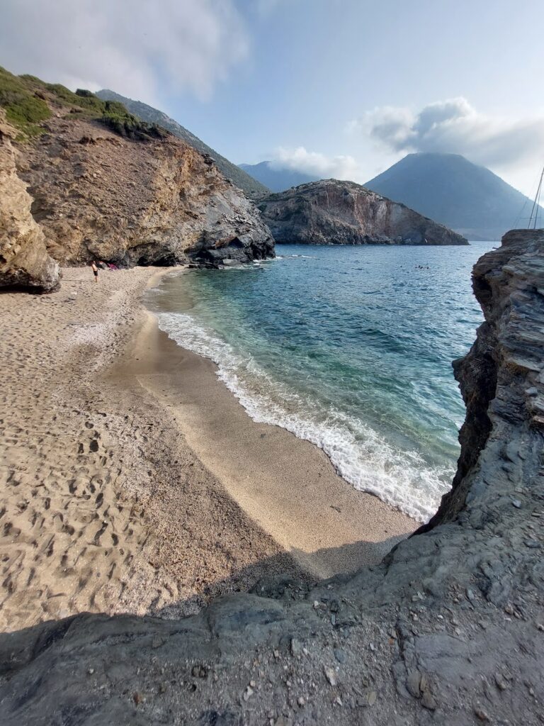
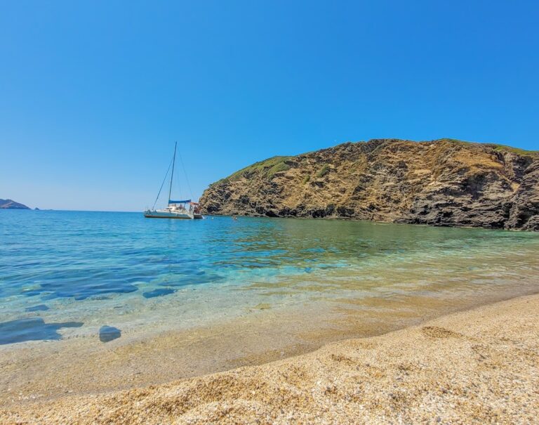
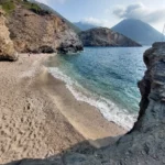
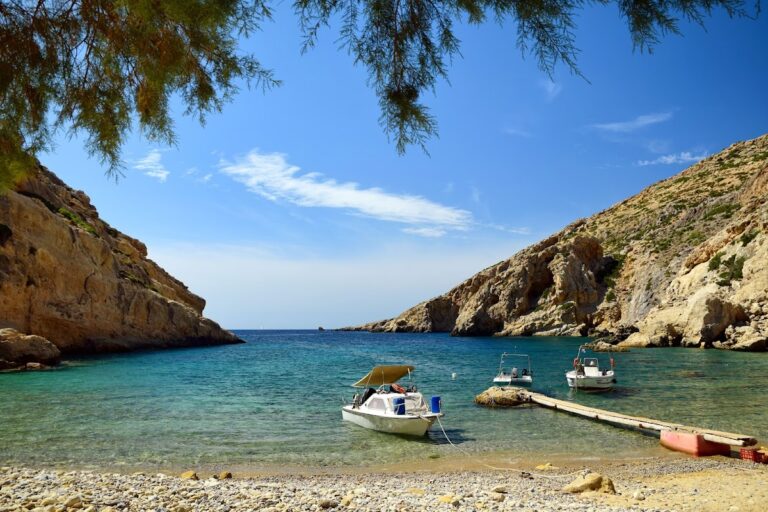
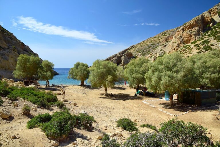
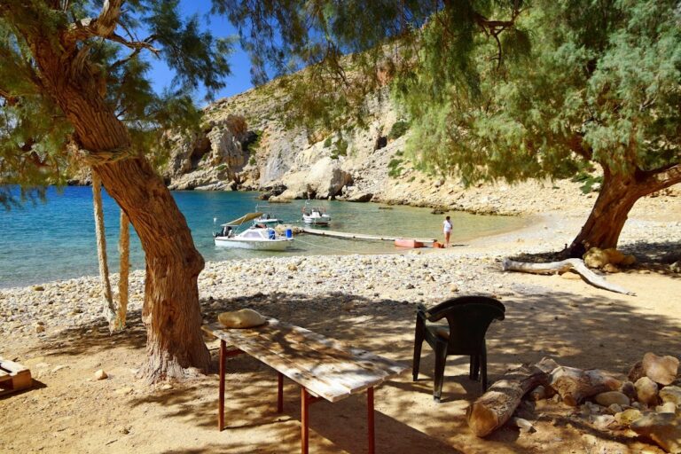
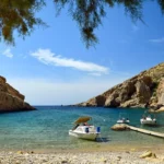
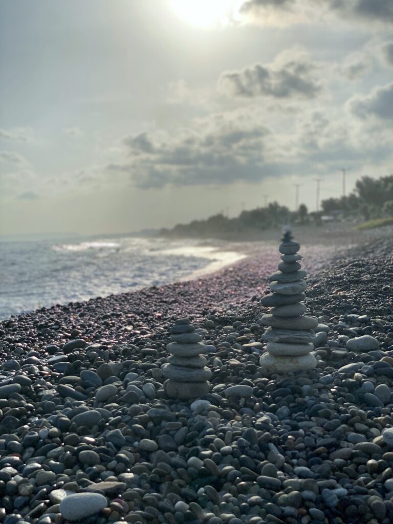
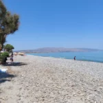
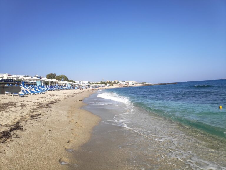
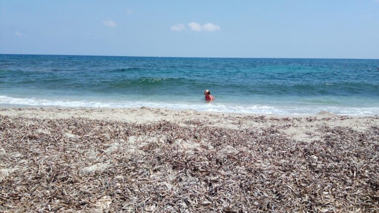
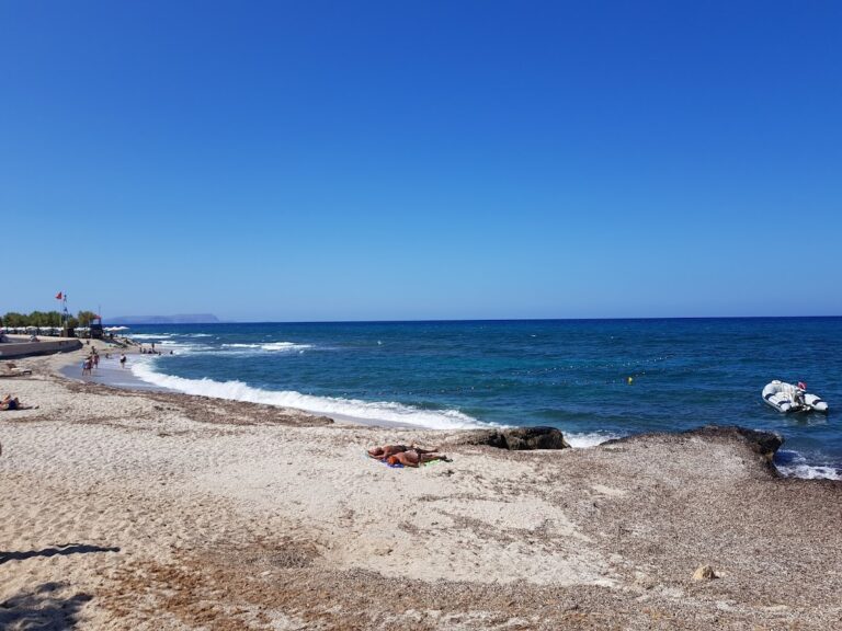
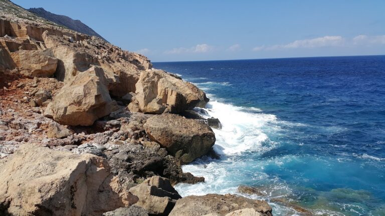
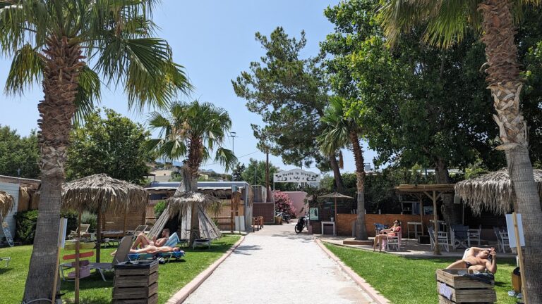
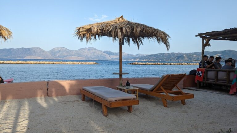
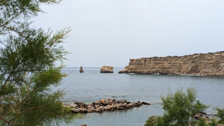
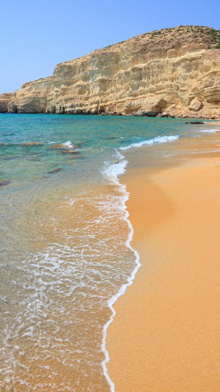
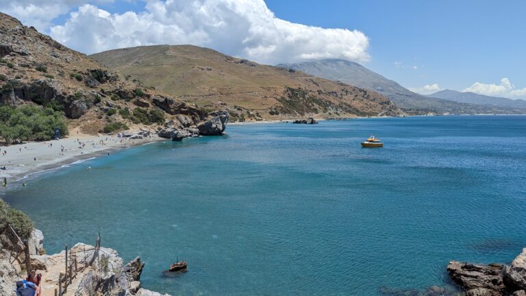
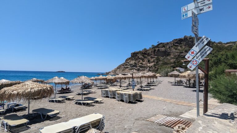
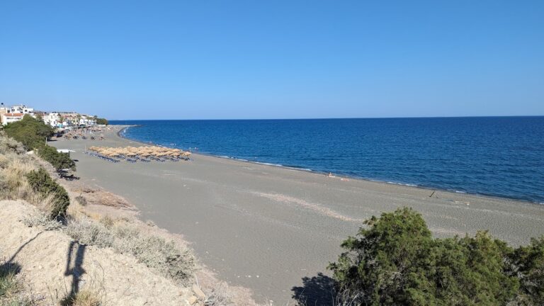
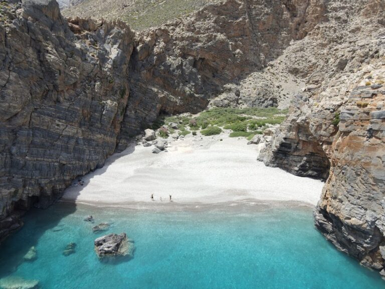
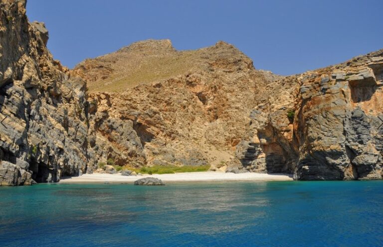
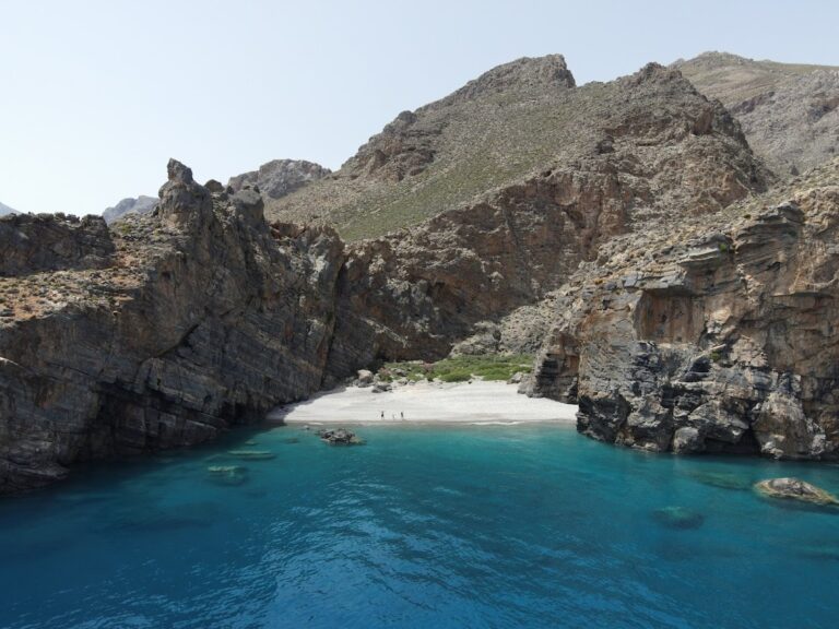
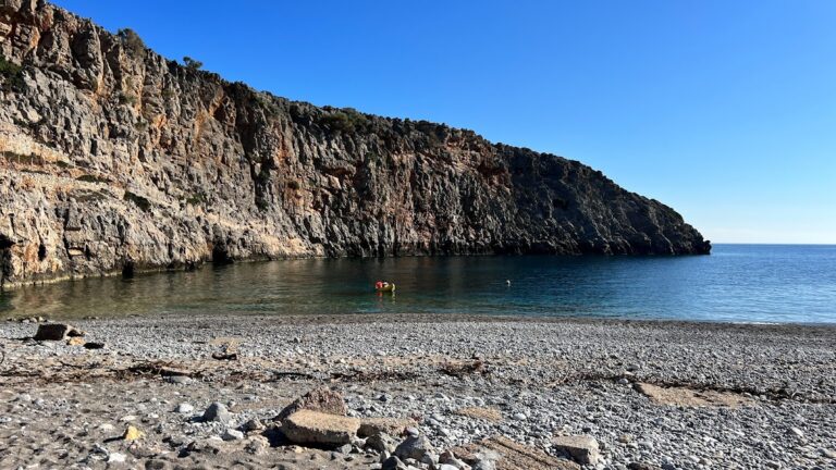
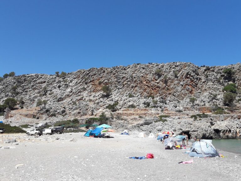
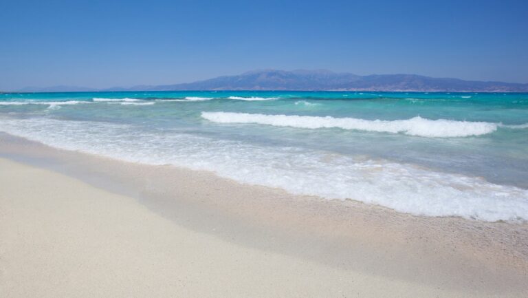
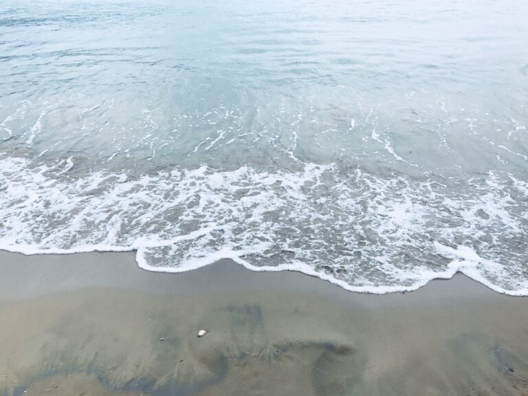
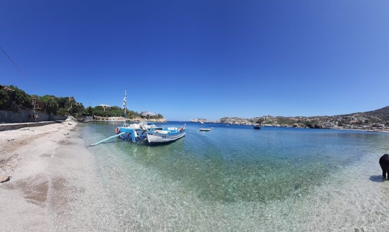
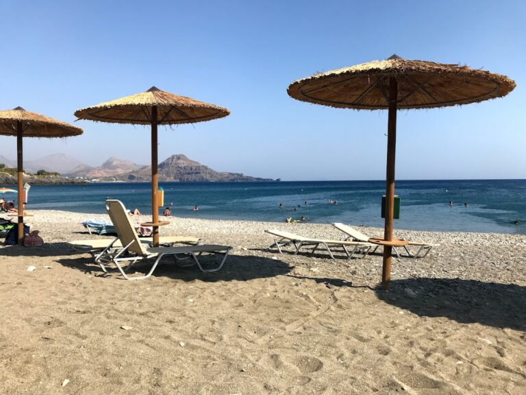
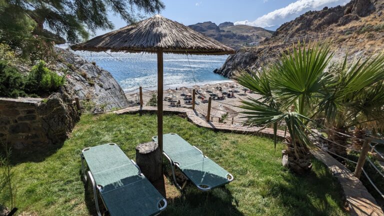
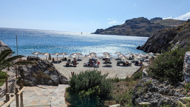
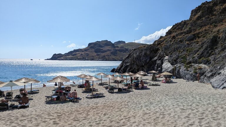
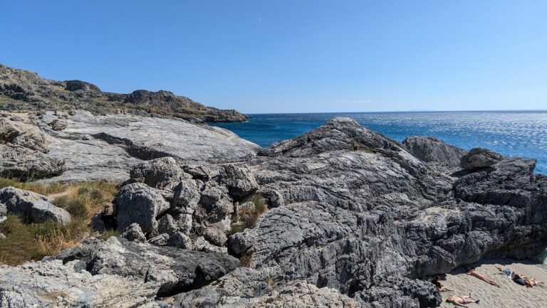
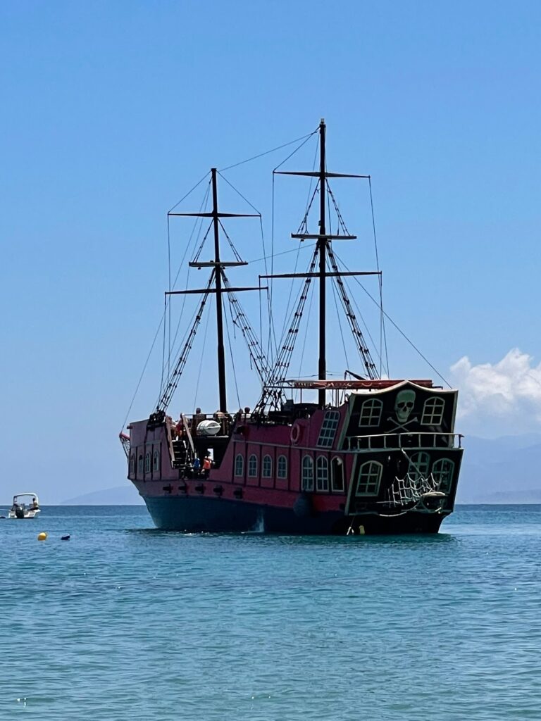
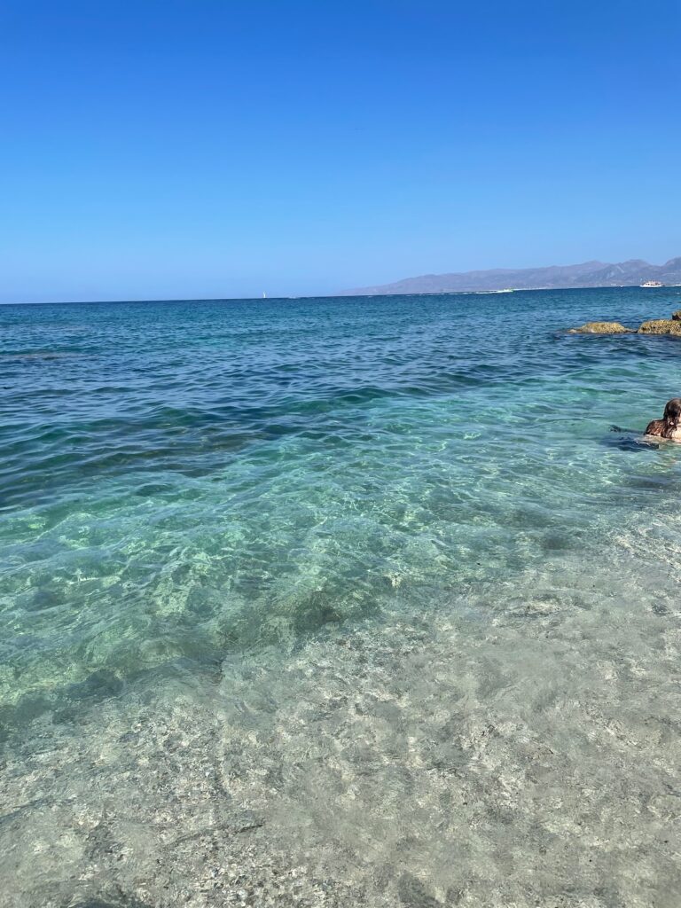
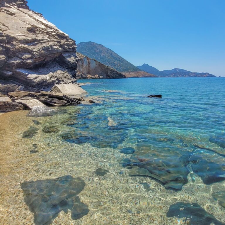
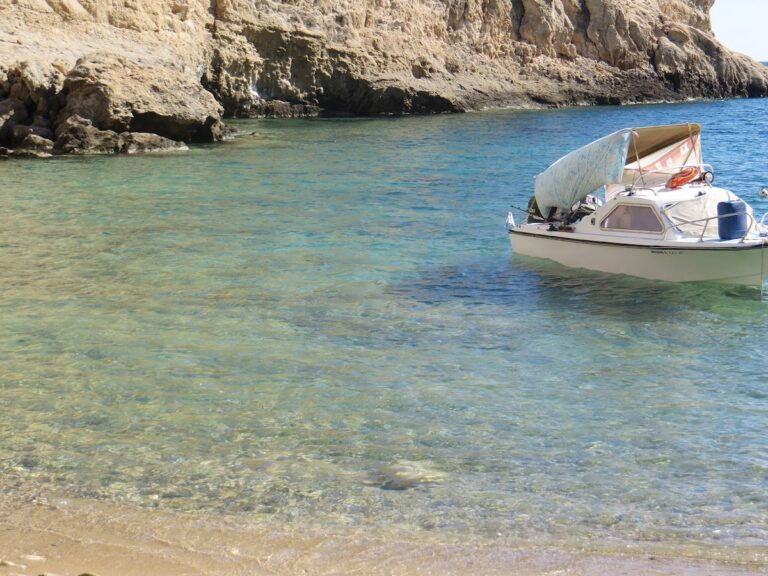
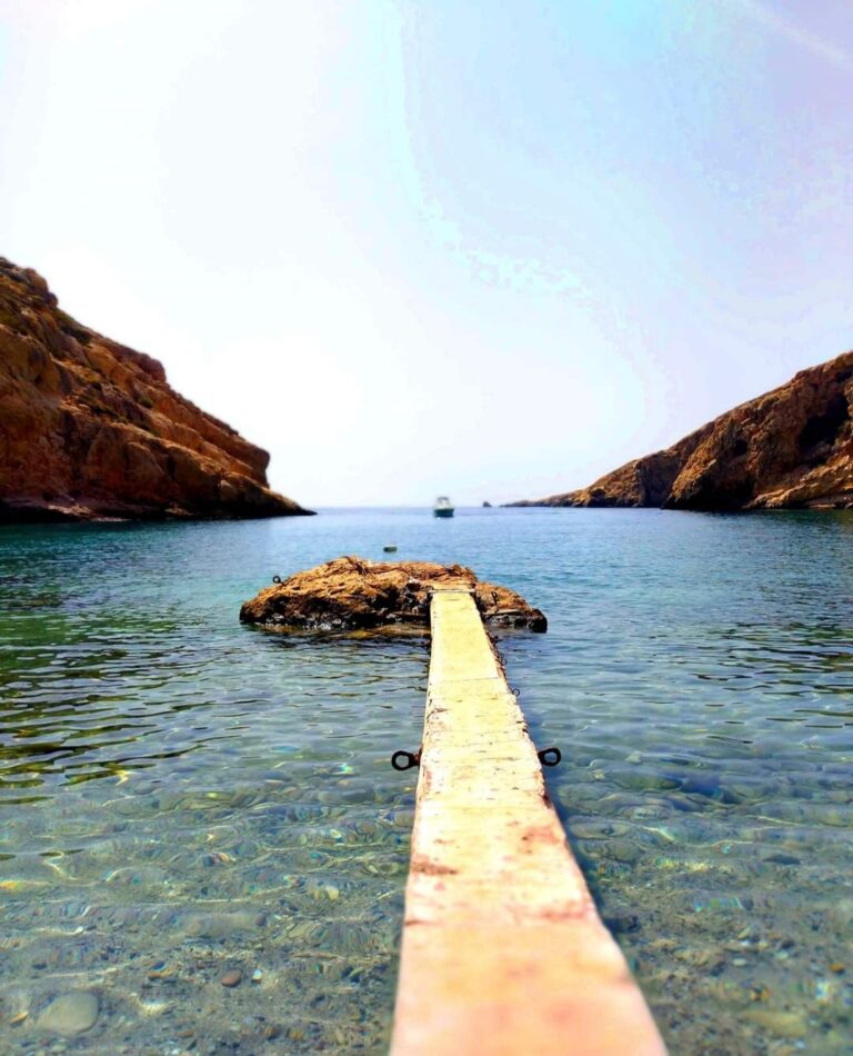
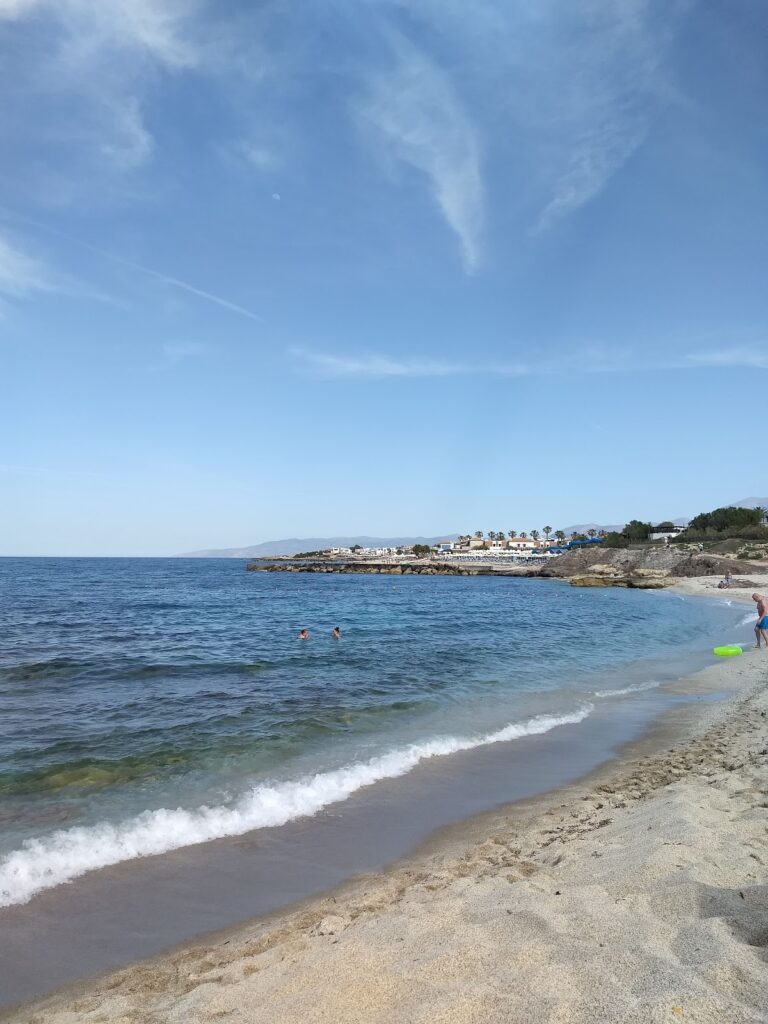
A 15-20 minute walk through the palm trees will lead you to the beach at the mouth of Martsalo. This isolated beach with its large pebbles and calm waters (Martsalo translates to Good Harbor in Latin) is an ideal spot for solitude. A simple pier serves boats coming from Kali Limenes or Matala, and surrounding tamarisk trees provide natural shade. As a religious site, it’s important to respect the hermits and refrain from activities such as nudism.

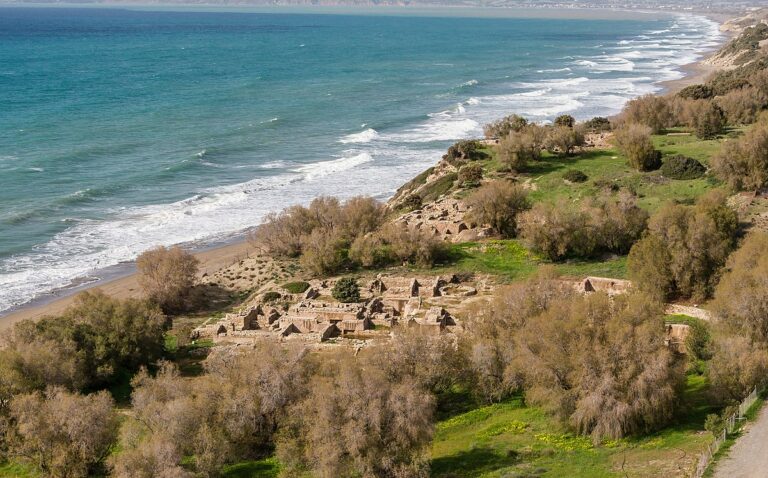
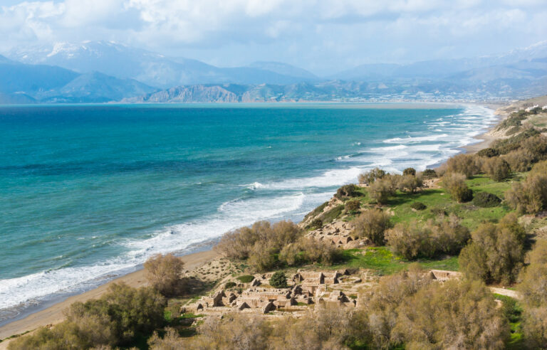
Traces of a harbour hamlet from 1800-1600BC suggest the beach has served as a port since the Minoan period. The Apostle Paul also reportedly stopped at Martsalo to preach Christianity during his journey to Rome.

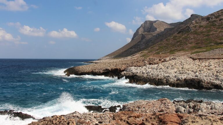
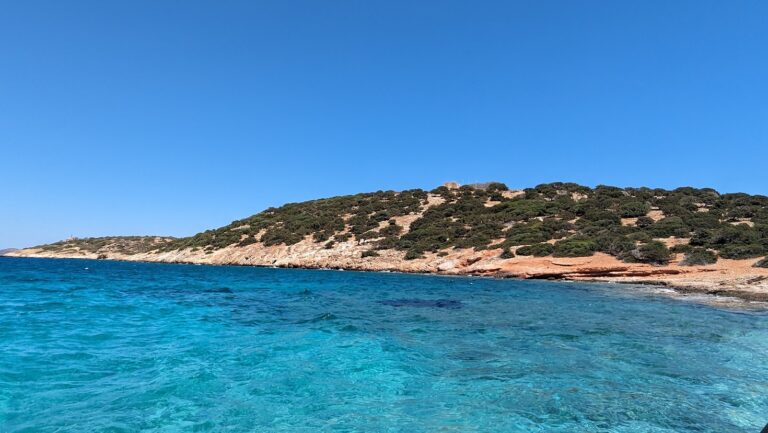
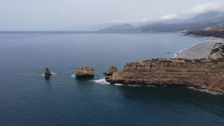
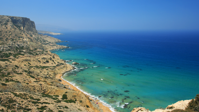
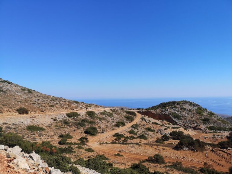
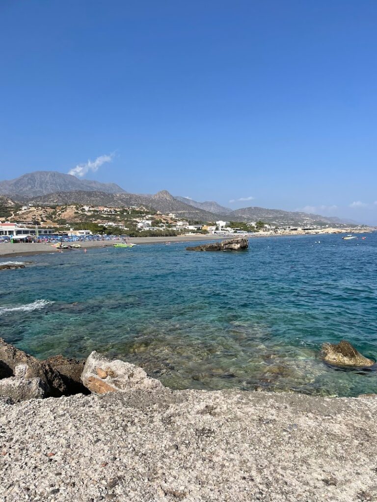
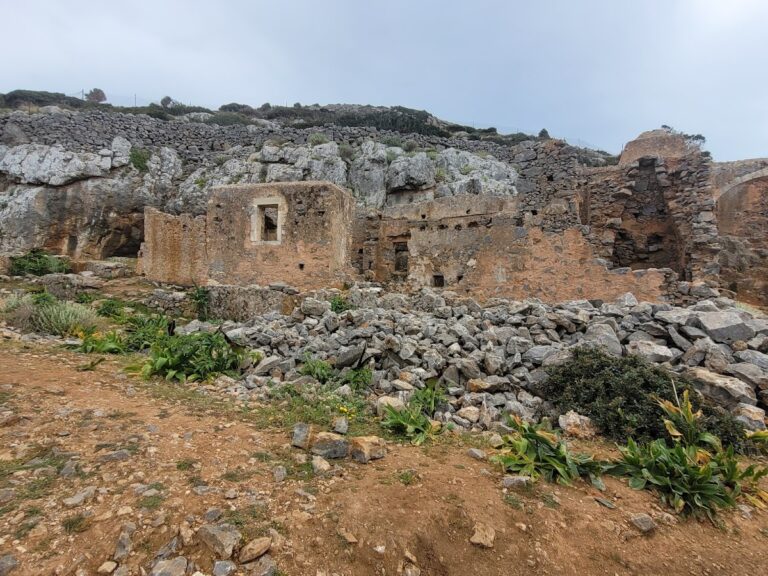
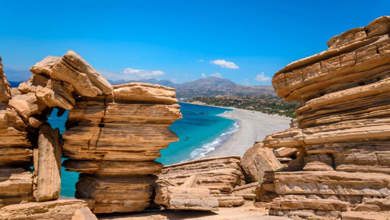
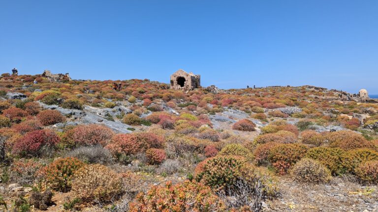
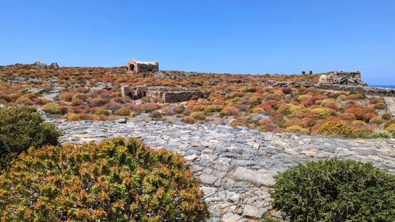
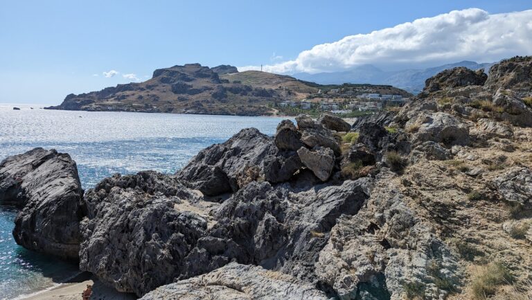
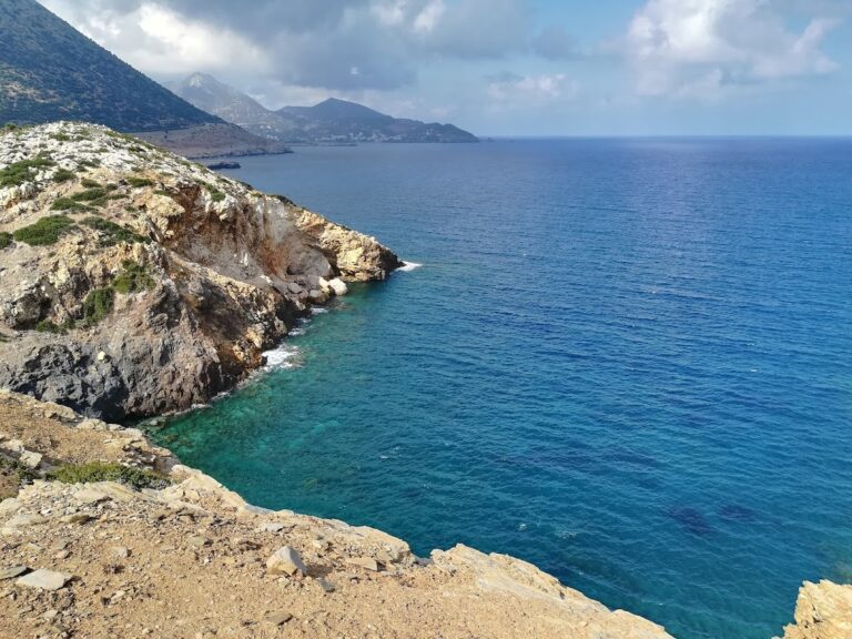
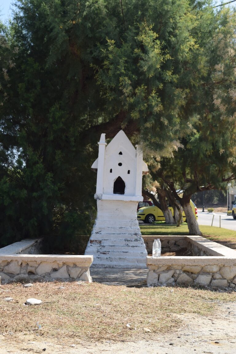
Cape Lithino, the southernmost point of Crete and the “corner” of Messara plain, is home to the dry Kefali peak. From here, cliffs plunge 391m into the sea. The view is breathtaking. To reach Kefali, follow the 13km long rough dirt road starting from Odigitria Monastery and heading west. On Kefali, you’ll find the ruins of a German military establishment from World War 2 and a small stone church dedicated to the Holy Cross.

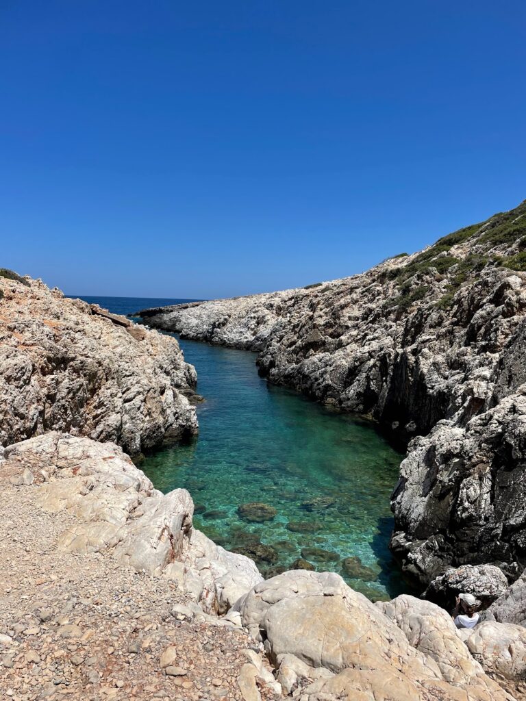
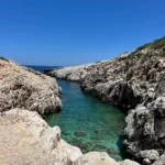
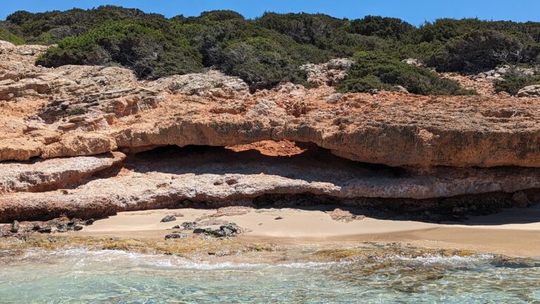
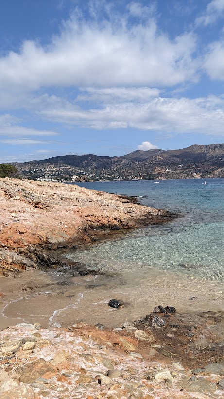
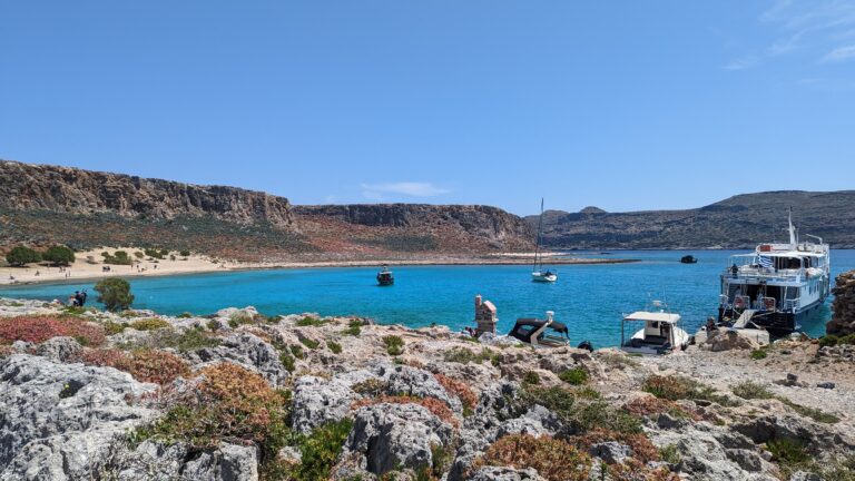
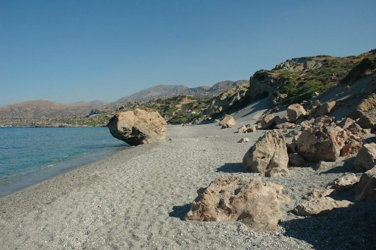
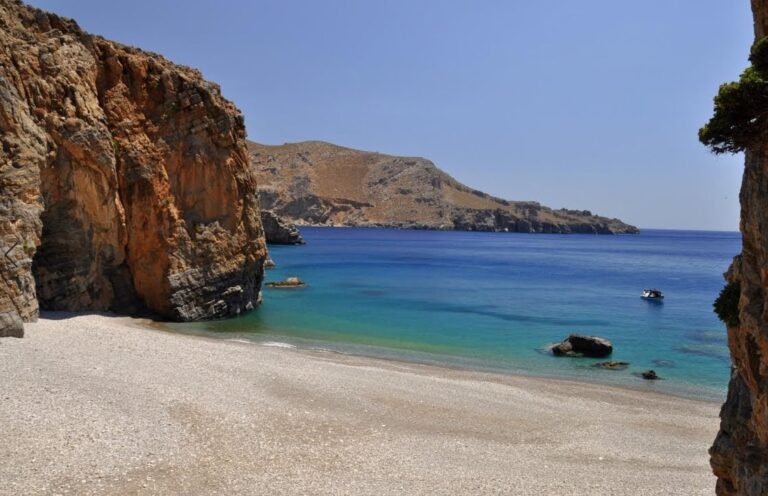
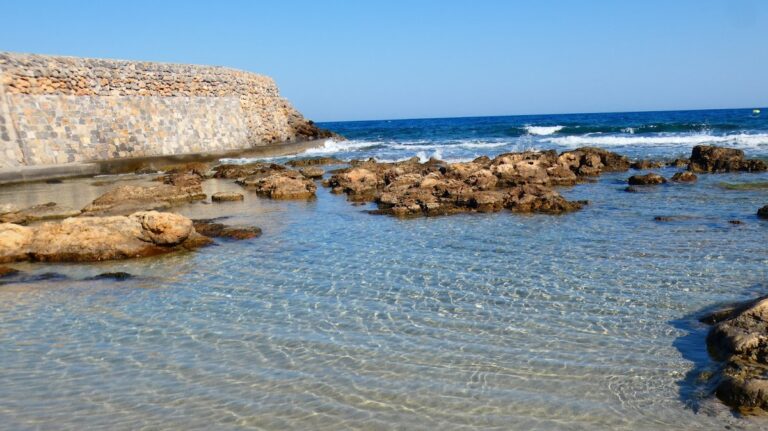
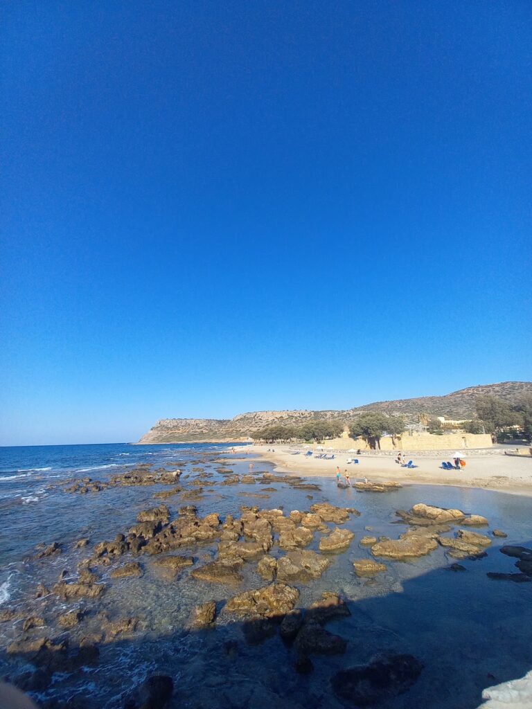
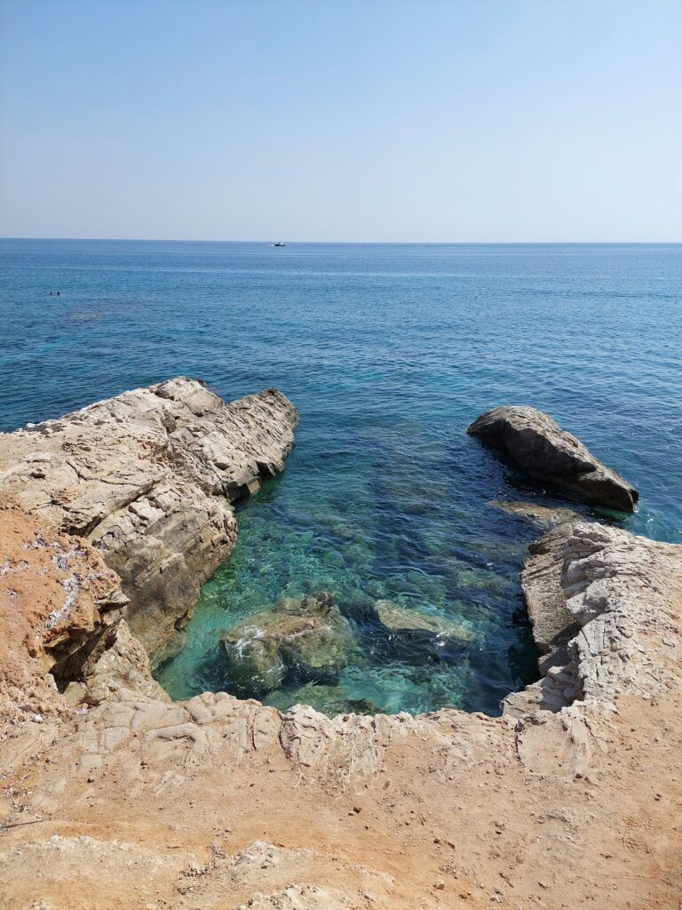
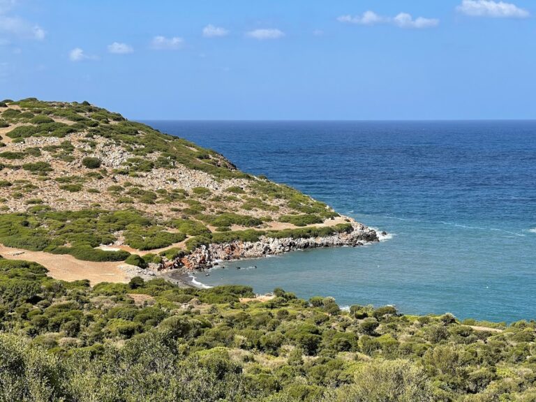
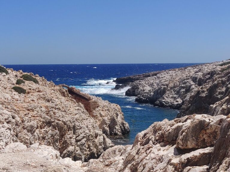
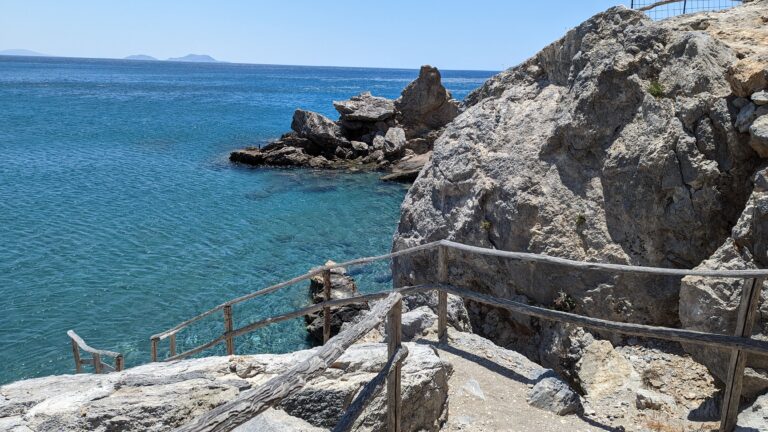
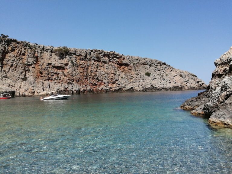
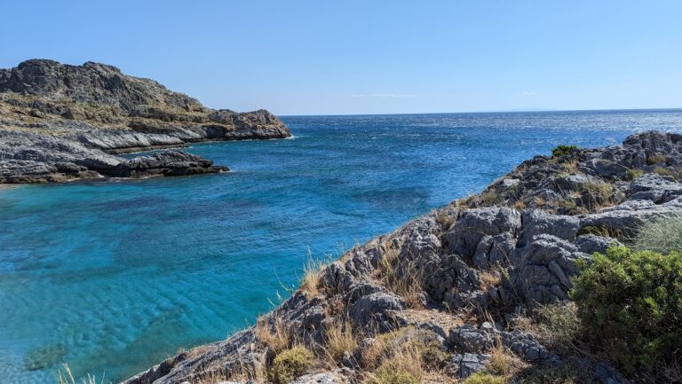
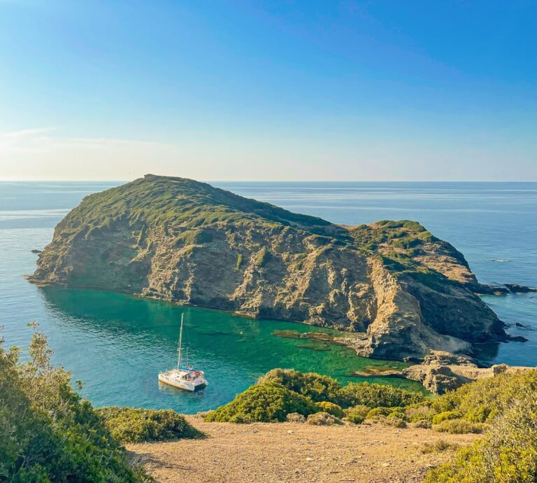
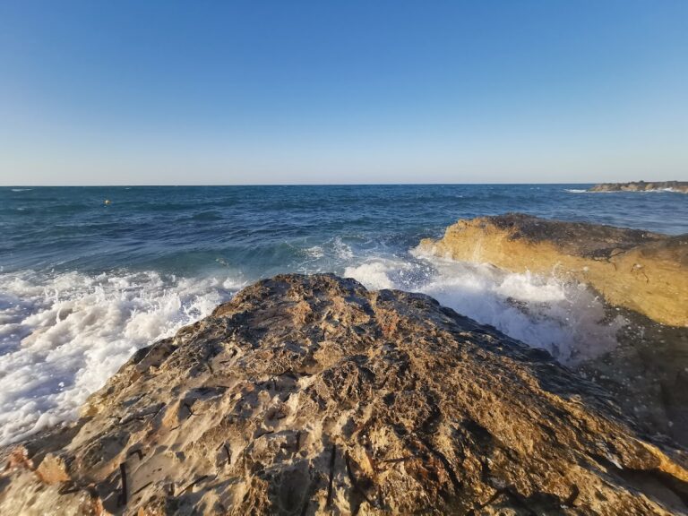
Locals may tell you there are no beaches between Martsalo and Vathi, but this isn’t true. Below Kefali is a small cape called Platys Poros or Trahili, home to two bays with deep blue water and coarse pebbles, known as “Maragou Limani” or “Carpenter’s Harbor”. These southernmost beaches of Crete are only accessible by boat, and the surrounding coast is riddled with caves worth exploring.

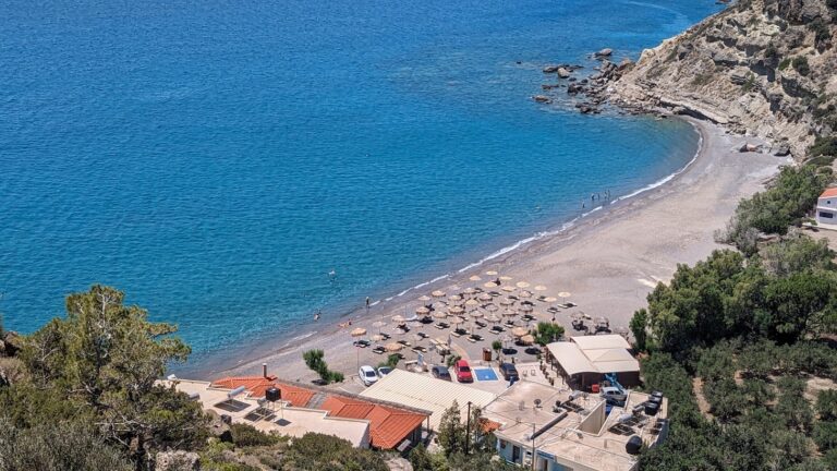
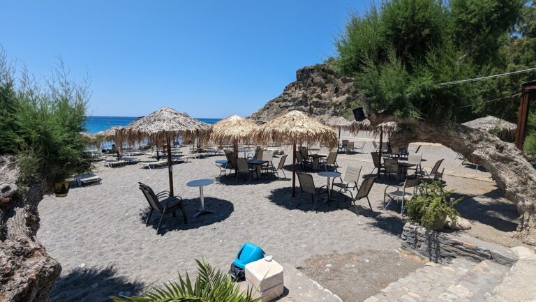
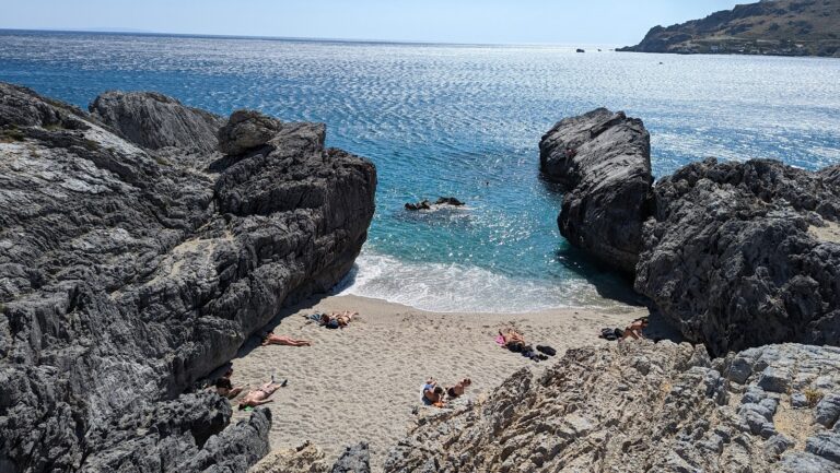
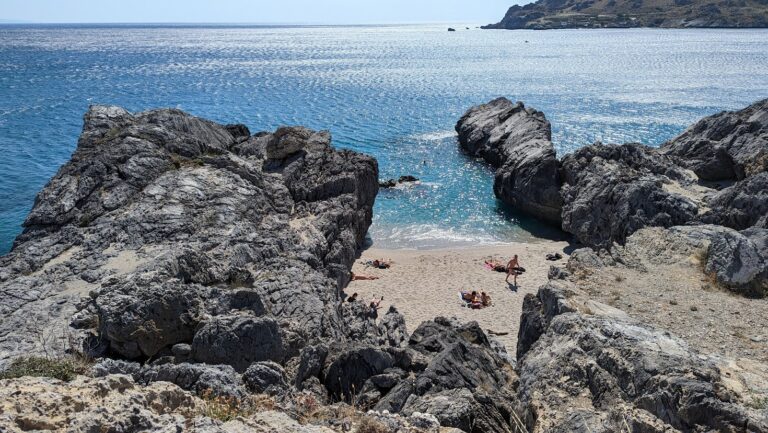
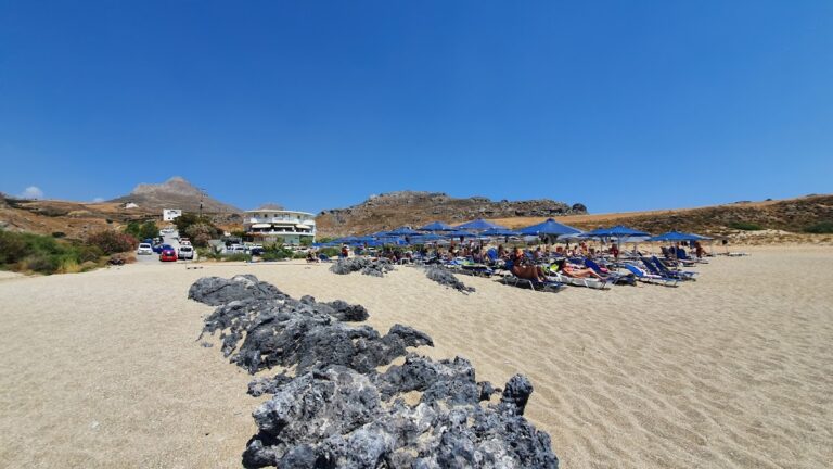
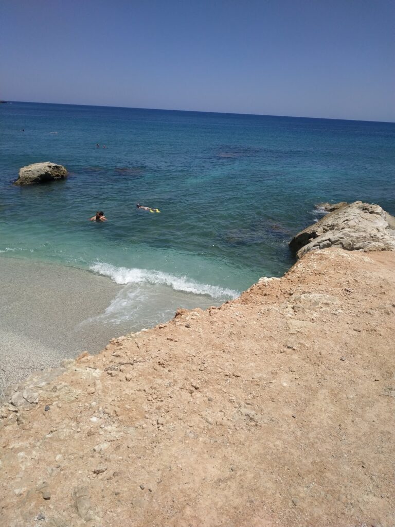
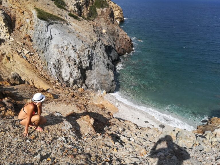
Just west of Martsalo beach and 600m east of Poros is the small beach of Kounenos, accessible via a footpath near Martsalo. The surrounding landscape, filled with caves, cliffs, and unique rock formations, makes this an ideal spot for nature lovers. The beach features small pebbles and deep waters.

  • Maleme beach
  • Fine Pebbles, Sand
  • Normal
  • Blue

Situated 18km west of Chania, Maleme forms part of the expansive beach that stretches from Kolimbari to the vicinity of Chania. This lengthy bay is adorned with stunning sandy and pebbly beaches, although they are exposed to frequent northerly winds. The beach at Maleme is sandy and the surrounding area is well developed, with all necessary amenities conveniently located near the beach. For those seeking a more secluded spot for a swim, the west end of the beach, adjacent to the old military airport, offers a quieter location.

The name Maleme is believed to derive from the word “Malama”, translating to gold, hinting at the possibility of a gold mine existing in ancient times, although this hasn’t been confirmed. In addition, a domed tomb from the late Minoan period has been discovered near Maleme. Despite having been looted, two cylindrical seals depicting running wild animals were found by archaeologists.

During World War II, Maleme held significant historical importance. It was home to the Allies’ military airport until it was seized by German forces. The Battle of Crete in 1941 saw German paratroopers descend upon Maleme to gain control of the airport. They were met with fierce resistance from local Cretans and Allied forces, leading to substantial casualties on the German side. With only rudimentary weapons at their disposal, the local Cretans dealt a significant blow to the German paratroopers, which drew praise for Cretan patriotism from Hitler himself. This marked the first time in the Second World War where German forces faced strong resistance from a local population. It was also the first large-scale airborne invasion in history, and the last of its kind. The German Cemetery, located on a hill near Maleme, is the final resting place for the 4500 German paratroopers who lost their lives. A monument dedicated to fallen RAF airmen can also be found near Maleme, close to the River Tavronitis bridge.

  • Anissaras beaches
  • Fine Pebbles, Rocks in places
  • Normal
  • Blue

Located 21km east of Heraklion and west of Cape Sarandaris, the tranquil resort of Anisaras is now home to a plethora of large hotels, most of which provide all-inclusive services. Small sandy beaches with rocky seabeds line the front of these hotels, all well-equipped with umbrellas and sun beds mainly offered complimentary to hotel guests.

Although beautiful, the beaches have a generally rocky seabed, making them popular with snorkelers. Regular waves can pose challenges. The beach near Analipsi, however, the longest in the area, is notably sandier. The coastal road of Anissaras starts from here, running along the coast, stopping before the large Anissaras hotel complex, and then extends southwards, passing around the hotels up to Cape Sarandaris. To swim at the hotel-front beaches, one must either stroll along the coast until finding a preferred cove or seek permission from hotel security to cross the hotel grounds.

The small, picturesque chapel of St. George can be found on Cape Sarandaris, offering breathtaking views of Hersonissos’ western coves. It can be accessed by walking eastwards from the hotel beaches or by taking the road that links Anisaras and Hersonissos. Near the cape, a stone footpath leads to the church.

Anisaras is not a structured settlement, but rather a scattering of hotels and holiday homes, limiting dining and entertainment options outside the hotels. However, the close proximity of Hersonissos provides alternatives. Access to Anisaras from Heraklion by bus is slightly problematic, with no direct route available. The buses destined for Hersonissos stop about 2km from the beach, necessitating a taxi.

Contrary to rumors, Anisaras does not derive its name from the plant anise, which is not found in the area. Instead, the name is a corruption of ‘agisaras,’ the Greek name for the plant Cistus creticus (also known as aladania), which is abundant in the region.

  • Koutsounari beach
  • Fine Pebbles, Pebbles, Sand
  • Normal
  • Blue

Koutsounari, a quaint seaside hamlet, lies 6km east of Ierapetra and 43km southeast of Agios Nikolaos. It nestles near the scenic village of Agios Ioannis, set against the backdrop of the Thripti Range. The village is perched on a verdant hill, surrounded by olive groves and pine trees, just a kilometer north of the South Cretan Sea coastline.

A kilometer to the south of Koutsounari is the expansive Long Beach of Agios Ioannis, stretching 5km, one of the longest in Crete. This broad, serene beach features the distinctive coarse grey sand typical of southern Crete. In many spots, tamarisk trees punctuate the landscape, and their length makes the beach appear deserted. The beach is somewhat organized in certain areas (near hotels) and is dotted with hotels, restaurants, mini markets, and a camping site.

If you venture eastward along the beach, you’ll encounter fewer swimmers. On the eastern end of Long Beach, a bay known as Psaropoula (named after an old local tavern) is shaped. Psaropoula features soft sand and tranquil waters, situated in front of a hotel, it is well-equipped with umbrellas, sunbeds, showers, and water sports. The sea here is typically calm, and the rocky seabed makes it a suitable spot for snorkelling.

Beyond Psaropoula lies another small cove boasting a well-appointed beach with umbrellas, showers, and water sports. This beach, located in front of the Kakkos Bay hotel, is called Villa Despot, translating to “Priest’s Villa” in Greek, named after a priest-owned building nestled between the two beaches. The beach is flanked by large rocks that provide a perfect spot for diving into the sea.

Visiting Long Beach in autumn offers a sight of the rare white sand lilies, signaling the summer’s end. These lilies are protected, so visitors are encouraged to appreciate their beauty from a distance without touching or picking them.

© All rights reserved. Crete Locals