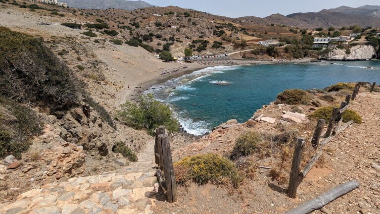
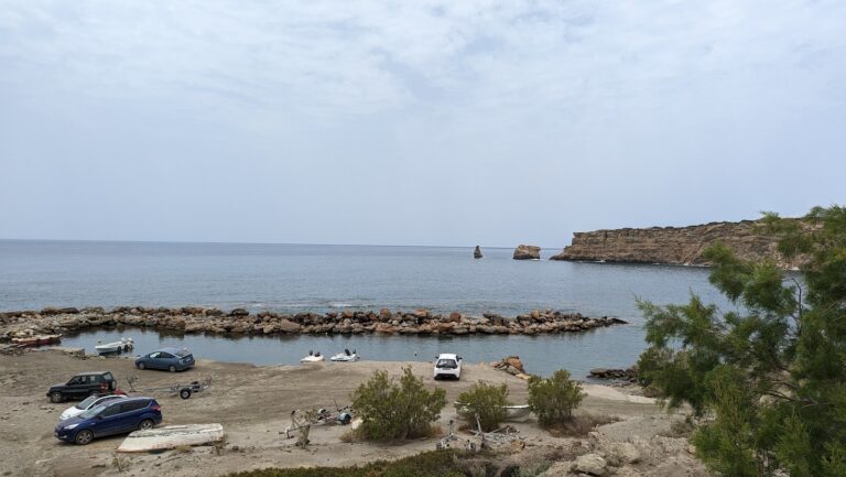
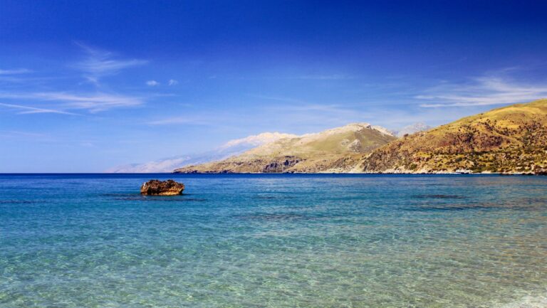
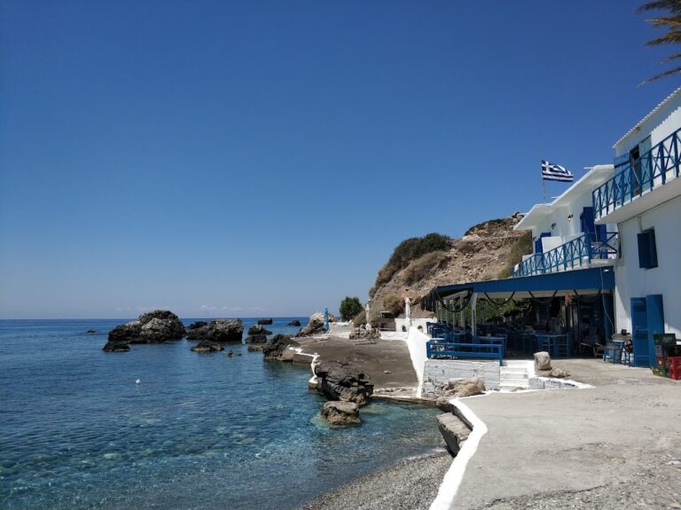
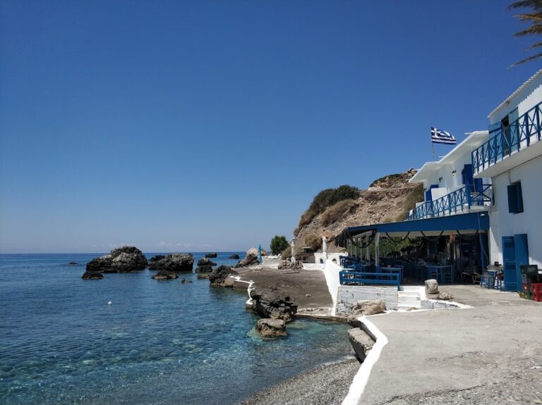
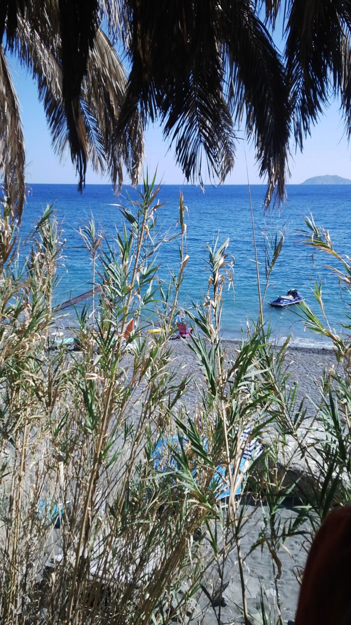
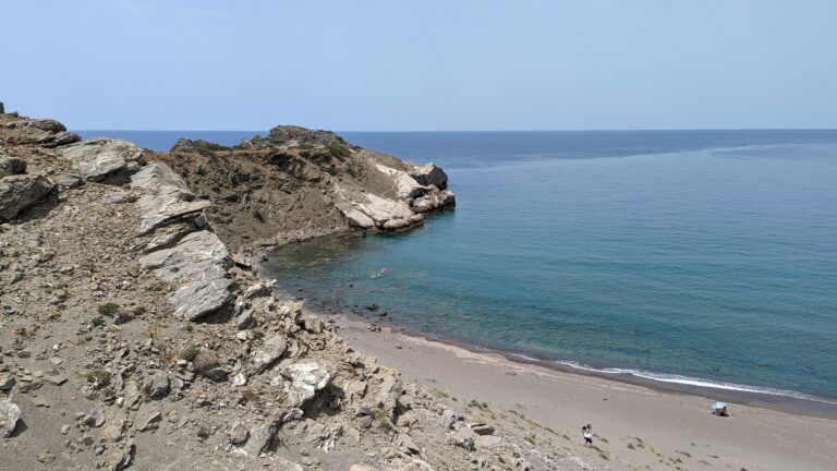
Agios Pavlos, a quaint seaside village, lies 58km south of Rethymnon city and to the west of Agia Galini, situated conveniently close to the extremity of Cape Melissa. The village, mainly owned by locals from nearby Sachtouria, can be accessed via a scenic drive from there. This hidden gem nestled in a shielded bay is perfect for serene family getaways.
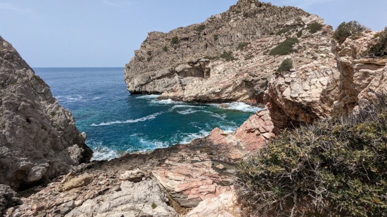
A breathtakingly beautiful beach with emerald deep waters and an impressive rocky seabed characterizes the bay. Several accommodations and taverns dot the area near the beach, offering various amenities including sunbeds, umbrellas, and pedal boats. An intriguing point of interest here is the quaint church of Saint Paul perched above the beach. Legend has it that Saint Paul resided here during his voyage to Rome – a folklore shared by other regions in Crete such as Kali Limenes and Selouda.
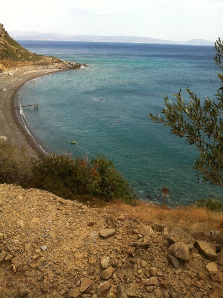
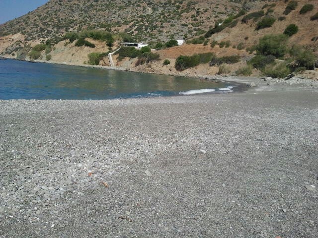
The village’s beach is certainly picturesque, yet some visitors choose to lodge and dine in Agios Pavlos, preferring to swim in the nearby stunning beach known for its enormous sandhills. This beach, referred to as Akoumiani Gialia or Melissa, lies beyond the western rim of the Agios Pavlos bay. Although it’s often wavy, it’s considered one of Rethymno prefecture’s finest beaches, accessible via a pathway originating from Agios Pavlos.
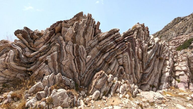
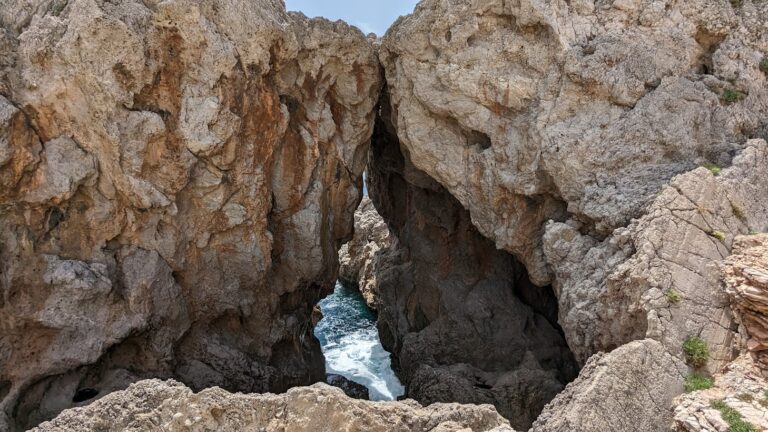
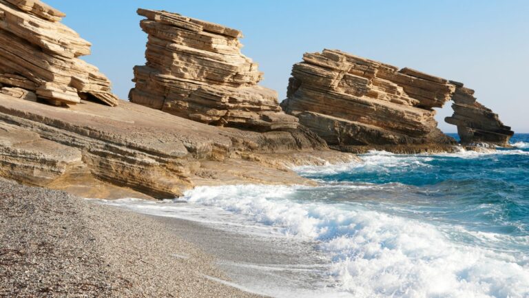
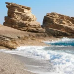
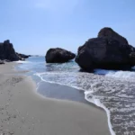
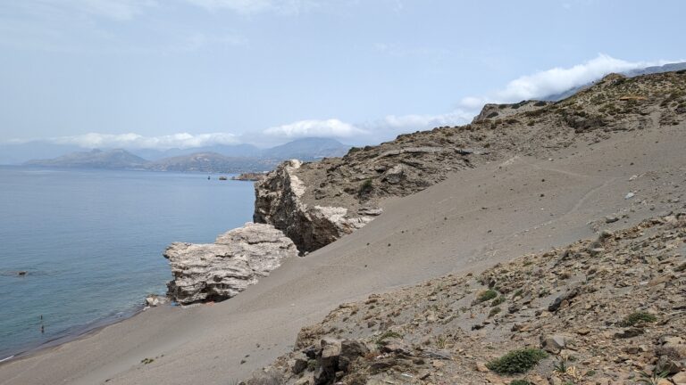
The vibrantly coloured geological rock folds at the Apoplystra location, situated between Agios Pavlos village and Melissa’s Sandhills, are incredibly striking and have been recommended for inclusion in Greece’s Natural Monuments list.
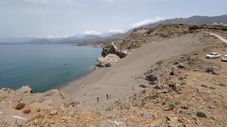
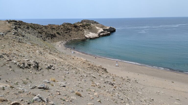
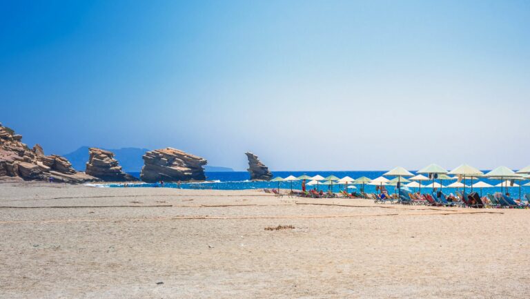
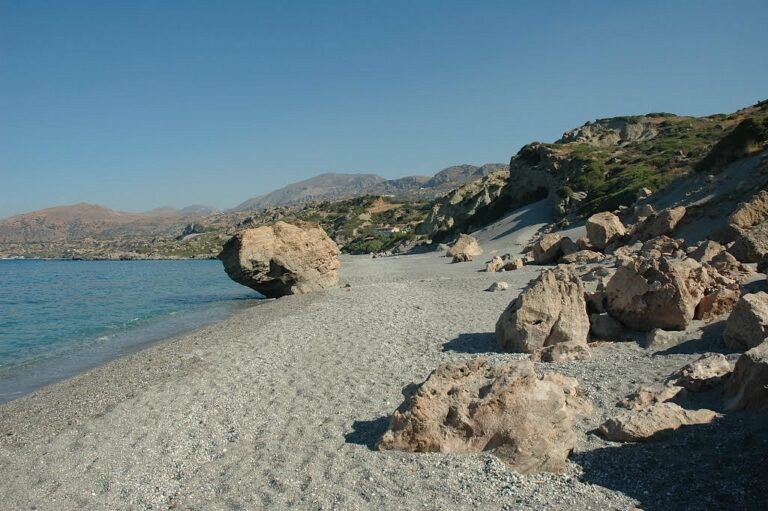
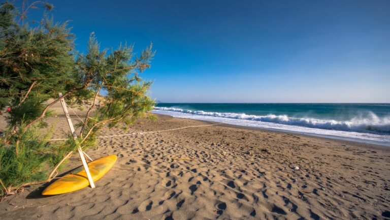
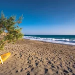
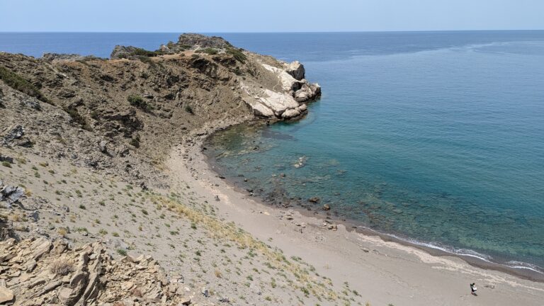
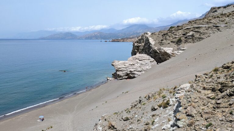
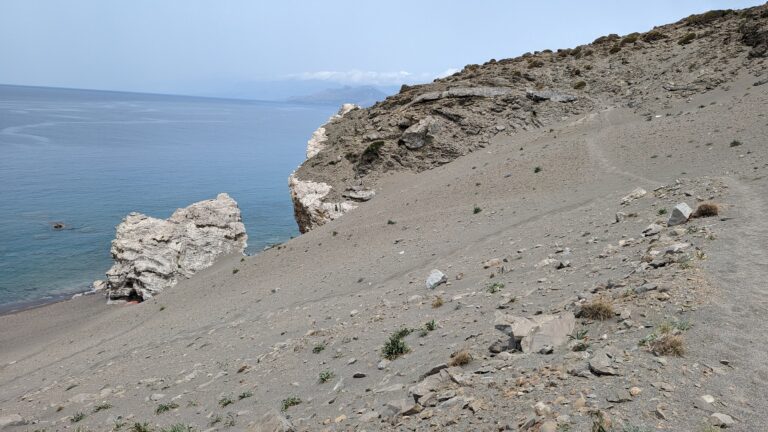
Among the premier beaches in central Crete, the Melissa Cape Sandhills shine bright. Situated near Agios Pavlos, at the southern tip of the expansive Akoumiani Gialia coastline, this stunning location is approximately 55km south of Rethymno city. It’s framed by the beautiful Cape Melissa to the south, the Akoumianos river, and the Triopetra beach to the north. The deep sea here beckons swimmers, and the area’s secluded nature often leads to a variety of beachwear or a lack thereof. Locally, the beach is also known as Alatsogremi or “salt cliffs”.
The Melissa Cape Sandhills, arguably the most scenic beach in the Rethymnon prefecture, boast massive sand dunes nestled amidst a majestic, untouched landscape. A few scattered umbrellas offer shade, although natural refuge can be found in the rocky caves mid-beach. Despite its generous expanse, the beach rarely feels crowded, even allowing for nude bathing during peak season. A rich seabed makes it a snorkelling hotspot, although visitors should be aware of the frequent large waves due to western winds. The water temperature remains warm year-round, hardly dropping below 15 degrees Celsius, perfect for winter swims.
The area is famed for its breathtaking sunsets, providing a serene backdrop for a thriving yoga and Tai Chi club that boasts world-class trainers. The best view of the sunset can be found atop Thronos peak, overlooking the beach from towering cliffs. To reach it, follow the dirt track next to the junction of Agios Pavlos – Sactouria and Triopetra-Agios Pavlos roads, then hike to the cliff edge. This vantage point offers sweeping views of Paximadia islets, Gavdos Island, and the White Mountains.
Access to the Sandhills is straightforward. Head west from Triopetra harbour (Stomio) for about 500m until you reach the beach on your right, with the Akoumianos river below. Park your vehicle here and make your way down to the beach through the valley near the river. Alternatively, you can park in Agios Pavlos and take the short 5 to 10-minute trail behind the western edge of the Agios Pavlos beach, which descends down a steep sandy slope.
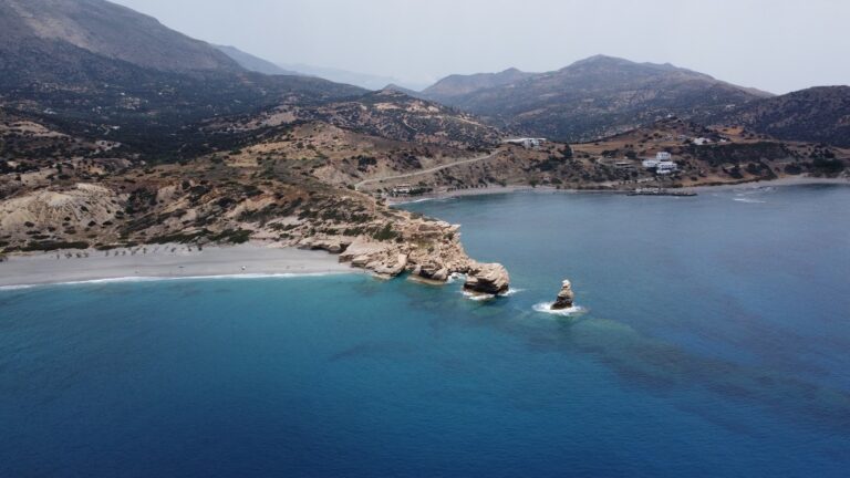
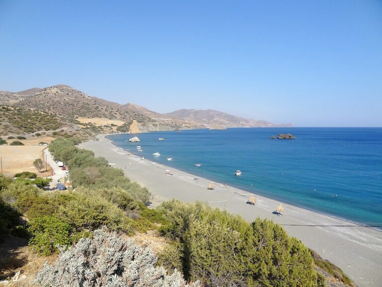
Triopetra beach, nestled at the base of Mount Siderotas and 52km south of Rethymno, can be reached via paved roads leading from either Akoumia or Sachtouria. Part of the extensive Akoumiani Gialia beachfront, Triopetra got its name as a historical winter refuge for the inhabitants of Akoumia, who built small huts near their olive groves. Presently, most land and hotels in the area are owned by descendants of these Akoumia residents.
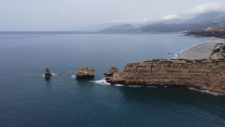
Triopetra boasts two distinct beaches, separated by a petite peninsula. The peninsula’s defining feature is the three spectacular rocks jutting out from the sea, giving Triopetra its name, which translates to “Three Rocks”.
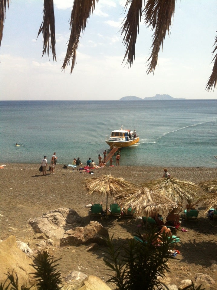
The first beach, Small Triopetra or Koumado, resides in an enclosed bay lined with sand and rock to the south of the three rocks. Here, the Akoumianos river meanders into the sea, forming a natural boundary between Triopetra and the enchanting Agios Pavlos Sandhills at Cape Melissa. Small Triopetra hosts a handful of taverns and rooms, with umbrellas available for sun-seekers. Additionally, the southeast edge of the beach is home to a small harbour, known as Stomio or “mouth”, named after the river’s mouth meeting the sea. Just 1km northeast of the beach, the awe-inspiring chapel of Prophet Elias stands on a high hill, commanding an impressive view over Akoumiani Gialia.
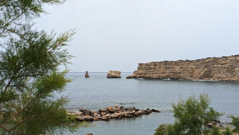
Louros, nestled between the settlements of Agios Georgios and Agios Pavlos, is characterized by its rocky terrain and a collection of small, pebbly beaches. A scenic coastal road provides stunning views of the two Paximadia islets. Heading west from Agios Georgios, travelers will encounter the quaint beaches of Armenopetra, named after a solitary boulder found in the sea. These beaches offer excellent opportunities for snorkeling and spearfishing.
Two kilometers before reaching Agios Pavlos, another beach, either known as Agios Markos or Ligiolakos, is found across from the rock known locally as Prasonisi. The waters here are typically tranquil, making it a favorite spot for local families from Melambes. The seabed is also a great place for snorkeling and spearfishing. Further east of Prasonisi, more similar beaches can be found, usually accessed on foot.
The next beach, Aniforas or Vigdolidi, is difficult to reach due to private property blocking the path. The beach is situated near a striking rocky cape, and while the beach itself is unremarkable, the towering rock formation provides excellent photo opportunities.
The final beach, located 500m east of Agios Pavlos, is positioned at the mouth of a stream. Ancient Cretan date palm trees, known as Theophrastus, line the banks of the stream, giving the pebbly beach its name – Finikidia.
Situated 51km to the south of Rethymno and 7km below the village of Kerames, Ligres is nestled at the base of the grand Siderotas mountain. It forms the northern segment of the Akoumiani Gialia beachfront, which runs from the cape of Mellissa to the south.
Ligres is an expansive beach graced with rough sand and a spectacular deep sea. Its somewhat challenging access has thankfully deterred the encroachment of tourism, preserving it as one of the most serene, secluded and pristine beaches on the island. Although the beach is not developed, there are a few taverns and rooms available on its western side accessible via a poorly maintained asphalt road. At the beach’s western tip, there is a stunning waterfall that boasts a year-round water supply, cascading right next to the sea.
Beyond the northern end of the beach, also known as Katsouni, lies a secluded beach favored primarily by nudists. Despite its seclusion, there are numerous spots along this vast, uninhabited beach where nude swimming is possible. It’s worth venturing along the beachfront to Triopetra, up to the Xiromilia area, to marvel at the astonishing rock formations. In the heart of Ligres, a remarkable reddish boulder stands out near the sea.
Kerames, a village situated 49km south of Rethymno, neighbors the village of Agalianos. It is surrounded by stunning beaches to its south, including the well-known beaches of Akoumiani Gialia, such as Ligres, Triopetra, and Agios Pavlos sandhills. Keramiani Giulia, or Keramean Beach, lies to the north of Akoumiani Gialia, its name derived from the nearby village.
A somewhat dilapidated asphalt road leads to Keramiani Gialia, ending near the local harbour of Agia Fotini, also referred to as Agia Fotia. To the southeast of Agia Fotini, the primary beaches of Keramiani Gialia are located. A well-maintained dirt track from Agia Fotini leads to these beaches, the first being Podare. With its coarse sand and rocky areas, Podare is perfect for activities like fishing and snorkelling. Despite being an unorganized beach, it offers rental rooms for visitors.
After leaving Podare, a simple dirt road heads eastward, taking you past a large hill to a parking area situated near more rental rooms. Here, the road ends, and the beach on your right, Glima, begins. This sandy, secluded, and unorganized beach offers total privacy.
Continuing eastward on foot for about 100m, a towering sandhill becomes visible to your left. Pahia Ammos, or Coarse Sand, lies in front of the sandhill and provides an ideal spot for those seeking complete seclusion.
The quaint village of Kerames is situated 49km to the south of Rethymno, in close proximity to the village Agalianos. South of Kerames, there are numerous stunning beaches, with Ligres, Triopetra and Agios Pavlos sandhills of Akoumiani Gialia being the most well-known. To the north of Akoumiani Gialia, there is Keramiani Gialia or Kerames Beach, named after the nearby village.
The narrow, poorly paved road leading to Keramiani Giulia ends near the local port of Agia Fotini, which is also known as Agia Fotia. This location is home to beautiful small pebble beaches, perfect for snorkelling and swimming, and is surrounded by large boulders. The traditional Stavros tavern is built on an old carob storehouse and serves fresh fish on the beach. It also offers accommodation, and has a reminiscent atmosphere of the Greek islands of the 1960s. The tavern provides free umbrellas and showers. Near Agia Fotia, there is a small river that forms a green forest. Following the path north along the river, you will encounter a tall palm tree and the old church of Agia Fotini, located near a small house with a lovely garden. A 5-minute walk west of the tavern along the rocky shore will lead you to another pebbly beach.
On the hill near Agia Fotini tavern, you can still see the remnants of the ancient town Kionia, which thrived in its heyday. Today, the ruins cover an area of over 150 meters east to west and 100 meters north to south, while the other half of the town is submerged underwater, in front of the tavern. Traces of buildings and terraces that suggest the existence of Kionia can be seen in the surrounding area. It is thought that the sinking of the town forced its inhabitants to leave and move to higher ground, where the villages Kerames and Agallianos now stand.
Two neighboring beaches, named Pirgos, are nestled between Gialopotama and the Agia Fotini harbor. These beaches, adorned with fine sand and pebbles and bordered by towering rocks, are perfect for those who enjoy snorkelling and naturism due to their potential for solitude. A dirt path leading to Pirgos begins 500m north of Gialopotama, though you can also choose to walk from Gialopotama along the rocky shoreline. Overlooking Pirgos are three striking caves.
Gialopotama is located about 45km south of Rethymno city, 4km south of the village Kerames and near the exit of a small valley, where a small stream flows. The beautiful unknown beach of Gialopotama is formed west of a small hill, on which a few small houses and apartments for renting were built in the last decades.
The beach is sandy with rocks in places. The rocky bottom makes it ideal for snorkelling and spearfishing. It is unorganized and appropriate for isolation. Especially, its eastern part, where huge boulders are dispersed, can be visited for naturism.
Gialopotama can be accessed by car via asphalt road from Kerames village or via a paved track starting east of Preveli beach and coming along the coastline of Drymiskos.
Situated 3km west of Agia Galini, 69km southwest of Heraklion, and 60km south of Rethymno, you’ll find the tranquil valley of Agios Georgios. This spot is home to two small bays, each boasting beautiful pebbly beaches separated by a rocky shore. The weather is often mild, making these beaches perfect for year-round swimming.
The area remains relatively undeveloped, but on the eastern beach, known as Lichnistis, you’ll find a handful of rooms, a tavern, and some umbrellas for shade. A visit to Agios Georgios offers the chance to explore the rugged Cretan countryside and take a stroll to the historic Monastery of St. George, located 500m to the north. The church’s sloping walls show signs of age and soil sedimentation, and inside, you’ll find ancient frescoes.
For those seeking solitude, the western beach, Kolimbistiri, or “swimming area”, is the ideal location. Here, you can swim in peace, and the seabed offers excellent snorkelling opportunities. To reach Agios Georgios’ beaches, take the asphalt-paved road from Agia Galini to Agios Pavlos, or hop on a boat from Agia Galini.


