Gorges to hike and walk near Frangokástellon, in Chania region

List of Gorges near Frangokástellon

  • 3.0 km
  • Rehta Gorge at Kolokasia

In the heart of the Sfakia Province, nestled in the ruins of the village Kolokasia, a stream begins to form at the base of the Virgin Mary (Panagia) church. This stream, fed by the village’s water, meanders through the local olive grove before transforming into a rugged, small gorge known as Rechtas or Rektas – a name signifying ‘waterfall’ in the local dialect.

True to its name, shortly after the gorge’s onset, a breathtaking 20-meter high waterfall cascades down, barring further access to the gorge without the aid of a rope. Beyond this majestic waterfall, the gorge is adorned with awe-inspiring rock shelters and caves, once used by locals as animal paddocks.

The journey through the gorge also includes small waterfalls, a natural arch, and a grove of carob trees. Eventually, the canyon opens up, revealing an ancient trail that ascends up the eastern side, leading to a rock shelter. This shelter, perched high above the riverbed, provides stunning vistas of the gorge and the Fragokastello valley.

In recent years, this wild rock shelter has been transformed into a charming, cavernous temple, possibly the newest in Crete. This transformation was inspired by a priest from Sfakia, George Chiotakis, who received a divine vision from the Blessed Porphyrios of Athos, advising him to build a temple. Consequently, the church is unofficially dedicated to Saint Porphyrius, with his icons scattered throughout the temple, along with several icons of the revered Saint Anthimos from Cephalonia, who once resided in the Sfakia region.

  • 3.9 km
  • Kallikratis Gorge
  • 6.5 km
  • 3 h
  • E4 trail

The Kallikratis Canyon, a relatively small gorge located in the southeast of Lefka Ori (White Mountains) in the Sfakia province, forms part of the E4 European walking route. It serves as a passageway connecting the mountain pasture lands with the lowland villages of the Frangokastelo plain. A hike through this gorge offers a delightful walk and stunning views of the South Cretan Sea. The entrance to the canyon is situated at the Kallikratis plateau, accessible via a paved road from Askyfou, Asi Gonia, or Frangokastelo.

Kallikratis is home to the charming Panagia church, and from here, you can begin your descent through the gorge, which concludes in the village of Patsianos. From Kallikratis village, follow the asphalt road leading to Patsianos that runs parallel to the gorge bed. At certain points, you will need to follow the riverbed, which gradually deepens, with the road rising high above you. After about half an hour, the road will have risen considerably to the left, and the stream will be fairly deep. The trail has been slightly modified in some places due to debris from road construction.

  • 4.7 km
  • Skaloti Gorge
  • 2 km
  • 1.5 h
  • Hiking

The Skaloti Gorge, nestled within the extensive area of Fragokastelo, is one of many parallel canyons in the region. This compact canyon spans a distance of 2km, beginning from the picturesque Manikas plateau and concluding at the coastal village of Skaloti. The journey, which takes approximately 2.5 hours, involves hiking along an ancient path paved with stones and surrounded by steep inclines. Initially, the canyon is wide and open, but it gradually narrows and the walls become vertical. Vegetation in the area is primarily composed of bushes and undergrowth. The Perama stream traverses the gorge, finally emptying onto the shores of Lakki beach.

  • 7.3 km
  • Kapni Gorge
  • 5 km
  • 4 h
  • Hiking

The Kapni Gorge, one of Eastern Sfakia’s most stunning canyons, remains largely undiscovered. The gorge begins as an open stream south of the Akones peak at Hionistra, located on the road between Askyfou and Asfendou villages. It concludes in the village of Nomikiana in the Sfakia province. In Hionistra, two streams in calcareous soils converge to form the Kapni Gorge after an hour’s walk. The canyon is extensive, requiring around four hours to traverse. It is among Crete’s challenging and perilous trekking gorges, with a rugged riverbed that forms dry waterfalls in certain areas, necessitating climbing.

It is not advisable for those inexperienced in mountaineering. The riverbed features several small caves that were previously used as sheepfolds. In one of these caves, there is drinking water, the only source in the harsh Kapni region. This water source is hard to find unless one is very familiar with the area. Kapni is home to beautiful vegetation, including maples and oak trees, and stunning walls of platy limestone in several places.

The name Kapni, meaning smoke, traces back to a story from the Venetian era. East Sfakia was once densely forested, providing refuge for Cretans fighting the Venetians. To counter this, the Venetians burned these forests, including the one in Kapni, which was so dense that the fire burned for weeks. The narrowness of the gorge created an oven-like effect, trapping the fire and significantly raising the temperature. The intense heat baked the mountain rock, similar to a lime kiln, and smoke lingered for days after the fire ceased. That autumn, a massive flood swept through the bare, fire-scorched hillsides, moving rocks with immense force to the gorge’s exit. This event resulted in a large deposit of sediment, creating the most impressive scree (locally known as sara) in Crete, visible from miles away. This scree starts at the gorge’s exit and extends to the village of Nomikiana.

  • 8.0 km
  • Sykia Gorge at Rodakino

The stunning Sykia gorge, which is actually the easternmost gorge in the province of Sfakia, is located north of Rodakino village. It’s a technical canyon, meaning that traversing it requires specialized equipment due to its over 10 steep descents or waterfalls, which are safeguarded by the speleological groups of Crete. The tallest rappel stands at around 12 meters high.

The Sykia stream combines with the untamed canyons of Rodakino (also known as Maglinara) and the longest gorge in the area, Karavos. The stream then flows under both the new and old bridges of Rodakino, finally reaching the picturesque Korakas beach. Canyon explorers typically leave the gorge just after the old bridge, while those up for a full-length trek will encounter another rappel. The narrowest part of Sykia, after it merges with the Rodakino Gorge, is truly breathtaking.

Speleological clubs have named the gorge Sykia, meaning sycamore-fig tree, due to the abundance of fig trees found along the route. However, its official name is Xepitira. Except for times following heavy rainfall, the gorge is typically dry.

  • 8.7 km
  • Sfakiano Gorge
  • 6.5 km
  • 4 h
  • Hiking

The Sfakiano Gorge, also known as Gorge Vartholoma or Gorge Lago, concludes around 2km east of Chora Sfakion within the Sfakia province. It originates from the Trikoukia area of the White Mountains at a height of 1200 meters and culminates at the Fylaki Caves of the South Cretan Sea. The gorge spans 6.5km and it’s a breeze to traverse along its riverbank.

The suggested hiking trail within the gorge initiates from the Niato plateau (close to Askifou Plateau) and heads towards the abandoned village of Kali Lakki. The gorge, one of Crete’s greenest, begins just before reaching Kali Laki and boasts an incredibly diverse plant life. Oaks, cypresses, and pines are the dominant trees within the Sfakiano Gorge.

The gorge’s starting point is home to the Byzantine church of Saint Paul (Agios Pavlos), constructed by the locals in 1407. The gorge meets the main road to Chora Sfakion near the exit, at the Porolago location. It’s certainly worthwhile to continue your adventure towards the sea, as the gorge bed leads to the breathtakingly beautiful Fylaki fjords, some of the most captivating beaches in the Sfakia region.

  • 8.7 km
  • Imbros Gorge
  • 11 km
  • 3 h
  • Hiking

Situated in the Sfakia province, Imbros Gorge is Crete’s third most frequented gorge, following Samaria Gorge and Agia Irini by Sougia. These are all part of the E4 European hiking path. The gorge’s breathtaking landscape and easy trail make it perfect for family trips. The gorge spans 11 km and the hike takes about 2-3 hours.

The journey begins in the quaint village of Imbros, nestled 700 meters above sea level.

The gorge’s initial section, known as Porofarago or Porolagos, is fairly broad. The trail starts off as a descent with relatively low sidewalls. As you go further, the canyon gradually narrows, the sidewalls rise, and the views become awe-inspiring. The canyon’s sides start to close in and rise, revealing various caves. The vegetation includes ancient cypresses, oaks, and maples emerging from the rocks.

Throughout the gorge, remnants of the old stone-paved path, once the main route from Sfakia to Chania, can be seen. The canyon has witnessed numerous battles between the Ottomans and the Christians during the Turkish Occupation of Crete, notably in 1821 and 1867.

Further along, you’ll pass the spot known as Airplane, where a German plane crashed during World War II (the wreckage is displayed in the war museum at Askyfou). Following this, you’ll come across the gorge’s first narrow passages and then reach the position Gournia (i.e. basins), where several small rock basins fill with water in the winter.

Next, you’ll arrive at the gorge’s most magnificent section, Stenada. Here, the gorge walls close in to 1.6m and reach a height of 300m! The rocks are adorned with stunning formations.

After this narrow stretch, the canyon broadens and you’ll near a rest area at position Mesofarango. Here, you’ll find a Venetian water cistern and the gorge guard’s hut.

A few meters ahead, you’ll cross a landslide and shortly after, the striking narrowing at Gremnaria. Following this, you’ll see another gorge trademark, the stone arch Xepitira. As you continue, you’ll navigate some narrow passages and soon arrive at the gorge’s exit by the village Komitades. Several taverns are located near the exit, providing a perfect spot to rest and grab a bite.

There are multiple bus services from Chania to Imbros during the summer. To catch the bus to Chora Sfakia, Imbros (where many hikers park their cars at the gorge’s entrance), or Chania, you’ll need to either walk 4 kilometers towards Chora Sfakion (be sure to check the schedules) or take a taxi from the gorge’s exit (which can be quite pricey).

  • 8.8 km
  • Rodakino Gorge
  • 3.2 km
  • 6 h

The canyon, located to the north of Rodakino village, requires canyoning equipment for access. It begins to the south of Kryoneritis Mount’s peak and extends for 5km before merging with the SykiaSykia canyon, just prior to the Rodakino bridge. The stretch before the Sikia junction features 16 rappels, and there are an additional 4 rappels in the Sikia gorge leading up to the bridge.

Most of the year, the canyon is dry, and in many spots, it narrows to just 1.5m. Typically, canyoners enter the gorge midway, not at the beginning. To find the entrance, one must drive on a dirt road that starts in Rodakino and ends at a sheepfold roughly 2.5km to the northeast. From there, a small stream is descended until the canyon’s riverbed is reached. This part of the canyon has a maximum rappel of 15m and takes around four hours to traverse.

  • 10.2 km
  • Kavis Gorge
  • 12 km
  • 4 h
  • Hiking

The Iligas Gorge, also known as Kavis, begins south of the Kastro peak in the White Mountains, near the abandoned village of Kali Laki, and concludes at the Iligas beach, approximately 2.5 kilometres west of Chora Sfakion. Despite its proximity to Chora Sfakion, the Kavis canyon, one of the longest and most untamed in the Sfakia region, remains a hidden gem. Most visitors are unaware of its existence and instead enjoy a swim at the beach where the gorge ends. The riverbed is typically dry unless it has been raining for several hours. The Kavis canyon also includes five additional sub-gorges, which are equally wild.

The Kavis gorge begins at an elevation of 1080 meters at the Rekti location. However, it is advised to avoid crossing its upper part due to the need for a rope. The most accessible route to the riverbed is through the dilapidated village of Mouri or above Anopolis, where a road leads to the Achlada location. From there, a trail leads to the riverbed, where the Byzantine chapel dedicated to the Holy Cross (Timios Stavros) is located. This chapel, filled with frescoes, has been neglected and forgotten by local authorities. The region’s only water spring is located opposite the Holy Cross in a cave on the path leading to Mouri. From this point, it takes about three hours to trek to the exit, with some descents being 2-3m high.

Another point of interest in the Kavis gorge is the cave where Basias, the chieftain of the Selino province, died during the Ottoman period. The primary section of the canyon is enveloped by a pristine forest of cypress and maple trees, one of Crete’s largest woods. As you near the sea, the forest transitions into towering cliffs with trees clinging to their sides. The riverbed is generally broad but can narrow to half a meter at certain points. Just before reaching the sea, you’ll find a stone-paved trail (similar to the Aradena Gorge trail) which descends on one side and ascends on the other, serving as the only walking route from Chora Sfakion to Anopolis.

  • 14.1 km
  • Kollita Gorges (Vilandredo)
  • 4 km
  • 2.5 h
  • E4 trail

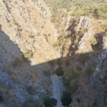
The Twin Ravines, or Kollita Gorges, can be found near the charming village of Argyroupolis, approximately 22km southwest of the city of Rethymnon. The name refers to the two parallel canyons that conclude near the village of Kato Poros. The easternmost canyon, Moundros Gorge, is bordered by the Vigla peak (567m) to the east and the Nissiani hill to the west, where you can find the abandoned settlement of Nissi. Adjacent to Moundros Gorge to the west, is the Vilandredo Gorge, named after the village at its entrance and often referred to as Kollita Gorge.

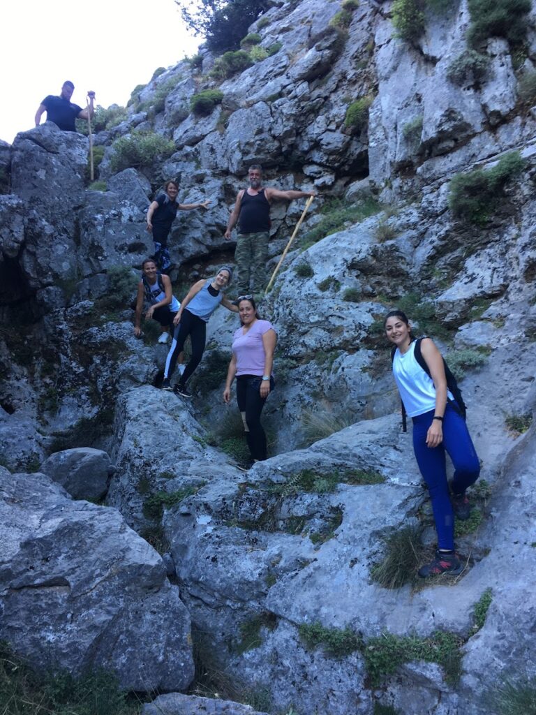
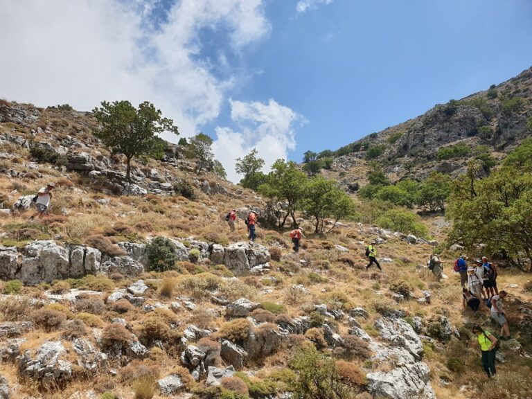
The gorges offer an ideal hiking experience for novices due to their ease and stunning surroundings. It’s a perfect outing for groups of friends – park your car in Kato Poros or Argyroupolis, explore the Moundriano canyon, and return via the second Kollita Gorge for a round trip.

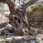
A suggested itinerary for the two gorges starts in the verdant Argiroupoli, built on the site of the ancient city of Lappa. From there, head east to the village of Moundros, known for its springs, fountains, and beautiful Venetian architecture. Don’t miss a stroll through the narrow streets of Moundros and a visit to the churches of Saint Constantine, Saints Anargyri (11th century), and Saint Nicholas. Near Moundros, you’ll find the deserted settlement of Nissi, notable for its impressive stone structures.

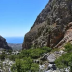
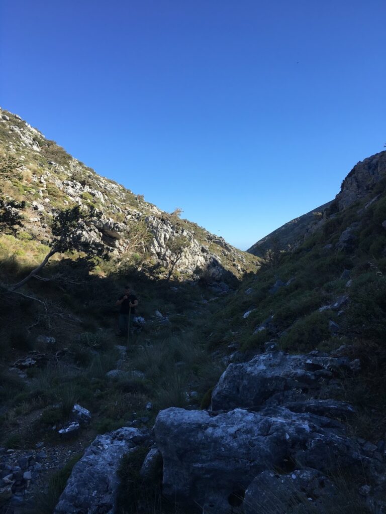
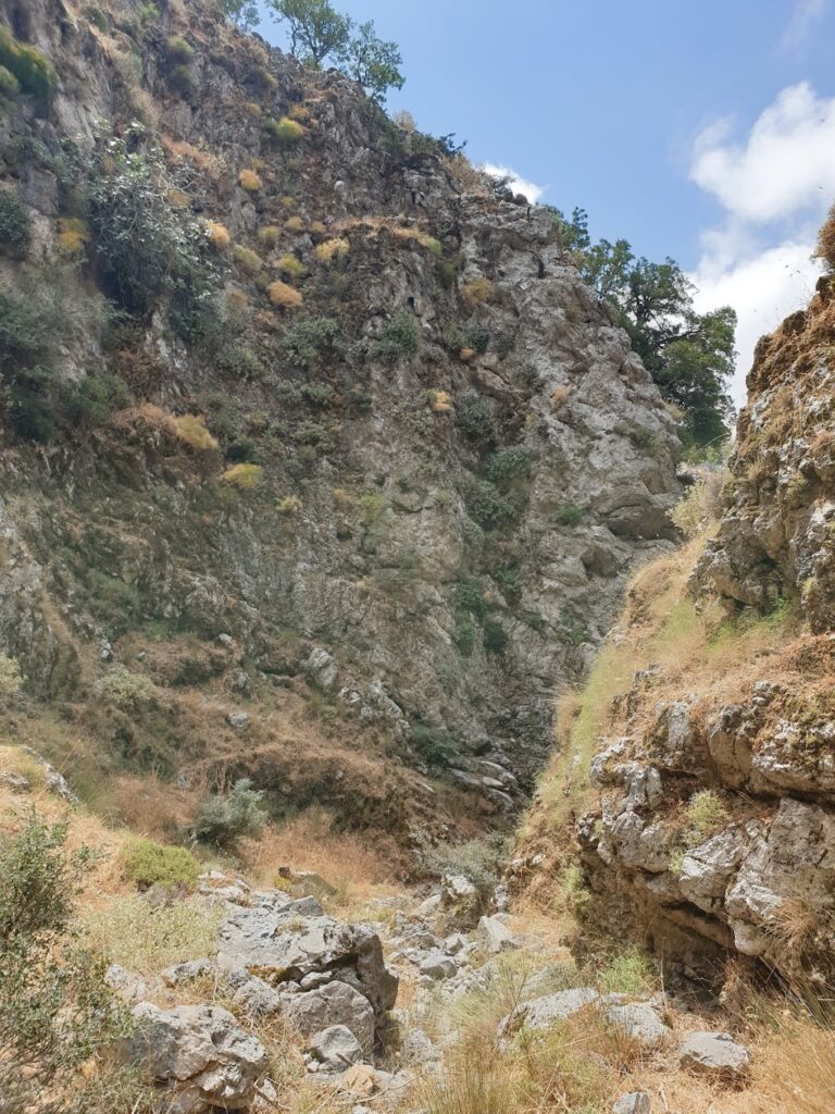
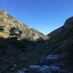
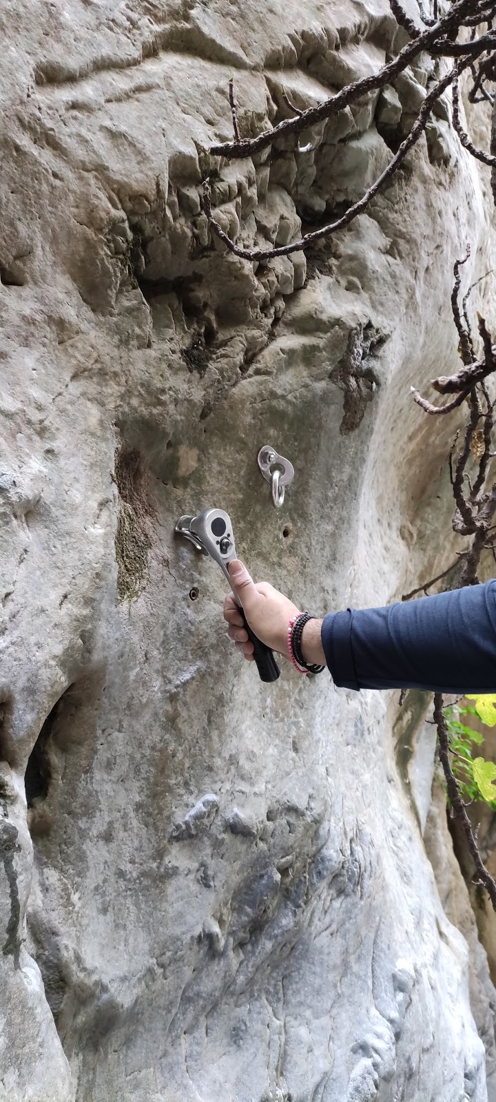
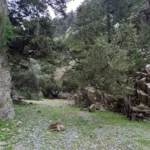
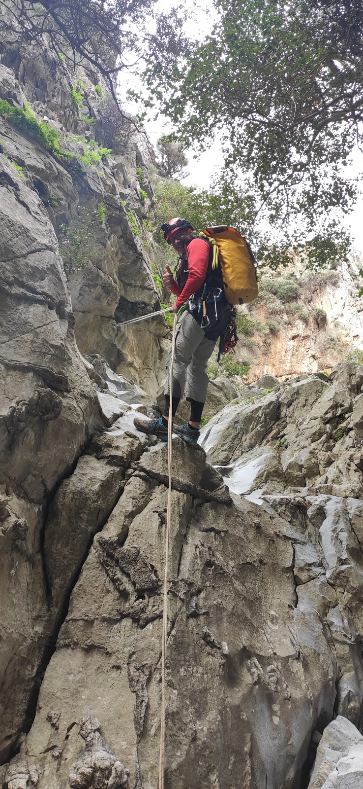
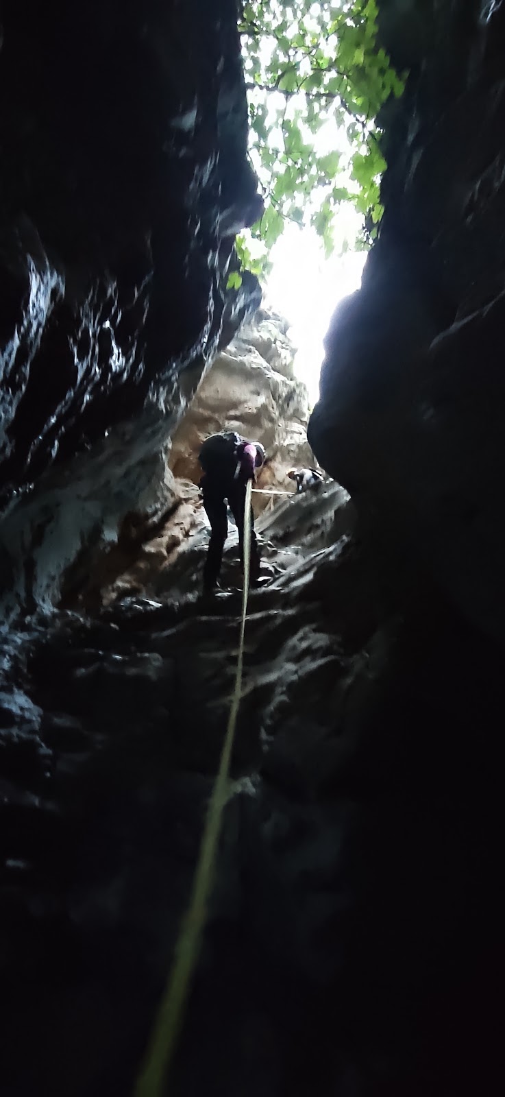
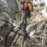
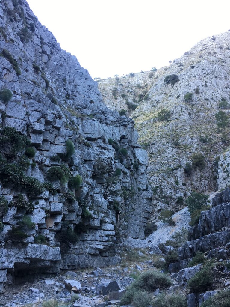
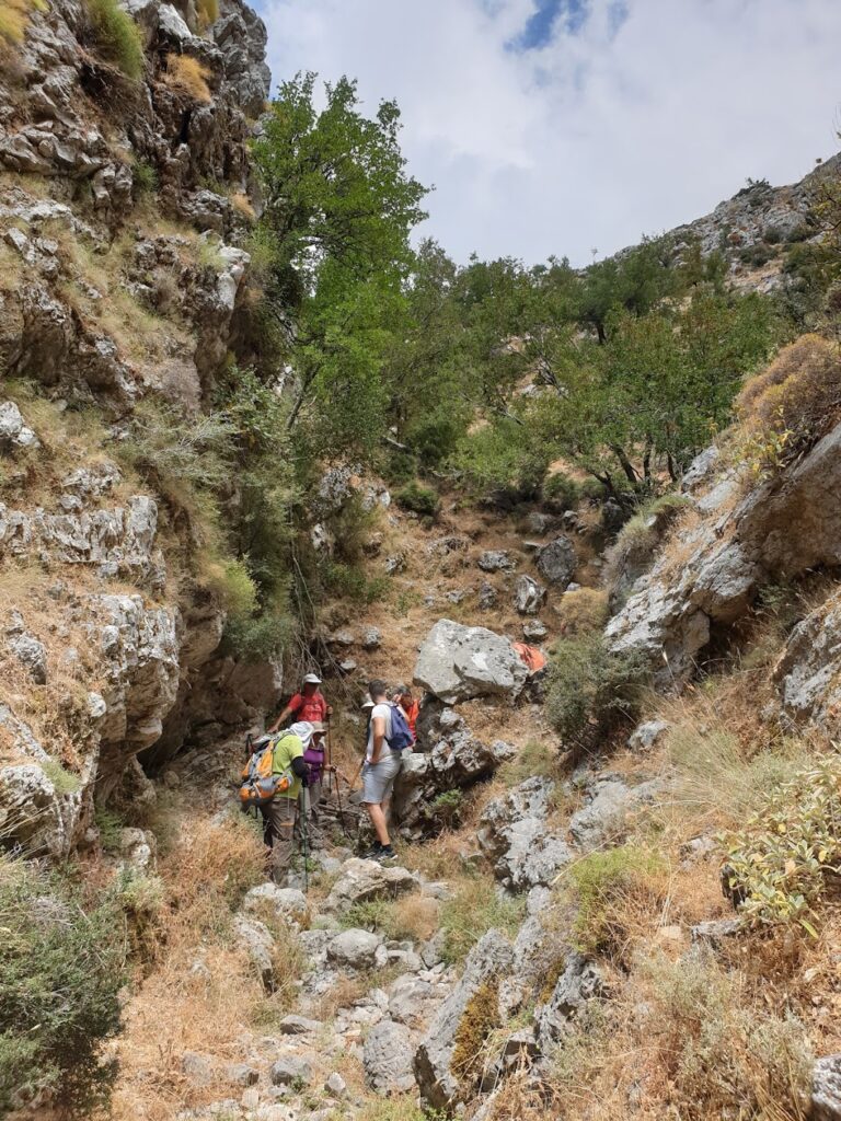
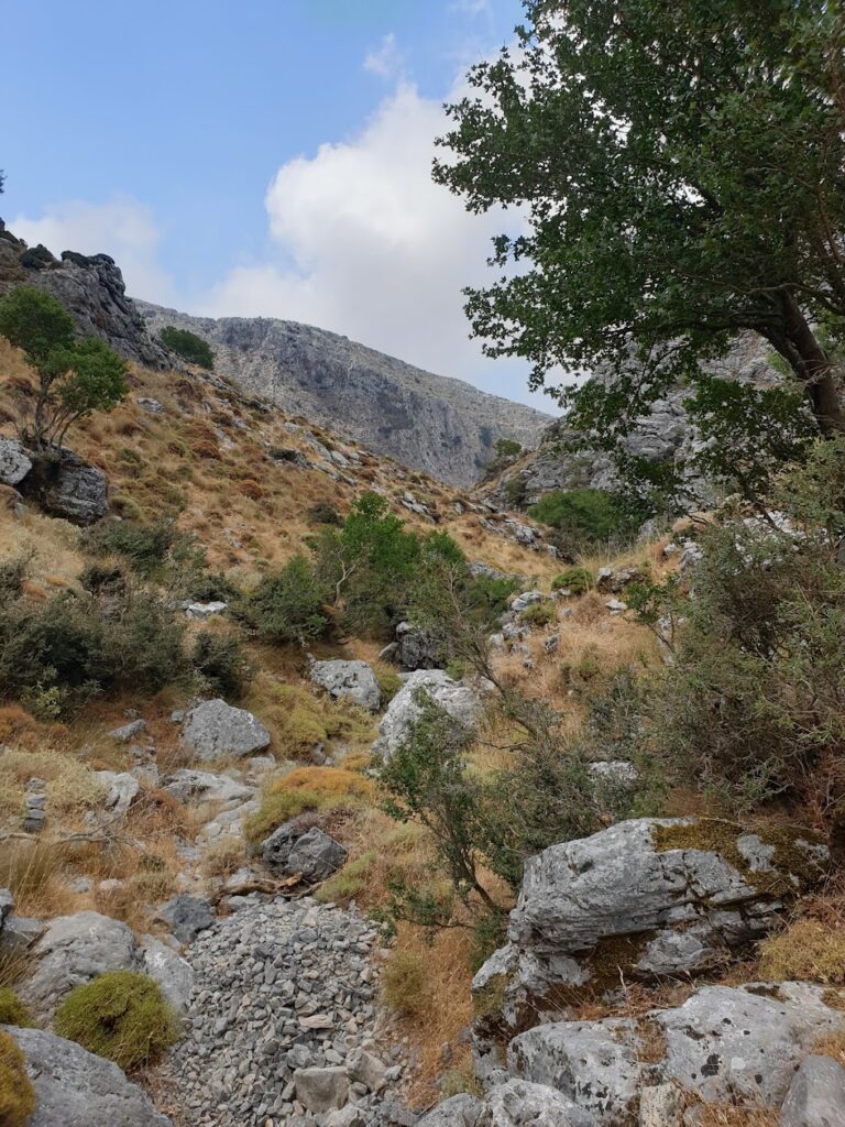
From the village, make your way to the northern entrance of the lush Moundros Gorge, which leads to the village of Velonado. A well-marked path descends to the riverbed, which is typically full of water. The canyon boasts towering plane trees and several freshwater ponds. After about a 1.5-hour walk, you’ll reach the southern entrance of Moundriano Gorge near Velonado.

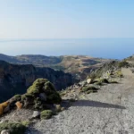
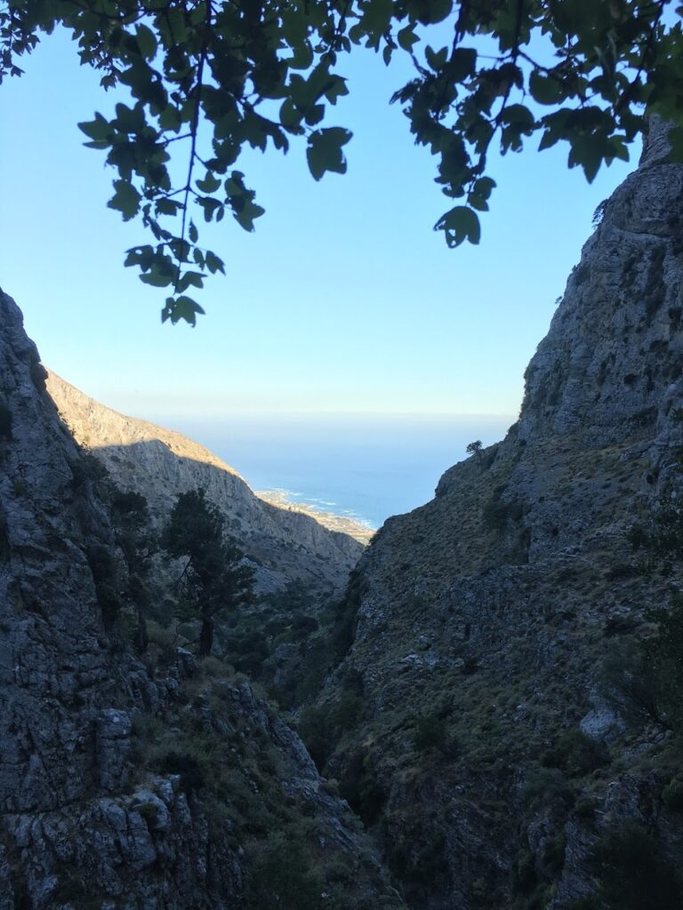
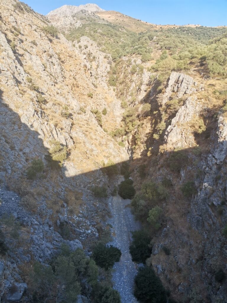
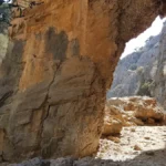
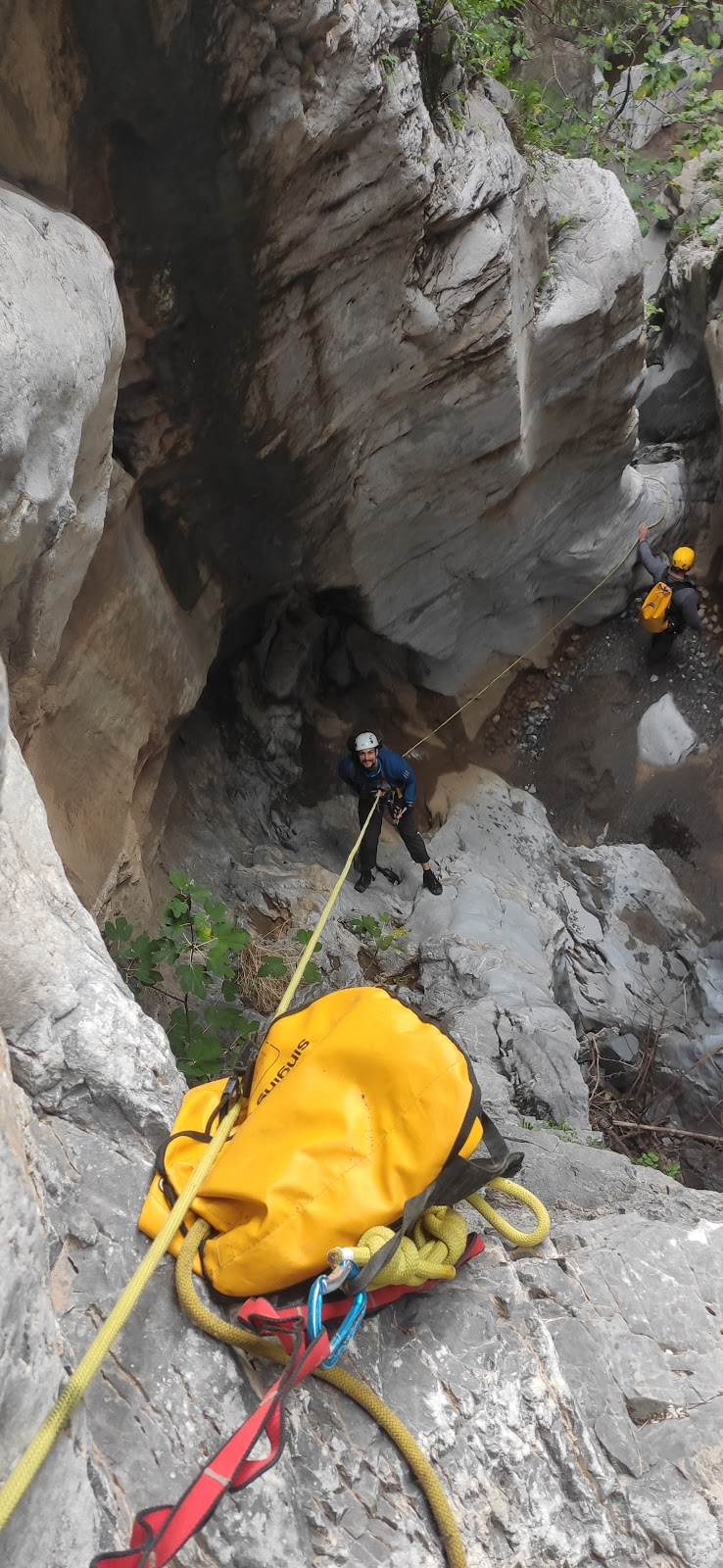
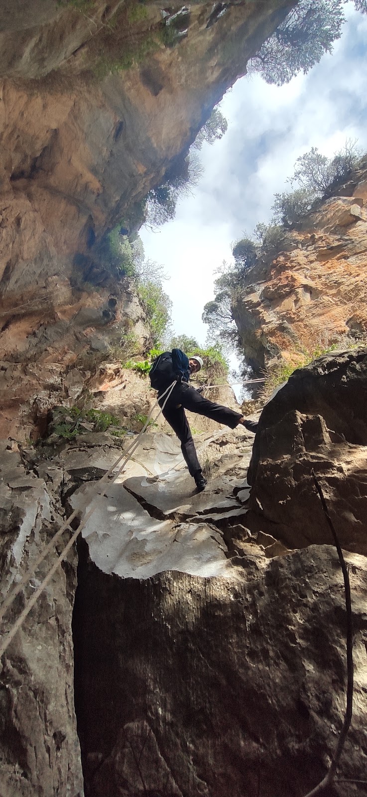
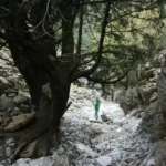
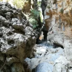
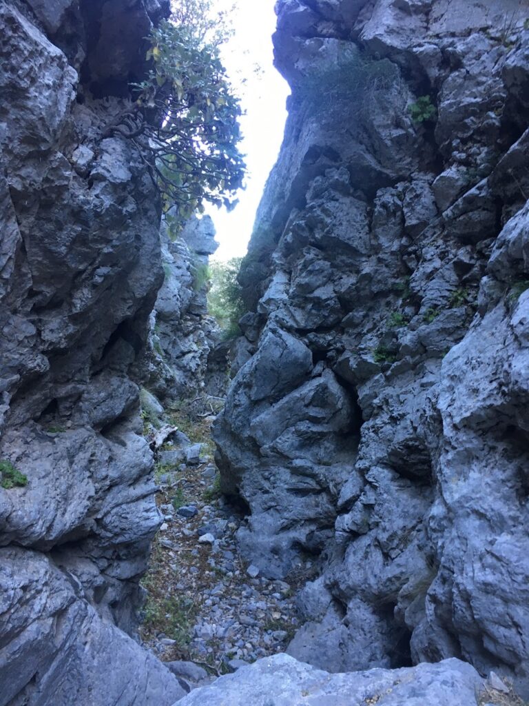
Exiting the canyon, head west on the asphalt road to the entrance of the second canyon, Kollita Gorge, near Vilandredo. This canyon is even more impressive than Moundriano, filled with plane trees and a path that runs along the riverbed. The most breathtaking part of the canyon is where its towering walls nearly touch, creating a very narrow passage. Along the slopes of the gorge, you’ll spot numerous fig and holly trees. After a total of four hours, you’ll exit the canyon, which once supplied water to the Roman baths of Lappa, now Argyroupolis.

Following the old stone path amidst laurels, myrtles, and hollies, you’ll reach Kato Poros and the area of Pente Parthenes (Five Virgins). Here, you’ll find a spring under the perennial plane tree of Pente Parthenes, the chapel of the Five Virgins, and the Hellenistic and Roman tombs of Lappa. From here, the trail broadens and leads back to the lush green Argiroupoli. In Argiroupoli, be sure to visit the Venetian buildings, churches, and picturesque alleyways. The springs of Argyroupolis are a popular attraction, particularly the spring in the cavernous chapel of Agia Dynami. The area is lush with several small waterfalls and numerous restaurants.

© All rights reserved. Crete Locals