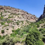
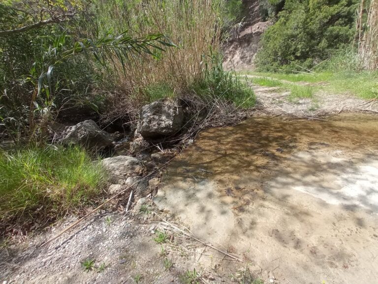
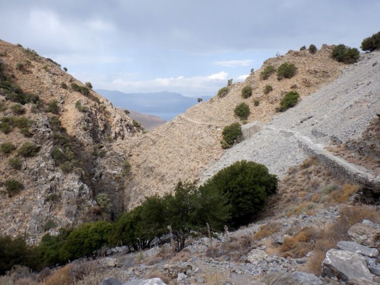
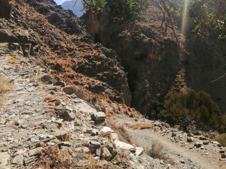
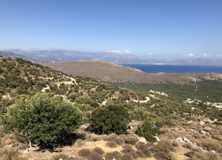
The Pefki Gorge, also known as Anegyrous Gorge, is a stunning small gorge located in East Crete. Its beauty is characterized by breathtaking rock formations molded by nature and lush greenery. The gorge extends for approximately 4.5 km, with an elevation difference of 300 meters between the entrance and exit. The gorge begins south of Pefki village and concludes at the Aspros Potamos settlement, 2km north of Makrigialos. The stream running through the gorge collects water from the area south of the Romanati peak (937m) and carries it to the Analipsi beach. The gorge features a well-defined path that traces the riverbed for most of its length. At certain points, benches are available for rest. A 2-hour journey through the gorge is part of the E4 European long-distance path.
The Journey
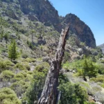
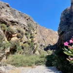
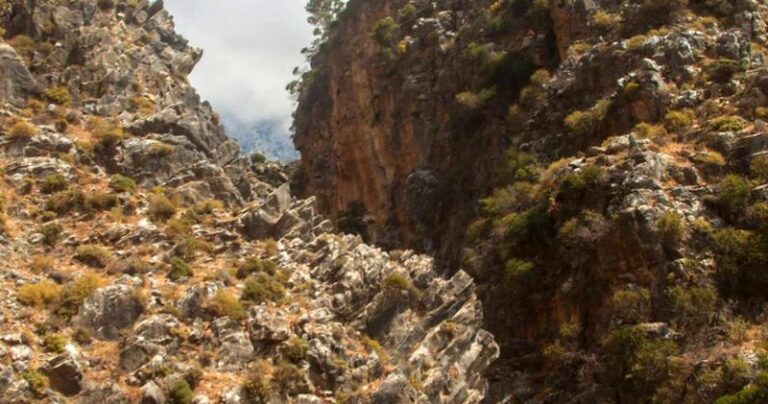
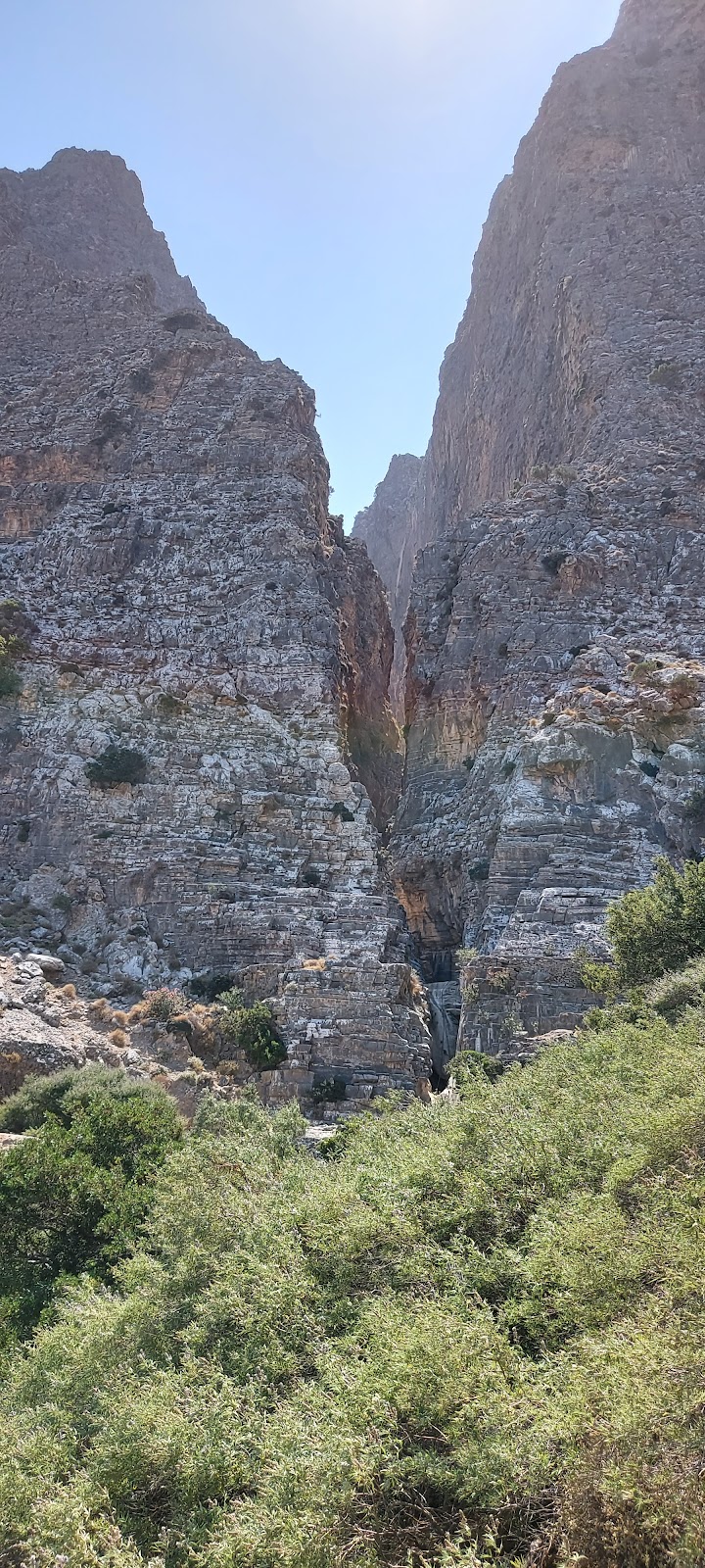
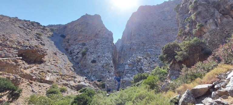
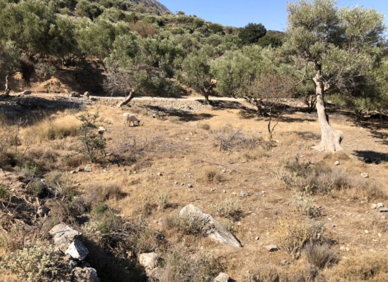
The journey through the gorge commences slightly south of Pefki, where the familiar black and yellow E4 signs direct you to the entrance, adjacent to the old Ilias water mill (1925). From here, an easy path skirts the edges of the canyon before descending to the river bed at the heart of the gorge. The canyon is vibrant with pine trees, while the riverbed is predominantly surrounded by platans and herbs. Spectacular white rock formations, unique to Crete and over 100 meters tall, flank the sides of the canyon.
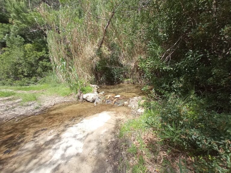
Upon reaching the southern exit of the gorge, you’ll find a spring of clean, drinkable water for refreshment. The gorge’s exit is located in the Pisokaminos area, near the Aspros Potamos village, rather than by the sea. Further along, you’ll encounter the remarkable large rock known as Volakas Sarakinou (Saracen’s rock). Legend has it that a Saracen pirate once took refuge here after being left behind in Crete. The rock is covered in small pebbles, believed to be the remnants of an old children’s game. The kids would throw stones at Volakas, and if a stone stayed on the rock, they would find food at home. If not, they wouldn’t. Following Aspros Potamos village, you’ll reach the main road connecting Makrigialos and Pefki. If no one is waiting to pick you up by car, you’ll need to walk the remaining 2km to Makrigialos.
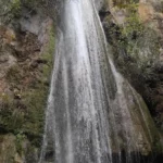
In the vicinity of the verdant and water-rich springs of Orino village, we encounter one of Crete’s most precipitous rivers. The river’s sources are found high up on the Abelia plateau, nestled within the Thripti and Papouri mountains. These springs quickly form a river which traverses the village square before making its way into the rugged Orino canyon. To navigate the canyon along the riverbed, canyoneering gear is necessary. The river carves out stunning waterfalls and pools, with the final section being particularly breathtaking. The last trio of waterfalls at Peristerionas are among Crete’s most beautiful. The river’s water volume is also noteworthy, particularly in the typically dry region of East Crete. Even in the summer, the gorge maintains a steady water flow.
The river continues its journey downstream, passing through the Red Butterflies canyon before reaching Koutsouras beach. Despite suffering considerable damage in a 1993 fire, the gorge’s vegetation remains lush, serving as a green oasis in the warm eastern Crete. The gorge begins near the exit of the Orino Gorge and concludes at Koutsouras after a 3-4 hour walk (starting from Orino village and circumventing the wilder parts of the Orino gorge). Signposts along the route guide the way. At the route’s commencement, there are a few small springs and waterfalls which dry up during the summer. Winter, however, makes hiking in the gorge quite challenging. The gorge earns its name from the red butterflies that flutter amongst the bushes and flowers, creating a truly unique spectacle. Regrettably, their numbers have significantly dwindled in the aftermath of the fire.
The Kapsas gorge, a wild and majestic natural wonder, is situated 8-9km to the east of Makrigialos and 33km to the east of Ierapetra. It is also known as Pervolakia, named after the charming and remote village located near its northern entrance. While in the area, it’s worth taking a stroll through the neighboring traditional village of Pezoulas, known for its stunning houses. The gorge concludes by the Kapsa Monastery, opening up to the Libyan Sea. Here, visitors can enjoy a peaceful swim on the serene pebbly beach, just opposite the gorge’s end.
The gorge spans approximately 4km, and hiking through it is a moderately challenging task. The trek takes around 2 hours if you decide to start from the southern end (the Monastery) and head towards Perivolakia. However, if you opt for the less strenuous route, descending from Perivolakia to Kapsa Monastery, it takes roughly 1.5 hours.
The gorge’s interior is a sight to behold, characterized by towering walls and sparse vegetation, giving it a desolate and arid appearance. The trail features several climbing points and signposts. The road that links Makrigialos and Goudouras runs adjacent to the gorge’s exit, near the Monastery. Public transportation is available, with buses running between Goudouras and Ierapetra. Alternatively, you can drive to Pervolakia or Kapsa Monastery and then hail a taxi in Makrigialos to return to your vehicle.
The gorge is also a habitat for one of the rarest plant species in Crete, the Limonium of Cornaros (limonium cornarianum). This plant is found only in certain limestone maritime rocks within the gorge and a tiny islet named Agia Fotia.
Commencing from the west of the village of Skinokapsala, at the Kipos spot, lies the petite yet fairly broad Ahlia gorge. This gorge, blanketed by pine trees, concludes at the Ahlia beach, also referred to as Galini. Throughout the winter season, the Thripti Range feeds a river with its waters, creating a string of waterfalls that vary in height from 5 to 8 meters. The gorge’s sandstone walls are wide enough to make hiking a breeze, eliminating the need for any canyoning gear.
The Mylonas or Saint John Gorge is situated 18km to the east of Ierapetra. It commences near the St. John village at a height of 500m and concludes at the Kakia Skala beach. It is not feasible to descend the gorge from Saint John due to a tall waterfall, necessitating the use of canyoning equipment.
Nonetheless, there are two ascending trails that start near the Kakia Skala beach, providing access to the high fall of the Mylonas canyon. The first trail (easy – 20’) takes you through the pine-wooded side of the gorge, a large portion of which is the old concrete ditch, formerly used to transport water to Koutsounari. The other trail follows the riverbed and can be quite exhausting, especially in winter (takes approximately 1:30 hour).
Upon reaching the end of the ascending trails at a height of 300m, you will encounter the tall fall of Milonas, which stands at 20m. Below it, you will find a small pond filled with crystal-clear water, perfect for a refreshing swim. In winter, and after heavy rainfall, a second waterfall appears to the left of the main fall, creating a breathtaking view.
The Koudoumis canyon, situated approximately 27km west of Sitia, is close to the village of Tourloti. You can reach the canyon by foot, but be aware that there are six minor but steep rappels that need careful navigation.
Also known as the Tourloti Gorge, the canyon’s exit is near Tourloti while its entrance is at the small plateau of Monokara, which is a few kilometres further south. The stream that flows through it carries water to the Mavro Seli beach near Mochlos. The canyon’s striking rock formations coupled with the vibrant nature during spring make trekking through the Koudoumis gorge a fascinating experience.
Located on the northern slopes of the Thripti range, near Kavoussi village and Avgos settlement, you’ll find the short but incredibly wild and imposing Mesonas gorge. This 4km long gorge requires technical canyoneering equipment to traverse its steep waterfalls. The gorge connects the Thripti Plateau to the Kavoussi plain, with its exit close to the Azorias archaeological site. The same stream forms the technical Havgas gorge, crosses the fertile Kavoussi plain, and eventually empties onto Tholos beach.
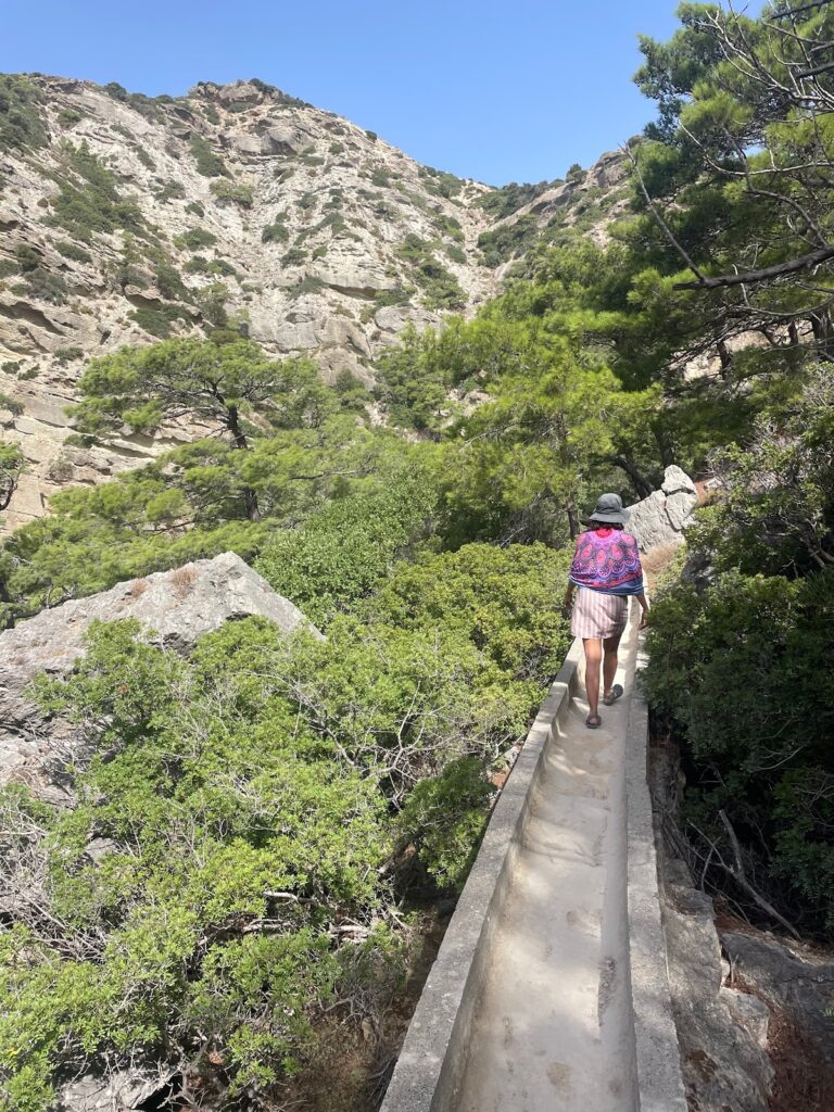
Starting from the Tsamadi position near Thripti village, there’s a hiking trail that runs high above the gorge bed, following the concrete channel used to transfer spring water to Kavoussi. The breathtaking views of the canyon, surrounding mountains, and Mirabello bay are beyond words. The trail descends to ancient Azorias, from where you can approach Kavousi via the ancient path parallel to the Havgas Gorge, or through the dirt road passing the Monumental Olive Tree of Azorias.
For canyon enthusiasts wanting to traverse the river bed, it’s worth noting that the water levels are generally low, with the flow ceasing mid to late spring depending on seasonal rainfall. The gorge starts out smoothly, with the hiking portion exceeding the steep descent sections. The last part of the gorge changes dramatically, narrowing significantly and forming high waterfalls, with the highest rappel at 30m. A small group of canyoneers can descend its 9 rappels in about 3 hours.
In the eastern region of Crete, the term Havgas is frequently encountered, often used to name canyons and in some variations such as Ha, Havgoudi, and so on. One of the many gorges bearing the Havgas name is located near Kavousi, in the Ierapetra province. This gorge is essentially the lower segment of the wild Mesonas gorge, which originates from the Thripti plateau.
The section known as Havgas begins close to the Minoan settlement of Azorias and concludes its path in Kavoussi. Despite its short length of only 700m, traversing it via its stream demands technical (canyoning) gear due to the presence of six stunning waterfalls. The tallest of these waterfalls reaches 20 meters in height and retains water well into the late winter.
As an alternative, the gorge can be navigated by foot along the ancient hiking trail that skirts the canyon from its eastern side, linking Avgos to Kavoussi.
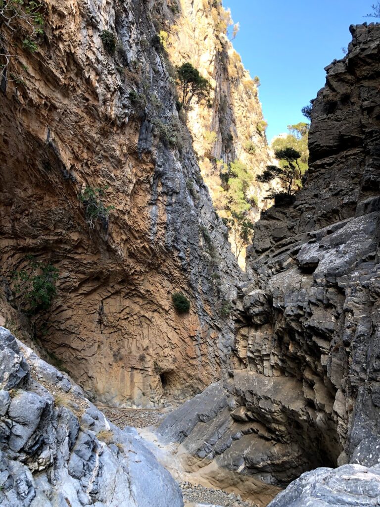
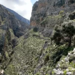
Ha Gorge, a mesmerizing natural wonder carved into the western side of Mount Thrypti, channels water from the Thripti plateau to the Pachia Ammos beach. The gorge’s journey commences near the Saint Anne Byzantine church and the E4 footpath at approximately 800m altitude, and concludes near the Monastiraki village, about 100m above sea level.
Traversing the Ha Gorge demands canyoneering skills and specific gear due to its series of cascading waterfalls, including a 35m high plunge. The gorge tightens to a mere thirty centimetres at certain points, squeezed between cliffs that rise to 400 meters. The Mastoras waterfall, one of Greece’s tallest free falls reaching 215m, contributes substantial water midway through the route.
For those with less experience, a hike from the Monastiraki exit of the gorge provides a peek into its splendour, leading to a charming pond at the base of the final waterfall and past ancient grain mills. The name of the gorge, Ha, originates from the Greek verb “Hasko,” which means to create a gap. However, local folklore offers vibrant alternative explanations. From stories of misleading Saracens to myths of a golden chariot hidden deep within, the Ha Gorge is not only a stunning natural spectacle but also a symbol of intriguing local mythology.


