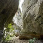
Also known as Kalami I, the Panagia (Virgin Mary) Canyon runs in parallel to the Xerofarago Gorge, or Kalami II. It’s named after the Panagia Keralimeniotissa Monastery, which used to be located at the canyon’s exit. This canyon is technical, meaning it features steep descents and requires special canyoning gear to traverse. Spanning roughly 600 meters, the canyon includes six rappels, the highest of which is about 15 meters. It’s rich in vegetation and has a distinct beauty. The riverbed holds water until spring. Crete’s speleological clubs have bolted the canyon, and a small canyoning group can navigate it in about 1:30 hours.
If you’re planning to use two cars and park them at the canyon’s entrance and exit, the distance between the two parking spots is around 2.5 km or a 10-minute drive. Alternatively, you can reach the entrance by walking along the canyon walls for approximately 20-25 minutes.
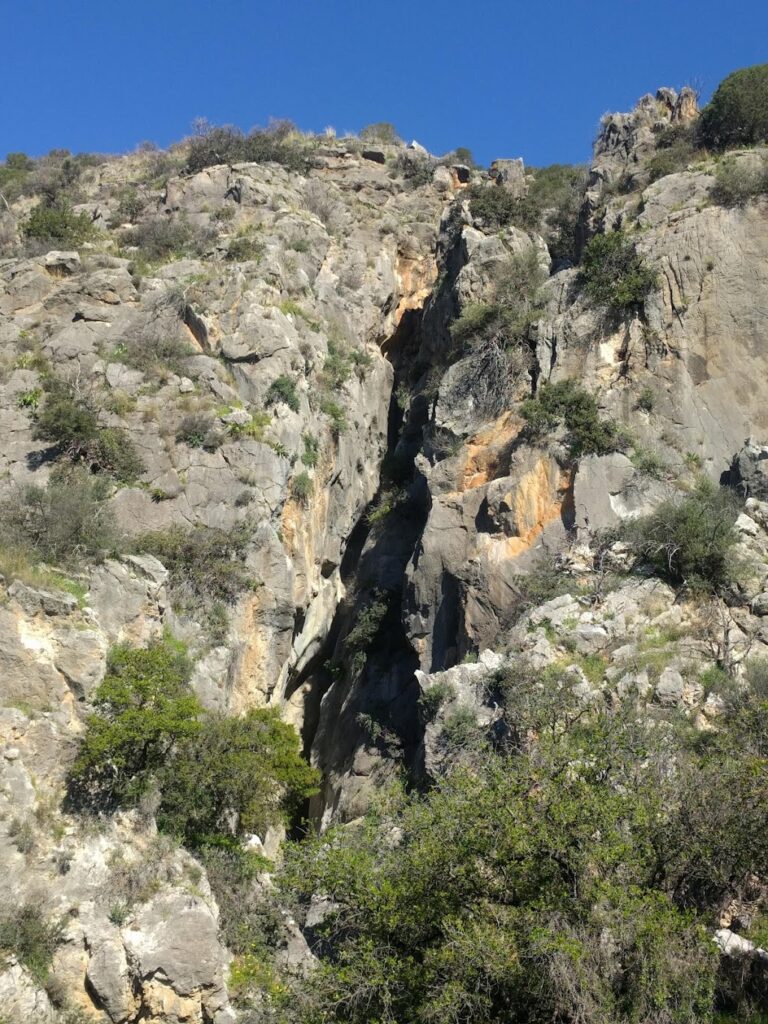
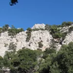
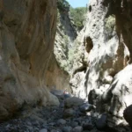
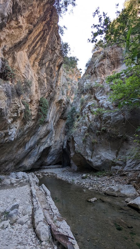
Crete is home to numerous stunning locations, but a select few can truly be classified as natural marvels. One such marvel is the Arvi gorge, which dramatically splits Arvion Mount in two. This is the location where the shrine of Zeus Arveios once stood. The Arvi and Cha gorges are considered the most awe-inspiring canyons in Crete. The Arvi gorge can be found to the north of the coastal village of Arvi, in the southern region of the Heraklion prefecture, and it has been carved out of the limestone of Mount Dikti.
This gorge is technical in nature, meaning it necessitates canyoning equipment and flashlights to navigate due to the presence of numerous waterfalls in succession. It is a truly perilous area, and any attempts to cross it by those unaccustomed to canyoning could result in tragedy. From winter until the onset of summer, the canyon is filled with water, which adds to its awe-inspiring beauty. The majority of this water originates from the perennial springs of Kefalovrysi. The Arvi gorge presents a high level of difficulty.
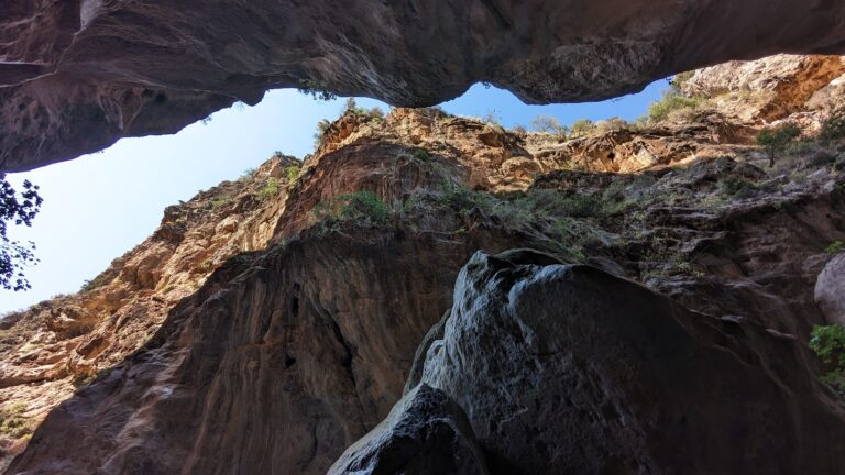
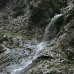
The entrance to the gorge is located in the Konisma (Icon) forest, named after a rock that resembles an icon of Christ. The gorge stretches across the Fournos area and features numerous descents, the most remarkable of which is an astounding 85-meter waterfall named Kapnistis (Smoker). This waterfall is named for its smoke-like water spray, which is a result of its incredible height. Kapnistis is one of Crete’s tallest and most impressive waterfalls. However, what truly sets this canyon apart from others in Greece is the section after the high rappel of Kapnistis, where the river flows into the earth for 150 meters, forming an underground river within a cave. In this underground section, the river continues to form waterfalls. Lighting equipment is necessary to navigate this completely dark area. After this dark section, the gorge remains incredibly narrow with extraordinary formations and large rocks, known as splines, beneath which we pass.
Following approximately 20 waterfalls, the gorge concludes and leads to the fertile plains of Arvi, renowned for their banana crops, and situated next to the monastery of Saint Anthony (Agios Antonios). The area at the gorge’s exit is humorously named Donkey’s Ass! In ancient times, a bountiful water spring existed here, but it has since dried up due to the construction of wells. This natural wonder has been a popular attraction for travelers since ancient times. The gorge’s river ends in the South Cretan Sea, but the water never reaches the sea due to its use for irrigation.
The Holy Apostles (Agii Apostoli) or Lapathos Gorge is situated on the southern part of Mount Dikti, 28km to the west of Ierapetra and 72km to the south of Heraklion, in the broader vicinity of the village of Kato Simi. This is a technical canyon, implying that crossing it necessitates technical gear and specific training. The Lapathos canyon is an ideal challenge for highly skilled canyoners. It spans approximately 4km and there is a height difference of about 900m between the start and finish points.
The canyon originates from the small plateau of Lapathos, where the Holy Apostles church stands, and concludes on the road that links the village of Pefkos with Ierapetra. Although it’s typically a dry canyon, in 2009, the team of seasoned canyoners Vassilis Vagias, Savvas Paragamian, and Giannis Skondinakis discovered it to contain surprisingly large amounts of water.
The gorge features 28 steep descents that demand excellent rappelling skills. The tallest rappel is 80m, making it one of the highest in all of Crete. The sheer walls of Lapathos serve as nesting grounds for a variety of birds including vultures, hawks, and crows. Towards the gorge’s exit, the vegetation is predominantly made up of pines and cypresses. Following the exit, the stream continues its journey to Tertsa beach.
This magnificent natural phenomenon – Sarakina Gorge – can be found near the traditional village of Mythi and the coastal settlement of Myrtos, where the Kryos river merges with the sea.
As the tale goes in Greek mythology, Zeus’s son, the giant Sarantapihos, once paused to quench his thirst from the Myrtos or Kryos river, near Ierapetra. His sweeping beard slashed the mountain, dividing it into two parts, thereby forming the Sarakina canyon.
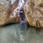
Regarded by many visitors as Crete’s most captivating hiking gorge, Sarakina may only stretch 1.5km, but within this concise journey, one encounters an awe-inspiring spectacle of nature, a natural sculpture painstakingly crafted by water over countless years. The canyon boasts towering walls that rise up to 150m high and extremely narrow passages often found in technical gorges that require canyoneering equipment. The width of Sarakina fluctuates between 3 to 10 meters, rarely extending beyond these points.
The majority of the canyon is accessible to explorers of all abilities, featuring water, pools, and a handful of climbing points that necessitate careful navigation. A standout feature is the abundant water almost all year round, creating picturesque waterfalls and ponds perfect for a refreshing dip, even in the summer. In winter, traversing the gorge without getting soaked is a challenge. As one embarks on the route, they’ll encounter the need to climb, navigate immense boulders, and cross rocky bridges. Carved stone stairs and tree trunks are present in tricky spots to facilitate easier climbing.
The Portela Gorge, positioned in the southern region of the Heraklion prefecture, serves as a drainage channel for the Ano Viannos basin, directing water towards the South Cretan Sea. The gateway to this gorge is situated at the Hondros village, and it leads out to Keratokambos. It ranks among Greece’s most perilous canyons, only to be traversed by seasoned canyoners. Particularly after heavy rainfall, the gorge can prove lethal. However, a passable trail and road run alongside the gorge, stretching from Hondros to Keratokambos, but they lack the allure of the canyon’s interior.
This gorge is a blend of beauty and wilderness, earning it legendary status in the region and ranking it among Crete’s most popular canyoning locations, alongside Ha and Arvi. It boasts the greatest water volume during winter and early spring compared to other local gorges. The canyon features 25 technical descents with the highest being 30m, and a 340m altitude difference between the entrance and exit. Owing to the area’s inaccessibility, locals are primarily familiar with the last waterfall, Richtra, at the gorge’s exit, which can be reached without any equipment.
Five faults intersect the canyon, contributing to its formation along with gully erosion. These faults divide Portela into three sections, resulting in a rich variety of plants and landscapes. A unique feature of this canyon is the abundance of mud it holds, possibly due to the “Viannos” rock formation visible before the gorge. This formation contains large amounts of clay, which is carried into the canyon by the water flow. The gorge’s signature feature is the stunning Sifoni, a large waterfall in a sinkhole, the “bottom” of which has been opened, allowing the waters to continue their journey.
On the southeastern side of the Afendis Christos peak, nestled above the villages of Embaros, you’ll discover lush vineyards sprawled across the Erganos plateau at an elevation of 900 meters. The water, collected from the melting snow of the nearby slopes and numerous regional springs, contributes to the main tributary of the Anapodaris river, Baritis. This river traverses the Erganos plateau, carving out the striking Erganos canyon.
The Erganos canyon, adorned with flourishing plane trees, cypresses, and oaks, is a natural gem in this region. However, it is only navigable for a small portion, suitable for trekkers. After the initial 20-minute descent, the scenery transforms, revealing a unique natural sculpture with slender walls and spectacular waterfalls at nine different points. To navigate these areas, rappelling equipment is necessary.
Eligas Gorge, a stunning natural monument, is nestled on the western side of Koupa Mountain, just above the village of Miliaradon in Embaros. This remarkable location boasts a towering waterfall with nine rappels, making it a perfect spot for canyoning. The altitude difference from the entrance to the exit is approximately 230m.
Eligas is just one of numerous waterfalls in the vicinity, standing tall at 150 meters. It cascades down in 5-6 stages, with the largest drop being 50 meters.
During the winter, the waterfall is fed by crystal clear water from the local ‘Papa Lagos’ springs. On exiting the gorge, it merges with the Baritis River, a primary tributary of the Anapodaris River.
In the Cretan dialect, Eligas translates to ‘waterfall’. The gorge is unique due to its distinctive formations, created by layers of limestone that resemble a vast open-air theatre with stone tiers.
A trail from Miliaradon village leads to the base of the waterfall. From there, visitors can ascend to its highest points, offering a breathtaking view of the impressive waterfall and the Baritis-irrigated plain villages.


