Gorges to hike and walk near Kelia, in Heraklion region

List of Gorges near Kelia

  • 3.5 km
  • Spiliotissa Gorge
  • 1 km
  • 0.5 h
  • Hiking

The Spiliotissa gorge, situated approximately 24km to the south of Heraklion, is a verdant chasm that originates from the Houdetsi village, passes through Agios Vasilios, and terminates in the Peza valley, where its waters feed into the Kounaviano gorge. The most picturesque section of the gorge is the 1.5km stretch between Houdetsi and Agios Vasilios. Starting from Houdetsi, where parking is available in the village, a well-kept trail leads down to Agios Vasilios, meandering through dense foliage and groves of orange and olive trees, irrigated by the stream.

At the beginning of the path, two Byzantine churches, Saint John the Baptist and Saint Nicholas, are encountered, along with two former grain mills. After approximately 500m, the historic Sinai Monastery of Panagia Spiliotissa can be found, which lends its name to the gorge. A quick exploration of the small monastery with its cave-like church is followed by a continued journey into the verdant heart of the canyon, towards Agios Vasilios. A beautiful fountain and the Byzantine church of Saint John are located just outside the monastery.

  • 4.4 km
  • Kounaviano Gorge
  • 4 km
  • 2 h
  • Hiking

The Kounaviano gorge, known for its lush vegetation, is the greenest canyon in the entire Heraklion prefecture, serving as a verdant oasis in the heart of Pediada province. The gorge is named after the village of Kounavi in its district, even though it actually begins from the village of Peza, hence it could be referred to as Pezzano Gorge. This gorge is a tributary of the Karteros river and runs parallel to the Astrakiano gorge. The Astrakiano and Kounaviano gorges converge at the Kaki Rachi area near Skalani, forming the Karteros Gorge. Kounaviano’s entrance is situated at the northernmost point of the fertile Peza plain, collecting all the area’s water. It has numerous springs along its bed, some of which retain water throughout the year.

In recent years, the gorge’s trail has been marked and cleared, with the addition of small bridges, wooden railings, and informational signs. Walking along this trail is a delightful and easy experience, shaded by perennial plane, oak, and other trees. The riverbed walk is simple, without significant altitude changes or difficulties. At the gorge’s starting point, two small waterfalls can be seen. Old watermills, once used to grind the area’s cereals, can be found at three different points along the trail. This region has always been one of Crete’s most productive. Additionally, limestone kilns and various fruit tree gardens can be spotted. A walk from the gorge’s entrance at Peza to its exit at Kaki Rachi near Skalani takes approximately 2 hours.

  • 6.0 km
  • Astrakiano Gorge
  • 11 km
  • 5 h
  • Hiking

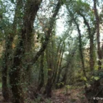
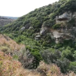
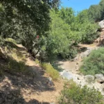
The Astrakiano and Kounaviano canyons are two verdant gorges that converge near Skalani village and empty out onto Karteros beach. The combined length of these canyons is roughly 21 km. Situated to the east of Heraklion city, these gorges are part of the broader Mount Jiouktas area. They offer easy walking trails, making them perfect for families and children.

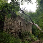
The longer of the two, Astrakiano, begins at the Paliarda location in Kolomodi and extends to the area beneath the deserted Kato Astraki village, after crossing the picturesque Astrakiani Kamara bridge. From Kato Astraki, a brief trail leads to the Neraidospilios site, known for its stunning pond and gushing water caves.

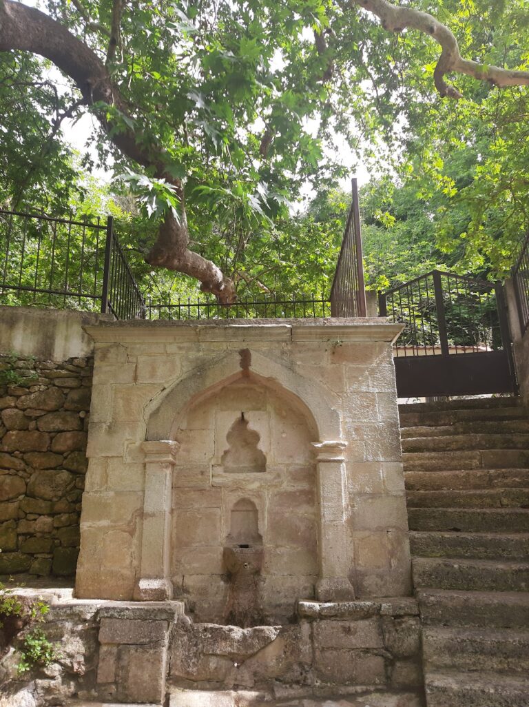
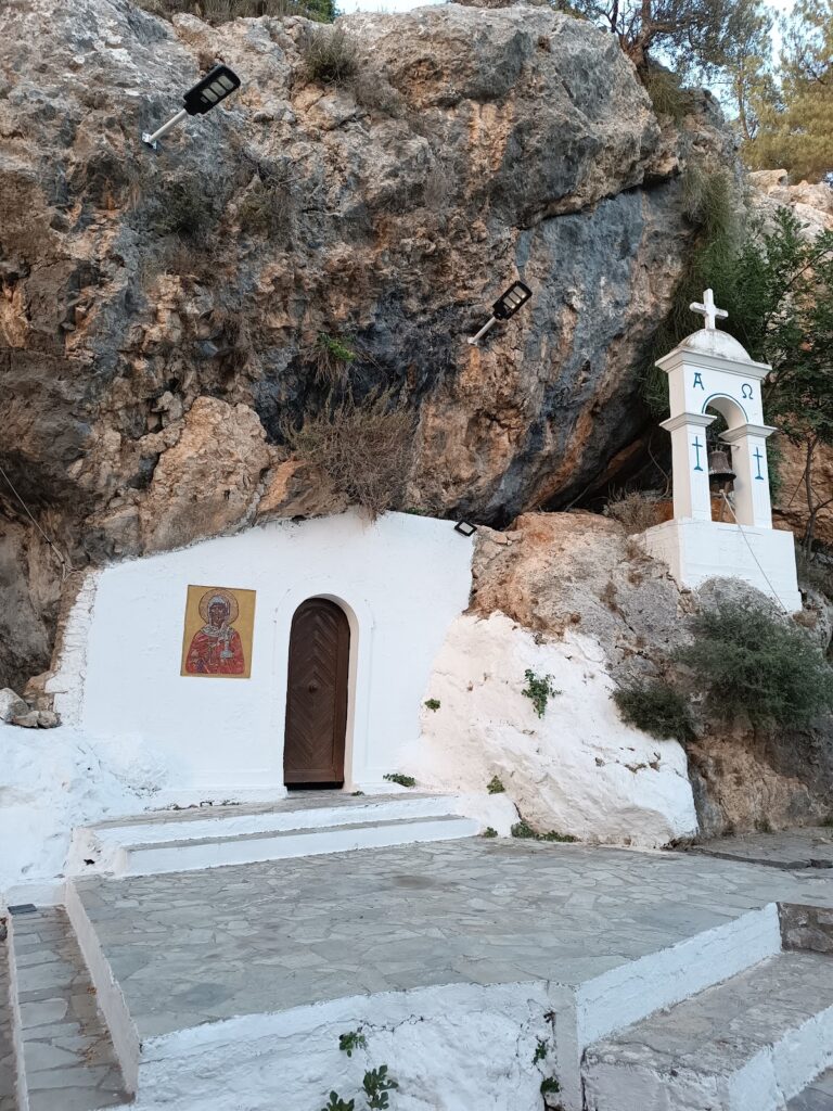
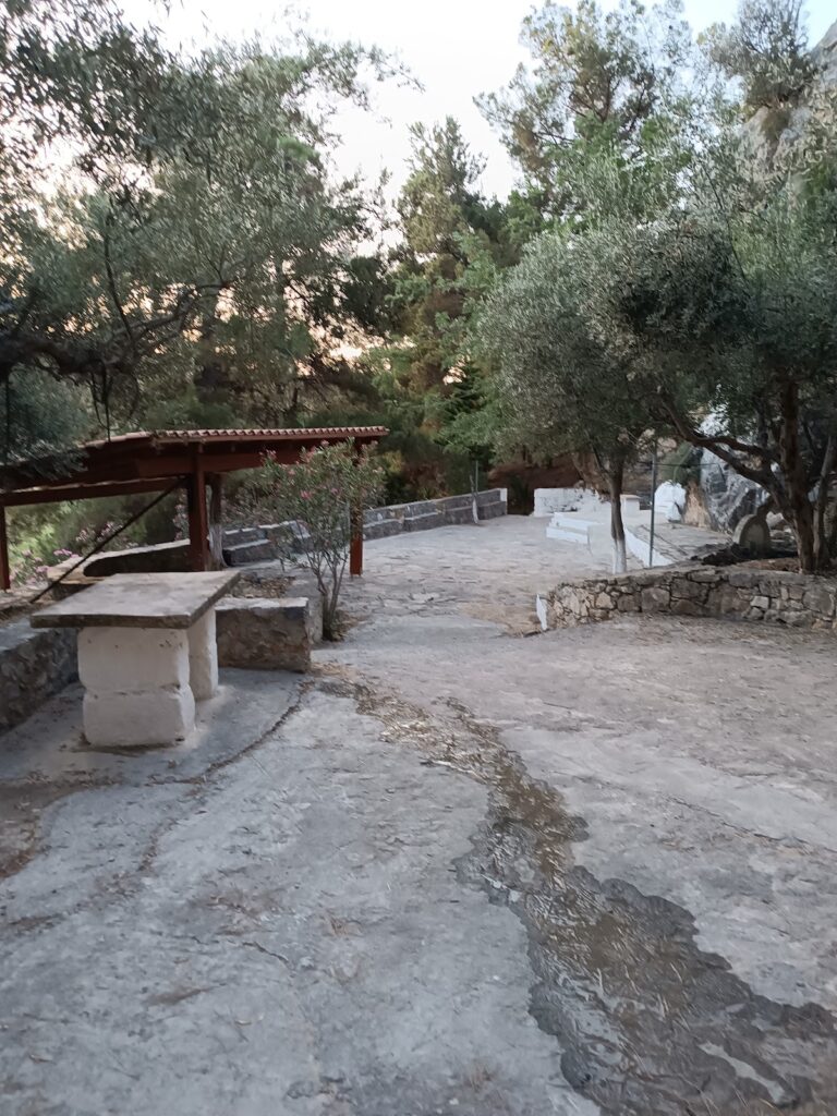
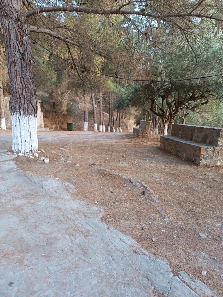
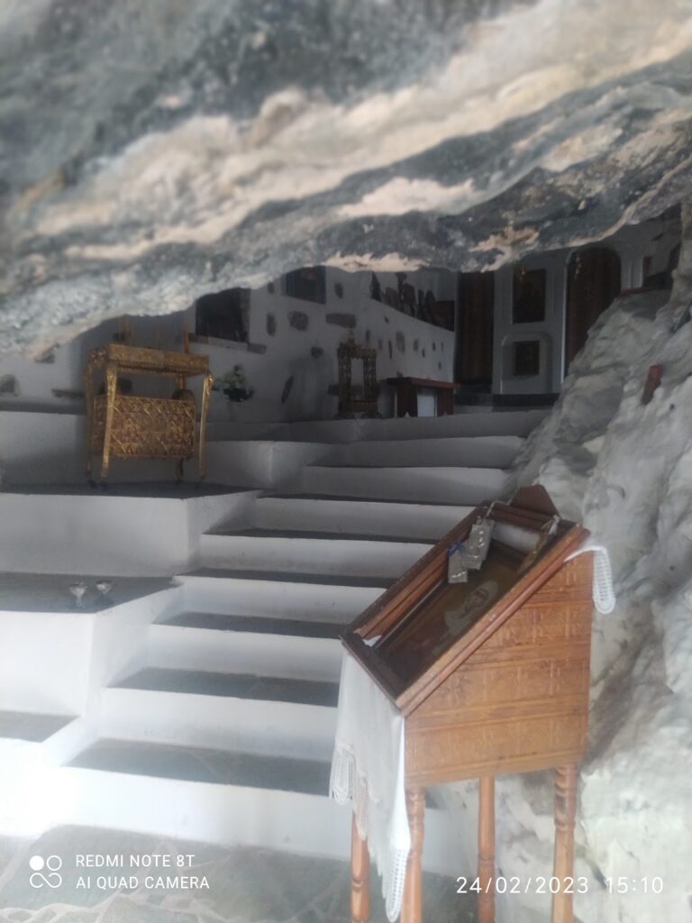
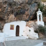
The path along the Karteros river commences from this point, offering a lush green trail equipped with wooden bridges and railings. After crossing the Aitania bridge at Kaki Rachi, we reach Kali Rachi where the Astrakiano and Kounaviano Gorges, originating from Peza, merge. From Kali Rachi, the river continues to Karteros along a well-structured path. This section, known as Karteros Gorge, passes by ancient water mills and the historic Saint Nicholas Church (Agios Nikolaos). Near the Karteros gorge exit, at the Mesa Karteros spot, you’ll find an old inn and a second chapel dedicated to Saint Nicholas. This location, accessible by car from Karteros, is an ideal picnic spot.

The Astrakiano canyon (Astraki – Kali Rachi) measures about 7km, with a hiking duration of 3-4 hours. The Kounaviano Gorge (Peza- Kali Rachi) is roughly 4km long, requiring about 2 hours for trekking. The shared section of the Karteros gorge (up to the second Saint Nicholas chapel (Kali Rachi – Mesa Karteros)) is approximately 6km.

The canyons’ route is abundant in natural, morphological, aesthetic, historical, and cultural aspects. The landscape boasts exceptional natural beauty, featuring springs, ponds, rivers, mini waterfalls, and lush vegetation. Prior to World War II, the canyon housed 10 watermills, and locals would fish for eels and crabs, some of which still exist today.

  • 11.7 km
  • Agia Anastasia Gorge
  • 4 km
  • 3 h
  • Hiking

The Agia Anastasia Gorge commences from Kenourgio Horio in the Pediada Province (at an elevation of 160m) and concludes at the coastal village of Gournes. It’s named after the cavernous chapel of Saint Anastasia situated near its entry point. The stream that flows within it collects water from the region east of Sgourokefali and originates near Agia Triada.

Its plant life mainly consists of oleanders and the gorge narrows at various points along its path. A descent through the gorge typically takes around three hours. Regrettably, the gorge has been heavily polluted by trash and waste from nearby sheepfolds. Despite ongoing appeals from hiking clubs to the Hersonissos municipality, the situation remains dire.

  • 14.8 km
  • Aposelemis Gorge
  • 6 km
  • 2.5 h
  • Hiking

The Aposelemis Canyon, also known as the longest and most significant geological canyon in the northern part of the Heraklion prefecture, terminates at the settlement of Agrianá (locally known as Adrianna), near Hersonissos. The Aposelemis River traverses this canyon, though water is only present in parts of the canyon following heavy rainfall. However, the river at higher altitudes retains water throughout the wet months, thanks to the phyllite rocks. Despite its length, accessibility, and proximity to Heraklion, the canyon remains relatively undiscovered by the local population. The Aposelemis Canyon is characterized by strikingly beautiful and imposing vertical walls that reach up to 200 meters in height, along with several rock shelters. The canyon floor is smooth throughout, posing no technical challenges. In recent times, the Hersonissos Municipality has constructed a lovely trail along the canyon floor, making the walk both enjoyable and easy. The trail also features recreational areas with wooden benches at the start and end points.

This crucial ecosystem is home to waterfowl and birds of prey. A hidden riparian forest, particularly in the upper region of the canyon, is the real gem. The mixed forest is made up of ancient trees with massive trunks, truly natural marvels. Trees such as the plane, holm oak, oak, holly, carob, osier, among others, can be found here. The dense forest often obscures the trail. An old stone bridge, Xerokamares, is located just before the southern entrance, within the river. The most convenient way to access the canyon is via its northern exit. A dirt road from the bridge of the old national road leads to the Aposelemis gorge. Following this dirt road, you’ll pass the picturesque yet ruined settlement of Plevris, and eventually reach the bridge of the new highway, where the trail begins. It takes at least two hours to traverse the gorge.

© All rights reserved. Crete Locals