Beaches near Vrouchás, in Lassithi region

Here is list of closest beaches to Vrouchás

  • 1.8 km
  • Plaka beach
  • Pebbles
  • Normal
  • Blue

Plaka, a picturesque village, is situated 16km north of Agios Nikolaos, on the opposite side of the Korfos (or Elounda) lagoon’s entrance, and boasts one of Crete’s most stunning landscapes. The village is renowned for its spectacular views of Kalydon Island, home to the famous Spinalonga fortress, a leper hospital during the early half of the 20th century. Access to the island is primarily via boats from Elounda and Plaka. Plaka’s existence is closely tied to Spinalonga, as it was established to serve the leper colony.

Present-day Plaka is a traditional village with charming old houses and taverns, giving a sense of time standing still for 2-3 centuries. Its idyllic setting made it the perfect filming location for the popular Greek TV series “The Island” (2010). A significant change to the landscape has been the construction of a large luxury hotel on the outskirts of Plaka.

Plaka is also notable for its two beautiful pebble beaches with clear waters. The first beach, named after the nearby Byzantine church and cemetery of Agia Marina, is located in the east of the village, in front of the large hotel. It is a popular fishing ground with a rough seabed in some parts and is organized by the hotel, providing basic services mostly to its residents. The second beach, Plaka beach, lies to the west of the village and has calm waters and an interesting seabed. It is well-organized and close to Plaka’s taverns.

Apart from visiting Spinalonga, it’s worth exploring the surrounding area when in Plaka. This includes the picturesque villages, ancient sites, and extensive olive groves of Ano Mirabello, the mountainous region west of Plaka. Venturing north of the village, you’ll encounter the village of Vrouchas with its old windmills, and further east, the Aforesmenos Cape lighthouse at the northwest tip of the vast Gulf of Mirabello, along with the area’s modern wind farm. Another recommended route is through Mirabello and its scenic villages, leading to either Neapoli or Milatos, where you can find the main road to Heraklion.

  • 2.4 km
  • Spinalonga beach
  • Rocks in places, Sand
  • Deep
  • Blue

Spinalonga, a fortified islet, stands as one of Greece’s most popular tourist destinations. Visitors are ferried over from Elounda, Plaka, and Agios Nikolaos to explore the island that once served as a Venetian stronghold protecting their Elounda saltpans. The island’s later inhabitants were Ottomans, and eventually, it became a leper colony until the mid-20th century.

While most people are familiar with this history, many are unaware of the stunning beach located on the island’s southwest part. Here, visitors can enjoy a refreshing dip in the sea, lounge under tamarisk trees, and marvel at the fortress’s backdrop and the view of the Kolokitha peninsula.

Despite the nearby coast’s proximity, it’s advised not to swim over due to the strong sea currents and frequent ferry traffic.

  • 2.7 km
  • Agios Dionysios beaches
  • Pebbles
  • Deep
  • Blue

On the easternmost shore, a dirt road begins at Agios Antonios and stretches 1km east towards Cape Kenti, near the wind turbines of Aforesmenos Cape, also known as Avlaki. Beside Avlaki, lies the pebbled beach of Xepapadia (Xepapadeas) , the only beach in the Mirabello area that faces purely east and is typically calm. Adjacent to Xepapadia, you can find the picturesque chapel of St. Dionysios.

  • 2.7 km
  • Kato Selles beaches
  • Pebbles
  • Deep
  • Blue

Located 30km northwest of Agios Nikolaos on the less-traveled northern shores of the Mirabello area is Agios Antonios at Kato Selles, or Saint Anthony. This secluded area, nestled 3km north of the village Selles, can be reached by taking a mostly passable dirt road heading north from the village. The region is home to a few small beaches and sparsely scattered cottages and farms.

The northern Mirabello is characterized by pebble-strewn beaches tucked amid rugged rocks. Agios Antonios follows this pattern, hosting a collection of small beaches sprinkled with white, round pebbles and stones. These conditions make the beaches perfect for fishing, though not ideal for family swimming due to the frequent large waves crashing onto the northern Cretan shores and the rocky seabed. However, if the weather is calm, Agios Antonios’ beaches offer a tranquil retreat.

400m east of Agios Antonios lies the beach of Patsavra, a secluded pebble beach favored by locals for swimming. To the west, near the village of Kato Selles, you will find the stony beach of Vato Mouri followed by the even rockier beach of Agios Antonios or St Anthony. Tamarisk trees provide shade on the beach, offering a relaxing spot to unwind. Nearby stands the cavernous chapel of Agios Antonios. A small distance further east amongst the rocky shore, you will find a petite beach named Lagadaki with its crystal clear blue water. On calm sea days, which are unfortunately infrequent, Lagadaki is a fantastic spot for swimming and snorkelling.

  • 3.0 km
  • Tsifliki beach
  • Sand
  • Shallow
  • Blue

The Tsifliki community is situated 13km to the north of Agios Nikolaos, along the route that links Elounda to the charming village of Plaka. This area is blanketed by olive groves and boasts stunning vistas of Elounda’s lagoon and the former leper colony, Spinalonga Fortress.

The local beaches are sandy, interspersed with occasional rocky areas, and feature tranquil waters. The beach named Dreros, after a nearby hotel, is abundant with tamarisk trees that stand close to the shoreline. The hotel has excellently maintained this beach, making it a perfect destination for families. The serene sea, the tree shadows that reach the beach, and the basic facilities of an organized beach all contribute to its appeal. Plus, the shops of Plaka and Elounda are conveniently nearby.

As previously noted, the most frequented beach in Tsifliki is named after an old hotel, Dreros. This name is not coincidental; it references the ancient Doric city of Dreros, positioned above the modern town of Neapolis. Dreros was home to the Dorians who came to Crete in 1125 BC, as well as the Eteokrites, who are indigenous Cretans and Minoan descendants. The hotel’s original proprietor hailed from Neapoli and named it Dreros in honor of his hometown’s ancient nearby city.

  • 3.8 km
  • Chomatistra beach
  • Pebbles
  • Deep
  • Blue

Situated 24km north of Agios Nikolaos and 9km north of Plaka, near Vrouchas village, lies the bay of Chomatistra. It’s located at the Agios Ioannis – Aforesmenos Cape. The area is known for its wild landscape, featuring bare mountains, steep cliffs and frequent strong winds. Amidst this stark landscape, there exists a small bay with calm water, often used by fishermen when the northern Cretan Sea gets stormy. Chomatistra beach, located within the bay, is strewn with rocks and pebbles, making it an ideal spot for fishing. Its seclusion often means you might have the place to yourself.

To reach the beach, follow the road leading to the Aforesmenos lighthouse from Plaka. En route, you’ll pass through Vrouchas village, marked by its old windmills, stone houses and quaint churches. Further along, you’ll encounter a wind park, the white chapel of St. John (Agios Ioannis) and an ancient German observation post. From this point, there’s a dirt track that leads to Chomatistra cove. Although typically locked, it’s accessible by foot. Adjacent to Chomatistra, there’s another path that leads to an abandoned lighthouse at the tip of Cape Aforesmenos, built in 1864 by the French Lighthouse Company.

Cape Aforesmenos is known for its relentless winds. However, its peculiar name, which translates to ‘expelled from church’, stems from a different source. Legend has it that after Caiaphas crucified Jesus, he attempted to journey to Rome to meet Caesar, but died of disease en route. His sailors, intending to give him a noble burial, approached Crete and aimed for the bay of Chomatistra. However, the calm sea turned tumultuous. Despite this, the sailors managed to reach the coast and bury Caiaphas. Consequently, Cape Aforesmenos was named to denote the final resting place of Christ’s crucifier, as it was believed the sea remained restless from that point onward.

  • 3.9 km
  • Vlyhadia beaches
  • Pebbles, Rocks in places
  • Deep
  • Blue

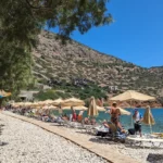
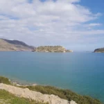
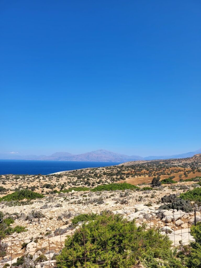
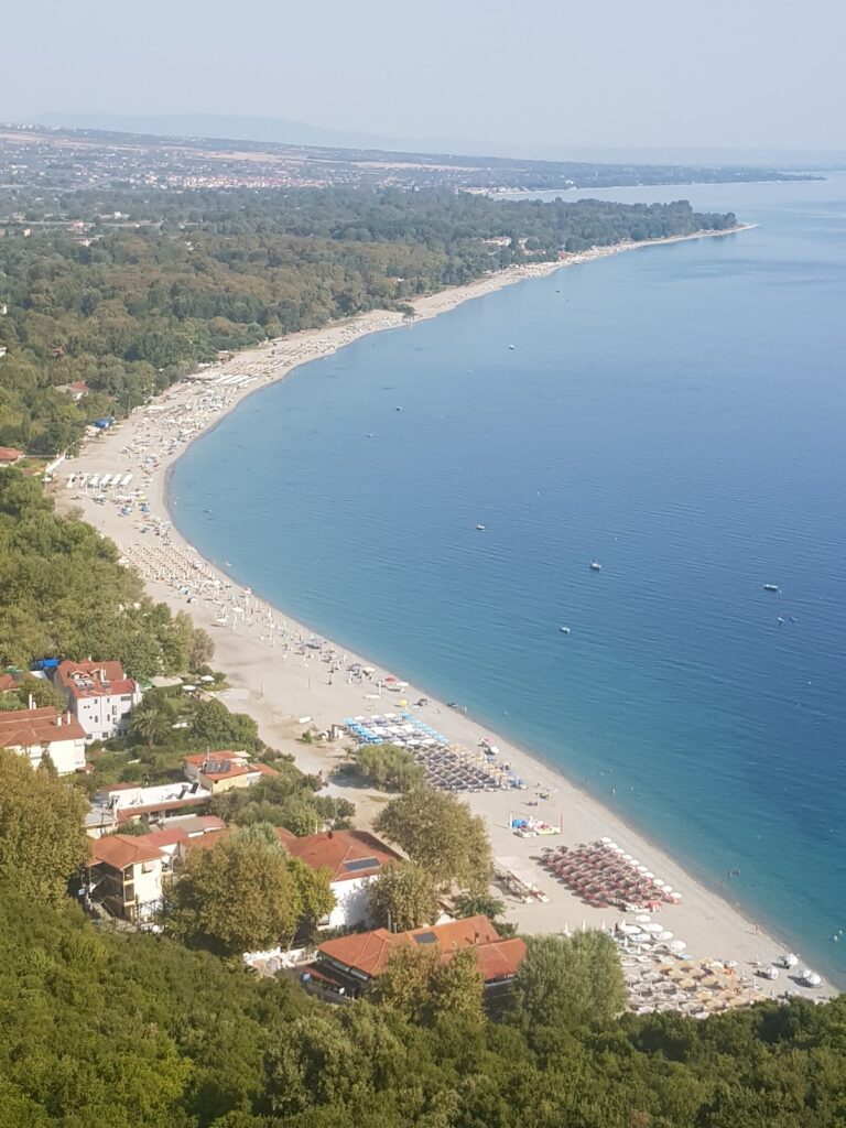
Vlychadia, a quaint seaside settlement, is nestled 31km north of Agios Nikolaos, along the northern coastline of the Mirabello region. A scenic drive from Neapolis, through the villages of Skinias and Agios Georgios, brings you to this tranquil haven. Here, a small fish tavern offers a taste of local cuisine. The area is dotted with secluded bays featuring mainly rocky and pebbly beaches. Vlychadia beach, directly in front of the village, is a rough and rocky terrain, perfect for spearfishing, though swimming can be dangerous during rough seas.

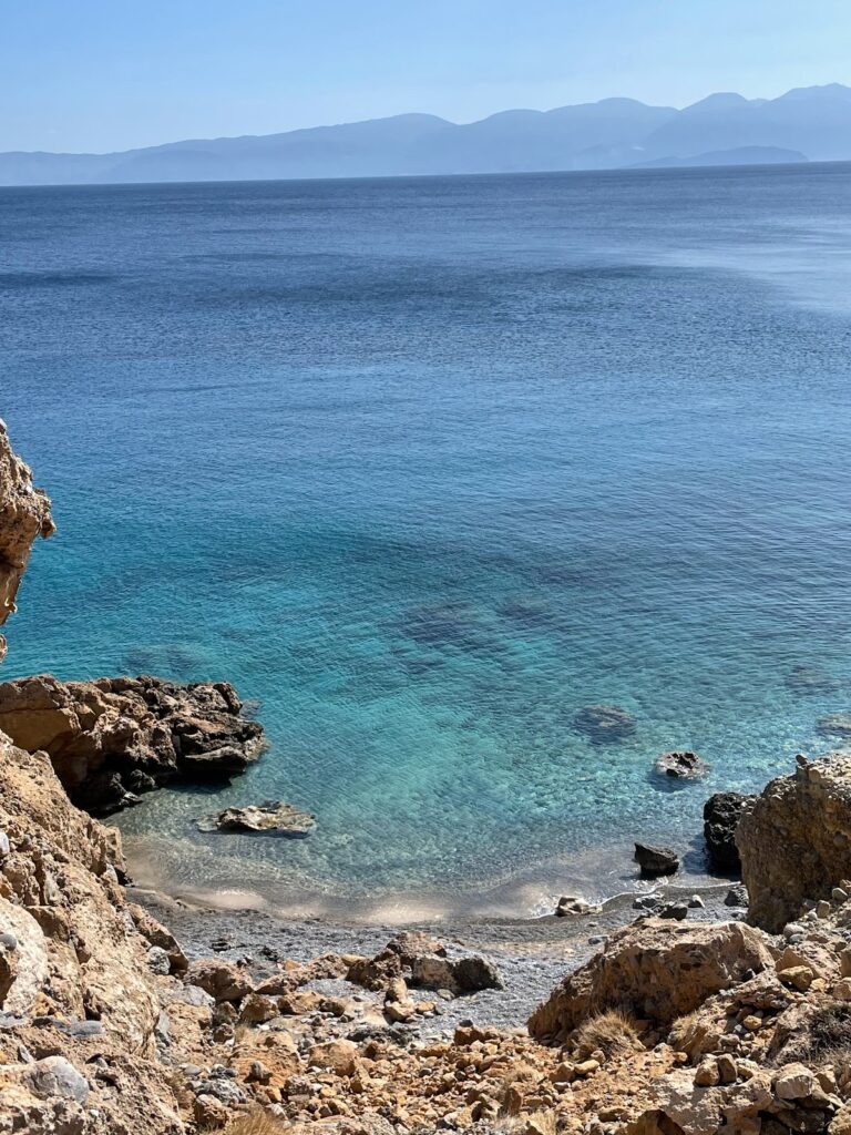
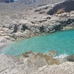
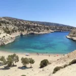
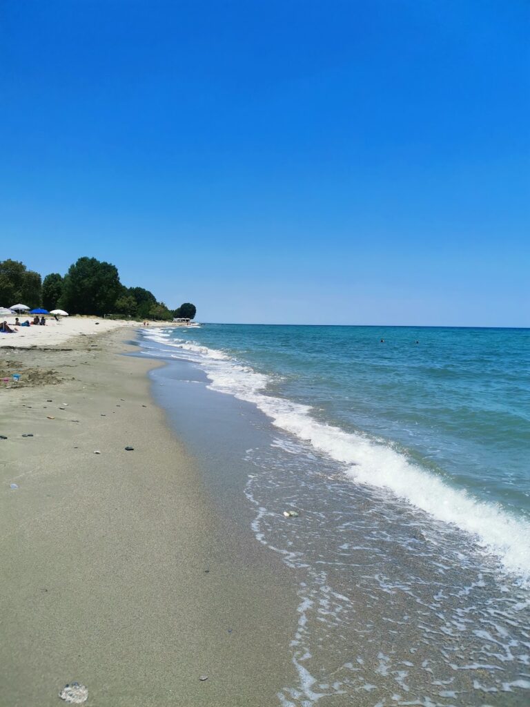
Further west, at the end of the road, lies Avlaki, arguably the most beautiful beach in northern Mirabello. It is nestled at the exit of the Skinias or Mavrogiannis gorge and is known for its white pebbles and crystal clear water. When the sea is calm, a rare occurrence, swimming at Avlaki is an unforgettable experience.

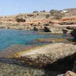
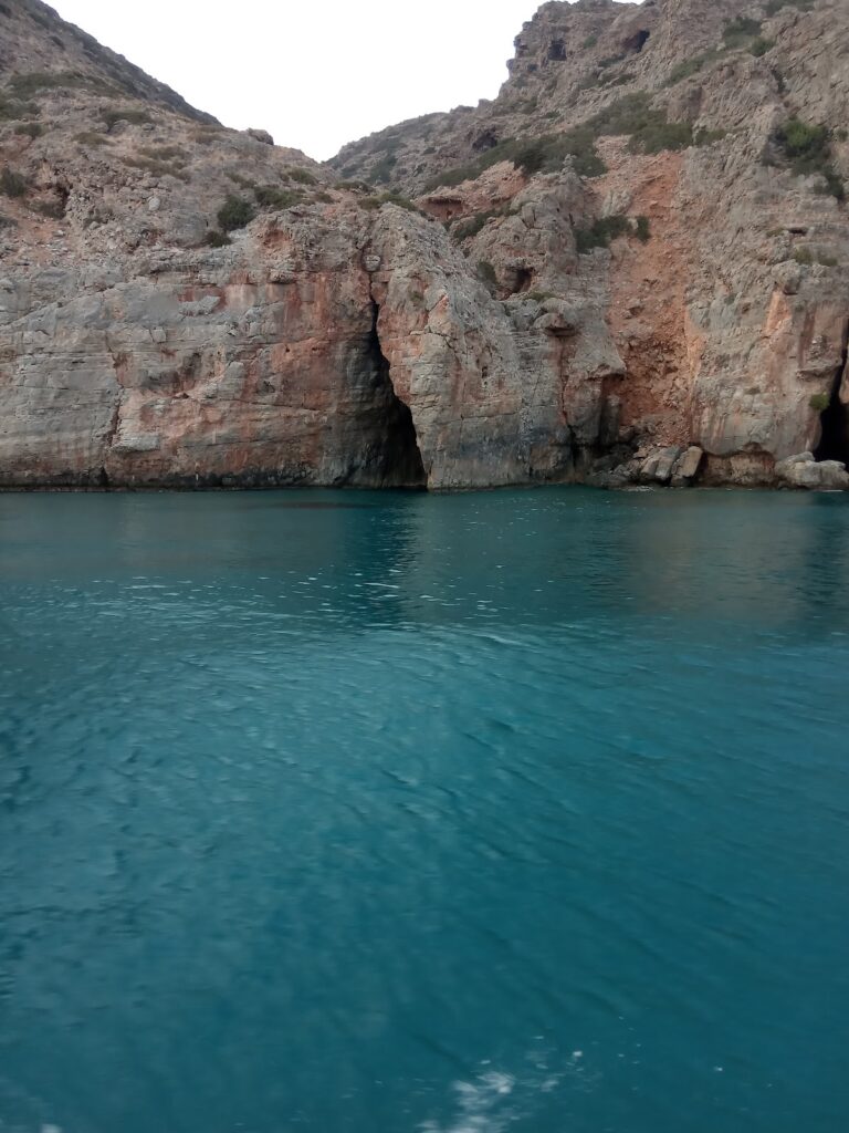
The road ends at Avlaki, but the beaches continue. About 800m west of Avlaki, the pebbly and rocky beaches of Kakia Naspa and Kouroukoulos can be found. These secluded beaches are only accessible on foot, making them a peaceful retreat. Interestingly, a small olive grove has been planted in the area, despite its inaccessibility by car.

Vlychadia and Avlaki, unspoiled and unorganized, are among the few beaches on the north side of Mirabello. While they are a great choice for a swim, they are not the only reason to visit the area. The gorgeous Mirabello region, with its picturesque villages, ancient monasteries and unique natural beauty, is worth exploring alongside a swim in Vlychadia.

Vlychadia itself is a quiet place, with only a few farmhouses. The site was once home to the Venetian Monastery of St. Nicholas, which was destroyed and later rebuilt in the same location. Today, it is celebrated every year on December 6th.

  • 4.0 km
  • Armos beaches
  • Pebbles, Sand
  • Normal
  • Blue

Armos, the northern area of the Spinalonga Peninsula, opposite the Spinalonga fort’s islet, Kalydon, is a unique site. It’s dotted with deserted old farms and is relatively unexplored due to a lack of roads leading to it. Besides the renowned Kolokitha beach at the peninsula’s southeast base, several hidden beaches are located in the northern part, which are well worth a canoe trip from Plaka to explore.

Vathi, one of these beaches, is found two kilometres northeast of Elounda port, on the peninsula’s northwest side. This small, sheltered cove boasts calm waters, a southeast orientation, and stunning views of Elounda town and its mountains. The beach at Vathi is a mix of pebbles and sand with relatively shallow water. Old farm remnants are scattered next to the beach, and a nearby boat platform serves as a stop for excursion boats from Elounda. Tamarisk and carob trees offer shade for resting beachgoers.

At the Spinalonga peninsula’s northernmost point, opposite the Spinalonga fort, lies the area known as Oxo Harakia or Skourgeto. The name Oxo Harakia refers to the rocks (haraki in Cretan dialect) that jut out above the sea surface at the narrow pass between the islet and the peninsula. Skourgeto, a Cretan term, describes the sharp, salt and sea-eroded rocks that are unwalkable without shoes. Two secluded, sandy beaches with crystal clear waters are ideal for snorkeling. Pottery fragments scattered around hint at ancient habitation.

Further northeast lies the sandy beach of Pelekiti, situated at a narrow ravine’s exit. The entire northern Spinalonga area, including all limestone-covered places, was previously used to extract boulders for building the Spinalonga fort. From Pelekita to Skourgeto, the area served as a limestone quarry, leading to large stair-like formations and distinctive rock shapes. In some places, the carvings extend into the sea. The name Pelekiti is Greek for “chiseled.”

  • 4.6 km
  • Agia Paraskevi beaches
  • Rocks in places, Sand
  • Normal
  • Blue

Beginning your journey from Elounda and heading towards Plaka along the coastal road, you will soon encounter a series of small pebble and stone beaches at the Mavrikiano and Agia Paraskevi settlements. In certain spots, you’ll see olive trees rooted on the beach itself, unharmed by the tranquil and saline waters of the lagoon. Occasionally, you’ll come across beach bars perched on platforms. The charming sight of fishing boats docked nearby undoubtedly tempts you to pause your journey for a photo op. As you move further north, the beaches of Tsifliki and Plaka unveil themselves, offering breathtaking views of Spinalonga, the famous leper island, and one of Greece’s most renowned attractions.

  • 5.7 km
  • Skotini beach
  • Pebbles, Rocks in places
  • Deep
  • Blue

Skotini Beach is situated 32 kilometers northwest of Agios Nikolaos, north of Finokalias village. It is found at the exit point of Skotini gorge, one of the most secluded and untamed areas of Crete island. This isolated location houses a University of Crete research station for aerosol studies, established here due to the clean, unpolluted air and lack of human interference.

To get to the beach, one can follow a small canyon from Finokalias village until it meets the sea. A short path leading northwards will take you to the gorge bed. As you walk, you’ll encounter a stunning, undomesticated landscape dotted with bare rocks, sparse vegetation, and a plethora of herbs and spices. The gorge houses 2-3 water wells and numerous caves within its towering walls. According to local folklore, a mysterious woman named Datserolenia once lived in one of these caves, its entrance still guarded by a stone wall. A little further along the path, you’ll stumble upon the secluded Skotini beach.

Alternatively, from Finokalias, you could take the dirt road to St. Andrew’s monastery nestled amidst a pine forest on Cape Drepani. Part of the church is built into the mountain rock, with an inscription indicating it was restored using funds from Spinalonga patients. To get to the beach from the monastery, walk eastwards along the coastline. Eventually, you’ll come across an old fountain that still gushes fresh water.

The beach itself is characterized by pebbles and patches of rocks. The rocky seabed, coupled with frequent waves, makes swimming a challenge and occasionally hazardous. However, on a calm day, you’re likely to enjoy a refreshing, solitary dip in Skotini’s cool waters.

The name “Skotini” translates to “Dark” in Greek, likely a reference to the high and closely spaced walls of the canyon that block out the sun. This, along with the tree canopies overhanging the edges, creates a “dark” environment within the gorge. Another theory suggests the name comes from the numerous caves found within the gorge.

© All rights reserved. Crete Locals