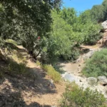
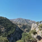
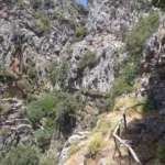
The Aposelemis Canyon, also known as the longest and most significant geological canyon in the northern part of the Heraklion prefecture, terminates at the settlement of Agrianá (locally known as Adrianna), near Hersonissos. The Aposelemis River traverses this canyon, though water is only present in parts of the canyon following heavy rainfall. However, the river at higher altitudes retains water throughout the wet months, thanks to the phyllite rocks. Despite its length, accessibility, and proximity to Heraklion, the canyon remains relatively undiscovered by the local population. The Aposelemis Canyon is characterized by strikingly beautiful and imposing vertical walls that reach up to 200 meters in height, along with several rock shelters. The canyon floor is smooth throughout, posing no technical challenges. In recent times, the Hersonissos Municipality has constructed a lovely trail along the canyon floor, making the walk both enjoyable and easy. The trail also features recreational areas with wooden benches at the start and end points.
This crucial ecosystem is home to waterfowl and birds of prey. A hidden riparian forest, particularly in the upper region of the canyon, is the real gem. The mixed forest is made up of ancient trees with massive trunks, truly natural marvels. Trees such as the plane, holm oak, oak, holly, carob, osier, among others, can be found here. The dense forest often obscures the trail. An old stone bridge, Xerokamares, is located just before the southern entrance, within the river. The most convenient way to access the canyon is via its northern exit. A dirt road from the bridge of the old national road leads to the Aposelemis gorge. Following this dirt road, you’ll pass the picturesque yet ruined settlement of Plevris, and eventually reach the bridge of the new highway, where the trail begins. It takes at least two hours to traverse the gorge.
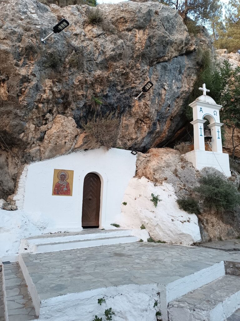
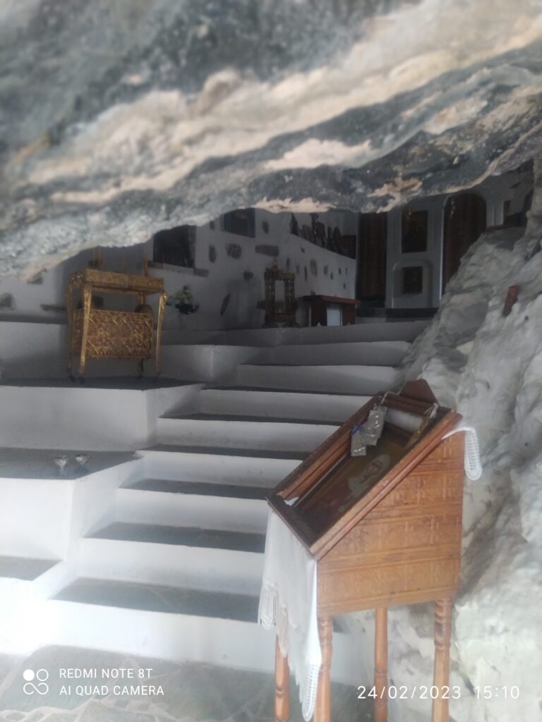
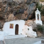
The Agia Anastasia Gorge commences from Kenourgio Horio in the Pediada Province (at an elevation of 160m) and concludes at the coastal village of Gournes. It’s named after the cavernous chapel of Saint Anastasia situated near its entry point. The stream that flows within it collects water from the region east of Sgourokefali and originates near Agia Triada.
Its plant life mainly consists of oleanders and the gorge narrows at various points along its path. A descent through the gorge typically takes around three hours. Regrettably, the gorge has been heavily polluted by trash and waste from nearby sheepfolds. Despite ongoing appeals from hiking clubs to the Hersonissos municipality, the situation remains dire.
The Embasa Gorge, also known as Apotyposi, begins its journey from the village of Kato Kera in the Pediada province and concludes near the village of Gonies, spanning a length of approximately 2km. The upper section of the gorge is notably steep, giving rise to several waterfalls during the winter season, with the tallest one measuring around 20m in height. The largest waterfall is particularly intriguing due to its division into several smaller cascades. It is possible to reach all the waterfalls without any special equipment as they can be circumvented from the sides.
Ascending the canyon from Gonies provides easier access to the waterfalls. However, the dense vegetation and steep inclines may pose a challenge for beginners. The gorge is predominantly populated by oak trees, planes, and brambles. The Life-Giving Spring church (Zoodohos Pigi) is located on the edges of the gorge, above the largest waterfall. According to local lore, a natural rock formation resembling the Virgin Mary can be found above this church. Hence, the gorge is also referred to as Apotiposi (Depiction). The church serves as the nearest parking spot to the large waterfall and can be conveniently reached from here, provided one can first overcome the initial hurdle of the fence erected by local shepherds.
Roza Gorge, a branch of the larger Ambelos Gorge, originates near the Panagia Kera Kardiotissa Monastery in the Ano Kera region. It connects with the rural road that traverses the Ambelos Gorge close to the village of Gonies. Walking along the riverbed is not feasible due to the precipitous drops, but a well-marked hiking trail is available on the gorge’s sides. The gorge’s sides are visually striking, showcasing unique geological formations that captivate visitors. After heavy rainfall, surface water is visible in the gorge, evidenced by the growth of oleander plants in the riverbed.
The name ‘Roza’ is derived from the pinkish hue (‘roz’ translates to pink) of the gorge’s walls. Another theory suggests that the gorge was used as a disposal site for sterile animals like donkeys in the past. As a result, locals named it ‘Stira Za’ (meaning sterile animals), which eventually evolved into ‘Sti Roza’ (or in Roza).
Canyoning in the Roza Gorge Roza Gorge is technical in nature, implying that hiking in its bed is not an option due to the numerous steep descents (rappels) that necessitate specific technical gear and training. For canyoning enthusiasts, it’s important to note that the largest rappel is approximately 18m high. The points are secured with relays from the speleological clubs of Crete, and the descent for a small group typically takes around 3 hours. The gorge’s proximity to Heraklion and easy accessibility make it a popular choice for canyoning schools.
Located approximately 45km east of Heraklion and 21km west of Agios Nikolaos, the Gorge Sellinari is nestled on the eastern slopes of Selena Mount, draining the valley west of Vrachassi. This gorge is a well-known location for all Cretans as the National Road from Heraklion to Agios Nikolaos runs along it. Historically, it served as the natural passage from the region of Lassithi to the fertile north coasts of Heraklion.
The dense vegetation of Selinari can be enjoyed either by car or by taking a leisurely walk until its exit near Milatos. A route worth exploring is the old National Road, which runs parallel to the New Road and winds through the gorge. The gorge walls and surrounding mountains provide a haven for many birds of prey. Selinari was once a refuge for the rare Cretan wild goat, but sadly, it is now extinct. Several springs are scattered around the area, but the most renowned attraction is the historic Saint George Monastery. For the Cretans, it is considered a bad omen to pass a gorge without stopping at the monastery. This belief stems from the past when the Selinari Monastery served as a rest stop for travelers and their animals.


