Gorges to hike and walk near Léntas, in Heraklion region

List of Gorges near Léntas

  • 3.6 km
  • Trafoulas Gorge
  • 0.5 h
  • Hiking

The Trafoulas Gorge, located in the Asterousia Range, begins southeast of Krotos village and concludes at the Psili Ammos beach on the southern coast of the Cretan Sea. The majority of trekkers only explore a small portion of the gorge, typically from where they park their vehicle to the beach, despite the gorge’s origin being at a greater altitude. Even this limited section of the gorge is quite striking, characterized by narrow walls and towering rocks. According to local lore, the most narrow section of the gorge is referred to as the Pidimatou Gorge, or Jumping Gorge, given that a goat could feasibly leap from one side to the other.

  • 6.7 km
  • Tripiti Gorge - Heraklion
  • 4 km
  • 3 h
  • Hiking

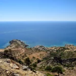
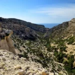
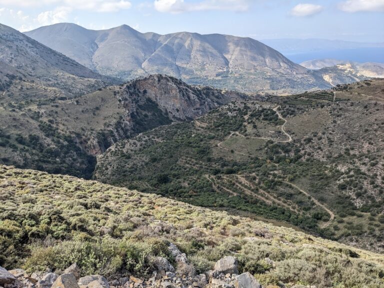
The Trypiti Gorge, nestled in the Asterousia mountain range, lies south of Vassiliki village and channels water from the valley east of Miamou village through the Agiosavvitis river. Stretching over 4 km, the gorge ends in a stunning pebble beach named Tripiti. A dirt road, running along the eastern side of the gorge, provides access to the beach, following several kilometers before reaching the riverbed at the sea’s edge.

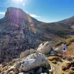
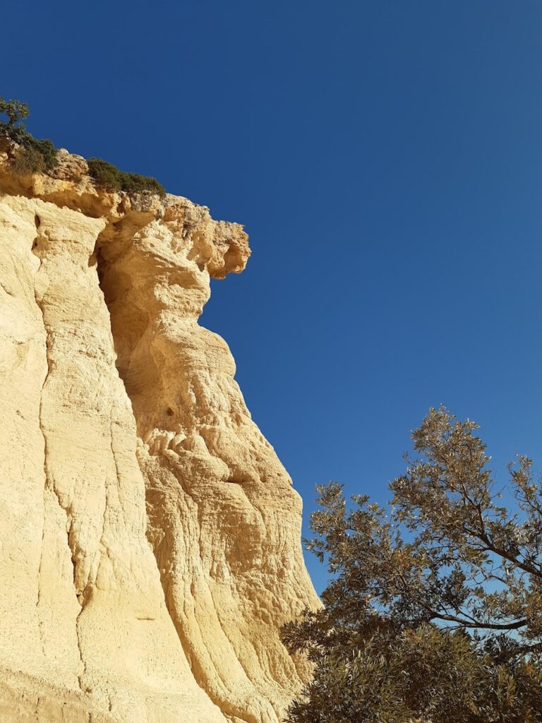
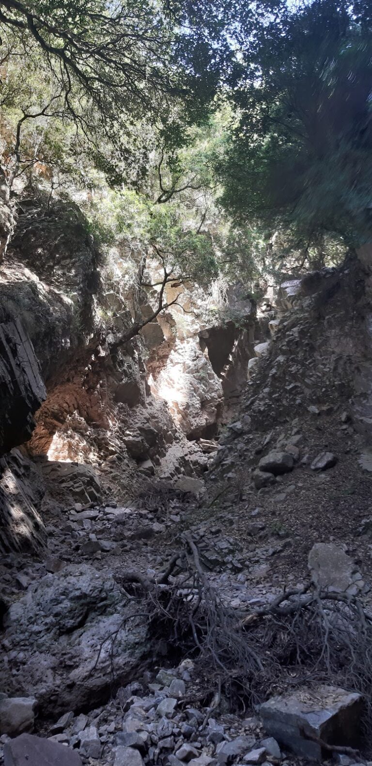
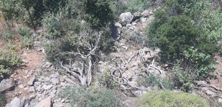
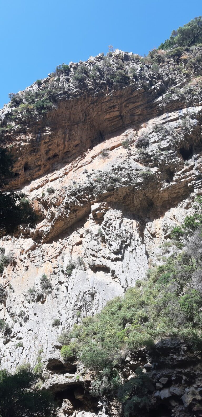
The gorge narrows near Saint Paraskevi church, situated at an elevation of 655m. The initial section of the gorge houses steep waterfalls, making it inaccessible without technical expertise and canyoneering equipment. The western side, in particular, is incredibly steep and dangerous. The Prophet Elijah church is a prominent feature at Katsakne, the peak of the western slopes. This church can be accessed via another dirt road that begins about half a kilometer before the gorge’s entrance.

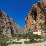
Midway through the gorge, close to the dirt road, lies the Saint Savas church, surrounded by wild olive trees. The unique feature of this woodland is its wild, uncultivated olive trees, offering a glimpse into the natural habitat of these trees. The gorge is also home to an array of wildlife and bird species.

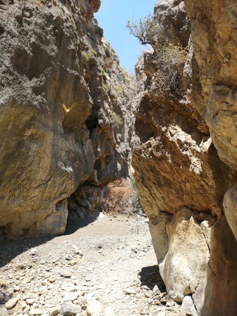
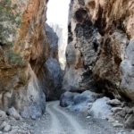
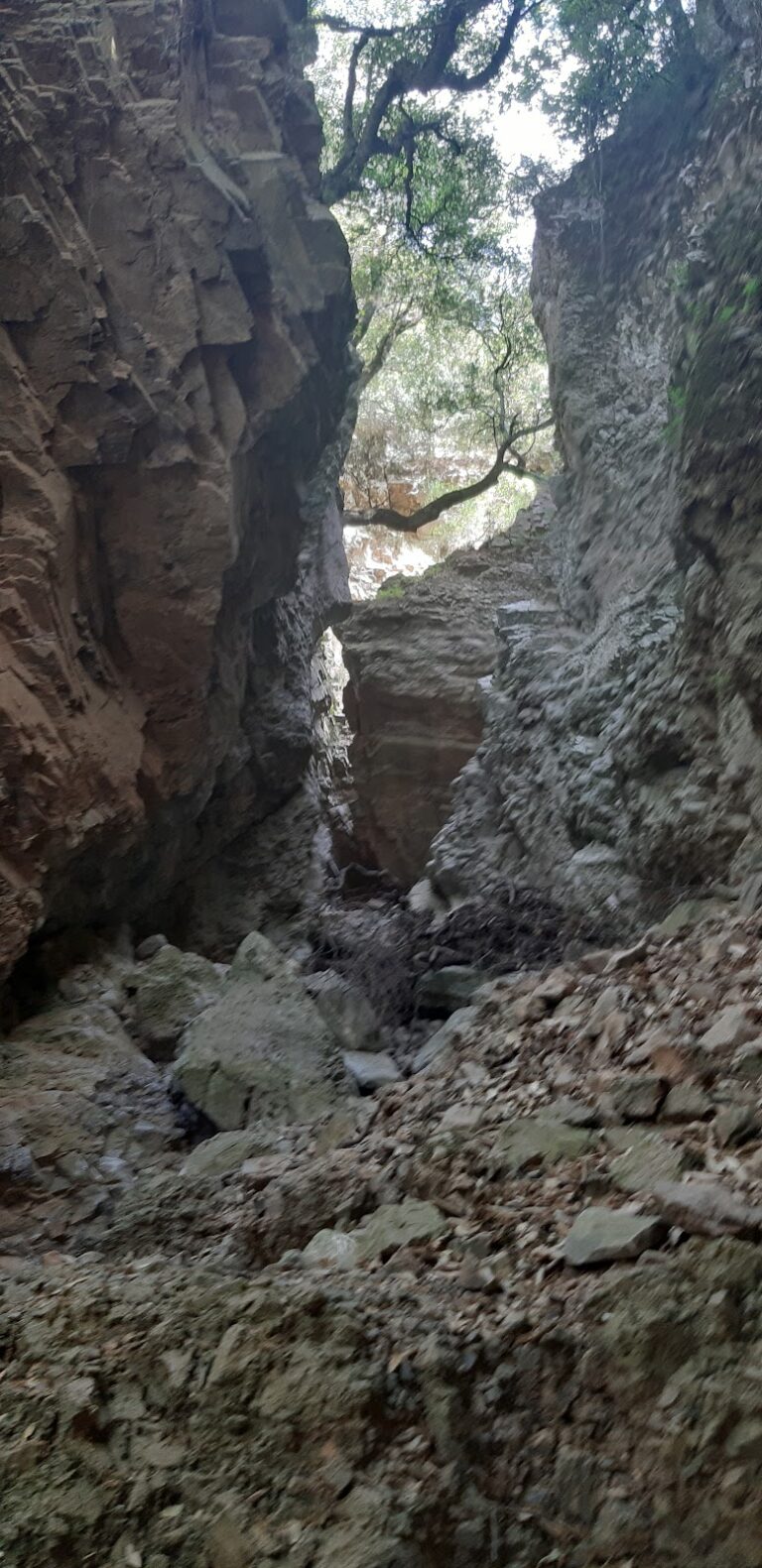
As you continue towards the sea, the road merges with the ravine and soon leads to the most picturesque part of the gorge: the narrow canyon, also known as Steno Faragi. Here, the sides of the gorge come so close together that they appear to touch. A road, just wide enough for a car, passes through this narrow gap. At the end of this narrow section, next to the beach, you’ll find the Panagia Tripiti church, built inside a cave, that celebrates its feast on September 1st.

The Trypiti Gorge is known by various other names, including Saint Savas Gorge, Katsakne, and Lavri. On the eastern side’s Papouri hill, archaeologists have uncovered a significant Preminoan settlement. Additionally, vaulted graves have been discovered at the Kalokambos location.

  • 11.4 km
  • Koumos Gorge

The Koumos Gorge, nestled in the Kapetaniana region, concludes near the coastal village of Agios Ioannis, amidst a landscape abundant with pine trees. This relatively undiscovered gorge requires technical equipment for access, making it exclusively passable for canyoning experts. Typically, the gorge remains dry, but intense rainfalls transform it into a spectacle of stunning waterfalls. The tallest waterfall reaches a height of 60m, accompanied by approximately 10 smaller cascades.

  • 11.8 km
  • Goula Gorge
  • 1.7 km
  • 4.5 h

The Goula Gorge, a rugged canyon nestled in the Asterousia Range, begins just south of the village of Kapetaniana and concludes at the coastal settlement of Agios Ioannis. Like its counterparts in the area, such as Flomias, Salamiano, Koumos, Gerakia, and Valahas, it is untraversable without the correct canyoneering gear. Nonetheless, there is a hiking trail on the eastern side of the gorge that takes approximately 2 hours and 30 minutes to complete.

Entry to the gorge is via Kapetaniana, with the closest access point being the telephone antenna en route to Agios Ioannis. The gorge boasts 18 rappels, the tallest of which is 55m, and others measuring 25m, 15m, 13m, and smaller. The gorge spans roughly 1700m in length and a team of five would require around 4 and a half to 5 hours to traverse it.

The gorge’s beauty lies in its wild and haunting rocky landscape, caves, and rock shelters. The primary vegetation is pine trees. Although it is generally dry, the name “Goula” translates to “spring” in the local Cretan dialect. True to its name, Goula is home to the area’s main spring, which provides for the water needs of the Agios Ioannis settlement.

  • 13.2 km
  • Agiofarago Gorge
  • 1.5 km
  • 0.5 h
  • Hiking

The Agiofarago Gorge, situated to the south of the Panagia Odigitria Monastery, was formed near two stream beds. One stream originates from the north-northeast of Gyalomonochoro, while the other begins west of Pigaidakia village. These two streams converge near Saint Kiriaki’s chapel, and after a fairly gentle course, they form the main Agiofarago Gorge that terminates at the stunning Agiofarago beach. The gorge features vertical cliffs with caves, but the path along the flat stream bed is quite easy to traverse. Just before reaching the sea, there’s a climbing field where climbers are often spotted.

Agiofarago, meaning Gorge of Saints, is named after the hermits who established a significant hermitage in Central Crete during the early Christian era, following Saint Paul’s visit to the region. As per a legend, around 300 hermits lived here in complete solitude, only gathering once a year in the Cave Goumenospilios to count their numbers and see who had died in the past year. The church of Saint Anthony (Agios Antonios), encountered on the way to the cave Goumenospilios, became the hub of the area’s asceticism when the hermits began forming a religious community. The church, believed to have been renovated three times, initially started as a small church in a rock cave. As the hermit population grew, the church was expanded. The final renovation is thought to have occurred in the 14th or 15th century. A small well outside the church supplied the hermits with water as there was no nearby spring. A circular Minoan tomb on a small hill south of the church indicates human presence from the Minoan era.

You can reach Agiofarago in several ways. You can take a boat from the ports of Kokkinos Pirgos, Agia Galini, or Kali Limenes, or you can take a dirt road starting from the historic Monastery of Odigitria near Sivas, which the area is a part of. From the monastery, follow the signs to Agiofarago, descend into the gorge, and continue until you reach a dead-end and a small parking area. Be cautious not to park your car under the trees as goats might climb on the roof to eat the leaves, causing damage. The hike from the parking area to the sea through the gorge takes approximately 25-35 minutes.

  • 13.8 km
  • Martsalo Gorge
  • 2 km
  • 1 h
  • Hiking

The Martsalo Gorge, stretching around 2km, is nestled on the southern coast of the rugged Asterousia Range. It collects rainwater from the Aginara region, near the Panagia Odigitria Monastery and eventually flows out onto Martsalo beach. Initially, a well-kept short trail leads from the closest dirt road to the historic church of Panagia Martsaliani. This ancient church, dating back to the early Christian era, is believed to have served as a catacomb, providing refuge for the first Christians. Surrounding the church, one can find hermit cells carved into the rocks and remnants of old structures.

From this point, it’s a relatively easy descent into the gorge’s bed, leading to the picturesque Martsalo beach. According to local lore, the Apostle Paul briefly landed here during his journey to Rome. The path to the beach is dotted with clusters of Cretan date palm trees, forming the second largest colony in Asterousia, only surpassed by the palm forest of Agios Nikitas.

  • 14.7 km
  • Koudoumas Gorge
  • 3.5 h
  • Hiking

The Koudoumas or Kofinas gorge starts at an elevation of 1000m near the base of Kofinas, the tallest peak of the Asterousia Range, and concludes at the Koudoumas Monastery beach. Its initial segment is a technical gorge of exceptional beauty, locally known as Katarraktis (Waterfall) or Keadas (Kenad). The total descents in the gorge leading to Koudoumas monastery are 18, with the highest reaching 38m. The upper section is only accessible with canyoning gear and was first explored in 2004 by Kostas Psarakis and Manolis Kambourakis, and bolted in 2017 by the Asterusia Adventure Team (Manos Petrakis, George Makrygiannakis, Nikos Foukakis, Savvas Paragmaian, Giannis Aggelis, Christina Aggelidou, Savvas Eftychis, and Dimitris Karatarakis).

It is possible to descend the gorge without technical equipment by navigating around the Katarraktis section. However, caution is required due to the area’s steep slopes, unstable ground, and lack of marked trails, which can strain the knees.

As you descend, the initial vegetation is predominantly cypress and oak trees, but as you near sea level, pine trees become more prevalent.

© All rights reserved. Crete Locals