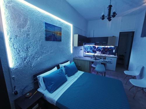
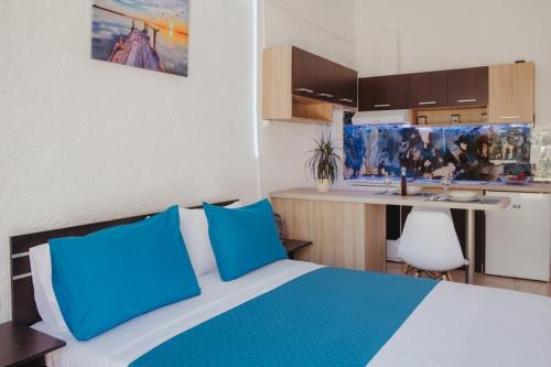
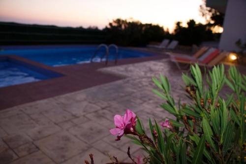
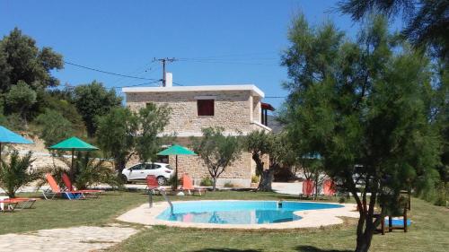
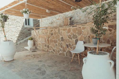
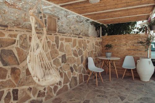
Set in Akoumia, 35 km from Archaeological Museum of Rethymno and 42 km from Museum of Ancient Eleftherna, AkoumiaStudio offers air-conditioned accommodation with a patio and free WiFi. The property has city and quiet street views, and is 43 km from Psiloritis National Park.
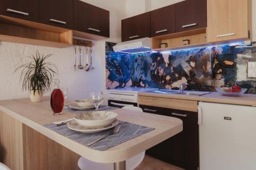
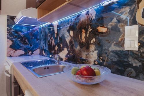
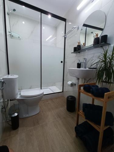
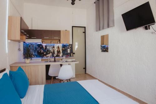
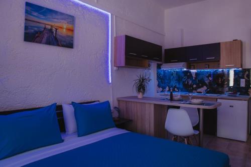
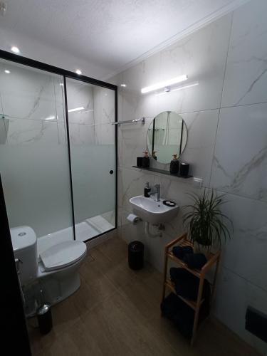
The apartment has 1 bedroom, 1 bathroom, bed linen, towels, a flat-screen TV with streaming services, a fully equipped kitchen, and a terrace with mountain views.
Museum of Cretan Ethnology is 33 km from the apartment, while Arkadi Monastery is 34 km from the property. The nearest airport is Heraklion International Airport, 89 km from AkoumiaStudio.
No results available
Find below list of things to do near AkoumiaStudio:
This is the trip to the treasure of the South Coast. In the morning, our bus will pick you up and drive you to a small bay from where a boat will carry us to the beautiful beach of Preveli in the Libyan Sea. At the beach, you will see a natural palm forest,
falls and a riverside. Everything around you makes you feel that you are on a tropical island. on the way back, we will pass the Kourtaliotiko Gorge with the pretty little churches built into the cliff.
Discover Preveli on this Land Rover safari from Rethymno. Admire the beautiful scenery, taste locally-produced raki, take a swim, and explore the palm forest at Preveli before returning to Rethymno.
Benefit from pickup at your hotel. Start by taking in a breathtaking view of the Prasses Gorge. Look for resident wildlife, including the impressive vultures that live in the gorge. Continue to the Potamon Dam and admire the small church built by the lake as a reminder of the importance of religion on the island.
Pass through typical villages, such as Karines and Spili and learn about the local customs and habits. Savor an authentic raki produced in the village along with other specialties at a traditional tavern overlooking the Libyan Sea. Swim in the crystal-clear waters of Preveli and explore the palm forest.
Feel the wind in your hair as you get back to nature in the Kourtaliotiko Gorge. End with a panoramic view of Rethymno before drop off at your hotel.
On this unforgettable beach tour we visit the south of Crete and the beautiful beach Preveli . Our route starts around 08:00 in the morning from Heraklion areas, pick up service near the hotel.
Preveli is an idyllic and incredibly beautiful beach, where we have free time to enjoy a splendid swim in the crystal clear water of the Libyan Sea, to sunbathe and relax as well as to undertake an adventurous walk through the tropical palm tree forest or have a coffee.
Preveli is located about 35km south of Rethymno and 10km east of Plakias. Beach of Preveli, also known as Lake Preveli or Phoenix, is located at the exit of the imposing Kourtaliotikos Gorge, where the Grand River (Megalos Potamos) flows.
About 20:00 we will be back at Heraklion.
There are 3 options from which you can choose:
-Preveli Palm Beach
-Preveli Palm Beach & Rethymno City
-Preveli Palm Beach – Damnoni Beach & Rethymno City
Enjoy a full-day excursion from Heraklion to Preveli Beach on a bus trip with a local guide. Discover South Crete’s Grand River, Kourtaliotikos Gorge, and a colony of Theophrastus palm trees.
Sunbathe on the sandy beaches, swim in the turquoise waters, watch for wildlife, or hike regional trails.
Begin your tour with a bus ride from the north coast to Preveli Beach, where you can swim in the turquoise Mediterranean water or stroll the sandy beaches.
Look for a rock shaped like a heart, known as The Stone of Lovers, and marvel at the steep cliffs and misty hilltops of nearby Kourtaliotikos Gorge.
Continue your tour by hiking along the banks of the Grand River to discover the Forest full of Theophrastus palm trees. Hike further up the river trail to a canyon and beach where you can further swim, hike, or sunbathe, before heading back down the path to the bus and returning to Heraklion.
Preveli is a famous beach on the south side of Crete Island. The local legend says that the mythological king Odysseus stopped in Preveli on the way to his homeland, Ithaka. What makes Preveli beach so famous is the palm forest surrounding the river, which comes from a gorge and ends up in the sea. The exotic beauty of nature attracted in the 60s and 70s hippies from around the globe who used to live here and make huts under the palm trees. Due to the sensitivity of nature around Preveli Beach, the area is protected by the Natura 2000, and it is a natural reserve.
Kourtaliotiko gorge is believed to have been used as a natural fortress by the ancient Minoans, who lived on the island of Crete more than 4,000 years ago. In the Middle Ages, the gorge was used as a route for transporting goods between the towns of Plakias and Koxare.In modern times, Kourtaliotiko gorge has become a popular tourist destination, with visitors from all over the world coming to explore its rugged landscape and take in the stunning views. The gorge is also a
popular spot for outdoor activities such as hiking, rock climbing, and photography. Despite its popularity, the gorge remains an important part of the local culture and traditions, and efforts are being made to preserve its natural beauty and cultural significance for future generations.
Damnoni beach in an idyllic bay just a few kilometres from the more famous resort of Plakias. It is about 35 km south of the city of Rethymno, on the southern coast of the island, on the southern coast of the island. The beach of Damnoni is backed by mountains and closed in by splendid rock formations, with white sand and turquoise waters.Another advantage of visiting Damnoni is that it is relatively uncrowded for most of the year.
Get off the road and out into the wilderness of southwest Crete on this 8-hour Land Rover safari of stunning mountains and remote beaches. A professional driver will navigate the difficult terrain, taking you to places inaccessible to other vehicles, while teaching you about Cretan culture.
The day starts with a drive through the wilderness, up to high altitudes, where you will get aerial views of the magnificent gorges. Look out for vultures and eagles high above. Pass through small traditional villages full of character, and make a brief stop for coffee at one of the remote mountain villages.
Back in the vehicle, drive through the mountains to the village of Spili, famous for its spring water. Located under the shadow of Mount Vorizi, the village has a Venetian fountain with a row of more than 25 lion heads supplying cold mountain water all year round. Stroll around the small shops selling handmade souvenirs and traditional handicrafts.
Continue along dirt tracks and bumpy roads through more villages, where time has virtually stood still. Passing Kerame, guests will see panoramic views of the southern Cretan coast and the Libyan Sea.
Stop for a swim at Preveli Beach to wash off the dirt and dust. Fringed with tall palm trees and boasting crystal clear water, Preveli is one of the most beautiful beaches on Crete, and was chosen by Bacardi as an ideal location for its TV adverts. It is also the only beach in Crete where you can swim in cold mountain water or ocean water in the same place!
Working up an appetite, walk back from the beach and stop for a traditional Cretan meal with unlimited wine. After lunch, drive back into the mountains for more dramatic scenery, and more photos as you climb through the stunning Gorge of Kroustaliotico.
As you head back towards the end of the tour, look at a magnificent panorama of the entire city of Rethymno from the top of a mountain that can only be reached by Land Rover.
No results available
Find below list of beaches near AkoumiaStudio:
Situated 51km to the south of Rethymno and 7km below the village of Kerames, Ligres is nestled at the base of the grand Siderotas mountain. It forms the northern segment of the Akoumiani Gialia beachfront, which runs from the cape of Mellissa to the south.
Ligres is an expansive beach graced with rough sand and a spectacular deep sea. Its somewhat challenging access has thankfully deterred the encroachment of tourism, preserving it as one of the most serene, secluded and pristine beaches on the island. Although the beach is not developed, there are a few taverns and rooms available on its western side accessible via a poorly maintained asphalt road. At the beach’s western tip, there is a stunning waterfall that boasts a year-round water supply, cascading right next to the sea.
Beyond the northern end of the beach, also known as Katsouni, lies a secluded beach favored primarily by nudists. Despite its seclusion, there are numerous spots along this vast, uninhabited beach where nude swimming is possible. It’s worth venturing along the beachfront to Triopetra, up to the Xiromilia area, to marvel at the astonishing rock formations. In the heart of Ligres, a remarkable reddish boulder stands out near the sea.
Triopetra beach, nestled at the base of Mount Siderotas and 52km south of Rethymno, can be reached via paved roads leading from either Akoumia or Sachtouria. Part of the extensive Akoumiani Gialia beachfront, Triopetra got its name as a historical winter refuge for the inhabitants of Akoumia, who built small huts near their olive groves. Presently, most land and hotels in the area are owned by descendants of these Akoumia residents.
Triopetra boasts two distinct beaches, separated by a petite peninsula. The peninsula’s defining feature is the three spectacular rocks jutting out from the sea, giving Triopetra its name, which translates to “Three Rocks”.
The first beach, Small Triopetra or Koumado, resides in an enclosed bay lined with sand and rock to the south of the three rocks. Here, the Akoumianos river meanders into the sea, forming a natural boundary between Triopetra and the enchanting Agios Pavlos Sandhills at Cape Melissa. Small Triopetra hosts a handful of taverns and rooms, with umbrellas available for sun-seekers. Additionally, the southeast edge of the beach is home to a small harbour, known as Stomio or “mouth”, named after the river’s mouth meeting the sea. Just 1km northeast of the beach, the awe-inspiring chapel of Prophet Elias stands on a high hill, commanding an impressive view over Akoumiani Gialia.
Kerames, a village situated 49km south of Rethymno, neighbors the village of Agalianos. It is surrounded by stunning beaches to its south, including the well-known beaches of Akoumiani Gialia, such as Ligres, Triopetra, and Agios Pavlos sandhills. Keramiani Giulia, or Keramean Beach, lies to the north of Akoumiani Gialia, its name derived from the nearby village.
A somewhat dilapidated asphalt road leads to Keramiani Gialia, ending near the local harbour of Agia Fotini, also referred to as Agia Fotia. To the southeast of Agia Fotini, the primary beaches of Keramiani Gialia are located. A well-maintained dirt track from Agia Fotini leads to these beaches, the first being Podare. With its coarse sand and rocky areas, Podare is perfect for activities like fishing and snorkelling. Despite being an unorganized beach, it offers rental rooms for visitors.
After leaving Podare, a simple dirt road heads eastward, taking you past a large hill to a parking area situated near more rental rooms. Here, the road ends, and the beach on your right, Glima, begins. This sandy, secluded, and unorganized beach offers total privacy.
Continuing eastward on foot for about 100m, a towering sandhill becomes visible to your left. Pahia Ammos, or Coarse Sand, lies in front of the sandhill and provides an ideal spot for those seeking complete seclusion.
The quaint village of Kerames is situated 49km to the south of Rethymno, in close proximity to the village Agalianos. South of Kerames, there are numerous stunning beaches, with Ligres, Triopetra and Agios Pavlos sandhills of Akoumiani Gialia being the most well-known. To the north of Akoumiani Gialia, there is Keramiani Gialia or Kerames Beach, named after the nearby village.
The narrow, poorly paved road leading to Keramiani Giulia ends near the local port of Agia Fotini, which is also known as Agia Fotia. This location is home to beautiful small pebble beaches, perfect for snorkelling and swimming, and is surrounded by large boulders. The traditional Stavros tavern is built on an old carob storehouse and serves fresh fish on the beach. It also offers accommodation, and has a reminiscent atmosphere of the Greek islands of the 1960s. The tavern provides free umbrellas and showers. Near Agia Fotia, there is a small river that forms a green forest. Following the path north along the river, you will encounter a tall palm tree and the old church of Agia Fotini, located near a small house with a lovely garden. A 5-minute walk west of the tavern along the rocky shore will lead you to another pebbly beach.
On the hill near Agia Fotini tavern, you can still see the remnants of the ancient town Kionia, which thrived in its heyday. Today, the ruins cover an area of over 150 meters east to west and 100 meters north to south, while the other half of the town is submerged underwater, in front of the tavern. Traces of buildings and terraces that suggest the existence of Kionia can be seen in the surrounding area. It is thought that the sinking of the town forced its inhabitants to leave and move to higher ground, where the villages Kerames and Agallianos now stand.
No results available
Find below list of gorges near AkoumiaStudio:
Located just 1km north of Kissos village in Agios Vasilios province and 34km southeast of Rethymnon, Kissano Gorge serves as a link between Kambos Kissou settlement and the small Gious Kambos plateau. The gorge’s river is a primary tributary of the Gorge Frati. The canyon, though not lush with vegetation, boasts small waterfalls, the tallest of which measure between 5-7m. These waterfalls make it an ideal location for canyoning, but it’s also possible to bypass them carefully from the sides without any specialized equipment.
The journey begins at the Gious Kambos plateau, a small haven of diverse flora. A 0 to 30-minute walk along or beside the riverbed leads you to a point where the river intersects the road connecting Kissos with Gerakari. Here, you’ll find a striking reddish rock peppered with numerous caverns known as Kokkinos Detis, leading locals to also refer to this area as the Kokkinos Detis Gorge.
While this marks the end of the main part of the canyon, the river continues its descent, creating more small waterfalls. It then passes through the 60-hectare artificial pine forest of Vatolakki, before continuing towards Spili and eventually to Frati.
Approximately 1 km to the east of Spili, in the Agios Vassilios province, you’ll find the church of Agia Fotini, also known as Saint Photini. Like many places in Crete, it’s often referred to as Agia Fotia. Situated on the main road leading to Agia Galini, the church is adjacent to a spring that flows with water throughout the year. Nearby, you’ll see a large, old watermill. This area marks the end of the picturesque Agia Fotia gorge, which is small but incredibly lush.
The gorge begins at the Gious Kambos plateau, which is 750m above sea level, and concludes at the spring, which sits at an altitude of 500m, after a 1.5km journey.
Close to the gorge’s starting point, you’ll discover waterfalls of unparalleled beauty. In the springtime, these falls are abundant with water, creating a unique and breathtaking landscape filled with plane trees. The easiest way to reach the waterfalls is by walking from the spring along the gorge. Alternatively, you can access them from Gious Kambos, though this route is more challenging. It requires bypassing the waterfalls from the sides and descending the steep slope to the riverbed.
Located approximately 100km southwest of Heraklion city, north of Ano Meros village, you’ll find the Kalamafka or Gorge Smiliano. The Lygiotis river, originating from the Gerakari valleys and the Samitos Mount slopes, flows through this gorge. The 2.5km long canyon begins near Vrysses village, close to the deserted settlement of Smile, and concludes north of Ano Meros, accessible via an asphalt road.
During winter, the gorge is filled with water, making entrance risky even for experienced canyoners. However, an alternative route via a dirt road descending from Drygies village leads just above the gorge. Here, the canyon’s steep walls form a slope with a trail, allowing relatively easy descent to the gorge’s heart, precisely at the point where the stunning waterfalls are formed continuously. The gorge comprises about 10 remarkable rappels, with the tallest waterfall being 13 meters. The ponds formed beneath each waterfall are equally breathtaking, and it’s worth noting that Gorge Smiliano boasts the largest and deepest ponds compared to any other gorge in Crete.
A journey through the canyon (as described in June of a particularly rainy year)
Starting near Smile, we first cross a small arched bridge. After just 50m, we enter the gorge’s main section, greeted by a large pond. The canyon then narrows to about 2m and forms a deep pond, 2-3m deep, requiring swimming. The first small rappel we encounter ends in a large, deep pond (perfect for jumping), where the depth exceeds 3m.
Following this, a rock lodged between the canyon walls forms a natural arch. After swimming for several meters (over 25) without touching the ground, we continue our journey unimpeded. We soon encounter the first high waterfall, and the gorge narrows further (1-1.5m). To continue through this narrow section of the canyon, ropes are required. Alternatively, we can walk alongside the canyon until we reach the 15m high rappel that ends in a very deep pond, perfect for a big jump.
The gorge extends eastward, and the deep ponds gradually become small, shallow ponds. Towards the end of the gorge, the water almost disappears, making it impossible to anticipate the aquatic paradise that lies just a few meters ahead.
The Swallow Gorge, situated 33km south of Rethymnon city, is in close proximity to the renowned Preveli beach, known for its magnificent palm grove and breathtaking river. The gorge begins from Kenda peak (881m altitude), passes through Drymiskos village, runs nearly parallel to the Kourtaliotiko canyon, and concludes at Drymiskiano Ammoudi beach. It gets its name from the swallows that flock here every summer.
Unlike Kourtaliotiko, this lesser-known canyon is dry during the summer but is still worth a visit. The vertical, awe-striking rocks and the verdant riverbed (which flows in winter) are a sight to behold. The winding Swallow Canyon is relatively easy to hike and doesn’t require any specific skills, despite not being marked.
A significant portion of the canyon runs parallel to the road leading to Amoudi beach, which is where the easy trail to Preveli begins. To find this road, take a left at the picturesque arched bridge of Megalos Potamos that you’ll come across en route to the Preveli monastery. Therefore, even if you’re not much of a walker, you can still enjoy the beauty of the gorge during your visit to Preveli.
No results available
© All rights reserved. Crete Locals