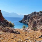
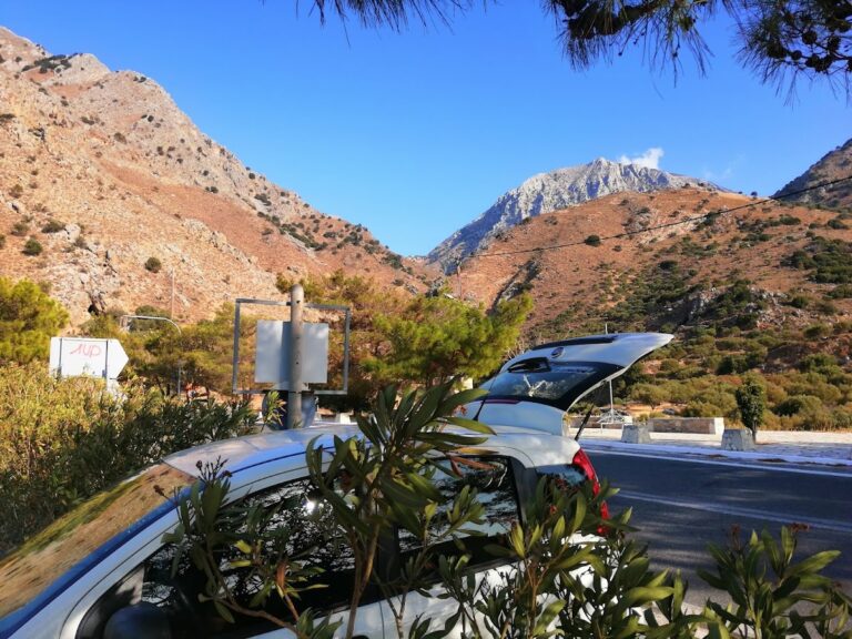
The Agriomandra gorge, though brief in length, leads to the charming, small beach of Agriomandra. To reach it, one must traverse the verdant meadows to the west of Kavoussi, known as the Lakos Ambelion area, via a dirt road until the gorge’s entrance is reached.
Commencing from this point, a straightforward trail leads to Agriomandra beach within a mere 10-minute walk. As you approach the beach, you’ll notice several petite caves embedded within the rocks. One of these has been constructed from stone and serves as a church, built during the Byzantine era by a hermit and dedicated to St. John the Theologian. This church is still occasionally used for baptisms.
A short walk further, approximately 650 meters from the parking area, you’ll arrive at the stunning pebble beach, graced with crystal-clear, emerald waters.
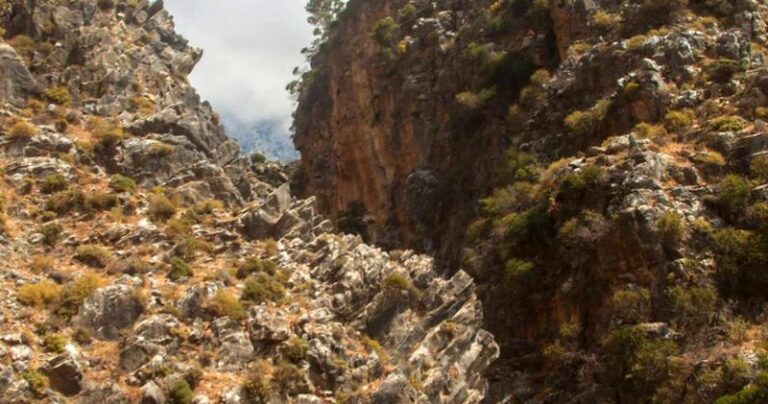
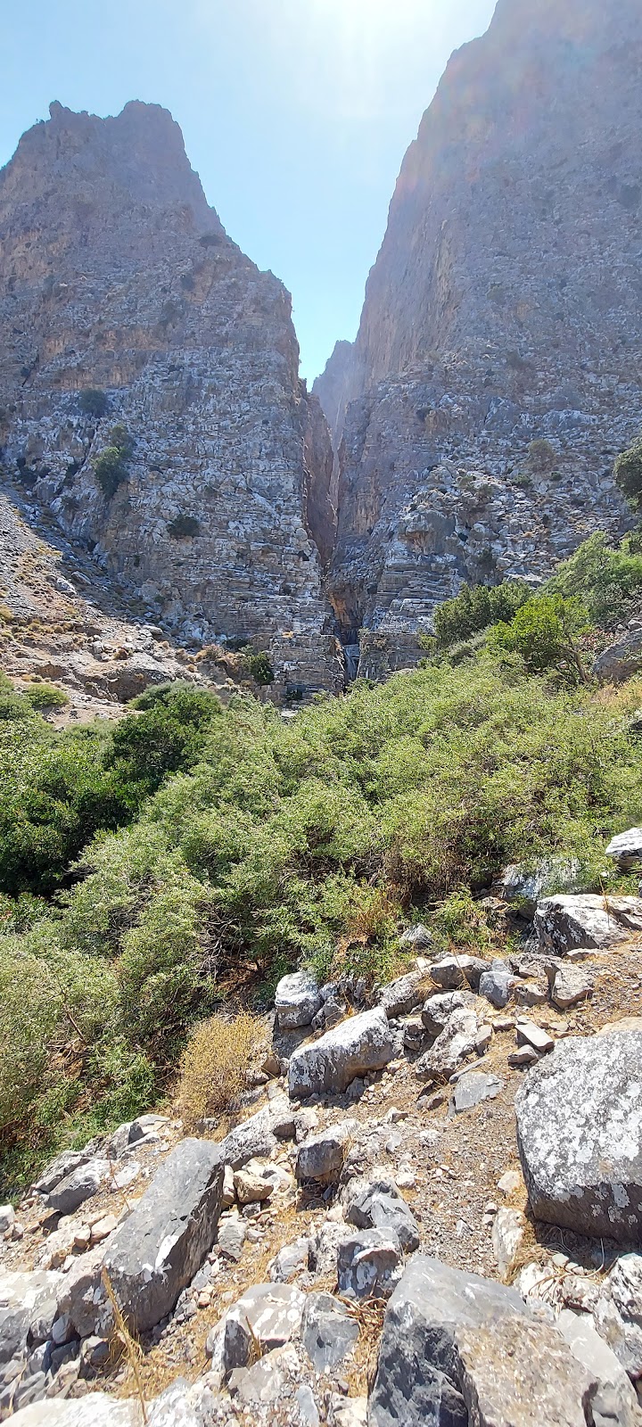
Ha Gorge, a mesmerizing natural wonder carved into the western side of Mount Thrypti, channels water from the Thripti plateau to the Pachia Ammos beach. The gorge’s journey commences near the Saint Anne Byzantine church and the E4 footpath at approximately 800m altitude, and concludes near the Monastiraki village, about 100m above sea level.
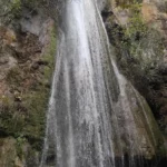
Traversing the Ha Gorge demands canyoneering skills and specific gear due to its series of cascading waterfalls, including a 35m high plunge. The gorge tightens to a mere thirty centimetres at certain points, squeezed between cliffs that rise to 400 meters. The Mastoras waterfall, one of Greece’s tallest free falls reaching 215m, contributes substantial water midway through the route.
For those with less experience, a hike from the Monastiraki exit of the gorge provides a peek into its splendour, leading to a charming pond at the base of the final waterfall and past ancient grain mills. The name of the gorge, Ha, originates from the Greek verb “Hasko,” which means to create a gap. However, local folklore offers vibrant alternative explanations. From stories of misleading Saracens to myths of a golden chariot hidden deep within, the Ha Gorge is not only a stunning natural spectacle but also a symbol of intriguing local mythology.
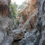
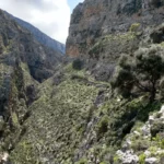
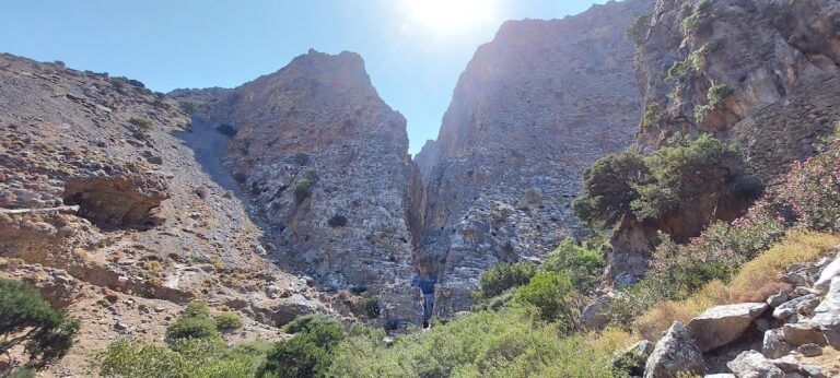
The Havgas Gorge, situated near the village of Kalamafka and just 12km north of Ierapetra city, is one of several gorges with the same name scattered across Crete. Other examples include the Havgas Gorge in the Lassithi Plateau, Plaka, and Kavoussi. The Havgas Gorge is nestled between the Megali Korfi (1103m) and Kokies (993m) peaks, and its stream, the Kapsous, serves as the primary tributary of the Kalamavkianos River that empties into the Stomio beach of Gra Ligia.
This stunning canyon boasts unique rock formations, sculpted by rare geological events. Many of these rocks are adorned with nature’s own “artwork”, etched over time by the elements. Despite its relatively short length, the gorge offers an easy and enjoyable walk along the riverbed, even for novices. The area’s altitude of around 500m provides the perfect environment for a lush pine forest. Regrettably, repeated fires have caused the forest to diminish in size. Nevertheless, the area is worth a visit, and visitors are sure to be charmed by the sight of small pine trees sprouting from the rocks, akin to bonsai trees.
The gorge’s depth extends to 300m. At one spot, two narrow rocks form the entrance to a series of caves that served as a refuge for Cretan rebels and Allies during the German Occupation. The locals refer to this area as the “Chinese Landscape”, due to the smooth rocks dotted with bonsai-like trees. Adjacent to the gorge’s exit, visitors can explore the village of Kalamafka with its inviting taverns and babbling water. Additionally, nearby attractions include an ancient olive oil mill and the churches of Saint John and Saint Anthony.
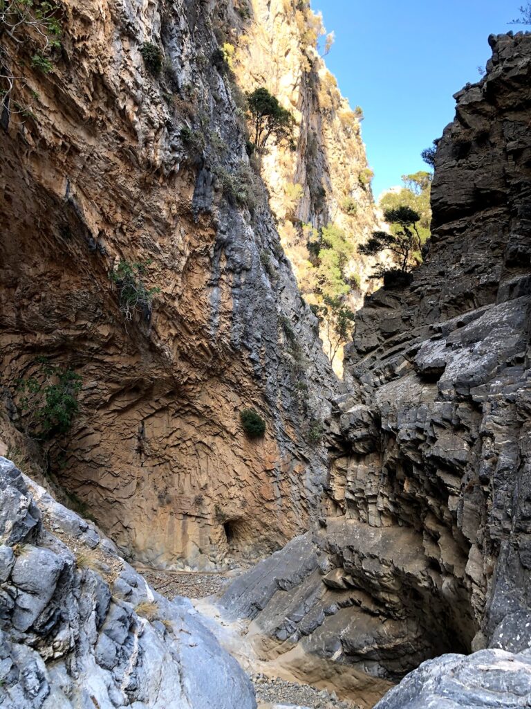
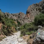
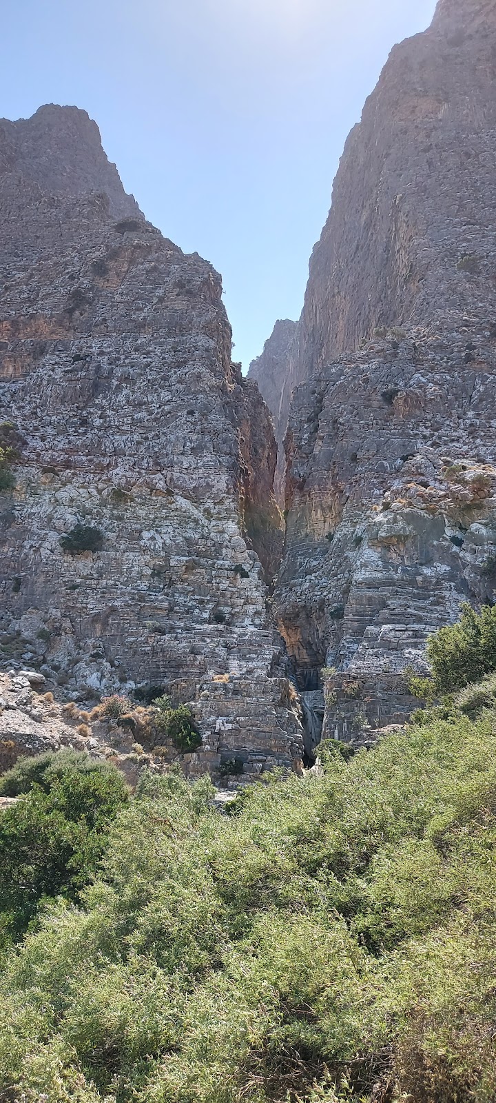
The Kritsa Gorge, located 9.5km southwest of Agios Nikolaos, begins near the charming village of Kritsa and concludes at Tapes village. This 4 km long gorge, at some points, is only 1.5m wide. It is fairly easy to navigate, with a few areas requiring caution, where large rocks need to be climbed over. However, it is not advisable to visit the gorge following rainfall, as the resulting ponds can obstruct the paths.
The canyon’s entrance near Kritsa is striking. The mountain is split in two, creating the narrow Havgas passage (Havgas is a common term for gorges in East Crete). In addition to the main trail that begins near Kritsa’s stone bridge, there is an alternate path that starts in the village itself.
Close to the trailhead, you’ll find a large rock that can be scaled with relative ease. Beyond this point, the canyon becomes even more breathtaking, with slender passages and towering walls that block out sunlight. This natural wonder is particularly beautiful in spring when flowers are in bloom and water levels are low. The walls eventually recede, revealing a picturesque valley filled with olive groves. If you continue along the riverbed for approximately 1.5 hours, you’ll arrive at the lovely village of Tapes, where you can relax at the local coffee shop.
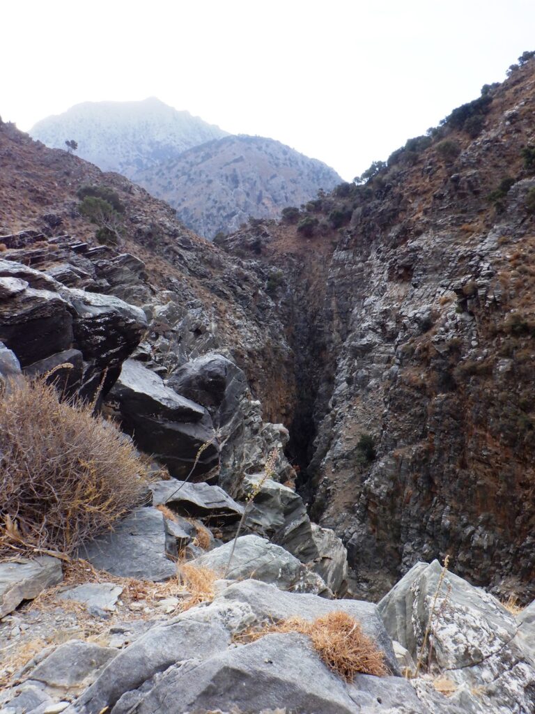
In the eastern region of Crete, the term Havgas is frequently encountered, often used to name canyons and in some variations such as Ha, Havgoudi, and so on. One of the many gorges bearing the Havgas name is located near Kavousi, in the Ierapetra province. This gorge is essentially the lower segment of the wild Mesonas gorge, which originates from the Thripti plateau.
The section known as Havgas begins close to the Minoan settlement of Azorias and concludes its path in Kavoussi. Despite its short length of only 700m, traversing it via its stream demands technical (canyoning) gear due to the presence of six stunning waterfalls. The tallest of these waterfalls reaches 20 meters in height and retains water well into the late winter.
As an alternative, the gorge can be navigated by foot along the ancient hiking trail that skirts the canyon from its eastern side, linking Avgos to Kavoussi.
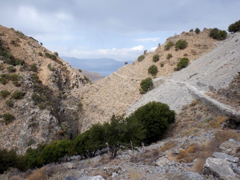
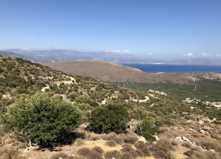
Located on the northern slopes of the Thripti range, near Kavoussi village and Avgos settlement, you’ll find the short but incredibly wild and imposing Mesonas gorge. This 4km long gorge requires technical canyoneering equipment to traverse its steep waterfalls. The gorge connects the Thripti Plateau to the Kavoussi plain, with its exit close to the Azorias archaeological site. The same stream forms the technical Havgas gorge, crosses the fertile Kavoussi plain, and eventually empties onto Tholos beach.
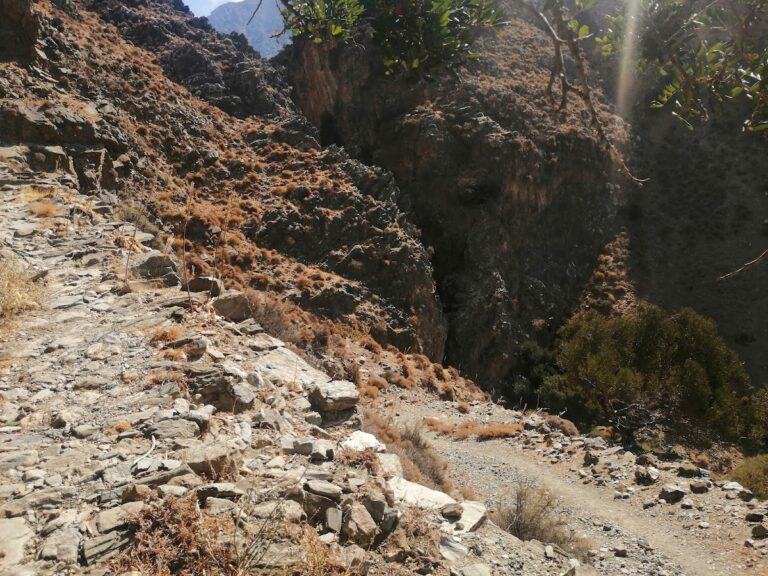
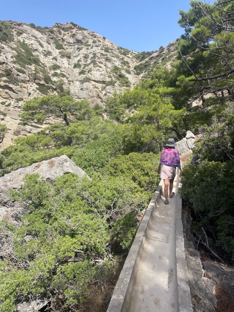
Starting from the Tsamadi position near Thripti village, there’s a hiking trail that runs high above the gorge bed, following the concrete channel used to transfer spring water to Kavoussi. The breathtaking views of the canyon, surrounding mountains, and Mirabello bay are beyond words. The trail descends to ancient Azorias, from where you can approach Kavousi via the ancient path parallel to the Havgas Gorge, or through the dirt road passing the Monumental Olive Tree of Azorias.
For canyon enthusiasts wanting to traverse the river bed, it’s worth noting that the water levels are generally low, with the flow ceasing mid to late spring depending on seasonal rainfall. The gorge starts out smoothly, with the hiking portion exceeding the steep descent sections. The last part of the gorge changes dramatically, narrowing significantly and forming high waterfalls, with the highest rappel at 30m. A small group of canyoneers can descend its 9 rappels in about 3 hours.
The Mylonas or Saint John Gorge is situated 18km to the east of Ierapetra. It commences near the St. John village at a height of 500m and concludes at the Kakia Skala beach. It is not feasible to descend the gorge from Saint John due to a tall waterfall, necessitating the use of canyoning equipment.
Nonetheless, there are two ascending trails that start near the Kakia Skala beach, providing access to the high fall of the Mylonas canyon. The first trail (easy – 20’) takes you through the pine-wooded side of the gorge, a large portion of which is the old concrete ditch, formerly used to transport water to Koutsounari. The other trail follows the riverbed and can be quite exhausting, especially in winter (takes approximately 1:30 hour).
Upon reaching the end of the ascending trails at a height of 300m, you will encounter the tall fall of Milonas, which stands at 20m. Below it, you will find a small pond filled with crystal-clear water, perfect for a refreshing swim. In winter, and after heavy rainfall, a second waterfall appears to the left of the main fall, creating a breathtaking view.
The Adrianos Gorge originates from the Adrianos village. There are areas within the gorge where large rocks obstruct the pathway, making navigation challenging, but achievable (it takes approximately 3 hours to traverse). In close proximity to the gorge, you can explore the Maridon and Atziganospilios caves.
The river that courses through the gorge is a segment of the Skoulikaris or Xeropotamos River. This river collects water from the Potami village valley and, after covering several kilometers, it finally drains near the Agios Nikolaos town stadium.


