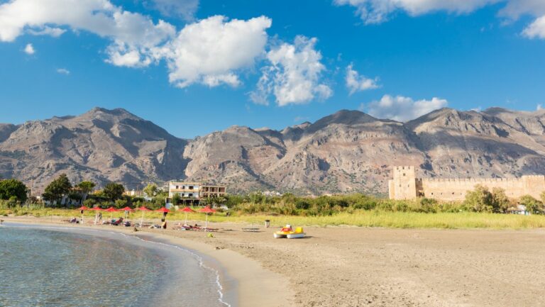
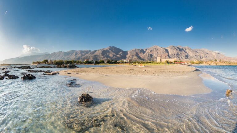
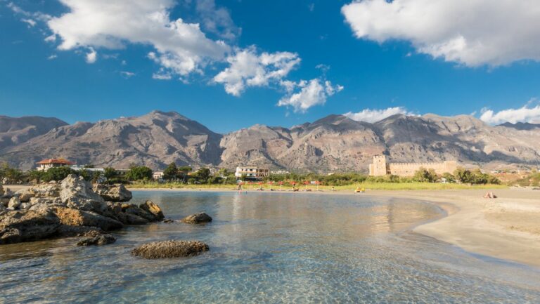
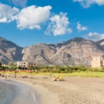
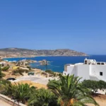
Frangokastello, meaning “Castle of the Franks”, is a renowned beach in Western Crete, steeped in history and folklore due to its age-old Venetian castle and the intriguing legend of the Drosoulites ghosts. This beautiful beach lies in a valley at the foot of the White Mountains, situated 13km east of Hora Sfakion and 80km southeast of Chania.
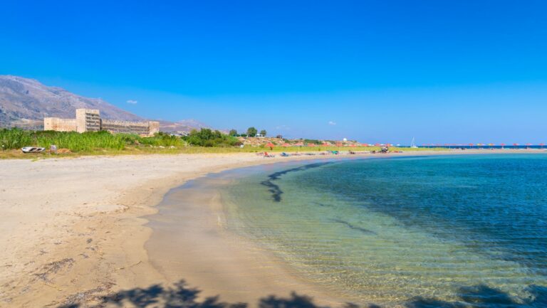
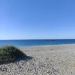
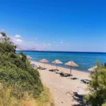
Fragokastelo’s main beach is an appealing spectacle with its sandy shoreline and shallow turquoise waters, a perfect setting for children and families. Despite being well-equipped with amenities and buzzing during the summer months, the beach is sometimes subject to bothersome northern winds that sweep the sand. However, the area boasts plenty of accommodations, dining options, shops, and an ATM, with the nearest hospital located in Sfakia.
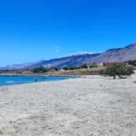
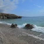
To the west of the main beach, the expansive Vatalos beach and a significant wetland (in winter) offer a different experience, with a mix of sand, pebbles, and rocks perfect for snorkelling. A short 300m walk to the east from the main beach leads you to the breathtaking Orthi Ammos beach, renowned for its sand dunes.
Accessing Fragokastelo from Crete’s northern coast requires a drive along the National Road connecting Chania and Heraklion, exiting at Vrysses and following the road to Chora Sfakion (Sfakia). This route takes you across the Askyfou plateau and through the stunning Imbros Gorge to the southern coast of the Sfakia province. Fragokastelo is well-signposted from here, and the journey typically takes around 1 hour and 20 minutes. If you’re coming from Rethymnon, take the road to Plakias, then head east to Rodakino before reaching Fragokastelo. This drive is around one hour and provides a less challenging but also less scenic route than through the Imbros Gorge. Alternatively, buses to Fragokastelo are available from Chania.
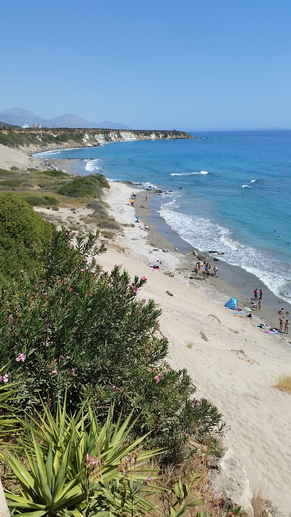
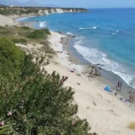
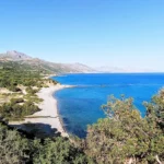
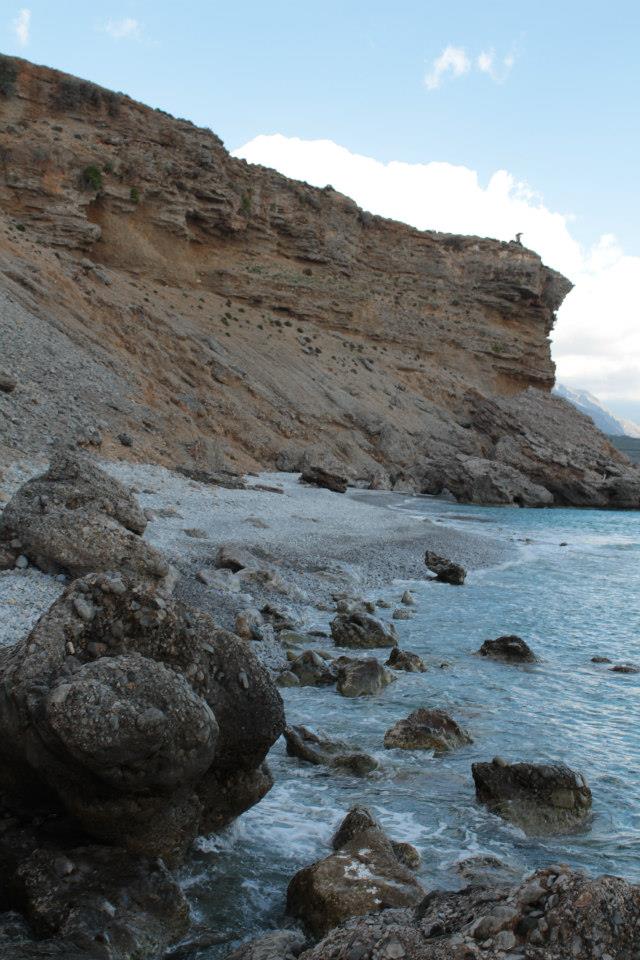
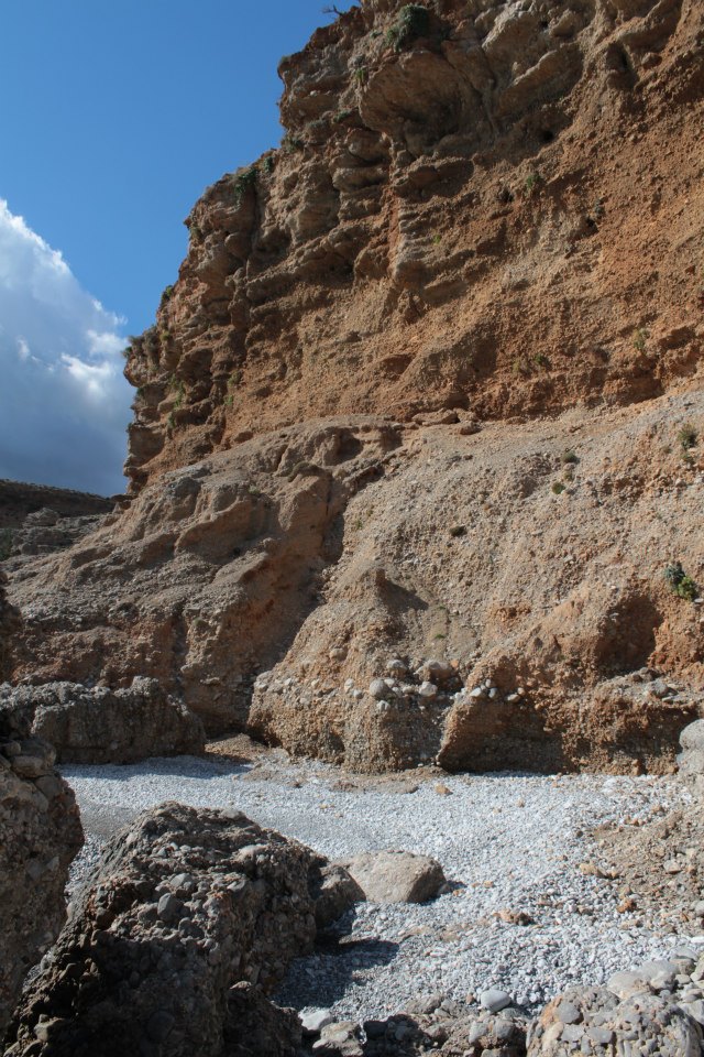
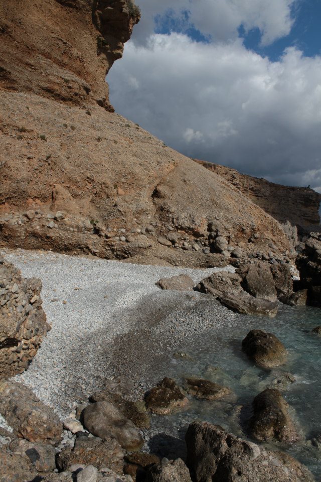
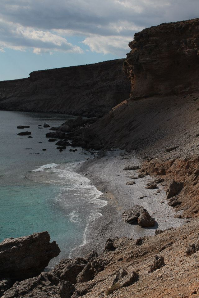
Orthi Ammos is a stunning sandy, shallow beach located next to Frangokastelo, 80km south of Chania, on the edge of a large valley with a warm climate. It has seen modest development compared to the neighboring tourist hotspot of Frangokastelo.
The beach is known for its vast sand hills and dunes, as well as its crystal-clear waters. Although it is affected by southern winds, the impact is mild. The eastern section of the beach has traditionally been a spot for nudists, though their numbers have dwindled in recent years. The beach can be reached by a 10-minute walk from Frangokastelo or by parking above the sand hills. But beware, the sand can get very hot on the descent to the beach!
Compared to adjacent Frangokastelo, Orthi Ammos is a peaceful beach. However, it offers limited accommodations and food amenities, without any sunbeds or water sports services. Its easternmost part, known as Kritama, is marked by high cliffs and turquoise water.
Legend has it that the sand of Orthi Ammos hid the unburied bodies of the 335 Greek heroes who fought against the Turks in the Battle of Frangokastelo on 17 May 1828. These heroes’ spirits are known as the Drosoulites, the famed “ghosts” of Fort Frangokastelo.
Situated 80km southeast of Chania and just 1.5km west of the renowned Fragokastelo beach, you’ll find the scenic location of Vatalos. Many Fragokastelo hotels and lodging options are found in the Vatalos area, which boasts fertile fields, breathtaking views of the south slopes of the White Mountains, and transforms into a significant wetland during winter. This wetland stretches about 2km to the west, starting from the castle.
Vatalos is dotted with peaceful coves boasting sandy beaches interspersed with pebbles and rocks. From the fortress, you’ll encounter the beaches of Iligas, Hodros Volakas, Mavro Nero, and finally, Vatalos. While most visitors prefer the shallows of the bustling Fragokastelo beach, Vatalos’ beaches provide an idyllic setting for peaceful vacations and snorkelling. Fragokastelo is noted for its medieval castle, the exotic beach, and the legendary Drosoulites ghosts.
The secluded Viglistiri beach is nestled between the peaceful town of Lakki and Orthi Ammos, near Fragokastelo. The primary way to reach this beach is by boat, given the complexity of the area’s dirt road network that makes it difficult to locate. Low vegetation provides a natural border to the beach. In 2014, the Sfakia municipality designated this beach as pet-friendly.
Lakki, also known as Laki or Lakkes, is situated 81km southeast of Chania and 48km southwest of the city of Rethymno. It’s nestled close to Fragokastelo, a mere 2km to the east, and adjacent to the village of Skaloti. The beach, which can be reached by a drive from Skaloti, is to the west of Lakki, where a small stream from the Sfaggofarago Gorge flows into the sea.
The area is characterized by several picturesque sandy coves separated by petite rocky piers. It’s a tranquil location with minimal organization, featuring a handful of accommodations and taverns. The bustling region of Fragokastelo is within walking distance, making it convenient for those with vehicles.
Lakki is perfect for peaceful holidays, particularly for families and children. The sea is pristine and rarely crowded. Some coves provide umbrellas, but the abundance of tamarisk trees ensures ample shade.
If you find the time, a walk to Skaloti village is worthwhile, where you can appreciate the stunning Byzantine church of Prophet Elijah, constructed in 1335.
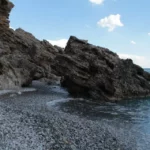
Koutelos, a tranquil and unstructured beach with large round pebbles, is situated close to the village of Nomikiana. It’s approximately 9km to the east of Chora Sfakion, 4km to the west of Fragokastelo, and 76km to the south of Chania.
If you’re traveling from Sfakia, take the road leading to Fragokastelo. Shortly after passing Vouvas and Nomikiana, turn onto the road leading to the beach. Koutelos is clearly signposted. It’s a place worth visiting if you’re in the area, but it’s not a standalone attraction. It’s best to combine a trip to Fragokastelo with a visit to Koutelos if you’re looking for some peaceful moments or a bite to eat at the local fish tavern.
The beach features a traditional fish tavern where you can also find accommodations in a few adjacent rooms. Additionally, the beach is dotted with tamarisk trees providing shady spots. Next to the beach, you can explore the cave of Anapsis or set up camp at the small bay of Pera Koutelos, located to the west of the main beach. Between Koutelos and Vatalos beach, you’ll find the rocky beaches of Psilou Roumi Cape. Just a few meters to the west of Koutelos beach, there’s the secluded Leska beach.
Situated 47km southwest of Rethymno and 84km south of Chania, nestled between Fragokastelo and Rodakino village, is Agia Marina. It is also 2km south of Argoules village. The beach presents a mix of sand, fine pebbles, and occasional rocky areas, making it an ideal spot for spearfishing and snorkelling. The beach is not organized, so it’s essential to bring your own necessities. Small canteens can be found at Peristeres beach, a short 3-5 minute walk to the east. The towering carob trees provide ample shade, especially on windless days.
To reach Agia Marina, follow the dirt road that connects Skaloti village (or Lakki beach) with Polirizos beach. Just before reaching Polyrizos, take the route to Peristeres beach and continue along the seaside dirt track until you arrive at Agia Marina. This same dirt road extends to Lakki beach.
The beach is named after the chapel of Agia Marina located on its shores. A small river, which draws water from the White Mountains through the Argoule gorge, flows into the beach year-round.
A few meters to the west of Koutelos beach, you will find the hidden gem known as Leska beach. Its name, which translates to “Steep Place” or “trap” in the local Cretan dialect, is derived from the sheer cliffs that surround the area. The beach is mostly pebbly, but you can find patches of sand here and there. On the western side, there’s a tiny cove with a rocky seabed. It’s primarily accessible by boat, as the journey on foot from Koutelos beach can be dangerous due to unstable terrain and towering cliffs.
Peristeres, situated 47km southwest of the city of Rethymnon, is nestled between the villages of Fragokastelo and Rodakino. This beach is a well-known spot among Greeks due to its association with Alexis Tsipras, the former Prime Minister of Greece, who loved this beach. The beach extends from the western side of Kastelos hill all the way to Agia Marina. It comprises two separate coves and is typically tranquil, given its less accessible location compared to nearby Korakas and Polirizos beaches. There are no amenities on the beach, only a few small taverns. The beach is pebbly with some rocky patches, and is often frequented by nudists and campers who find respite under the large carob trees.
In Greek, Peristeres translates to ‘pigeons’, a name originating from the small sea caves at Kastelos cape where pigeons nest. These caves, located beyond the eastern end of the beach, are strikingly beautiful with arches, massive boulders, and tiny sandy beaches inside. The sea bed, reminiscent of an aquarium, is a perfect spot for snorkelling.
This beach also holds historical significance as it was from here that German General Heinrich Kreipe was transported to Egypt. Kreipe, the general commander of the land forces of “Fortress Crete” or Festung Kreta, was captured in Heraklion by two British officers and Cretan resistance fighters. After evading German patrols and traversing the mountains, they reached the southern side of the island where a British Motor Launch picked them up on May 14, 1944. This daring operation infuriated Hitler and is considered one of the most audacious of the Second World War. A resident of Rodakino village still possesses Kreipe’s handcuffs. The bay was also used by allied submarines and destroyers to bring in supplies for the battle against the Germans.
To reach Peristeres, one can either take the paved road from Polirizos heading west and then turn left onto the first dirt road, or use the 4km dirt road that connects Lakki, near Skaloti village, with Polirizos.
Rodakino, a village situated 45km southeast of Rethymno city, can be found at the mouth of the steep Rodakino canyon that cuts through the Kryoneritis mountain. This village lies a few kilometres west of the Plakias resort and east of Fragokastelo. Half a kilometre west of Rodakino’s primary beach, Korakas, you’ll find Polirizos beach, encircled by lush olive groves. To reach Polirizos, you need to follow the paved road heading west from Korakas, which runs along the coastline. After crossing a small sandhill and a few minor coves, you’ll encounter the tiny Polirizos settlement, complete with accommodations and taverns. A charming small beach with fine sand and serene, shallow waters extends in front of Polirizos.
This beach, which is slightly organized with umbrellas and sunbeds, is a perfect spot for children. The coastal road ends here due to the rocky Kastelos hill that rises on the western part of the coast and extends inland. On the hill’s other side, you’ll find the awe-inspiring long bay of Peristeres, which can be accessed by turning left approximately 500m after Polirizos.


